Overview of recent work and access to online publications and resources
RESTORE4Cs 1st Policy Brief: How can coastal wetlands help achieve EU climate goals?
The first RESTORE4Cs Policy Brief of RESTORE4Cs, “How can coastal wetlands help achieve EU climate goals?“, highlights the importance of European coastal wetlands for reducing Greenhouse Gas emissions. The key messages of the first RESTORE4Cs Policy Brief include: Coastal wetlands are important natural carbon stores, ...
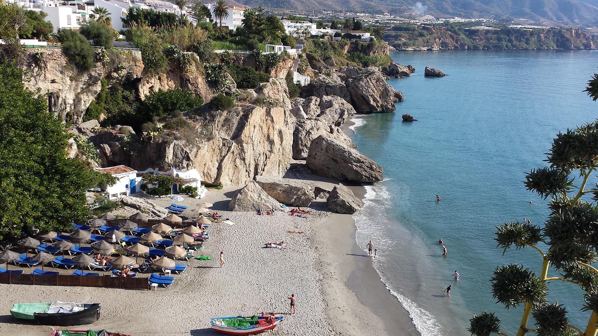
Mapping the Impact of Blue Tourism in the Mediterranean
The IUCN Centre for Mediterranean Cooperation with the support of ETC-UMA in the framework of the Blue Tourism Initiative, has released a comprehensive report entitled “Mapping the Impact of Blue Tourism in the Mediterranean: Vulnerability Assessment of Coastal and Marine ...
Brief update of the MedBioLitter database version 10 updated in January 2023
The MedBioLitter knowledge base is an entry-point to the peer reviewed research evidence published on the impacts of marine litter on marine biota in the Mediterranean region. This knowledge base was created in 2017, under the Interreg-Med funded initiative PANACeA ...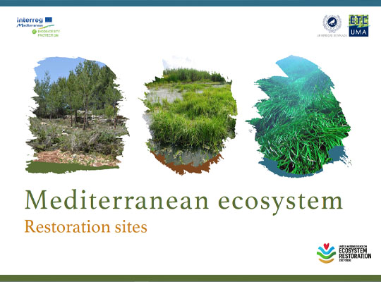
Mediterranean ecosystem restoration sites
In the frame of its strategic activities in the Mediterranean region, ETC-UMA as coordinator of the Mediterranean Biodiversity Protection Community (MBPC) has joined the Task Force on Best Practices on Ecosystem Restoration and committed to use its network of practitioners ...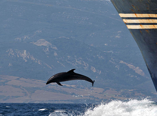
Supporting cetacean conservation in the Pelagos Sanctuary
A new report has been presented today, 18 November 2022, online in the frame of the cooperation between the Pelagos Permanent Secretariat and the Mediterranean Biodiversity Protection Community (MBPC), a project led by ETC-UMA. The new report, entitled Pathways to ...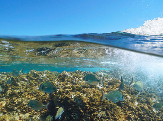
An assessment of marine biodiversity protection in the Mediterranean Sea: A threatened global biodiversity hotspot
The Mediterranean Sea is a World’s biodiversity hotspot. It harbours around 11% of all marine species in less than 1% of the global marine area (Bianchi & Morri, 2000). Furthermore, around 20% of those species are endemic (Coll et al., ...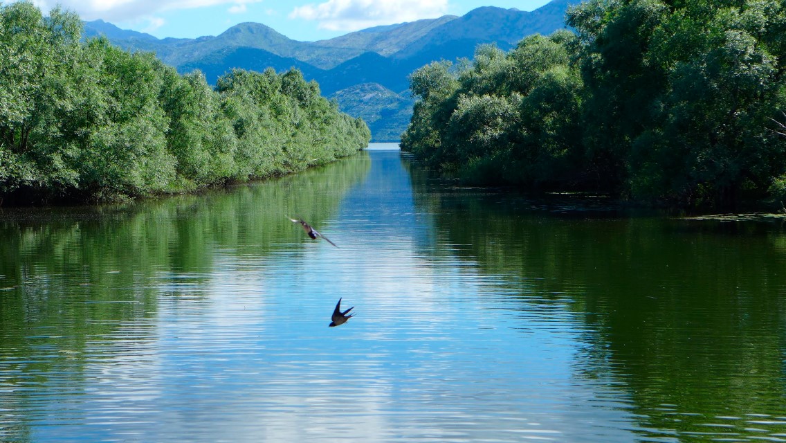
Mediterranean wetlands – their current state and ways to improve their conservation
The recent report entitled “Mapping and assessment of the state of wetland ecosystems: a Mediterranean perspective” led by ETC-UMA, in the frame of the Mediterranean Biodiversity Protection Community initiative co-funded by the EU Interreg Mediterranean programme, is the result of ...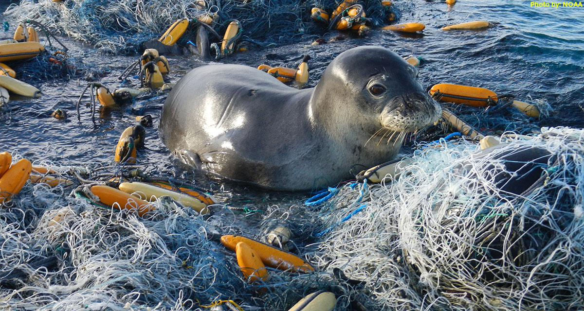
ETC-UMA issues new report on the impacts of litter on Mediterranean marine species
On the occasion of the workshop organized by IUCN and Région Sud in collaboration with its CPMR partner, the ETC-UMA Director, Dania Abdul Malak is presenting today 1 April 2022 a highlight on the wide range of actions required to ...
The role of healthy wetlands in fighting climate change
The new report developed by the ETC-UMA (University of Malaga), as partner of the European Topic Centre on Urban, Land and Soil Systems (ETC/ULS) has shed light on the role of healthy wetland habitats in the carbon cycle and the ...
A Mediterranean snapshot on what we have and how to protect it
The report on the State of the Environment and Development in the Mediterranean (SoED) published in November 2020 warns that the Mediterranean basin is facing escalating environmental and developmental challenges: warming 20% faster than other regions, with 78% of fishing stocks subject ...
Mapping and Assessment of Ecosystems and their Services: An EU ecosystem assessment
This report presents an ecosystem assessment covering the total land area of the EU as well as the EU marine regions. The assessment is carried out by Joint Research Centre, European Environment Agency, DG Environment, and the European Topic Centres ...
MedBioLitter: an open database on marine litter and biodiversity science
An open database and spatial geoportal on current scientific knowledge related to marine litter and biodiversity interactions in the Mediterranean region. ...Check all our resources
You can access additional resources and publications per year through our engine below
Journal Articles
Burgueño, A. M.; Aldana-Martín, J. F.; Vázquez-Pendón, M.; Barba-González, C.; Gómez, Y. J.; García-Millán, V. E.; Navas-Delgado, I.
Scalable approach for high-resolution land cover: a case study in the Mediterranean Basin Journal Article
In: Journal of Big Data, vol. 10, no. 91, 2023.
Abstract | Links | BibTeX | Tags: Geotechnology, Land and soil
@article{Burgueño2023,

title = {Scalable approach for high-resolution land cover: a case study in the Mediterranean Basin},

author = {A. M. Burgueño and J. F. Aldana-Martín and M. Vázquez-Pendón and C. Barba-González and Y. J. Gómez and V. E. García-Millán and I. Navas-Delgado},

url = {https://doi.org/10.1186/s40537-023-00770-z},

doi = {https://doi.org/10.1186/s40537-023-00770-z},

year  = {2023},

date = {2023-06-02},

journal = {Journal of Big Data},

volume = {10},

number = {91},

abstract = {The production of land cover maps is an everyday use of image classification applications on remote sensing. However, managing Earth observation satellite data for a large region of interest is challenging in the task of creating land cover maps. Since satellite imagery is getting more precise and extensive, Big Data techniques are becoming essential to handle the rising quantity of data. Furthermore, given the complexity of managing and analysing the data, defining a methodology that reduces the complexity of the process into different smaller steps is vital to data processing. This paper presents a Big Data methodology for creating land cover maps employing artificial intelligence algorithms. Machine Learning algorithms are contemplated for remote sensing and geodata classification, supported by explainable artificial intelligence. Furthermore, the process considers aspects related to downloading data from different satellites, Copernicus and ASTER, executing the pre-processing and processing of the data in a distributed environment, and depicting the visualisation of the result. The methodology is validated in a test case for er map of the Mediterranean Basin.},

keywords = {Geotechnology, Land and soil},

pubstate = {published},

tppubtype = {article}

}
Martorell-Guerrero, G.; Rodríguez-Rodríguez, D.; García-Millán, V. E.
Long-term assessment of the effectiveness of coastal protection regulations in conserving natural habitats in Spain Journal Article
In: Ocean & Coastal Management, vol. 239, 2023.
Abstract | Links | BibTeX | Tags: Conservation and management, Environmental conservation, Geotechnology, Land and soil, Pressures, Tourism
@article{nokey,

title = {Long-term assessment of the effectiveness of coastal protection regulations in conserving natural habitats in Spain},

author = {G. Martorell-Guerrero and D. Rodríguez-Rodríguez and V. E. García-Millán},

url = {https://www.sciencedirect.com/science/article/pii/S0964569123001266},

doi = {https://doi.org/10.1016/j.ocecoaman.2023.106601},

year  = {2023},

date = {2023-05-15},

journal = {Ocean & Coastal Management},

volume = {239},

abstract = {Spain has undergone rapid socioeconomic development in the past three decades. This has been linked to massive residential and infrastructural development based on a short-term, profitable and resource-intensive consuming model. As a result, large amounts of agricultural, natural and semi-natural soils have been lost to artificial areas, especially around main cities and on the coast. In this study, we assessed the effectiveness of the Spanish Shores Act at preventing land development in two biogeographical regions and three administrative scales between 1988 and 2020 using a BACI design and remote sensing data. We also analysed the combined effect of other regulations to prevent land development on the coast. The Shores Act was effective in reducing land development although moderate to substantial land development occurred in the zones affected by the Law, especially in the Mediterranean region. Adding other sectoral regulations to the Shores Act notably and consistently reduced land development across regions. Among them, cumulative protected area (PA) regulations were most effective in reducing coastal land development. The use of satellite images, especially Sentinel 2A MSI data within a BACI design, proved a useful method for assessing the effectiveness of fine-scale objectives of environmental policies such as the Shores Act.},

keywords = {Conservation and management, Environmental conservation, Geotechnology, Land and soil, Pressures, Tourism},

pubstate = {published},

tppubtype = {article}

}
Petersen, J. E.; Mancosu, E.; King, S.
Ecosystem extent accounts for Europe Journal Article
In: Ecosystem Services, vol. 57, iss. October 2022, no. 101457, 2022.
Abstract | Links | BibTeX | Tags: Conservation and management, Ecosystem, Ecosystem services, Environmental conservation, Land and soil
@article{Petersen2022,

title = {Ecosystem extent accounts for Europe},

author = {J.E. Petersen and E. Mancosu and S. King},

url = {https://doi.org/10.1016/j.ecoser.2022.101457},

doi = {https://doi.org/10.1016/j.ecoser.2022.101457},

year  = {2022},

date = {2022-07-31},

journal = {Ecosystem Services},

volume = {57},

number = {101457},

issue = {October 2022},

abstract = {This paper describes the set-up and results for ecosystem extent accounts at European level, developed in the context of the United Nations System of Environmental-Economic Accounting - Ecosystem Accounting (SEEA EA). These accounts inform on the opening and closing ‘stocks’ of ecosystems and provide essential geo-spatial data to support the calculation of ecosystem condition and services accounts. The paper presents the first set of ecosystem extent accounts for Europe, covering the period 2000–2018. These show that ecosystems are relatively stable at the European scale, with significant increases in Urban ecosystems and some decrease in Heathland and shrub and Grassland ecosystems. The paper demonstrates the use of a flexible geo-spatial database to gain analytical insights for different ecosystem accounting areas, using European biogeographical regions and Natura 2000 areas as examples. More detailed ecosystem extent accounts (tier II and tier III) show trends inter alia for Agro-forestry, Peat Bog, Beaches, dunes and sands as well as Salt marsh ecosystems, important for biodiversity and ecosystem services. The accounting approach presented delivers a geo-spatial data foundation that can support further ecosystem analysis and accounts. This enables the targeting of ecosystem analysis on specific geographic areas and policy instruments.},

keywords = {Conservation and management, Ecosystem, Ecosystem services, Environmental conservation, Land and soil},

pubstate = {published},

tppubtype = {article}

}
Sánchez-Espinosa, A.; Schröder, C.
Land use and land cover mapping in wetlands one step closer to the ground: Sentinel-2 versus Landsat 8 Journal Article
In: Journal of Environmental Management, vol. 247, pp. 484-498, 2019.
Abstract | Links | BibTeX | Tags: Geotechnology, Land and soil, SWOS, Wetlands
@article{Sánchez-Espinosa2019b,

title = {Land use and land cover mapping in wetlands one step closer to the ground: Sentinel-2 versus Landsat 8},

author = {A. Sánchez-Espinosa and C. Schröder},

url = {https://www.sciencedirect.com/science/article/pii/S0301479719308850},

doi = {10.1016/j.jenvman.2019.06.084},

year  = {2019},

date = {2019-10-01},

journal = {Journal of Environmental Management},

volume = {247},

pages = {484-498},

abstract = {Environmental studies with Landsat images have revealed many of the problems faced by wetland ecosystem, which are crucial for the conservation of biodiversity and the natural values of our planet. The study of LULC changes in wetlands through remote sensing constantly helps to identify and combat their main environmental threats improving the conservation of these natural habitats. Starting in mid-2015, the Sentinel-2 satellite opens new possibilities in the field of earth observation thanks to its higher spatial, spectral and temporal resolution becoming a powerful source of information for LULC monitoring in wetland areas. However, researchers may ask them selves to what extent Sentinel-2 is an improvement over Landsat 8 for general purposes. This research test if there is a real difference in the quality of the results delivered by both Sentinel-2 and Landsat 8 imagery when basic classification methods are applied.


The study uses Sentinel-2 and Landsat 8 imagery to produce LULC maps in a Mediterranean wetland area applying an object based classification method in order to compare the accuracy and reliability in the surface detected by both satellites. The results show that an object based classification using only the Sentinel-2 and Landsat 8 image information, without band indexes or ancillary data, offers very similar results for most LULC classes, being the overall accuracy around 87–88% with slightly better results when using Sentinel-2. Although using Sentinel-2 leads to an increase in file size and processing times, the analysis of certain LULC classes presents an improvement compared to Landsat 8, detecting more linear and small size elements with a better delineation of image features in the classified map. However, these improvements should not underestimate the value of Landsat imagery in the future since both satellites provide high precision information, so they can and should coexist and be used together to increase data availability in order to have the best possible results in remote sensing research.},

keywords = {Geotechnology, Land and soil, SWOS, Wetlands},

pubstate = {published},

tppubtype = {article}

}
The study uses Sentinel-2 and Landsat 8 imagery to produce LULC maps in a Mediterranean wetland area applying an object based classification method in order to compare the accuracy and reliability in the surface detected by both satellites. The results show that an object based classification using only the Sentinel-2 and Landsat 8 image information, without band indexes or ancillary data, offers very similar results for most LULC classes, being the overall accuracy around 87–88% with slightly better results when using Sentinel-2. Although using Sentinel-2 leads to an increase in file size and processing times, the analysis of certain LULC classes presents an improvement compared to Landsat 8, detecting more linear and small size elements with a better delineation of image features in the classified map. However, these improvements should not underestimate the value of Landsat imagery in the future since both satellites provide high precision information, so they can and should coexist and be used together to increase data availability in order to have the best possible results in remote sensing research.
Hatziiordanou, L.; Fitoka, E.; Hadjicharalampous, E.; Votsi, N. E.; Palaskas, D.; Abdul-Malak, D.
In: One Ecosystem, vol. 4, no. e32704, 2019.
Abstract | Links | BibTeX | Tags: Biodiversity, Climate Change, Conservation and management, Ecosystem services, Forest, Land and soil, Pressures, Wetlands
@article{Hatziiordanou2019,

title = {Indicators for mapping and assessment of ecosystem condition and of the ecosystem service habitat maintenance in support of the EU Biodiversity Strategy to 2020},

author = {L. Hatziiordanou and E. Fitoka and E. Hadjicharalampous and N.E. Votsi and D. Palaskas and D. Abdul-Malak},

url = {https://oneecosystem.pensoft.net/article/32704/},

doi = {10.3897/oneeco.4.e32704},

year  = {2019},

date = {2019-06-13},

journal = {One Ecosystem},

volume = {4},

number = {e32704},

abstract = {A systematic approach to map and assess the “maintenance of nursery populations and habitats” ecosystem service (ES) (hereinafter called “habitat maintenance”) has not yet emerged. In this article, we present an ecosystem service framework implementation at landscape level, by proposing an approach for calculating and combining a series of indicators with spatial modelling techniques. Necessary conceptual elements for this approach are: a) ecosystem condition, b) supply and demand of the targeted ecosystem service and c) spatial relationships between the Service Providing Units (SPU) and the Service Connecting Units (SCU). Ecosystem condition is quantified and mapped based on two indicators, the Biodiversity State and the Anthropogenic Impact. Quantification and mapping of supply and demand are based on the hypothesis that high supply can be activated in strictly protected areas and that a demand is localised in the Natura 2000 sites (N2K), considering them as the Service Benefit Areas (SBA). Wetlands are assessed as SCU between the SBA and the landscape areas where the habitat maintenance ES is supplied. By assessing wetlands as SCU, we intent to highlight their role as biodiversity stepping stones and as green infrastructures. Overall, we conclude that the EU biodiversity policy demand for no net loss and for a coherent N2K network can be met by enhancing the delivery of the habitat maintenance ES. This approach can assist policy-makers in prioritisation of conservation and restoration targets, in line with the EU biodiversity strategy to 2020 and the preparation of the post-2020 Strategy.},

keywords = {Biodiversity, Climate Change, Conservation and management, Ecosystem services, Forest, Land and soil, Pressures, Wetlands},

pubstate = {published},

tppubtype = {article}

}
Palomo, I.
Practical solutions for bottlenecks in ecosystem services mapping Journal Article
In: One Ecosystem, vol. 3, 2018.
Abstract | Links | BibTeX | Tags: Ecosystem services, Geotechnology, Land and soil
@article{etal.al.2018,

title = {Practical solutions for bottlenecks in ecosystem services mapping},

author = {I. Palomo et al.},

url = {https://oneecosystem.pensoft.net/article/20713/element/8/46777/},

doi = {10.3897/oneeco.3.e20713},

year  = {2018},

date = {2018-01-01},

journal = {One Ecosystem},

volume = {3},

abstract = {Background

Ecosystem services (ES) mapping is becoming mainstream in many sustainability assessments, but its impact on real world decision-making is still limited. Robustness, end-user relevance and transparency have been identified as key attributes needed for effective ES mapping. However, these requirements are not always met due to multiple challenges, referred to here as bottlenecks, that scientists, practitioners, policy makers and users from other public and private sectors encounter along the mapping process.


New information

A selection of commonly encountered ES mapping bottlenecks that relate to seven themes: i) map-maker map-user interaction; ii) nomenclature and ontologies; iii) skills and background; iv) data and maps availability; v) methods-selection; vi) technical difficulties; and vii) over-simplification of mapping process/output. The authors synthesise the variety of solutions already applied by map-makers and map-users to mitigate or cope with these bottlenecks and discuss the emerging trade-offs amongst different solutions. Tackling the bottlenecks described here is a crucial first step towards more effective ES mapping, which can in turn ensure the adequate impact of ES mapping in decision-making.},

keywords = {Ecosystem services, Geotechnology, Land and soil},

pubstate = {published},

tppubtype = {article}

}
Ecosystem services (ES) mapping is becoming mainstream in many sustainability assessments, but its impact on real world decision-making is still limited. Robustness, end-user relevance and transparency have been identified as key attributes needed for effective ES mapping. However, these requirements are not always met due to multiple challenges, referred to here as bottlenecks, that scientists, practitioners, policy makers and users from other public and private sectors encounter along the mapping process.
New information
A selection of commonly encountered ES mapping bottlenecks that relate to seven themes: i) map-maker map-user interaction; ii) nomenclature and ontologies; iii) skills and background; iv) data and maps availability; v) methods-selection; vi) technical difficulties; and vii) over-simplification of mapping process/output. The authors synthesise the variety of solutions already applied by map-makers and map-users to mitigate or cope with these bottlenecks and discuss the emerging trade-offs amongst different solutions. Tackling the bottlenecks described here is a crucial first step towards more effective ES mapping, which can in turn ensure the adequate impact of ES mapping in decision-making.
Aksoy, E.; Louwagie, G.; Gardi, C.; Gregor, M.; Schröder, C.; Löhnertz, M.
Assessing soil biodiversity potentials in Europe Journal Article
In: Science of The Total Environment, vol. 589, pp. 236-249, 2017.
Abstract | Links | BibTeX | Tags: Biodiversity, Conservation and management, Land and soil, Soil functions
@article{Aksoy2017c,

title = {Assessing soil biodiversity potentials in Europe},

author = {E. Aksoy and G. Louwagie and C. Gardi and M. Gregor and C. Schröder and M. Löhnertz},

url = {https://www.sciencedirect.com/science/article/pii/S0048969717304229},

doi = {10.1016/j.scitotenv.2017.02.173},

year  = {2017},

date = {2017-07-01},

journal = {Science of The Total Environment},

volume = {589},

pages = {236-249},

abstract = {Soil is important as a critical component for the functioning of terrestrial ecosystems. The largest part of the terrestrial biodiversity relies, directly or indirectly, on soil. Furthermore, soil itself is habitat to a great diversity of organisms. The suitability of soil to host such a diversity is strongly related to its physico-chemical features and environmental properties. However, due to the complexity of both soil and biodiversity, it is difficult to identify a clear and unambiguous relationship between environmental parameters and soil biota. Nevertheless, the increasing diffusion of a more integrated view of ecosystems, and in particular the development of the concept of ecosystem services, highlights the need for a better comprehension of the role played by soils in offering these services, including the habitat provision. An assessment of the capability of soils to host biodiversity would contribute to evaluate the quality of soils in order to help policy makers with the development of appropriate and sustainable management actions. However, so far, the heterogeneity of soils has been a barrier to the production of a large-scale framework that directly links soil features to organisms living within it. The current knowledge on the effects of soil physico-chemical properties on biota and the available data at continental scale open the way towards such an evaluation. In this study, the soil habitat potential for biodiversity was assessed and mapped for the first time throughout Europe by combining several soil features (pH, soil texture and soil organic matter) with environmental parameters (potential evapotranspiration, average temperature, soil biomass productivity and land use type). Considering the increasingly recognized importance of soils and their biodiversity in providing ecosystem services, the proposed approach appears to be a promising tool that may contribute to open a forum on the need to include soils in future environmental policy making decisions.},

keywords = {Biodiversity, Conservation and management, Land and soil, Soil functions},

pubstate = {published},

tppubtype = {article}

}
Aksoy, E.; Gregor, M.; Schröder, C.; Löhnertz, M.; Louwagie, G.
Assessing and analysing the impact of land take pressures on arable land Journal Article
In: Solid Earth, no. 8, pp. 683-695, 2017.
Abstract | Links | BibTeX | Tags: Land and soil, Pressures
@article{Aksoy2017c,

title = {Assessing and analysing the impact of land take pressures on arable land},

author = {E. Aksoy and M. Gregor and C. Schröder and M. Löhnertz and G. Louwagie},

url = {https://www.solid-earth.net/8/683/2017/},

year  = {2017},

date = {2017-06-20},

journal = {Solid Earth},

number = {8},

pages = {683-695},

abstract = {Land, and in particular soil, is a finite and essentially non-renewable resource. Across the European Union, land take, i.e. the increase of settlement area over time, annually consumes more than 1000 km2 of which half is actually sealed and hence lost under impermeable surfaces. Land take, and in particular soil sealing, has already been identified as one of the major soil threats in the 2006 European Commission Communication Towards a Thematic Strategy on Soil Protection and the Soil Thematic Strategy and has been confirmed as such in the report on the implementation of this strategy. The aim of this study is to relate the potential of land for a particular use in a given region with the actual land use. This allows evaluating whether land (especially the soil dimension) is used according to its (theoretical) potential. To this aim, the impact of several land cover flows related to urban development on soils with good, average, and poor production potentials were assessed and mapped. Thus, the amount and quality (potential for agricultural production) of arable land lost between the years 2000 and 2006 was identified. In addition, areas with high productivity potential around urban areas, indicating areas of potential future land use conflicts for Europe, were identified.},

keywords = {Land and soil, Pressures},

pubstate = {published},

tppubtype = {article}

}
Mancosu, E.; Gago-Silva, A.; Barbosa, A.; de Bono, A.; Ivanov, E.; Lehmann, A.; Fons, J.
Future land-use change scenarios for the Black Sea catchment Journal Article
In: Environmental Science & Policy, vol. 46, pp. 26-36, 2015.
Abstract | Links | BibTeX | Tags: Climate Change, Geotechnology, Land and soil, Pressures
@article{Mancosu2015,

title = {Future land-use change scenarios for the Black Sea catchment},

author = {E. Mancosu and A. Gago-Silva and A. Barbosa and A. de Bono and E. Ivanov and A. Lehmann and J. Fons},

url = {https://www.sciencedirect.com/science/article/pii/S1462901114000550},

doi = {https://doi.org/10.1016/j.envsci.2014.02.008},

year  = {2015},

date = {2015-02-01},

journal = {Environmental Science & Policy},

volume = {46},

pages = {26-36},

abstract = {Plausible future scenarios have been created for the Black Sea catchment, focussing on spatially explicit alternatives for land-use changes. Four qualitative storylines (HOT, ALONE, COOP and COOL) were first developed, based on interpretation of the respective global scenarios (A1, A2, B1 and B2) produced by the Intergovernmental Panel on Climate Change. Quantitative statistical downscaling techniques were then used to disaggregate the outputs of global scenarios at a regional level. The resulting land-use maps were spatially allocated at 1 km resolution in the Metronamica model, using a set of factors related to the identified drivers of change. The land-use change model was calibrated on historical trends of land-cover change (MODIS 2001 and 2008) translated into spatial allocation rules, and future land-use projections (IMAGE, 2001) were adopted. Suitability and constraint maps and population trends were used to regulate the modelling process. The calibrated model was validated by statistical procedures, visual evaluation and stakeholder involvement in order to ensure its plausibility and accuracy. This methodology bridged the gap between the global and regional scales. Four simulated future states were produced for the main land-use classes–forest, grassland, cropland and built-up areas, as well as scrublands, crops/natural vegetation and barren land–for 2025 and 2050. The results suggest that the features highlighted in these scenarios are guided by global trends, such as population rise and decreasing agriculture, but with different growth rates and a variety of spatial patterns, with regional variations resulting from local backgrounds and policy objectives. This study aims to provide future land-use data as a potential geographical tool to assist policy makers in addressing environmental emergencies such as water stress and pollution. In particular, the exploration of plausible futures can support future assessments to comply with the EU Water Framework Directive and Integrated Coastal Zone Management policies around the Black Sea.},

keywords = {Climate Change, Geotechnology, Land and soil, Pressures},

pubstate = {published},

tppubtype = {article}

}
Books
Fritz, S.
Chapter 21 (Ecosystem mapping and assessment) of the book “European Landscape Dynamics” Book
1, CRC Press, 2017, ISBN: 978-1482244663, (1482244667 ISBN-10).
Links | BibTeX | Tags: Conservation and management, Ecosystem, Geotechnology, Land and soil
@book{Fritz2017,

title = {Chapter 21 (Ecosystem mapping and assessment) of the book “European Landscape Dynamics”},

author = {S. Fritz},

url = {https://www.researchgate.net/publication/314867308_European_Landscape_Dynamics_CORINE_Land_Cover_Data_Jan_Feranec_Tomas_Soukup_Gerard_Hazeu_Gabriel_Jaffrain_CRC_Press_Boca_Raton_2016_337_pp_Price_Hardback_12700_eBook_8890_ISBN_978-1-4822-4466-3},

doi = {DOI: 10.1016/j.jag.2017.02.020},

isbn = {978-1482244663},

year  = {2017},

date = {2017-07-01},

journal = {CRC Press},

volume = {1},

pages = {367},

publisher = {CRC Press},

edition = {1},

note = {1482244667 ISBN-10},

keywords = {Conservation and management, Ecosystem, Geotechnology, Land and soil},

pubstate = {published},

tppubtype = {book}

}
Book Chapters
Rodríguez-Rodríguez, D.; Sánchez-Espinosa, A.; Prem, M.; Abdul-Malak, D.; Schröder, C.
In: Chapter 9, pp. 173-186, Tirant Editorial, 1, 2024, ISBN: 978-84-1183-238-0.
Abstract | Links | BibTeX | Tags: Conservation and management, Land and soil, Mediterranean sea, Pressures, Transboundary management
@inbook{nokey,

title = {Mediterranean landscape in trasition. Nuevos enfoques para hacer frente a los nuevos retos sociales y medioambientales.},

author = {D. Rodríguez-Rodríguez and A. Sánchez-Espinosa and M. Prem and D. Abdul-Malak and C. Schröder},

url = {https://editorial.tirant.com/es/libro/mediterranean-landscape-in-trasition-nuevos-enfoques-para-hacer-frente-a-los-nuevos-retos-sociales-y-medioambientales-maria-jose-marquez-ballesteros-9788411832380?busqueda=mediterranean+landscape+in+transition&},

isbn = { 978-84-1183-238-0},

year  = {2024},

date = {2024-06-05},

urldate = {2024-06-05},

pages = {173-186},

publisher = {Tirant Editorial},

edition = {1},

chapter = {9},

abstract = {El litoral mediterráneo se enfrenta a un futuro con importantes retos y desafíos como consecuencia de su fuerte urbanización y el impacto del cambio climático. Con esta premisa, la red internacional de investigadores Mediterránean Landscape in Transition presenta esta publicación que recoge sus principales reflexiones para hacer frente a esta realidad. La intersección de las diferentes aportaciones nos muestra la complejidad y la urgencia de la situación a la que se enfrentan los paisajes mediterráneos y sus costas; donde la evaluación y medición de las dinámicas de transformación del litoral, en el contexto del cambio climático y la resiliencia, son fundamentales para comprender y conservar estos valiosos ecosistemas.


El lector conocerá las vulnerabilidades que amenazan su conservación que afecta tanto a la biodiversidad como a sus comunidades locales, subrayando la necesidad de adaptación y resiliencia para su supervivencia. También se aborda el problema del turismo masivo y la turistificación, proponiendo estrategias para equilibrar la actividad turística con la preservación ambiental y cultural. Todo ello, en un contexto donde los movimientos sociales y territoriales desempeñan un papel relevante en su defensa; y donde el paisaje social se convierte en una tarea crucial para garantizar la sostenibilidad y el bienestar de las comunidades y la naturaleza, en estos entornos costeros tan especiales.},

keywords = {Conservation and management, Land and soil, Mediterranean sea, Pressures, Transboundary management},

pubstate = {published},

tppubtype = {inbook}

}
El lector conocerá las vulnerabilidades que amenazan su conservación que afecta tanto a la biodiversidad como a sus comunidades locales, subrayando la necesidad de adaptación y resiliencia para su supervivencia. También se aborda el problema del turismo masivo y la turistificación, proponiendo estrategias para equilibrar la actividad turística con la preservación ambiental y cultural. Todo ello, en un contexto donde los movimientos sociales y territoriales desempeñan un papel relevante en su defensa; y donde el paisaje social se convierte en una tarea crucial para garantizar la sostenibilidad y el bienestar de las comunidades y la naturaleza, en estos entornos costeros tan especiales.
Masters Theses
Merkohasanaj, M.; Abdul-Malak, D.; Aksoy, E.
Tools and indicators for integrated wetland monitoring. Case study, Fuente de Piedra Wetland, Andalusia, Spain Masters Thesis
2016.
Abstract | Links | BibTeX | Tags: Geotechnology, Land and soil, SWOS, Wetlands
@mastersthesis{Merkohasanaj2016,

title = {Tools and indicators for integrated wetland monitoring. Case study, Fuente de Piedra Wetland, Andalusia, Spain},

author = {M. Merkohasanaj and D. Abdul-Malak and E. Aksoy},

url = {/wp-content/uploads/publications/Master_Thesis_Matilda_Merkohasanaj_06_2016.pdf},

year  = {2016},

date = {2016-01-01},

abstract = {Wetland ecosystems are important for the welling of the people as they provide a wide range of ecosystem services; however they are suffering several pressures coming from land use changes. This study focused on identifying pressures and changes in the Fuente de Piedra wetland ecosystem (Malaga, Andalusia) by using latest Earth Observation and GIS techniques. The major drivers of pressures on this rural area have been identified being land use land cover changes, intensification of agricultural practices namely by conversion to irrigated crops as well as soil erosion. Several topo-climatic variables have been analyzed in order to valuate past changes and present risks of the Fuente de Piedra wetland. A number of indicators are used to assess spatial and temporal changes namely remote sensing based Normalized.

Difference Vegetation Index (NDVI) indicator was used to discriminate land use patterns, in particular agricultural crops focused in cereals and olive groves between 1985 and 2015. The mean NDVI values show high potential to distinguish between different LULC classes and their changes in time, but mostly prove to be an accurate tool to monitor the intra-annual distribution and seasonality between cereals and olive groves. Wetland surface and flooding processes are monitored by using Normalized Difference Water Index (NDWI) derived from satellite images and Topographic Wetness Indicator (TWI) extracted from digital elevation model. The NDWI indicator shows to be an adequate tool for water surface discrimination and the temporal change detection in the wetland surface. As a potential risk in the area, soil erosion was analyzed through statistical Regression analysis. Results reveal that high soil erosion rates come as a result of different spatial-temporal variables, affected mainly by precipitation and slope, but also show that the rate of soil erosion is greatly affected by the agricultural practice and type of land cover. Namely techniques and indicator can provide to wetland management and decision makers accurate and precise data for a continuous monitor of their territory in order to improve planning of rural areas and conservation of wetland ecosystems.},

keywords = {Geotechnology, Land and soil, SWOS, Wetlands},

pubstate = {published},

tppubtype = {mastersthesis}

}
Difference Vegetation Index (NDVI) indicator was used to discriminate land use patterns, in particular agricultural crops focused in cereals and olive groves between 1985 and 2015. The mean NDVI values show high potential to distinguish between different LULC classes and their changes in time, but mostly prove to be an accurate tool to monitor the intra-annual distribution and seasonality between cereals and olive groves. Wetland surface and flooding processes are monitored by using Normalized Difference Water Index (NDWI) derived from satellite images and Topographic Wetness Indicator (TWI) extracted from digital elevation model. The NDWI indicator shows to be an adequate tool for water surface discrimination and the temporal change detection in the wetland surface. As a potential risk in the area, soil erosion was analyzed through statistical Regression analysis. Results reveal that high soil erosion rates come as a result of different spatial-temporal variables, affected mainly by precipitation and slope, but also show that the rate of soil erosion is greatly affected by the agricultural practice and type of land cover. Namely techniques and indicator can provide to wetland management and decision makers accurate and precise data for a continuous monitor of their territory in order to improve planning of rural areas and conservation of wetland ecosystems.
Presentations
Mancosu, E.; Abdul-Malak, D.; Sánchez-Espinosa, A.
Regional indicators to support forest ecosystem management in the Carpathian Mountains Presentation
28.09.2016.
Abstract | Links | BibTeX | Tags: Conservation and management, Forest, Geotechnology, Land and soil, Protected areas
@misc{nokey,

title = {Regional indicators to support forest ecosystem management in the Carpathian Mountains},

author = {E. Mancosu and D. Abdul-Malak and A. Sánchez-Espinosa},

url = {https://www.etc.uma.es/wp-content/uploads/Poster_Forum_Carpaticum_2016.pdf},

year  = {2016},

date = {2016-09-28},

journal = {Forum Carpaticum 2016},

abstract = {The Carpathian Mountains are one of the most important forest ecosystems in Europe dueto the high concentration of virgin forests. The "protocol for sustainable forest management", signed by Carpathian convention Parties is formalising the need to preserve the richness and ensure sustainable use of its resources. Our research, in agreement with the Carpathian Convention Secretariat and the Environmental European Agency (EEA) is supporting this protocol with the identification and harmonization of dataset from multiple sources including Earth Observation, to combine and provide spatial indicators to support monitoring and management of forest far the Carpathians Environment Outlook (KEO) area.},

keywords = {Conservation and management, Forest, Geotechnology, Land and soil, Protected areas},

pubstate = {published},

tppubtype = {presentation}

}
Sánchez-Espinosa, A.; Abdul-Malak, D.; Schröder, C.; Martínez-Murillo, J. F.
01.01.2016.
Links | BibTeX | Tags: Ecosystem, Geotechnology, Land and soil, SWOS, Wetlands
@misc{Sánchez-Espinosa2016b,

title = {Determination of wetland ecosystem boundaries and validation of habitat classifications using remote sensing: Fuente de Piedra (Spain).},

author = {A. Sánchez-Espinosa and D. Abdul-Malak and C. Schröder and J. F. Martínez-Murillo},

url = {/wp-content/uploads/publications/SWOS_EGU2016.pdf},

year  = {2016},

date = {2016-01-01},

keywords = {Ecosystem, Geotechnology, Land and soil, SWOS, Wetlands},

pubstate = {published},

tppubtype = {presentation}

}
Aksoy, E.; Abdul-Malak, D.; Gardi, C.; Fons, J.
Impact assessment of major pressures on Earthworms in Europe. Global Soil Biodiversity Initiative in Dijon Presentation
01.12.2014.
Links | BibTeX | Tags: Biodiversity, Land and soil, Pressures, Soil functions
@misc{Aksoy2014,

title = {Impact assessment of major pressures on Earthworms in Europe. Global Soil Biodiversity Initiative in Dijon},

author = {E. Aksoy and D. Abdul-Malak and C. Gardi and J. Fons},

url = {/wp-content/uploads/publications/Poster_GSBI_Aksoy_3.pdf},

year  = {2014},

date = {2014-12-01},

keywords = {Biodiversity, Land and soil, Pressures, Soil functions},

pubstate = {published},

tppubtype = {presentation}

}
Mancosu, E.
Land Use Change Scenarios for Black Sea Catchment. 4th Bi-annual Black Sea Scientific Conference. Presentation
01.03.2013.
Links | BibTeX | Tags: Climate Change, EnviroGRIDS, Geotechnology, Land and soil
@misc{Mancosu2013,

title = {Land Use Change Scenarios for Black Sea Catchment. 4th Bi-annual Black Sea Scientific Conference.},

author = {E. Mancosu},

url = {/wp-content/uploads/publications/Poster_4BSScientificConference_BS-GES_E_Mancosu.pdf},

year  = {2013},

date = {2013-03-01},

keywords = {Climate Change, EnviroGRIDS, Geotechnology, Land and soil},

pubstate = {published},

tppubtype = {presentation}

}
Technical Reports
MBPC-PANACeA,
Mediterranean ecosystem restoration sites Technical Report
2022.
Abstract | Links | BibTeX | Tags: Biodiversity, Conservation and management, Ecosystem, Environmental conservation, Forest, Land and soil, Protected areas, Wetlands
@techreport{MBPC-PANACeA2022,

title = {Mediterranean ecosystem restoration sites},

author = {MBPC-PANACeA},

url = {https://biodiversity.uma.es/wp-content/uploads/restoration_sites_web_opt.pdf},

year  = {2022},

date = {2022-11-01},

urldate = {2022-11-01},

abstract = {This report was led by the European Topic Centre on Spatial Analysis and Synthesis (ETC-UMA) in the frame of the Mediterranean Biodiversity Protection Community initiative (MBPC) co-funded by the EU Interreg Mediterranean programme and is the result of a close consultation with the FAO-led Task Force on Best Practices. This report is the result of the collaborative efforts of many institutional partners, projects and individuals that made available information on their experience on restoration practices across the Mediterranean for wider dissemination. For each practice, the contributor’s name can be found as contact in the full annex description.},

keywords = {Biodiversity, Conservation and management, Ecosystem, Environmental conservation, Forest, Land and soil, Protected areas, Wetlands},

pubstate = {published},

tppubtype = {techreport}

}
Baritz, R.; Amelung, W.; Antoni, V.; Boardman, J.; Horn, R.; Prokop, G.; Römbke, J.; Romkens, P.; Steinhoff-Knopp, B.; Swartjes, F.; Trombetti, M.; de Vries, W.
ETC/ULS Report 2021: Soil monitoring in Europe. Indicators and thresholds for soil quality assessments Technical Report
2021.
Abstract | Links | BibTeX | Tags: Conservation and management, Environmental conservation, Land and soil, Soil functions
@techreport{Baritz2021,

title = {ETC/ULS Report 2021: Soil monitoring in Europe. Indicators and thresholds for soil quality assessments},

author = {R. Baritz and W. Amelung and V. Antoni and J. Boardman and R. Horn and G. Prokop and J. Römbke and P. Romkens and B. Steinhoff-Knopp and F. Swartjes and M. Trombetti and W. de Vries},

url = {https://www.eionet.europa.eu/etcs/etc-di/products/etc-uls-report-2021-soil-monitoring-in-europe-indicators-and-thresholds-for-soil-quality-assessments},

year  = {2021},

date = {2021-09-24},

abstract = {This report summarizes the current state of knowledge about key soil indicators in the light of current and new policies in support of healthy soils. Healthy soils are understood to have full capacity of their functions and do not exceed the recommended thresholds. This approach is essential in order to assess soil health in the context of policy challenges and societal needs. The development and application of thresholds sensitive to the functioning of the soils, is the prerequisite to understand where soils are degraded. Once critical limits are exceeded, the soil cannot provide its multiple services, for example as a medium to filter contaminants or store and release nutrients. Indicators are sorted by soil threat, though the underlaying mechanisms is the sensitivity of parameters towards soil processes, thus its functions. Each indicator is introduced based on a short literature review, and explained based on common definitions. Quantified thresholds as targets for healthy soils are provided for soil organic carbon, nitrogen and phosphorous, acidification, soil pollution, erosion and compaction. No such limits are yet available for soil biodiversity, while for soil sealing, examples for politically set, country-specific limits are provided.   },

keywords = {Conservation and management, Environmental conservation, Land and soil, Soil functions},

pubstate = {published},

tppubtype = {techreport}

}
Abdul-Malak, D.; Marín, A. I.; Trombetti, M.; San-Román, S.
Carbon pools and sequestration potential of wetlands in the European Union Technical Report
2021, ISBN: 978-3-200-07433-0.
Abstract | Links | BibTeX | Tags: Climate Change, Ecosystem services, Environmental conservation, Land and soil, Soil functions, Wetlands
@techreport{Abdul-Malak2021,

title = {Carbon pools and sequestration potential of wetlands in the European Union},

author = {D. Abdul-Malak and A. I. Marín and M. Trombetti and S. San-Román},

editor = {European Topic Centre on Urban, Land and Soil Systems},

url = {https://www.eionet.europa.eu/etcs/etc-uls/products/etc-uls-reports/etc-uls-report-10-2021-carbon-pools-and-sequestration-potential-of-wetlands-in-the-european-union},

isbn = {978-3-200-07433-0},

year  = {2021},

date = {2021-09-01},

urldate = {2021-09-01},

abstract = {Wetland ecosystems as defined by the Ramsar convention host a wide variety of wetland habitats across terrestrial, coastal and marine environments. When in good condition, wetland habitats provide many societal benefits and values, among others, they play a crucial role in the carbon cycle because of their capacities to limit the availability of oxygen to soil microbes and decomposition of organic matter. Policies and practices do not sufficiently consider these interconnections and interdependencies in Europe yet due to the fragmented consideration of this ecosystem in their schemes. The findings of this report argue that healthy European wetland habitats have an enormous capacity to contribute to carbon neutrality objectives in Europe. Across the wide array of European ecosystems they belong to, wetland habitats have a role in contributing to the carbon cycle. The most meaningful European wetland habitats to contribute to carbon storage include well-functioning salt marshes, healthy mires, bogs and fens as well as riparian, fluvial and swamp forests. Furthermore, when healthy, terrestrial wetlands namely mires, bogs and fens (where peatlands underly), followed by riparian, fluvial and swamp forests as well as inland marshes ensure a high carbon sequestration potential. If kept in a good condition or restored, the EU wetland related carbon stock capacity of their overall area in Europe (EU 27 and the UK) is estimated to be between 12 - 31 Gt CO2-eq, corresponding to an overall value ranging between 3 and 8 years of EU GHG emissions1. Whereas the Carbon sequestration potential of healthy EU Wetlands per year is calculated to range between 24 and 144 Mt CO2 eq yr-1 (24,352 and 14,3719 kt CO2 eq yr-1), being a quantity that contributes to “neutralising” between 1 and 4 % of the total GHG emissions registered in the EU27 and the UK (according to 2018 reference year for reported emission). These findings should trigger wetland conservation and restoration to become a high priority for the EU to support reaching climate neutrality by 2050. Climate reporting systems require Parties to report on anthropogenic emissions and removals of greenhouse gases which includes reporting heavily modified peatland habitats only partially and dominantly as a net carbon emitter. Using ecosystem-based approaches to managing reported peatland habitats and re-establishing their ecosystem functioning do transform many of them from climate ‘heaters’ (carbon net sources) into climate ‘coolers’ (carbon net sinks).},

keywords = {Climate Change, Ecosystem services, Environmental conservation, Land and soil, Soil functions, Wetlands},

pubstate = {published},

tppubtype = {techreport}

}
Maes, J.; Erhard, M.; Conde, S.; Rodriguez-Vallecillo, S.; Barredo-Cano, J. I.; Paracchini, M.; Abdul-Malak, D.; Trombetti, M.; Vigiak, O.; Zulian, G.; Addamo, A.; Grizzetti, B.; Somma, F.; Hagyo, A.; Vogt, P.; Polce, C.; Jones, A.; Carré, A.; Hauser, R.
EU ecosystem assessment - Summary for policymakers Technical Report
Joint Research Center (JRC) 2021, ISSN: 1831-9424.
Abstract | Links | BibTeX | Tags: Biodiversity, Conservation and management, Ecosystem, Ecosystem services, Environmental conservation, Forest, Land and soil, Pressures, Protected areas, Wetlands
@techreport{Maes2021,

title = {EU ecosystem assessment - Summary for policymakers},

author = {J. Maes and M. Erhard and S. Conde and S. Rodriguez-Vallecillo and J.I. Barredo-Cano and M. Paracchini and D. Abdul-Malak and M. Trombetti and O. Vigiak and G. Zulian and A. Addamo and B. Grizzetti and F. Somma and A. Hagyo and P. Vogt and C. Polce and A. Jones and A. Carré and R. Hauser

},

editor = {Publications Office of the European Union},

url = {https://publications.jrc.ec.europa.eu/repository/handle/JRC123783},

doi = {10.2760/190829},

issn = {1831-9424},

year  = {2021},

date = {2021-06-01},

institution = {Joint Research Center (JRC)},

abstract = {Europe’s ecosystems, on which we depend for food, timber, clean air, clean water, climate regulation and recreation, suffer from unrelenting pressures caused by intensive land or sea use, climate change, pollution, overexploitation and invasive alien species. Ensuring that ecosystems achieve or maintain a healthy state or a good condition is thus a key requirement to secure the sustainability of human activities and human well-being. This guiding principle applies for all ecosystems including marine and freshwater ecosystems, natural and semi-natural areas such as wetlands or heathlands but also managed ecosystems such as forests, farmlands and urban green spaces. Knowledge about ecosystem condition, the factors that improve or decline that condition, and the impacts on ecosystem services, with the benefits they deliver to people, is key to effective management, decision-making and policy design. Such an understanding helps target actions for conservation or restoration and more broadly sustainable use. This ecosystem assessment extends and complements the knowledge we have about the state and trends of ecosystems reported under the EU environmental legislation. The conservation of habitats and species as well as the environmental ambitions on freshwater and marine ecosystems have a well-defined thematic and geographical scope. This assessment goes beyond covering the entire terrestrial and marine territory of the EU and in many cases provides more spatially explicit information. Ecosystems inside and outside protected areas such as coastal and inland wetlands and forests contribute to the wellbeing of people through ecosystem services. Despite their importance, they are often heavily impacted and bringing these systems back in a good condition is a key objective for a more sustainable planet. But also human dominated ecosystems such as farmlands and urban green spaces are important providers of provisioning, regulating and cultural ecosystem services and can host remarkable levels of biodiversity that are at the basis of ecosystem services. These ecosystems should not be ignored when considering solutions to bend the curve of biodiversity loss. Consequently, this assessment brings together for the first time EU wide and commonly agreed data sets that can be used to assess the state and trends of ecosystems and their services as well as the pressures and their trends they are exposed to. This is particularly important to understand where and how much ecosystems are degraded and threatened so as to guide priority and cost-effective restoration efforts.},

keywords = {Biodiversity, Conservation and management, Ecosystem, Ecosystem services, Environmental conservation, Forest, Land and soil, Pressures, Protected areas, Wetlands},

pubstate = {published},

tppubtype = {techreport}

}
Ivits, E.; Milego, R.; Mancosu, E.; Gregor, M.; Petersen, J. E.; Büttner, G.; Löhnertz, M.; Maucha, G.; Petrik, O.; Bastrup-Birk, A.; Tafi, J.; Hazeu, G.
ETC/ULS Report 02/2020: Land and ecosystem accounts for Europe. Towards geospatial environmental accounting Technical Report
2020, ISBN: 978-3-200-07114-8.
Abstract | Links | BibTeX | Tags: Conservation and management, Ecosystem, Ecosystem services, Environmental conservation, Land and soil
@techreport{Ivits2020,

title = {ETC/ULS Report 02/2020: Land and ecosystem accounts for Europe. Towards geospatial environmental accounting},

author = {E. Ivits and R. Milego and E. Mancosu and M. Gregor and J.E. Petersen and G. Büttner and M. Löhnertz and G. Maucha and O. Petrik and A. Bastrup-Birk and J. Tafi and G. Hazeu},

url = {https://www.eionet.europa.eu/etcs/etc-di/products/etc-uls-report-02-2020-land-and-ecosystem-accounts-for-europe-towards-geospatial-environmental-accounting},

isbn = {978-3-200-07114-8},

year  = {2020},

date = {2020-09-30},

urldate = {2020-09-30},

abstract = {Land use and land use change are fundamental for sustainable resource use and the delivery of ecosystem services, including the provision of food, nutrient cycling and climate change mitigation through carbon sequestration. Land resources are part of our shared natural capital and must be well managed to maintain a healthy environment and human well-being. As such, only if land use and its impacts are properly addressed is progress towards sustainable development in Europe possible. Land-use related policies require the development of harmonised datasets, transparent methodologies and easily interpretable statistics. Land accounts fit the bill, describing how land resource stocks change over time.},

keywords = {Conservation and management, Ecosystem, Ecosystem services, Environmental conservation, Land and soil},

pubstate = {published},

tppubtype = {techreport}

}
European-Environment-Agency,
The European environment — state and outlook 2020 Technical Report
2019.
Abstract | Links | BibTeX | Tags: Conservation and management, Environmental conservation, Land and soil, Pressures
@techreport{European-Environment-Agency2019,

title = {The European environment — state and outlook 2020},

author = {European-Environment-Agency},

url = {https://www.eea.europa.eu/publications/soer-2020},

year  = {2019},

date = {2019-12-04},

abstract = {Overall environmental trends in Europe have not improved since the last EEA state of the environment report in 2015. The assessment notes that while most of the 2020 targets will not be achieved, especially those on biodiversity, there is still a chance to meet the longer-term goals and objectives for 2030 and 2050.


According to ETC-UMA’s analysis for this report, the expansion of urban areas and transport networks transforms large habitat patches into smaller, more isolated fragments, leading to habitat fragmentation. Fragmentation often jeopardises the provision of many ecosystem services and affects the stability and resilience of habitats. Although the EU biodiversity strategy to 2020 has a target to ‘restore at least 15 % of degraded ecosystems in the Union and to expand the use of Green Infrastructure’, there are only a few signs that pressure of land fragmentation has reached its peak.


In the EEA-39 territory, land fragmentation increased by 6.2 % between 2009 and 2012 but slowed down to a 2.6 % increase in the period 2012-2015 (EEA, forthcoming). Compared to 2009, in 2015 the most rapid increase in fragmentation was observed in Poland (18 %) due to construction of motorways. Bulgaria, Greece and Hungary also showed rapid increases in fragmentation pressure (around 14 %). In absolute terms Switzerland and the Benelux states became the most fragmented in Europe (Map 5.2). In both measurement periods, mostly uninhabited areas and dispersed rural areas became more fragmented (more than a 5 % increase); these are areas with a relatively higher potential to provide ecosystem services because of their lower degrees of urbanisation.},

keywords = {Conservation and management, Environmental conservation, Land and soil, Pressures},

pubstate = {published},

tppubtype = {techreport}

}
According to ETC-UMA’s analysis for this report, the expansion of urban areas and transport networks transforms large habitat patches into smaller, more isolated fragments, leading to habitat fragmentation. Fragmentation often jeopardises the provision of many ecosystem services and affects the stability and resilience of habitats. Although the EU biodiversity strategy to 2020 has a target to ‘restore at least 15 % of degraded ecosystems in the Union and to expand the use of Green Infrastructure’, there are only a few signs that pressure of land fragmentation has reached its peak.
In the EEA-39 territory, land fragmentation increased by 6.2 % between 2009 and 2012 but slowed down to a 2.6 % increase in the period 2012-2015 (EEA, forthcoming). Compared to 2009, in 2015 the most rapid increase in fragmentation was observed in Poland (18 %) due to construction of motorways. Bulgaria, Greece and Hungary also showed rapid increases in fragmentation pressure (around 14 %). In absolute terms Switzerland and the Benelux states became the most fragmented in Europe (Map 5.2). In both measurement periods, mostly uninhabited areas and dispersed rural areas became more fragmented (more than a 5 % increase); these are areas with a relatively higher potential to provide ecosystem services because of their lower degrees of urbanisation.
Gregor, M.; Löhnertz, M.; Schröder, C.; Aksoy, E.; Prokop, G.; Louwagie, G.
ETC/ULS Report 02/2018: Integrated accounting of land cover changes and soil functions Technical Report
European Topic Centre on Urban Land and Soil Systems (ETC/ULS) 2018.
Abstract | Links | BibTeX | Tags: Land and soil, Soil functions
@techreport{Gregor2018,

title = {ETC/ULS Report 02/2018: Integrated accounting of land cover changes and soil functions},

author = {M. Gregor and M. Löhnertz and C. Schröder and E. Aksoy and G. Prokop and G. Louwagie },

url = {https://www.eionet.europa.eu/etcs/etc-uls/products/etc-uls-report-02-2018-integrated-accounting-of-land-cover-changes-and-soil-functions/@@download/file/uls_report_2018-02-lre.pdf},

year  = {2018},

date = {2018-01-02},

urldate = {2018-01-02},

institution = {European Topic Centre on Urban Land and Soil Systems (ETC/ULS)},

abstract = {This report is the outcome of a study that was executed during the past five years by the EEA and ETC/ULS with support from EIONET (NRCs land use and spatial planning) and the European Soil Data Centre of DG JRC.


The analysis represents the first attempt to assess land use efficiency at a European scale. Several new data sets relating specifically to soil functions, were published only recently, and this made assessment possible. A key aim of this work was to study land cover changes and their positive or negative impacts on soil functions, and to obtain a disaggregated hotspot analysis and an overall balance of those impacts on soil functions. The report follows a logical flow.


Chapter 1 provides an introduction to the context of the study. It lays out a framework by giving information on the status of land and soil in the context of land resource efficiency, listing the most relevant current global and European policies, and introducing the concepts of soil function and land multi-functionality.


Chapter 2 provides details of the study’s input data, in particular the land cover flows as well as the pan-European soil function data, further explains the concept of multi-functionality and introduces the impact evaluation matrix.


The combined presentation of land processes and soil functions is the major topic in Chapter 3, whereas Chapter 4 then focuses on the impacts of a number of selected, sector-related land processes on several of the soil functions. The latter also identifies a number of hotspot regions at the NUTS 3 level in which the potential of soils to provide certain functions might be substantially affected.


At the end of the report, Chapter 5 provides information on the balance of impacts, by looking at the predominantly positive and predominantly negative impacts to assess the overall situation in Europe, but also at national and regional level. Finally, Chapter 6 identifies the implications of the analysis for land governance and attempts to shed light on the status of land resource efficiency in Europe. },

keywords = {Land and soil, Soil functions},

pubstate = {published},

tppubtype = {techreport}

}
The analysis represents the first attempt to assess land use efficiency at a European scale. Several new data sets relating specifically to soil functions, were published only recently, and this made assessment possible. A key aim of this work was to study land cover changes and their positive or negative impacts on soil functions, and to obtain a disaggregated hotspot analysis and an overall balance of those impacts on soil functions. The report follows a logical flow.
Chapter 1 provides an introduction to the context of the study. It lays out a framework by giving information on the status of land and soil in the context of land resource efficiency, listing the most relevant current global and European policies, and introducing the concepts of soil function and land multi-functionality.
Chapter 2 provides details of the study’s input data, in particular the land cover flows as well as the pan-European soil function data, further explains the concept of multi-functionality and introduces the impact evaluation matrix.
The combined presentation of land processes and soil functions is the major topic in Chapter 3, whereas Chapter 4 then focuses on the impacts of a number of selected, sector-related land processes on several of the soil functions. The latter also identifies a number of hotspot regions at the NUTS 3 level in which the potential of soils to provide certain functions might be substantially affected.
At the end of the report, Chapter 5 provides information on the balance of impacts, by looking at the predominantly positive and predominantly negative impacts to assess the overall situation in Europe, but also at national and regional level. Finally, Chapter 6 identifies the implications of the analysis for land governance and attempts to shed light on the status of land resource efficiency in Europe.
European-Environment-Agency,
Landscapes in transition — An account of 25 years of land cover change in Europe. EEA Report No 10/2017. Technical Report
2017, ISBN: 978‑92‑9213‑882‑0.
Abstract | Links | BibTeX | Tags: Forest, Land and soil
@techreport{EEA2017,

title = {Landscapes in transition — An account of 25 years of land cover change in Europe. EEA Report No 10/2017.},

author = {European-Environment-Agency},

url = {https://www.eea.europa.eu/publications/landscapes-in-transition},

isbn = {978‑92‑9213‑882‑0},

year  = {2017},

date = {2017-09-07},

abstract = {Landscape is one of the most precious assets contributing to Europe's cultural identity. As landscape is determined to a large extent by land use, the study of land use changes, especially through changes in the land cover, provides clues to the drivers of the transitions that landscape is currently going through. New data on land cover change in Europe up to 2012 show that total land cover change increased from the 2000‑2006 period to the 2006‑2012 period.},

keywords = {Forest, Land and soil},

pubstate = {published},

tppubtype = {techreport}

}
European-Environment-Agency,
Mapping and assessing the condition of Europe’s ecosystems: progress and challenges. EEA Report No 3/2016 Technical Report
no. 3/2016, 2016, ISBN: 978-92-9213-726-7ISSN.
Abstract | Links | BibTeX | Tags: Biodiversity, Conservation and management, Forest, Land and soil, Wetlands
@techreport{EEA2016,

title = {Mapping and assessing the condition of Europe’s ecosystems: progress and challenges. EEA Report No 3/2016},

author = {European-Environment-Agency},

url = {https://www.eea.europa.eu/publications/mapping-europes-ecosystems},

isbn = {978-92-9213-726-7ISSN},

year  = {2016},

date = {2016-02-22},

number = { 3/2016},

abstract = {We depend on healthy and resilient ecosystems to continue to deliver services, such as food, water, clean air and stable climate, which are essential for our well-being. This report provides an overview about the current condition of ecosystems in Europe and the human pressures they are exposed to. A ecosystem map for Europe reveals that many ecosystems are highly concentrated in a small number of countries, which could increase their vulnerability to environmental change, and a substantial proportion of the most vulnerable ecosystems are not protected within Natura 2000 sites, Marine Protected Areas or equivalent zones.},

keywords = {Biodiversity, Conservation and management, Forest, Land and soil, Wetlands},

pubstate = {published},

tppubtype = {techreport}

}
European-Environment-Agency,
European Ecosystem Assessment - concept, data, and implementation Technical Report
no. 6/2015, 2015, ISBN: 978-92-9213-646-8.
Abstract | Links | BibTeX | Tags: Conservation and management, Ecosystem, Geotechnology, Land and soil
@techreport{EEA2015,

title = {European Ecosystem Assessment - concept, data, and implementation},

author = {European-Environment-Agency},

url = {https://www.researchgate.net/publication/277637973_European_Ecosystem_Assessment_-_concept_data_and_implementation},

doi = {10.2800/629258},

isbn = {978-92-9213-646-8},

year  = {2015},

date = {2015-06-01},

number = {6/2015},

abstract = {This report summarises EEA contributions to Target 2 Action 5 'Mapping and Assessment of Ecosystems and their Services (MAES)' for the implementation of the EU Biodiversity Strategy to 2020 (EC, 2011), the Strategy of the EU to meet the global targets of the Convention of Biodiversity (UN, 2010).},

keywords = {Conservation and management, Ecosystem, Geotechnology, Land and soil},

pubstate = {published},

tppubtype = {techreport}

}
Barbosa, A.; Mancosu, E.; Gago-Silva, A.; de Bono, A.; Lehmann, A.; Mierla, M.; Hanganu, J.; Littkopf, A.
Proposed land use scenario analysis, model input parameters and allocation rules Technical Report
EnviroGRIDS 2011.
Abstract | Links | BibTeX | Tags: Climate Change, EnviroGRIDS, Geotechnology, Land and soil
@techreport{Barbosa2011,

title = {Proposed land use scenario analysis, model input parameters and allocation rules},

author = {A. Barbosa and E. Mancosu and A. Gago-Silva and A. de Bono and A. Lehmann and M. Mierla and J. Hanganu and A. Littkopf},

url = {http://envirogrids.net/indexa4c5.html?option=com_jdownloads&Itemid=13&view=view.download&catid=12&cid=120 / http://envirogrids.net/envirogrids_d3_7a10b.pdf?option=com_jdownloads&Itemid=13&view=finish&cid=120&catid=12},

year  = {2011},

date = {2011-07-06},

institution = {EnviroGRIDS},

abstract = {The enviroGRIDS scenarios comprise a number of plausible alternatives (storylines) based on a coherent set of assumptions, key relationships and driving forces, to create a set of quantitative, internally consistent and spatially explicit scenarios of future demography, climate and land use covering the entire Black Sea Catchment (BSC).

This report presents the analyses of the land use scenarios, a review of the combined method used to quantify the enviroGRIDS land use demand and the disaggregation of the global scenarios at a regional scale. Global land use demand was obtained from IMAGE 2.2 and disaggregated at regional (NUTS2) level. Afterwards a cellular automaton based land use model was applied to allocate the land use demands at local level. Land use allocation rules were assigned based on the scenario storylines and local decision rules. As a result, four alternative land use scenarios were derived: BS HOT, BS ALONE, BS COOP and BS COOL. The designation of allocation rules introduces local decisions based not only on the scenario storylines and expert knowledge but also on historical land use patterns. The method used can fill the gap between the global and regional scales and consequently translate land use patterns at various spatial levels.},

keywords = {Climate Change, EnviroGRIDS, Geotechnology, Land and soil},

pubstate = {published},

tppubtype = {techreport}

}
This report presents the analyses of the land use scenarios, a review of the combined method used to quantify the enviroGRIDS land use demand and the disaggregation of the global scenarios at a regional scale. Global land use demand was obtained from IMAGE 2.2 and disaggregated at regional (NUTS2) level. Afterwards a cellular automaton based land use model was applied to allocate the land use demands at local level. Land use allocation rules were assigned based on the scenario storylines and local decision rules. As a result, four alternative land use scenarios were derived: BS HOT, BS ALONE, BS COOP and BS COOL. The designation of allocation rules introduces local decisions based not only on the scenario storylines and expert knowledge but also on historical land use patterns. The method used can fill the gap between the global and regional scales and consequently translate land use patterns at various spatial levels.
Barbosa, A.; Ivanov, E.; Mancosu, E.; Hanganu, J.
Land cover model inputs and efficient data model with possibilities to be updated Technical Report
EnviroGRIDS 2010.
Links | BibTeX | Tags: Climate Change, EnviroGRIDS, Geotechnology, Land and soil
@techreport{Barbosa2010,

title = {Land cover model inputs and efficient data model with possibilities to be updated},

author = {A. Barbosa and E. Ivanov and E. Mancosu and J. Hanganu},

editor = {Autonomous University of Barcelona},

url = {http://envirogrids.net/indexae9e.html?option=com_jdownloads&Itemid=13&view=view.download&catid=12&cid=33},

year  = {2010},

date = {2010-03-01},

journal = {enviroGRIDS},

pages = {82},

institution = {EnviroGRIDS},

keywords = {Climate Change, EnviroGRIDS, Geotechnology, Land and soil},

pubstate = {published},

tppubtype = {techreport}

}
Latest news
Preparing for a greener and bluer summer 2025
With summer just around the corner, it is this time of the year when many of us get a chance to step back, recharge, and enjoy the outdoors. From ETC-UMA´s side, as we head into the vacation season, we want ...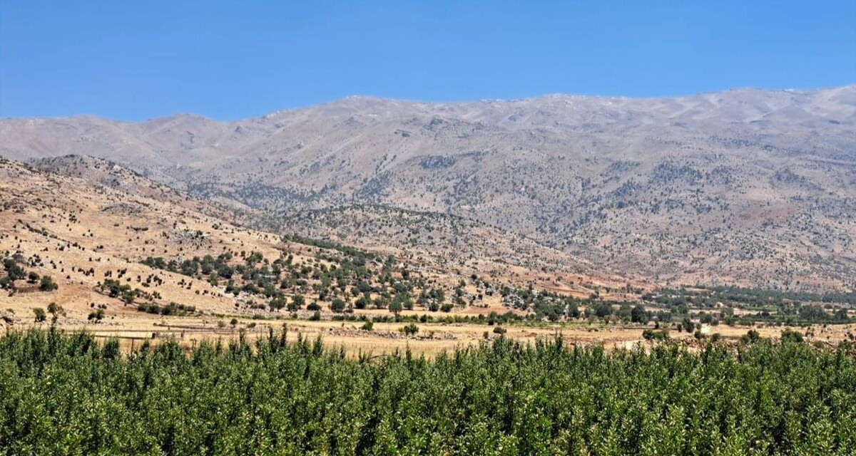
Back in Lebanon with BioConnect: Witnessing nature protection and socioecological resilience in action
As part of ETC-UMA’s role as the external evaluator for the EU-funded BioConnect project, the Centre’s Director, Dania Abdul Malak, carried out a site visit to Lebanon from July 8 to 12 to assess the project’s progress in its third ...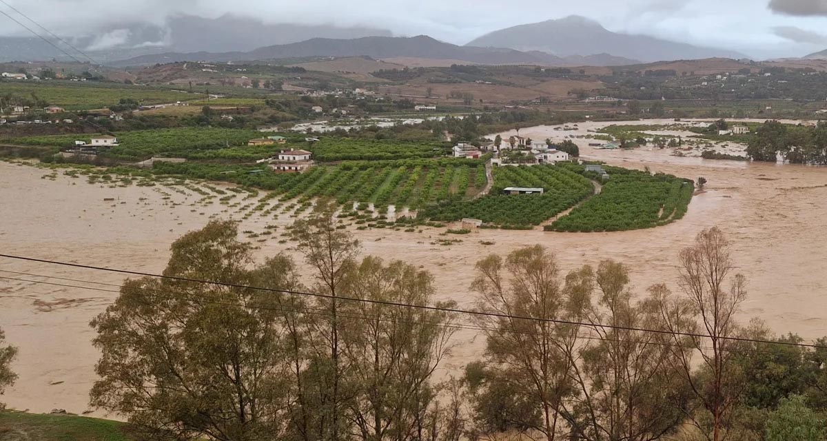
Boosting Climate Resilience: Wetland4Change Project Advances Flood Management Solutions for Mediterranean Coastal Zones
The Mediterranean coastal zone´s combination of multiple severe climate hazards – rising temperatures, water scarcity, sea-level rise, and extreme weather events – makes it a hotspot for highly interconnected climate risks for the ecosystems and societies. Recent catastrophic floods in ...RESTORE4Cs 1st Policy Brief: How can coastal wetlands help achieve EU climate goals?
The first RESTORE4Cs Policy Brief of RESTORE4Cs, “How can coastal wetlands help achieve EU climate goals?“, highlights the importance of European coastal wetlands for reducing Greenhouse Gas emissions. The key messages of the first RESTORE4Cs Policy Brief include: Coastal wetlands are important natural carbon stores, ...Mapping the Impact of Blue Tourism in the Mediterranean
The IUCN Centre for Mediterranean Cooperation with the support of ETC-UMA in the framework of the Blue Tourism Initiative, has released a comprehensive report entitled “Mapping the Impact of Blue Tourism in the Mediterranean: Vulnerability Assessment of Coastal and Marine ...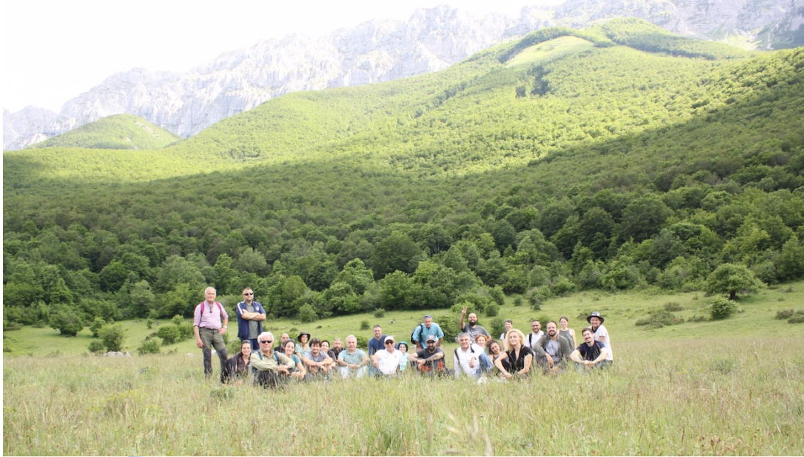
StrategyMedFor Presented at Annual Medforval Meeting 2024
StrategyMedFor was prominently featured at the Annual Medforval Meeting 2024, held from June 5-7 in Fontecchio, Italy. The event brought together 25 practitioners from national parks and natural reserves across 9 Mediterranean countries, providing a valuable platform for StrategyMedFor to ...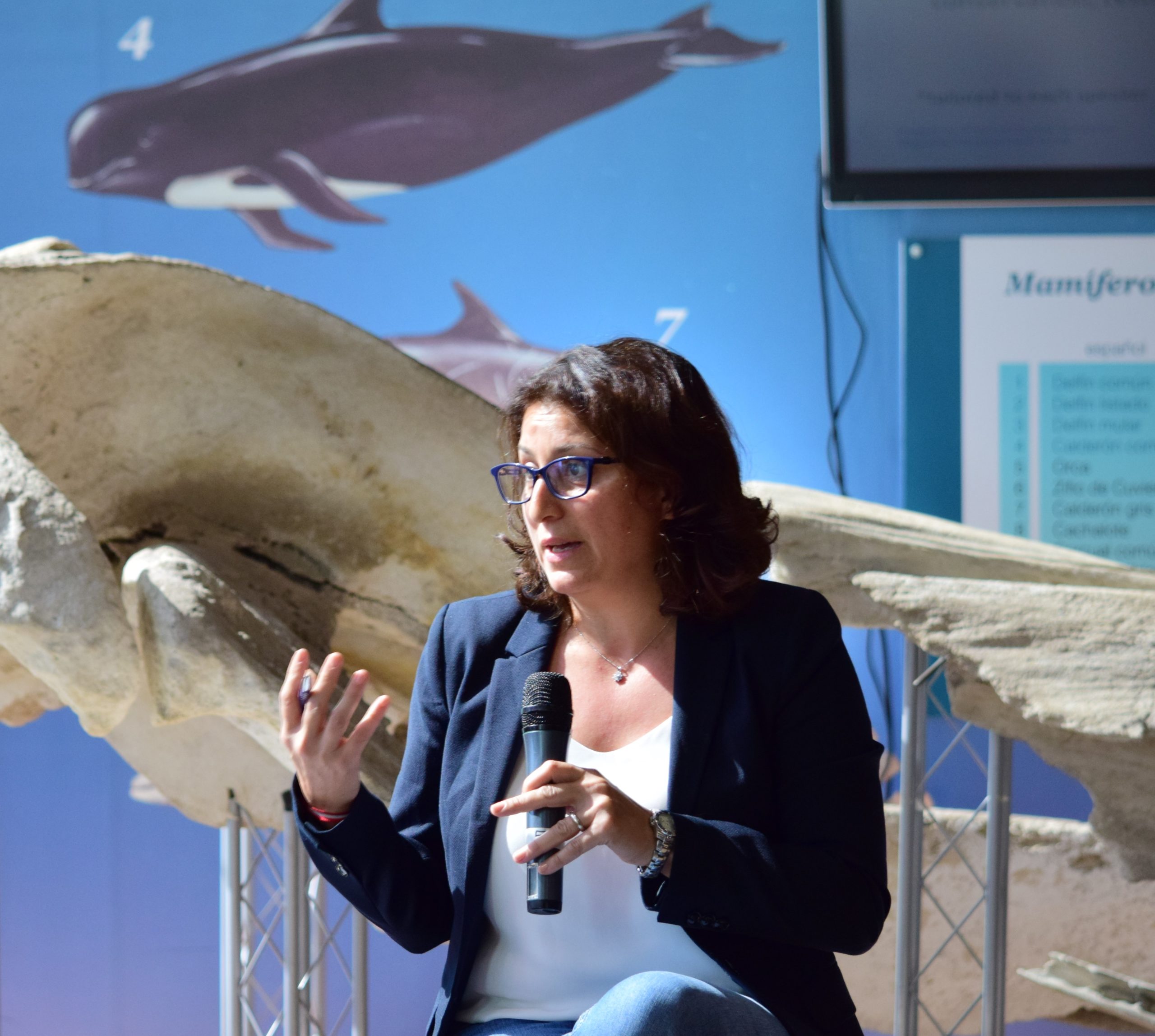
Celebrating leadership in environmental management: an interview with Dania Abdul Malak
From designing integrated ecosystem assessments in Europe and the Mediterranean to transforming outcomes into evidence-based recommendations for regional stakeholders, the European Topic Centre on Spatial Analysis and Synthesis (ETC-UMA) stands as a flagship for territorial cooperation. At the forefront of ...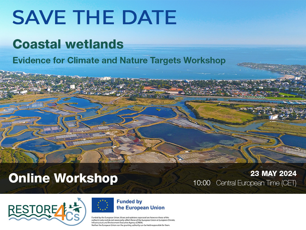
Save the date! Unlocking solutions for coastal conservation in Europe
How can coastal wetlands respond to major European Union objectives such as climate neutrality, biodiversity protection, and pollution reduction? What key role do coastal wetlands play in achieving EU commitments for climate mitigation and biodiversity conservation? The European Topic Centre ...
Towards a Strategy for the Sustainable Management of Mediterranean Forests (StrategyMedFor)
The StrategyMedFor project, co-financed by the Interreg Euro-MED programme, was launched at the University of Malaga during a two day meeting that took place on March 18 and 19, 2024. The European Topic Centre on Spatial Analysis and Synthesis (ETC-UMA), ...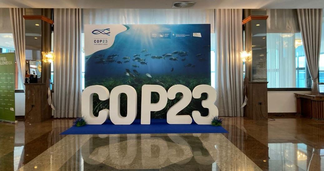
Collaborative science for forests by ETC-UMA showcased in Slovenia during the COP23
As UNEP MAP partner organization, ETC-UMA recently engaged in the organization of a session with Mediterranean institutions under the topic of climate change, entitled: From COASTAL to FOREST ecosystems: Mediterranean Nature-based Solutions to tackle climate change and ensure the Resilience ...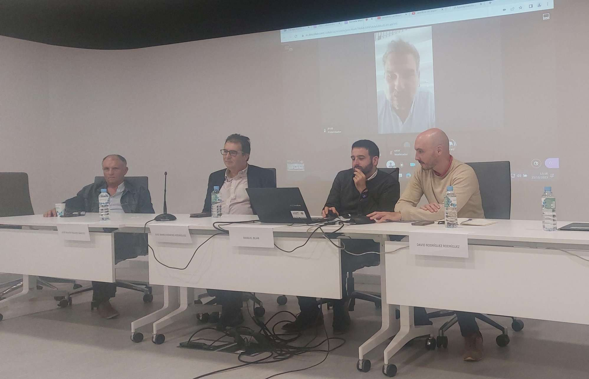
Tools for conserving the Spanish coast
On the initiative of the Instituto Universitario Hábitat Territorio y Digitalización (iHTD) of the University of Malaga, around 70 representatives of Spanish public administrations, researchers, architecture and environmental science players and civil society signed up to the second debate on ...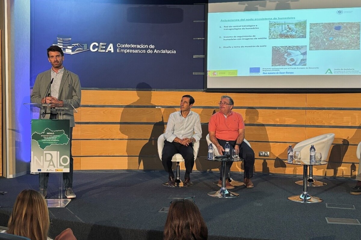
GreenEye System: a cloud-based system to monitor wetlands in Andalusia
Developed in the frame of the LifeWatch INDALO project cofinanced by the European Regional Development Fund (ERDF) for the study of biodiversity and global change in Andalucia, GreenEye System, this new cloud-based monitoring system, provides useful tools for wetlands’ assessment, ...
Looking back and forth to Mediterranean Forests
Timely published to enrich the knowledge available to fight fires and climate change challenges after an extremely hot summer, the proceedings of the Seventh Mediterranean Forest Week “Forest and Ecosystem Restoration for the next Mediterranean Generations” held from 21 to ...
More space for innovative Mediterranean forest data partnerships
The report entitled A knowledge baseline on Mediterranean forests supported by innovation launched in July by ETC-UMA provides a highlight of what Mediterranean countries and institutions are doing to integrate new digital, satellite and Artificial Intelligence technologies into forest monitoring ...