Overview of recent work and access to online publications and resources
RESTORE4Cs 1st Policy Brief: How can coastal wetlands help achieve EU climate goals?
The first RESTORE4Cs Policy Brief of RESTORE4Cs, “How can coastal wetlands help achieve EU climate goals?“, highlights the importance of European coastal wetlands for reducing Greenhouse Gas emissions. The key messages of the first RESTORE4Cs Policy Brief include: Coastal wetlands are important natural carbon stores, ...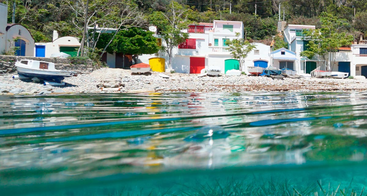
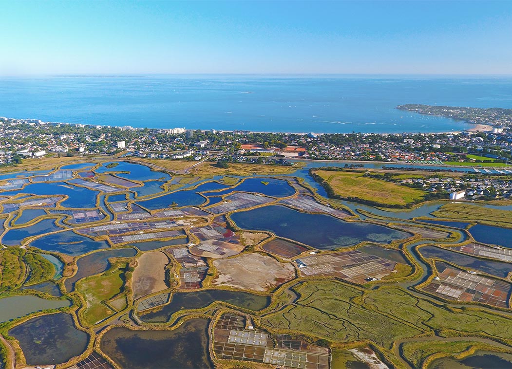
Mapping the Impact of Blue Tourism in the Mediterranean
The IUCN Centre for Mediterranean Cooperation with the support of ETC-UMA in the framework of the Blue Tourism Initiative, has released a comprehensive report entitled “Mapping the Impact of Blue Tourism in the Mediterranean: Vulnerability Assessment of Coastal and Marine ...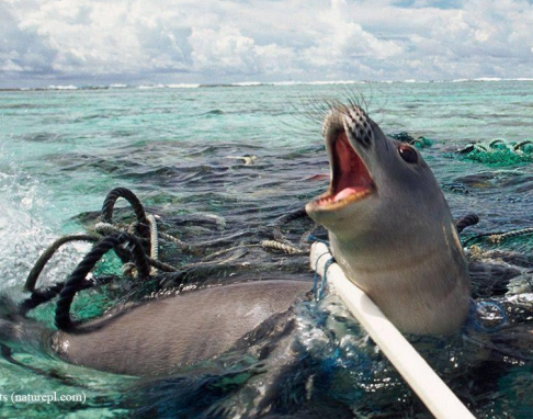
Brief update of the MedBioLitter database version 10 updated in January 2023
The MedBioLitter knowledge base is an entry-point to the peer reviewed research evidence published on the impacts of marine litter on marine biota in the Mediterranean region. This knowledge base was created in 2017, under the Interreg-Med funded initiative PANACeA ...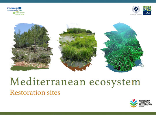
Mediterranean ecosystem restoration sites
In the frame of its strategic activities in the Mediterranean region, ETC-UMA as coordinator of the Mediterranean Biodiversity Protection Community (MBPC) has joined the Task Force on Best Practices on Ecosystem Restoration and committed to use its network of practitioners ...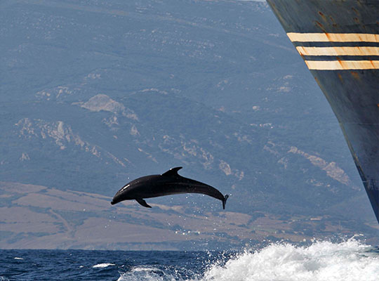
Supporting cetacean conservation in the Pelagos Sanctuary
A new report has been presented today, 18 November 2022, online in the frame of the cooperation between the Pelagos Permanent Secretariat and the Mediterranean Biodiversity Protection Community (MBPC), a project led by ETC-UMA. The new report, entitled Pathways to ...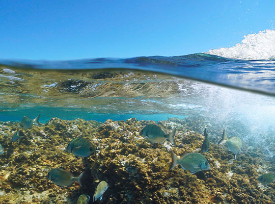
An assessment of marine biodiversity protection in the Mediterranean Sea: A threatened global biodiversity hotspot
The Mediterranean Sea is a World’s biodiversity hotspot. It harbours around 11% of all marine species in less than 1% of the global marine area (Bianchi & Morri, 2000). Furthermore, around 20% of those species are endemic (Coll et al., ...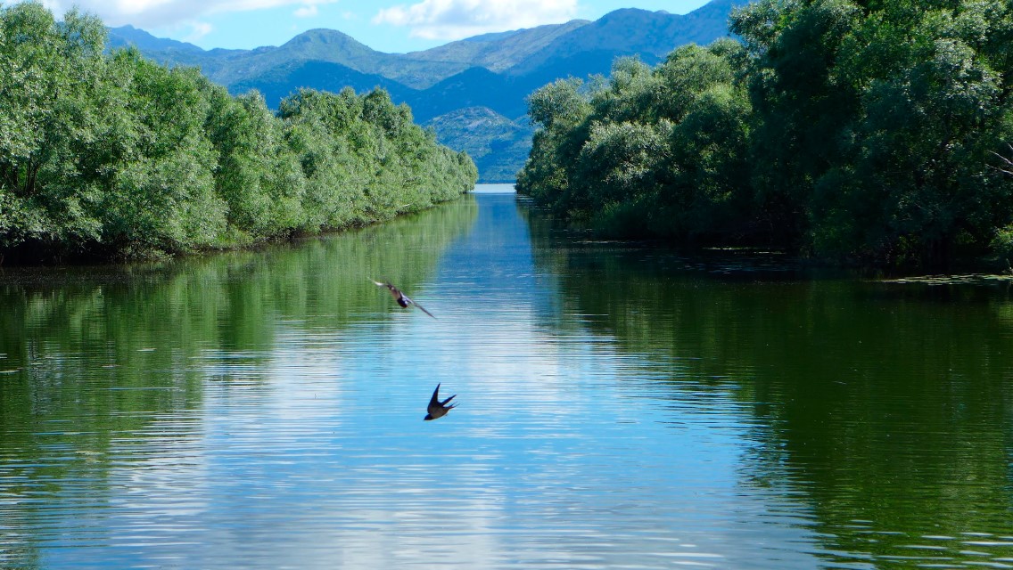
Mediterranean wetlands – their current state and ways to improve their conservation
The recent report entitled “Mapping and assessment of the state of wetland ecosystems: a Mediterranean perspective” led by ETC-UMA, in the frame of the Mediterranean Biodiversity Protection Community initiative co-funded by the EU Interreg Mediterranean programme, is the result of ...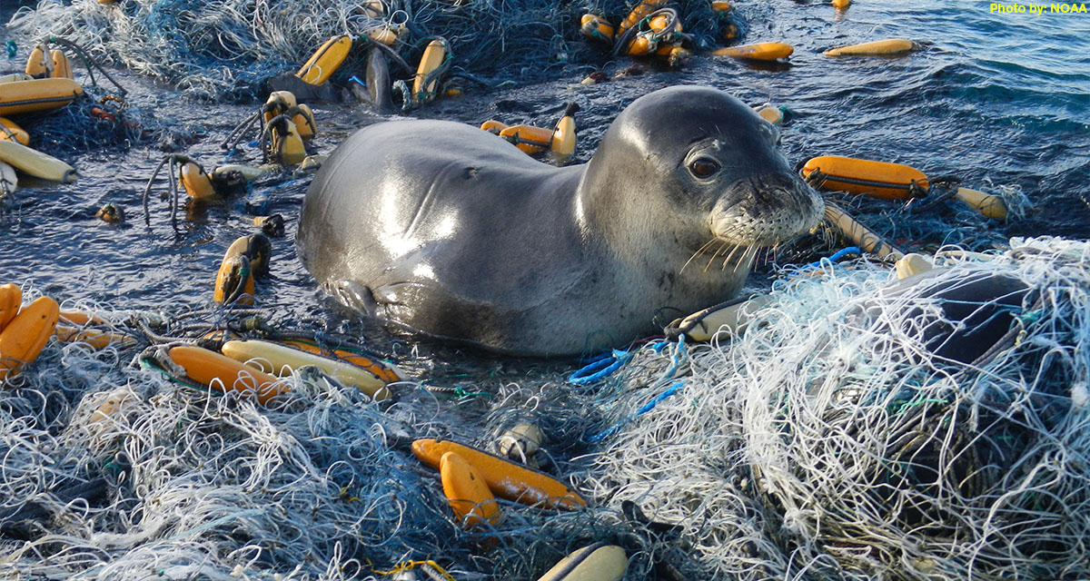
ETC-UMA issues new report on the impacts of litter on Mediterranean marine species
On the occasion of the workshop organized by IUCN and Région Sud in collaboration with its CPMR partner, the ETC-UMA Director, Dania Abdul Malak is presenting today 1 April 2022 a highlight on the wide range of actions required to ...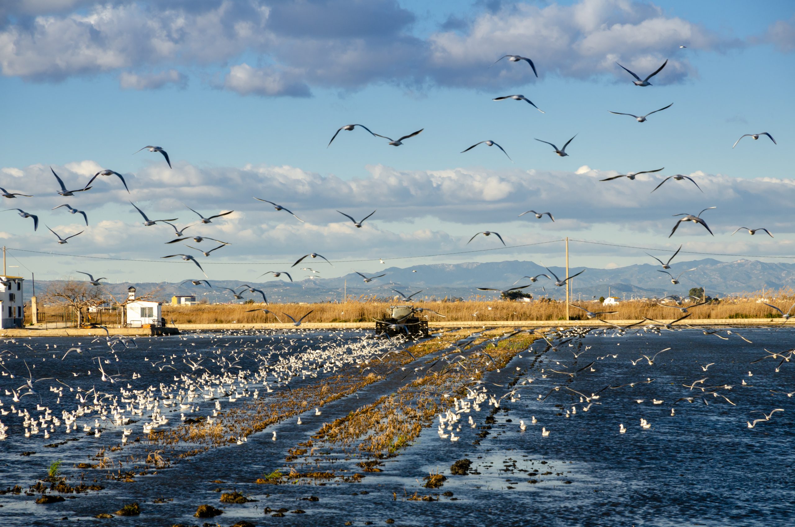
The role of healthy wetlands in fighting climate change
The new report developed by the ETC-UMA (University of Malaga), as partner of the European Topic Centre on Urban, Land and Soil Systems (ETC/ULS) has shed light on the role of healthy wetland habitats in the carbon cycle and the ...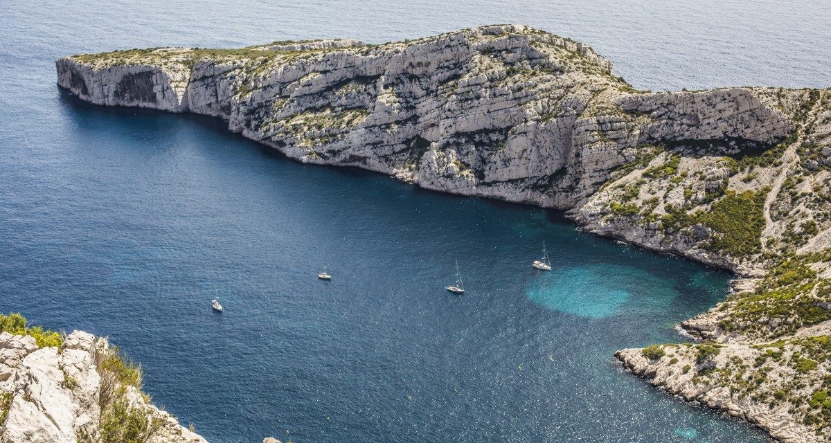
A Mediterranean snapshot on what we have and how to protect it
The report on the State of the Environment and Development in the Mediterranean (SoED) published in November 2020 warns that the Mediterranean basin is facing escalating environmental and developmental challenges: warming 20% faster than other regions, with 78% of fishing stocks subject ...
Mapping and Assessment of Ecosystems and their Services: An EU ecosystem assessment
This report presents an ecosystem assessment covering the total land area of the EU as well as the EU marine regions. The assessment is carried out by Joint Research Centre, European Environment Agency, DG Environment, and the European Topic Centres ...
MedBioLitter: an open database on marine litter and biodiversity science
An open database and spatial geoportal on current scientific knowledge related to marine litter and biodiversity interactions in the Mediterranean region. ...Check all our resources
You can access additional resources and publications per year through our engine below
Journal Articles
Mackelworth, P.; Fortuna, C. M.; Antoninić, M.; Holcer, D.; Abdul-Malak, D.; Attia, K.; Bricelj, M.; Guerquin, F.; Marković, M.; Nunes, E.; Perez-Valverde, C.; Ramieri, E.; Stojanović, I.; Tunesi, L.; McGowan, J.
Ecologically and Biologically Significant Areas (EBSAs) as an enabling mechanism for transboundary marine spatial planning Journal Article
In: Marine Policy, vol. 166, pp. 106231, 2024, ISSN: 0308-597X.
Abstract | Links | BibTeX | Tags: Biodiversity, Conservation and management, Environmental conservation, Mediterranean sea, Protected areas, Transboundary management
@article{MACKELWORTH2024106231,

title = {Ecologically and Biologically Significant Areas (EBSAs) as an enabling mechanism for transboundary marine spatial planning},

author = {P. Mackelworth and C. M. Fortuna and M. Antoninić and D. Holcer and D. Abdul-Malak and K. Attia and M. Bricelj and F. Guerquin and M. Marković and E. Nunes and C. Perez-Valverde and E. Ramieri and I. Stojanović and L. Tunesi and J. McGowan},

url = {https://www.sciencedirect.com/science/article/pii/S0308597X2400229X},

doi = {https://doi.org/10.1016/j.marpol.2024.106231},

issn = {0308-597X},

year  = {2024},

date = {2024-01-01},

urldate = {2024-01-01},

journal = {Marine Policy},

volume = {166},

pages = {106231},

abstract = {As the new global biodiversity targets kick in, the signatories to the Convention of Biological Diversity (CBD) are searching for means to fulfil their obligations. Fortunately, more than a decade ago a long-neglected solution was created for the marine environment. The ecologically or biologically significant marine areas (EBSAs) provide a means for opening discussions around the management of large marine areas, ideally with conservation as a core priority. While the biological and ecological criteria for the selection of the EBSAs is clearly outlined, there is little clarity on the means to manage or govern these areas. The conservation and management measures are left as a matter to be resolved by those states which maintain some form of jurisdiction over regions within an EBSA. Of course, these measures must be in accordance with international law. Within the Mediterranean there are 15 EBSAs which have been identified and recognised by the parties of the UNEP regional seas programme. For the past four years, technical and scientific discussions have looked to move the EBSA recognition of the Southern Adriatic Ionian Straight (SAIS) forward and identify potential governance frameworks. This work has included a biodiversity threat analysis, a legal and governance review, and a preliminary spatial prioritization. We report on the processes undertaken, the policy implications for the SAIS-EBSA and the way forward. This work has implications not only for this region but for other regions within the Mediterranean and beyond.},

keywords = {Biodiversity, Conservation and management, Environmental conservation, Mediterranean sea, Protected areas, Transboundary management},

pubstate = {published},

tppubtype = {article}

}
Rodríguez-Rodríguez, D.; Knecht, N.; Llopis, J. C.; Heriarivo, R. A.; Rakotoarison, H.; Andriamampionomanjaka, V.; Navarro-Jurado, E.; Randriamamonjy, V.
Socioeconomic impacts of small conserved sites on rural communities in Madagascar Journal Article
In: Environmental Development, pp. 100965, 2024, ISSN: 2211-4645.
Abstract | Links | BibTeX | Tags: Biodiversity, Conservation and management, Ecosystem services, Environmental conservation
@article{RODRIGUEZRODRIGUEZ2024100965,

title = {Socioeconomic impacts of small conserved sites on rural communities in Madagascar},

author = {D. Rodríguez-Rodríguez and N. Knecht and J. C. Llopis and R. A. Heriarivo and H. Rakotoarison and V. Andriamampionomanjaka and E. Navarro-Jurado and V. Randriamamonjy},

url = {https://www.sciencedirect.com/science/article/pii/S2211464524000034},

doi = {https://doi.org/10.1016/j.envdev.2024.100965},

issn = {2211-4645},

year  = {2024},

date = {2024-01-01},

urldate = {2024-01-01},

journal = {Environmental Development},

pages = {100965},

abstract = {Madagascar is considered one of the top global biodiversity hotspots while at the same time is among the world's least developed countries. Pressing socioeconomic needs such as food provision often lead to unsustainable land use and widespread loss, fragmentation and degradation of natural habitats. Thus, ascertaining the socioeconomic effects of small conserved sites is urgent in order to show their benefits and identify their costs to attain sustainable rural development on the island. Here, we used structured questionnaires in two surveys to key local stakeholders, including 1) managers of three conserved sites smaller than 100 ha, and 2) local communities living around such sites (cases) and similar neighbouring communities unaffected by those conserved sites (controls), following a Before-After-Control-Impact design. Median income did not differ between case and control communities, although case communities reported better self-perception of their economic situation and wider availability of basic services. Substantial revenues from tourism accrued only to one local community from a conveniently located, community-managed site: Anja Community Reserve. No differences in the economic effects from the establishment of the conserved sites were found between sex, age or education levels of community members. Exploitation of natural resources from conserved sites was either prohibited (two sites) or severely restricted (one site). As a result, case communities tended to collect fewer natural resources from nearby areas than control communities. Contrary to expectations, case communities reported less economic impact than control communities during the COVID-19 pandemic even though visitors were reduced to zero, which likely indicate greater socioeconomic resilience due to previous community investments and greater availability of ecosystem services. Successful, bottom-up and replicable approaches to locally manage natural resources sustainably are urgently needed in a country with rich and vanishing biodiversity, weak institutions, high poverty rates and strong dependence on natural resources for subsistence.},

keywords = {Biodiversity, Conservation and management, Ecosystem services, Environmental conservation},

pubstate = {published},

tppubtype = {article}

}
Martorell-Guerrero, G.; Rodríguez-Rodríguez, D.; García-Millán, V. E.
Long-term assessment of the effectiveness of coastal protection regulations in conserving natural habitats in Spain Journal Article
In: Ocean & Coastal Management, vol. 239, 2023.
Abstract | Links | BibTeX | Tags: Conservation and management, Environmental conservation, Geotechnology, Land and soil, Pressures, Tourism
@article{nokey,

title = {Long-term assessment of the effectiveness of coastal protection regulations in conserving natural habitats in Spain},

author = {G. Martorell-Guerrero and D. Rodríguez-Rodríguez and V. E. García-Millán},

url = {https://www.sciencedirect.com/science/article/pii/S0964569123001266},

doi = {https://doi.org/10.1016/j.ocecoaman.2023.106601},

year  = {2023},

date = {2023-05-15},

journal = {Ocean & Coastal Management},

volume = {239},

abstract = {Spain has undergone rapid socioeconomic development in the past three decades. This has been linked to massive residential and infrastructural development based on a short-term, profitable and resource-intensive consuming model. As a result, large amounts of agricultural, natural and semi-natural soils have been lost to artificial areas, especially around main cities and on the coast. In this study, we assessed the effectiveness of the Spanish Shores Act at preventing land development in two biogeographical regions and three administrative scales between 1988 and 2020 using a BACI design and remote sensing data. We also analysed the combined effect of other regulations to prevent land development on the coast. The Shores Act was effective in reducing land development although moderate to substantial land development occurred in the zones affected by the Law, especially in the Mediterranean region. Adding other sectoral regulations to the Shores Act notably and consistently reduced land development across regions. Among them, cumulative protected area (PA) regulations were most effective in reducing coastal land development. The use of satellite images, especially Sentinel 2A MSI data within a BACI design, proved a useful method for assessing the effectiveness of fine-scale objectives of environmental policies such as the Shores Act.},

keywords = {Conservation and management, Environmental conservation, Geotechnology, Land and soil, Pressures, Tourism},

pubstate = {published},

tppubtype = {article}

}
Zhang, Yin; West, Paige; Thakholi, Lerato; Suryawanshi, Kulbhushansingh; Supuma, Miriam; Straub, Dakota; Sithole, Samantha S.; Sharma, Roshan; Schleicher, Judith; Ruli, Ben; Rodríguez-Rodríguez, D.; Rasmussen, Mattias Borg; Ramenzoni, Victoria C.; Qin, Siyu; Pugley, Deborah Delgado; Palfrey, Rachel; Oldekop, Johan; Nuesiri, Emmanuel O.; Nguyen, Van Hai Thi; Ndam, Nouhou; Mungai, Catherine; Milne, Sarah; Mabele, Mathew Bukhi; Lucitante, Sadie; Lucitante, Hugo; Liljeblad, Jonathan; Kiwango, Wilhelm Andrew; Kik, Alfred; Jones, Nikoleta; Johnson, Melissa; Jarrett, Christopher; James, Rachel Sapery; Holmes, George; Gibson, Lydia N.; Ghoddousi, Arash; Geldmann, Jonas; Gebara, Maria Fernanda; Edwards, Thera; Dressler, Wolfram H.; Douglas, Leo R.; Dimitrakopoulos, Panayiotis G.; Davidov, Veronica; Compaoré-Sawadogo, Eveline M. F. W.; Collins, Yolanda Ariadne; Cepek, Michael; Burow, Paul Berne; Brockington, Dan; Balinga, Michael Philippe Bessike; Austin, Beau J.; Astuti, Rini; Ampumuza, Christine; Agyei, Frank Kwaku
Governance and Conservation Effectiveness in Protected Areas and Indigenous and Locally Managed Areas Journal Article
In: Annual Review of Environment and Resources, vol. 48, no. 1, pp. 559-588, 2023.
Abstract | Links | BibTeX | Tags: Biodiversity, Conservation and management, Environmental conservation, Marine protected areas, Protected areas
@article{doi:10.1146/annurev-environ-112321-081348,

title = {Governance and Conservation Effectiveness in Protected Areas and Indigenous and Locally Managed Areas},

author = {Yin Zhang and Paige West and Lerato Thakholi and Kulbhushansingh Suryawanshi and Miriam Supuma and Dakota Straub and Samantha S. Sithole and Roshan Sharma and Judith Schleicher and Ben Ruli and D. Rodríguez-Rodríguez and Mattias Borg Rasmussen and Victoria C. Ramenzoni and Siyu Qin and Deborah Delgado Pugley and Rachel Palfrey and Johan Oldekop and Emmanuel O. Nuesiri and Van Hai Thi Nguyen and Nouhou Ndam and Catherine Mungai and Sarah Milne and Mathew Bukhi Mabele and Sadie Lucitante and Hugo Lucitante and Jonathan Liljeblad and Wilhelm Andrew Kiwango and Alfred Kik and Nikoleta Jones and Melissa Johnson and Christopher Jarrett and Rachel Sapery James and George Holmes and Lydia N. Gibson and Arash Ghoddousi and Jonas Geldmann and Maria Fernanda Gebara and Thera Edwards and Wolfram H. Dressler and Leo R. Douglas and Panayiotis G. Dimitrakopoulos and Veronica Davidov and Eveline M. F. W. Compaoré-Sawadogo and Yolanda Ariadne Collins and Michael Cepek and Paul Berne Burow and Dan Brockington and Michael Philippe Bessike Balinga and Beau J. Austin and Rini Astuti and Christine Ampumuza and Frank Kwaku Agyei},

url = {https://doi.org/10.1146/annurev-environ-112321-081348},

doi = {10.1146/annurev-environ-112321-081348},

year  = {2023},

date = {2023-01-01},

urldate = {2023-01-01},

journal = {Annual Review of Environment and Resources},

volume = {48},

number = {1},

pages = {559-588},

abstract = {Increased conservation action to protect more habitat and species is fueling a vigorous debate about the relative effectiveness of different sorts of protected areas. Here we review the literature that compares the effectiveness of protected areas managed by states and areas managed by Indigenous peoples and/or local communities. We argue that these can be hard comparisons to make. Robust comparative case studies are rare, and the epistemic communities producing them are fractured by language, discipline, and geography. Furthermore the distinction between these different forms of protection on the ground can be blurred. We also have to be careful about the value of this sort of comparison as the consequences of different forms of conservation for people and nonhuman nature are messy and diverse. Measures of effectiveness, moreover, focus on specific dimensions of conservation performance, which can omit other important dimensions. With these caveats, we report on findings observed by multiple study groups focusing on different regions and issues whose reports have been compiled into this article. There is a tendency in the data for community-based or co-managed governance arrangements to produce beneficial outcomes for people and nature. These arrangements are often accompanied by struggles between rural groups and powerful states. Findings are highly context specific and global generalizations have limited value.},

keywords = {Biodiversity, Conservation and management, Environmental conservation, Marine protected areas, Protected areas},

pubstate = {published},

tppubtype = {article}

}
García-Millán, V. E.; Rodríguez-Rodríguez, D.; Oncina, A. Martín; Andrianarimisa, A.; Randriamiharisoa, L. O.; Martorell-Guerrero, G.; Bóveda, A.; Abdul-Malak, D.
Identification of Priority Forest Conservation Areas for Critically Endangered Lemur Species of Madagascar Journal Article
In: Land, vol. 11, iss. 9, no. 1455, 2022.
Abstract | Links | BibTeX | Tags: Biodiversity, Conservation and management, Environmental conservation, Forest, Geotechnology, Protected areas
@article{García-Millán2022,

title = {Identification of Priority Forest Conservation Areas for Critically Endangered Lemur Species of Madagascar},

author = {V. E. García-Millán and D. Rodríguez-Rodríguez and A. Martín Oncina and A. Andrianarimisa and L. O. Randriamiharisoa and G. Martorell-Guerrero and A. Bóveda and D. Abdul-Malak},

url = {https://doi.org/10.3390/land11091455},

doi = {https://doi.org/10.3390/land11091455},

year  = {2022},

date = {2022-09-01},

urldate = {2022-09-01},

journal = {Land},

volume = {11},

number = {1455},

issue = {9},

abstract = {Forests have extraordinary importance for the conservation of endemic species in Madagascar. However, they are disappearing fast due to a number of pressures, notably unsustainable agricultural practices leading to aggravated status of biodiversity. Here, we used a number of ecological and spatial criteria to identify and prioritise unprotected forest areas for the conservation of the eight critically endangered species of lemur belonging to the Lemuridae family in Madagascar. By combining spatial information layers on the distribution areas of the studied lemurs, forest extension and conservation status, and potential human impacts (such as roads, human settlements and agriculture lands), it was possible to identify the most appropriate sites for the expansion of the conservation areas of critically endangered lemur species. Seven new sites, totalling over 33,000 ha, were identified as priority sites for the protection of those species. All of them were adjacent to or inside (just one site) existing protected areas (PAs), which likely makes their protection both feasible and socioeconomically efficient by enlarging those PAs. Legally protecting these sites would not only take Madagascar one little step ahead for meeting oncoming global biodiversity targets for 2030 but could also make a substantial contribution to the mid-term survival of the studied lemur species.},

keywords = {Biodiversity, Conservation and management, Environmental conservation, Forest, Geotechnology, Protected areas},

pubstate = {published},

tppubtype = {article}

}
Petersen, J. E.; Mancosu, E.; King, S.
Ecosystem extent accounts for Europe Journal Article
In: Ecosystem Services, vol. 57, iss. October 2022, no. 101457, 2022.
Abstract | Links | BibTeX | Tags: Conservation and management, Ecosystem, Ecosystem services, Environmental conservation, Land and soil
@article{Petersen2022,

title = {Ecosystem extent accounts for Europe},

author = {J.E. Petersen and E. Mancosu and S. King},

url = {https://doi.org/10.1016/j.ecoser.2022.101457},

doi = {https://doi.org/10.1016/j.ecoser.2022.101457},

year  = {2022},

date = {2022-07-31},

journal = {Ecosystem Services},

volume = {57},

number = {101457},

issue = {October 2022},

abstract = {This paper describes the set-up and results for ecosystem extent accounts at European level, developed in the context of the United Nations System of Environmental-Economic Accounting - Ecosystem Accounting (SEEA EA). These accounts inform on the opening and closing ‘stocks’ of ecosystems and provide essential geo-spatial data to support the calculation of ecosystem condition and services accounts. The paper presents the first set of ecosystem extent accounts for Europe, covering the period 2000–2018. These show that ecosystems are relatively stable at the European scale, with significant increases in Urban ecosystems and some decrease in Heathland and shrub and Grassland ecosystems. The paper demonstrates the use of a flexible geo-spatial database to gain analytical insights for different ecosystem accounting areas, using European biogeographical regions and Natura 2000 areas as examples. More detailed ecosystem extent accounts (tier II and tier III) show trends inter alia for Agro-forestry, Peat Bog, Beaches, dunes and sands as well as Salt marsh ecosystems, important for biodiversity and ecosystem services. The accounting approach presented delivers a geo-spatial data foundation that can support further ecosystem analysis and accounts. This enables the targeting of ecosystem analysis on specific geographic areas and policy instruments.},

keywords = {Conservation and management, Ecosystem, Ecosystem services, Environmental conservation, Land and soil},

pubstate = {published},

tppubtype = {article}

}
Marín, A. I.; Abdul-Malak, D.; Bastrup-Birk, A.; Chirici, G.; Barbati, A.; Kleeschulte, S.
Mapping forest condition in Europe: Methodological developments in support to forest biodiversity assessments Journal Article
In: Ecological Indicators, vol. 128, 2021.
Abstract | Links | BibTeX | Tags: Biodiversity, Conservation and management, Ecosystem, Environmental conservation, Forest
@article{Marín2021b,

title = {Mapping forest condition in Europe: Methodological developments in support to forest biodiversity assessments},

author = {A. I. Marín and D. Abdul-Malak and A. Bastrup-Birk and G. Chirici and A. Barbati and S. Kleeschulte},

url = {https://doi.org/10.1016/j.ecolind.2021.107839},

doi = {10.1016/j.ecolind.2021.107839},

year  = {2021},

date = {2021-05-29},

journal = {Ecological Indicators},

volume = {128},

abstract = {Forest condition, biodiversity, and ecosystem services are strongly interlinked. The biodiversity levels depend to a large extent on the integrity, health, and vitality of forests at the same time as losses of forest biodiversity lead to decreased forest productivity and sustainability. Under this conceptual framework, this study presents a methodology for mapping forest condition at European scale supporting the attainment of the 2020 Aichi Biodiversity Target 5 “the rate of loss of all natural habitats, including forests, is at least halved and where feasible brought close to zero, and degradation and fragmentation is significantly reduced” and the implementation of Sustainable Development Goals (SDG), as well as the EU forest strategy since the sustainable forest management is oriented to support the provision of forest services and to enhance the condition of biodiversity forests’ host.


The work presents the developments of an operational indicator at European scale. This spatially explicit information on forest condition can be the baseline map with a 1 km resolution to monitor the state and changes of condition by exposition to pressures and threats. This condition indicator considers structural, functional, and compositional aspects of forest with relevance for health and vitality of species and habitats hosted by forest ecosystems.


The methodology implemented used harmonized, published and open datasets. It provided confident results for the assessment of the condition within hemiboreal, temperate and alpine forests, showing the Carpathian, Dinaric Alps and Alps, among others, as hotspots with pre-dominantly good condition. The results were validated with data derived from the reporting for the EU Habitat Directive and explicit dataset on known primary forests in Europe. However, this method underestimated the forest condition in the Mediterranean and Boreal forest types due to data gaps, regional specific characteristics, and design limitations.


This study illustrates an operational and transferable approach for addressing the assessment of ecosystem forest condition at European scale being considered as a support tool for European countries when mapping and assessing their national territory, as potential common approach to map forest ecosystems that allows for consistent aggregation and comparisons across scales.},

keywords = {Biodiversity, Conservation and management, Ecosystem, Environmental conservation, Forest},

pubstate = {published},

tppubtype = {article}

}
The work presents the developments of an operational indicator at European scale. This spatially explicit information on forest condition can be the baseline map with a 1 km resolution to monitor the state and changes of condition by exposition to pressures and threats. This condition indicator considers structural, functional, and compositional aspects of forest with relevance for health and vitality of species and habitats hosted by forest ecosystems.
The methodology implemented used harmonized, published and open datasets. It provided confident results for the assessment of the condition within hemiboreal, temperate and alpine forests, showing the Carpathian, Dinaric Alps and Alps, among others, as hotspots with pre-dominantly good condition. The results were validated with data derived from the reporting for the EU Habitat Directive and explicit dataset on known primary forests in Europe. However, this method underestimated the forest condition in the Mediterranean and Boreal forest types due to data gaps, regional specific characteristics, and design limitations.
This study illustrates an operational and transferable approach for addressing the assessment of ecosystem forest condition at European scale being considered as a support tool for European countries when mapping and assessing their national territory, as potential common approach to map forest ecosystems that allows for consistent aggregation and comparisons across scales.
Rodríguez-Rodríguez, D.; Sánchez-Espinosa, A.; Abdul-Malak, D.
Potential contribution of OECMs to international area-based conservation targets in a biodiversity rich country, Spain Journal Article
In: Journal for Nature Conservation, vol. 62, 2021.
Abstract | Links | BibTeX | Tags: Biodiversity, Conservation and management, Ecosystem, Environmental conservation, Marine protected areas, Protected areas
@article{Rodríguez-Rodríguez2021b,

title = {Potential contribution of OECMs to international area-based conservation targets in a biodiversity rich country, Spain},

author = {D. Rodríguez-Rodríguez and A. Sánchez-Espinosa and D. Abdul-Malak},

url = {https://doi.org/10.1016/j.jnc.2021.126019},

doi = {10.1016/j.jnc.2021.126019},

year  = {2021},

date = {2021-05-15},

journal = {Journal for Nature Conservation},

volume = {62},

abstract = {Other effective area-based conservation measures (OECMs) are new conservation tools intended to complement protected areas (PAs) at achieving effective biodiversity conservation and meeting international area-based targets. However, OECMs have been rarely considered in practical terms until recently. Here, we performed a rapid evaluation on the degree of fulfilment of current area-based international biodiversity targets, post-2020 foreseeable oncoming targets, and ecological targets by considering: 1) Protection coverage; 2) Inclusiveness of important areas for biodiversity; 3) Protection management; 4) Connectivity; and 5) Habitat representation, on land and at sea in Spain, a Euro-Mediterranean, biodiversity rich country. We conducted the evaluation under two scenarios: 1) Scenario 1 considers designated PAs; and 2) Scenario 2, that also includes potential OECMs. In order to generate Scenario 2, thirteen legal categories were assessed against international guidance on OECMs as a first step to screen their likelihood of providing OECMs in Spain. Our findings show that some potentially satisfactory OECM categories such as Public Utility Forests, River Reserves or Geoparks meet the OECM criteria to a large degree and deserve further study. Our results also highlight that Spain is currently well above most foreseeable post-2020 biodiversity targets and even close to some ecological targets using just PAs, except for marine protected area (MPA) management and MPA offshore coverage. Adding OECMs would noticeably improve the country’s figures yet without reaching many exigent ecological targets. OECMs can become a useful, cost-effective biodiversity conservation tool that contributes to international targets under new, more ambitious area-based conservation requirements in Spain and elsewhere. Nevertheless, for this to happen, suitable biodiversity management and monitoring schemes must be ensured.},

keywords = {Biodiversity, Conservation and management, Ecosystem, Environmental conservation, Marine protected areas, Protected areas},

pubstate = {published},

tppubtype = {article}

}
Rodríguez-Rodríguez, D.; Larrubia, R.; Sinoga, J. D.
Are protected areas good for the human species? Effects of protected areas on rural depopulation in Spain Journal Article
In: Science of The Total Environment, vol. 763, 2021.
Abstract | Links | BibTeX | Tags: Conservation and management, Ecosystem services, Environmental conservation, Marine protected areas, Protected areas
@article{Rodríguez-Rodríguez2021,

title = {Are protected areas good for the human species? Effects of protected areas on rural depopulation in Spain},

author = {D. Rodríguez-Rodríguez and R. Larrubia and J.D. Sinoga},

url = {https://www.sciencedirect.com/science/article/abs/pii/S0048969720379304#!},

doi = {https://doi.org/10.1016/j.scitotenv.2020.144399},

year  = {2021},

date = {2021-04-21},

journal = {Science of The Total Environment},

volume = {763},

abstract = {Protected areas (PAs) seek to conserve valuable genes, species and ecosystems by applying a legal regime that restricts some socioeconomic activities and also offers opportunities for new ones. As a result, PAs have been claimed by some authors to boost socioeconomic conditions in rural areas mainly through tourism activities. However, others have claimed that PAs contribute to rural depopulation through the worsening of living conditions of local residents because of restrictions resulting from protection regulations. Here, we applied a multiple-paired Before-After-Control-Impact (BACI) research design on a census on protected rural municipalities (cases; N = 52) versus unprotected rural municipalities (controls; N = 55) in Spain to ascertain whether PAs had positive or negative effects on rural populations using three indicators on depopulation with official municipal data from 1996 until 2019: Compound annual growth rate (CAGR); Proportion of reproductive individuals (REP); and Proportion of reproductive females (WREP). We controlled for some confounders such as biophysical characteristics and regional regulations by carefully selecting our sample of municipalities spatially. Our results show that depopulation figures were worse in cases than in controls, with some exceptions whose characteristics should be further explored. Municipalities in Sites of Community Importance (SCIs) performed best against rural depopulation and generally better than their controls, whereas municipalities in Biosphere Reserves and Special Protection Areas (SPAs) showed mostly worse figures. Our findings suggest that, while necessary and important for biodiversity, multiple-use PAs generally entailed negative consequences for Spanish rural populations that need to be offset by State's intervention.},

keywords = {Conservation and management, Ecosystem services, Environmental conservation, Marine protected areas, Protected areas},

pubstate = {published},

tppubtype = {article}

}
Bevilacqua, S.; Katsanevakis, S.; Micheli, F.; Sala, E.; Rilov, G.; Sarà, G.; Abdul-Malak, D.; Abdulla, A.; Gerovasileiou, V.; Gissi, E.; Mazaris, A. D.; Pipitone, C.; Sini, M.; Stelzenmüller, V.; Terlizzi, A.; Todorova, V.; Fraschetti, S.
The Status of Coastal Benthic Ecosystems in the Mediterranean Sea: Evidence From Ecological Indicators Journal Article
In: Frontiers in Marine Science, 2020.
Abstract | Links | BibTeX | Tags: Conservation and management, Ecosystem, Environmental conservation, Mediterranean sea
@article{Bevilacqua2020,

title = {The Status of Coastal Benthic Ecosystems in the Mediterranean Sea: Evidence From Ecological Indicators},

author = {S. Bevilacqua and S. Katsanevakis and F. Micheli and E. Sala and G. Rilov and G. Sarà and D. Abdul-Malak and A. Abdulla and V. Gerovasileiou and E. Gissi and A. D. Mazaris and C. Pipitone and M. Sini and V. Stelzenmüller and A. Terlizzi and V. Todorova and S. Fraschetti},

url = {https://doi.org/10.3389/fmars.2020.00475},

doi = {10.3389/fmars.2020.00475},

year  = {2020},

date = {2020-06-19},

journal = {Frontiers in Marine Science},

abstract = {The Mediterranean Sea is subject to multiple human pressures increasingly threatening its unique biodiversity. Spatially explicit information on the ecological status of marine ecosystems is therefore key to an effective maritime spatial planning and management, and to help the achievement of environmental targets. Here, we summarized scientific data on the ecological status of a selection of marine ecosystems based on a set of ecological indicators in more than 700 sites of the Mediterranean Sea. For Posidonia oceanica seagrass beds, rocky intertidal fringe, and coastal soft bottoms, more than 70% of investigated sites exhibited good to high ecological conditions. In contrast, about two-thirds of sites for subtidal rocky reefs were classified to be in moderate to bad conditions, stressing the need for prioritizing conservation initiatives on these productive and diverse environments. Very little quantitative information was available for the southern Mediterranean Sea, thus monitoring programs and assessments in this area are essential for a representative assessment of the health of marine coastal ecosystems in the whole basin. This overview represents a first step to implement a baseline that, through georeferenced data on ecological status, could help identifying information gaps, directing future research priorities, and supporting improvements to spatial models of expected cumulative impacts on marine ecosystems.},

keywords = {Conservation and management, Ecosystem, Environmental conservation, Mediterranean sea},

pubstate = {published},

tppubtype = {article}

}
Weise, K.; Höfer, R.; Franke, J.; Guelmami, A.; Simonson, W.; Muro, J.; O'Connor, B.; Strauch, A.; Flink, S.; Eberle, J.; Mino, E.; Thulin, S.; Philipson, P.; van Valkengoed, E.; Truckenbrodt, J.; Zander, F.; Sánchez-Espinosa, A.; Schröder, C.; Thinfeld, F.; Fitoka, E.; Scott, E.; Ling, M.; Schwarz, M.; Kunz, I.; Thürmer, G.; Plasmeijer, A.; Hilarides, L.
Wetland extent tools for SDG 6.6.1 reporting from the Satellite-based Wetland Observation Service (SWOS) Journal Article
In: Remote Sensing of Environment, vol. 247, 2019.
Abstract | Links | BibTeX | Tags: Climate Change, Conservation and management, Environmental conservation, SWOS, Wetlands
@article{Weise2019,

title = {Wetland extent tools for SDG 6.6.1 reporting from the Satellite-based Wetland Observation Service (SWOS)},

author = {K. Weise and R. Höfer and J. Franke and A. Guelmami and W. Simonson and J. Muro and B. O'Connor and A. Strauch and S. Flink and J. Eberle and E. Mino and S. Thulin and P. Philipson and E. van Valkengoed and J. Truckenbrodt and F. Zander and A. Sánchez-Espinosa and C. Schröder and F. Thinfeld and E. Fitoka and E. Scott and M. Ling and M. Schwarz and I. Kunz and G. Thürmer and A. Plasmeijer and L. Hilarides},

url = {https://doi.org/10.1016/j.rse.2020.111892},

doi = {https://doi.org/10.1016/j.rse.2020.111892},

year  = {2019},

date = {2019-09-15},

journal = {Remote Sensing of Environment},

volume = {247},

abstract = {Wetlands are the most fragile and threatened ecosystems worldwide, and also one of the most rapidly declining. At the same time wetlands are typically biodiversity hotspots and provide a range of valuable ecosystem services, such as water supply and purification, disaster risk reduction, climate change adaptation, and carbon sequestration.


Pressures on wetlands are likely to further intensify in the coming decades due to increased global demand for land and water, and due to climate change. Stakeholders at all levels of governance have to be involved to slow, stop and reverse these processes. However, the information they need on wetland extent, their ecological character, and their ecosystem services is often scattered, sparse and difficult to find and access.


The freely available Sentinel satellite data of the Copernicus Programme, as well as the Landsat archive, provide a comprehensive basis to map and inventory wetland areas (extent), to derive information on the ecological status, as well as long- and short-term trends in wetland characteristics. However, making use of these Earth Observation (EO) resources for robust and standardized wetland monitoring requires expert knowledge on often complex data processing techniques, which impedes practical implementation. In this respect, the Satellite-based Wetland Observation Service (SWOS), a Horizon 2020 funded project (www.swos-service.eu) has developed and made disseminated monitoring approaches based on EO data, specifically designed for less experienced satellite data users.


The SWOS monitoring tools aim at assisting countries in conducting national wetland inventories for their Sustainable Development Goals (SDG) reporting and monitoring obligations, and additionally facilitates other monitoring obligations such as those required by the Ramsar Convention and supports decision-making in local conservation activities. The four main components of the SWOS approach are: map and indicator production; software development; capacity building; and initializing the GEO Wetlands Community Portal. Wetland managers and data analysists from more than fifty wetland sites and river basins across Europe, the Middle East, and Africa investigated the benefits and limitations of this EO-based wetland mapping and monitoring approach.


We describe research that applies the SWOS tools to test their potential for the mapping of wetlands in a case study based in Albania, and show its effectiveness to derive metrics relevant to the monitoring of SDG indicator 6.6.1.},

keywords = {Climate Change, Conservation and management, Environmental conservation, SWOS, Wetlands},

pubstate = {published},

tppubtype = {article}

}
Pressures on wetlands are likely to further intensify in the coming decades due to increased global demand for land and water, and due to climate change. Stakeholders at all levels of governance have to be involved to slow, stop and reverse these processes. However, the information they need on wetland extent, their ecological character, and their ecosystem services is often scattered, sparse and difficult to find and access.
The freely available Sentinel satellite data of the Copernicus Programme, as well as the Landsat archive, provide a comprehensive basis to map and inventory wetland areas (extent), to derive information on the ecological status, as well as long- and short-term trends in wetland characteristics. However, making use of these Earth Observation (EO) resources for robust and standardized wetland monitoring requires expert knowledge on often complex data processing techniques, which impedes practical implementation. In this respect, the Satellite-based Wetland Observation Service (SWOS), a Horizon 2020 funded project (www.swos-service.eu) has developed and made disseminated monitoring approaches based on EO data, specifically designed for less experienced satellite data users.
The SWOS monitoring tools aim at assisting countries in conducting national wetland inventories for their Sustainable Development Goals (SDG) reporting and monitoring obligations, and additionally facilitates other monitoring obligations such as those required by the Ramsar Convention and supports decision-making in local conservation activities. The four main components of the SWOS approach are: map and indicator production; software development; capacity building; and initializing the GEO Wetlands Community Portal. Wetland managers and data analysists from more than fifty wetland sites and river basins across Europe, the Middle East, and Africa investigated the benefits and limitations of this EO-based wetland mapping and monitoring approach.
We describe research that applies the SWOS tools to test their potential for the mapping of wetlands in a case study based in Albania, and show its effectiveness to derive metrics relevant to the monitoring of SDG indicator 6.6.1.
Rodríguez-Rodríguez, D.; Abdul-Malak, D.; Schröder, C.; McGlade, K.; Pascual, D.
Bridging the research-management gap in environmental conservation: A case study from Andalusia, southern Spain Journal Article
In: SDRP Journal of Earth Sciences & Environmental Studies, vol. 4, no. 2, pp. 579-588, 2019, ISBN: 2472-6397 .
Abstract | Links | BibTeX | Tags: Conservation and management, Environmental conservation, Protected areas, SOSTPARK
@article{Rodríguez-Rodríguez2019b,

title = {Bridging the research-management gap in environmental conservation: A case study from Andalusia, southern Spain},

author = {D. Rodríguez-Rodríguez and D. Abdul-Malak and C. Schröder and K. McGlade and D. Pascual},

url = {https://www.siftdesk.org/article-details/Bridging-the-research-management-gap-in-environmental-conservation-A-case-study-from-Andalusia-southern-Spain/489},

doi = {10.25177/JESES.4.2.RA.489},

isbn = {2472-6397 },

year  = {2019},

date = {2019-04-01},

journal = {SDRP Journal of Earth Sciences & Environmental Studies},

volume = {4},

number = {2},

pages = {579-588},

abstract = {Science is believed to provide the most objective basis for effective decision-making, though it is rarely implemented in environmental management. Here we reflect on the results of a regional workshop aimed at exploring the knowledge and use of scientific evidence by environmental managers in an ecologically diverse region in southern Spain: Andalusia. Scientists were moderately aware of regional managerial needs. They stated that regional managers’ needs could be mostly addressed by their research centers, and that they often considered managerial needs when conducting research. In turn, environmental managers had limited knowledge of, and interest in, the environmental research carried out in the region. However, managers stated they frequently use scientific outputs in their jobs. The main perceived barriers to effective use of science in regional environmental management by both groups were: different priorities by each group, and limited time of managers to check scientific information. Scientists also perceived that managers were not sufficiently engaged in research and that they were often reluctant to change their usual managerial practices. Managers mentioned inadequate scientific dissemination formats. The perceived solutions to those issues were: reinforcing collaboration mechanisms between both groups; aligning research to managerial needs more closely; greater managers’ awareness of adaptive management; and developing user friendly, synthetic communication tools for managers. The insights from the workshop are intended to help scientists and managers to enhance effective use of environmental science in Spain and elsewhere.},

keywords = {Conservation and management, Environmental conservation, Protected areas, SOSTPARK},

pubstate = {published},

tppubtype = {article}

}
Rodríguez-Rodríguez, D.; López, I.
Socioeconomic effects of protected areas in Spain across spatial scales and protection levels Journal Article
In: Ambio, vol. 49, pp. 258–270, 2019.
Abstract | Links | BibTeX | Tags: Conservation and management, Environmental conservation, Protected areas, SOSTPARK
@article{Rodríguez-Rodríguez2019c,

title = {Socioeconomic effects of protected areas in Spain across spatial scales and protection levels},

author = {D. Rodríguez-Rodríguez and I. López},

url = {https://doi.org/10.1007/s13280-019-01160-7},

doi = {10.1007/s13280-019-01160-7},

year  = {2019},

date = {2019-03-11},

journal = {Ambio},

volume = {49},

pages = {258–270},

abstract = {Impacts of the legal designation of protected areas (PAs) may have contrasting implications for different stakeholders, and at different spatial scales. In this study, we analysed the organisational perception on the socioeconomic effects of PA designation from all sectors of activity in Spain, accounting for PAs’ legal stringency. A semi-structured questionnaire was administered to 68 organisations at national, regional (Andalusia) and local scales (two municipalities in the Almeria province, Andalusia) through an online survey. Local stakeholders and the primary, secondary and tertiary sectors were most concerned about the social and economic impacts of PAs designation on their organisations. By contrast, organisations at the national or regional scales together with public institutions, the quaternary sector and other miscellaneous stakeholders perceived predominantly positive effects. Only national organisations perceived an increase in local social and economic effects from the designation of legally stringent PAs with regard to multiple-use PAs.},

keywords = {Conservation and management, Environmental conservation, Protected areas, SOSTPARK},

pubstate = {published},

tppubtype = {article}

}
Rodríguez-Rodríguez, D.; Sebastiao, J.; Tierra, A. R. Salvo
In: Land Degradation & Development , vol. 30, no. 8, pp. 991-1005, 2019.
Abstract | Links | BibTeX | Tags: Conservation and management, Environmental conservation, Protected areas, SOSTPARK
@article{Rodríguez-Rodríguez2019e,

title = {Effect of protected area networks at reducing land development across inland and coastal areas and climatic condictions of a rapidly developing country, Spain},

author = {D. Rodríguez-Rodríguez and J. Sebastiao and A.R. Salvo Tierra},

url = {https://onlinelibrary.wiley.com/doi/full/10.1002/ldr.3286},

doi = {10.1002/ldr.328},

year  = {2019},

date = {2019-02-13},

journal = {Land Degradation & Development },

volume = {30},

number = {8},

pages = {991-1005},

abstract = {Protected areas (PAs) aim at safeguarding biodiversity and ecosystem services in the long term. Despite the remarkable growth in area covered by PAs in recent years, biodiversity trends continue to worsen as a result of serious global pressures such as habitat destruction and degradation. One main cause of habitat destruction and degradation is land development that implies the replacement of natural land uses–land covers (LULCs) with artificial ones. Here, we assessed the effectiveness of four PA networks at preventing land development in Spain, a biodiversity‐rich country that has experienced recent rapid environmental transformations, using two models of increased validity: an original model and a biophysically enhanced model. We applied a before–after control–impact (BACI) design whereby absolute artificial area increase (AAI) and relative artificial area increase (RAI) were compared across PA categories (nature reserves [NRs], nature parks [NPs], Sites of Community Importance [SCIs], and Special Protection Areas [SPAs]), study zones (coastal and inland), and climates (Atlantic and Mediterranean) using CORINE Land Cover (CLC) data and two control zones: 1‐ and 5‐km buffers around protected polygons. NRs prevented land development, whereas other categories reduced it moderately to very substantially in the assessed period. AAI was especially intense in inland SPAs and NPs. NRs and NPs were the most effective PA categories inland, whereas NRs and SPAs were the most effective ones on the coast. Land development was greater on the Spanish coast than inland inside and outside PAs, especially around Macaronesian and Mediterranean PAs. Atlantic PAs experienced similar or greater land development values than surrounding areas. Our results are intended to guide future conservation efforts in Spain, chiefly on its heavily pressured coastal environment.},

keywords = {Conservation and management, Environmental conservation, Protected areas, SOSTPARK},

pubstate = {published},

tppubtype = {article}

}
Rodríguez-Rodríguez, D.; Martínez-Vega, J.
Analysing subtle threats to conservation: a nineteen year assessment of fragmentation and isolation of Spanish protected areas Journal Article
In: Landscape and Urban Planning, vol. 185, pp. 107-116, 2019.
Abstract | Links | BibTeX | Tags: Conservation and management, Environmental conservation, Protected areas, SOSTPARK
@article{Rodríguez-Rodríguez2019f,

title = {Analysing subtle threats to conservation: a nineteen year assessment of fragmentation and isolation of Spanish protected areas},

author = {D. Rodríguez-Rodríguez and J. Martínez-Vega},

url = {https://doi.org/10.1016/j.landurbplan.2019.01.012},

doi = {10.1016/j.landurbplan.2019.01.012},

year  = {2019},

date = {2019-02-06},

journal = {Landscape and Urban Planning},

volume = {185},

pages = {107-116},

abstract = {Natural habitat fragmentation in and isolation of protected areas (PAs) are two ancillary but common threats that may have serious consequences to biodiversity conservation in the long term. They were assessed in four PA networks of diverse legal and managerial regimes across a highly biodiverse country, Spain, between 1987 and 2006, a period of intense development in the country: Nature Reserves (NRs), Nature Parks (NPs), Sites of Community Importance (SCIs) and Special Protection Areas (SPAs). ‘Contagion edge proportion’ was used to assess inner PA fragmentation by artificial land uses-land covers (LULCs), whereas two PA isolation indicators were compared: (a) increased proportion of artificial LULCs in the 500 m-buffers surrounding each protected polygon (PP); and (b) shortest distance to the nearest PA in 2006. In those 19 years, fragmentation increased in all PA networks except in Nature Reserves (NRs), which likely reflects high conservation effectiveness of stringent legislation. Isolation by artificial LULCs also increased in that period for all PA categories. NPs were the PA category with the highest values of fragmentation and isolation by 2006. Nevertheless, fragmentation and isolation values were still low on average by 2006 for all PA categories, although fine-scale fragmentation and isolation could not be assessed. Both PA isolation indicators yielded different results and were thus complementary. ‘Distance to major cities’ was the most strongly correlated variable with both pressures, which suggests that greater attention should be paid to such pressures to peri-urban PAs by territorial planners.},

keywords = {Conservation and management, Environmental conservation, Protected areas, SOSTPARK},

pubstate = {published},

tppubtype = {article}

}
Rodríguez-Rodríguez, D.; Martínez-Vega, J.; Echavarría, P.
In: International Journal of Applied Earth Observation and Geoinformation, vol. 74, pp. 169-179, 2019.
Abstract | Links | BibTeX | Tags: Conservation and management, Environmental conservation, Protected areas, SOSTPARK
@article{Rodríguez-Rodríguez2019g,

title = {A twenty year GIS-based assessment of environmental sustainability of land use changes in and around protected areas of a fast developing country: Spain},

author = {D. Rodríguez-Rodríguez and J. Martínez-Vega and P. Echavarría},

url = {https://doi.org/10.1016/j.jag.2018.08.006},

doi = {10.1016/j.jag.2018.08.006},

year  = {2019},

date = {2019-02-01},

journal = {International Journal of Applied Earth Observation and Geoinformation},

volume = {74},

pages = {169-179},

abstract = {Spain has experienced massive recent socioeconomic changes that have had an influence on biodiversity and landscapes through land use-land cover (LULC) changes. Protected areas (PAs) seek to conserve biodiversity by establishing a legal and, sometimes, managerial regime that forbids or restricts LULC changes that are damaging to biodiversity. Here, we used CORINE Land Cover (CLC) data between 1987 and 2006 to assess differences in LULC changes and processes of change as metrics of effectiveness in four PA networks of clear legal and managerial characteristics in Spain: Nature reserves (NRs), Nature parks (NPs), Sites of Community Importance (SCIs) and Special Protection Areas (SPAs). We also compared LULC changes and processes of change around each PA network applying a modified Before-After-Control-Impact (BACI) research design with two increasingly distant control areas and two models of increased validity. The four PA networks were more environmentally sustainable than their surrounding areas although an effectiveness gradient was shown: NRs > SCIs > SPAs > NPs, suggesting little influence of PA management on LULC changes overall. Another gradient of environmental sustainability of control areas was evident: SCIs > SPAs > NPs > NRs. Proximal controls were more sustainable than distant ones. The main LULC increases inside PAs affected agro-forestry areas and transitional woodland-shrub, whereas artificial surfaces, permanently irrigated lands and burned areas prevailed in the proximal and distant controls. Three main LULC processes of change inside and around Spanish PAs outstood: forest succession, land development, and new irrigated areas, the two former chiefly affecting surrounding areas and posing serious threats to effective biodiversity conservation.


},

keywords = {Conservation and management, Environmental conservation, Protected areas, SOSTPARK},

pubstate = {published},

tppubtype = {article}

}
Rodríguez-Rodríguez, D.; López, I.
Effects of Legal Designation and Management of a Multiple-Use Protected Area on Local Sustainability Journal Article
In: Sustainability , vol. 10, no. 9, pp. 3176, 2018.
Abstract | Links | BibTeX | Tags: Conservation and management, Environmental conservation, Protected areas, SOSTPARK
@article{Rodríguez-Rodríguez2018,

title = {	Effects of Legal Designation and Management of a Multiple-Use Protected Area on Local Sustainability},

author = {D. Rodríguez-Rodríguez and I. López},

url = {https://doi.org/10.3390/su10093176},

doi = {10.3390/su10093176},

year  = {2018},

date = {2018-09-05},

journal = {Sustainability },

volume = {10},

number = {9},

pages = {3176},

abstract = {The designation of protected areas (PAs) entails environmental, social, and economic effects to local stakeholders through access restriction to natural resources. We used a mixed methods research framework that combines time series analysis and stakeholder surveys to elicit objective and subjective effects of legal and managerial designation of Sierra Cabrera-Bedar Natura 2000 site on local sustainability in south-eastern Spain. Firstly, 47 environmental, social, and economic variables for which official time series data were available were assessed using a multiple-paired-Before-After-Control-Impact research design, where “Impacts” were: (1) legal designation of Sierra Cabrera-Bedar as a Site of Community Importance (SCI); and (2) management implementation of the site as an Special Area of Conservation (SAC). The two municipalities having most of their territories in Sierra Cabrera-Bedar SCI/SAC were selected as ‘Cases’, whereas two similar municipalities outside the PA were chosen as ‘Controls’. Additionally, 13 local organisations pertaining to 11 socioeconomic guilds from case municipalities were surveyed on their perceived effects of the designation Sierra Cabrera-Bedar as an SAC on 28 social and economic variables. The effects of legal and managerial protection of the site on local sustainability were unclear although greater SAC sustainability is suggested, even though limited time series availability for the SAC period increases uncertainty. Local organisations perceived mostly limited and negative socioeconomic effects from SAC designation. Disagreement between statistical and perceptual results suggests use of time series analyses for accurate assessment of socioeconomic effects of PAs in Spain.},

keywords = {Conservation and management, Environmental conservation, Protected areas, SOSTPARK},

pubstate = {published},

tppubtype = {article}

}
Rodríguez-Rodríguez, D.; Martínez-Vega, J. (Ed.)
Effect of legal protection and management of protected areas at preventing land development: a Spanish case study Journal Article
In: Regional Environmental Change, vol. 18, pp. 2483-2494, 2018.
Abstract | Links | BibTeX | Tags: Conservation and management, Environmental conservation, Protected areas, SOSTPARK
@article{Rodríguez-Rodríguez2018d,

title = {Effect of legal protection and management of protected areas at preventing land development: a Spanish case study},

editor = {D. Rodríguez-Rodríguez and J. Martínez-Vega},

url = {https://doi.org/10.1007/s10113-018-1369-8},

doi = {10.1007/s10113-018-1369-8},

year  = {2018},

date = {2018-06-26},

journal = {Regional Environmental Change},

volume = {18},

pages = {2483-2494},

abstract = {Protected areas are entrusted long-term biodiversity conservation, but measures of their effectiveness are limited, methodologically diverse and, sometimes, of improvable accuracy. Using a semi-experimental BACI research design, this study assesses the environmental effectiveness of two highly related multiple-use protected area (PA) categories of European relevance at preventing land development: Sites of Community Importance (SCIs) and Special Areas of Conservation (SACs). The non-overlapping SCI and SAC polygon networks of a northern Spanish region (Navarra) were used as the best possible case studies in the country because their main difference is implementation of active management (in the case of SACs). One kilometre outer buffer areas were created to serve as controls for each of the two PA networks. Three spatial-statistical models that progessively consider exclusion areas according to additional land protection legislation and biophysical covariates were tested to maximise their accurateness. Percentual increases of land development were compared for each of the four groups: SCIs, SCI-Buffers, SACs and SAC-Buffers, using Corine Land Cover (CLC) data from 2006 and 2012. Results show that SACs have been fully effective at preventing land development in the Navarra region whereas some exceptional development occurred in SCIs, even though their biophysical characteristics made them less prone to development than their buffer areas. Additional legislation seems to slightly add to protection inside PAs and provides clear protection to surrounding buffer areas. Residential uses were minor among the new artificial uses around Navarra’s PAs.},

keywords = {Conservation and management, Environmental conservation, Protected areas, SOSTPARK},

pubstate = {published},

tppubtype = {article}

}
Rodríguez-Rodríguez, D.; Martínez-Vega, J.
Protected area effectiveness against land development in Spain Journal Article
In: Journal of Environmental Management, vol. 215, pp. 345-357, 2018.
Abstract | Links | BibTeX | Tags: Conservation and management, Environmental conservation, Protected areas, SOSTPARK
@article{Rodríguez-Rodríguez2018g,

title = {Protected area effectiveness against land development in Spain},

author = {D. Rodríguez-Rodríguez and J. Martínez-Vega },

url = {https://doi.org/10.1016/j.jenvman.2018.03.011},

doi = {10.1016/j.jenvman.2018.03.011},

year  = {2018},

date = {2018-04-02},

journal = {Journal of Environmental Management},

volume = {215},

pages = {345-357},

abstract = {Land use-land cover (LULC) changes towards artificial covers are one of the main global threats to biodiversity conservation. In this comprehensive study, we tested a number of methodological and research hypotheses, and a new covariate control technique in order to address common protected area (PA) assessment issues and accurately assess whether different PA networks have had an effect at preventing development of artificial LULCs in Spain, a highly biodiverse country that has experienced massive socioeconomic transformations in the past two decades. We used digital census data for four PA networks designated between 1990 and 2000: Nature Reserves (NRs), Nature Parks (NPs), Sites of Community Importance (SCIs) and Special Protection Areas (SPAs). We analysed the effect of explanatory variables on the ecological effectiveness of protected polygons (PPs): Legislation stringency, cummulative legal designations, management, size, age and bio-physical characteristics. A multiple Before-After-Control-Impact (BACI) semi-experimental research design was used whereby artificial land cover increase (ALCI) and proportional artificial land cover increase (PALCI) results were compared inside and outside PAs, using 1 km and 5 km buffer areas surrounding PAs as controls. LULC data were retrieved from Corine Land Cover (CLC) 1990 and 2006 data. Results from three spatial-statistical models using progressively restrictive criteria to select control areas increasingly more accurate and similar to the assessed PPs were compared. PAs were a generally effective territorial policy to prevent land development in Spain. NRs were the most effective PA category, with no new artificial land covers in the assessed period, although exact causality could not be attributed due to legal overlaps. SPAs were the least effective category, with worse ALCI data than their control areas. Legal protection was effective against land development, which was influenced by most bio-physical variables. However, cumulative legal designations and PA management did not seem to influence land development. The spatial-statistical technique used to make cases and control environmentally similar did not produce consistent outcomes and should be refined.},

keywords = {Conservation and management, Environmental conservation, Protected areas, SOSTPARK},

pubstate = {published},

tppubtype = {article}

}
Rodríguez-Rodríguez, D.
Rapid assessment of protection and ecological effectiveness of the Spanish Fishing Reserve Network Journal Article
In: Marine Policy, vol. 90, pp. 29-36, 2018.
Abstract | Links | BibTeX | Tags: Conservation and management, Environmental conservation, Marine protected areas, Mediterranean sea, SOSTPARK
@article{Rodríguez-Rodríguez2018f,

title = {Rapid assessment of protection and ecological effectiveness of the Spanish Fishing Reserve Network},

author = {D. Rodríguez-Rodríguez},

url = {https://doi.org/10.1016/j.marpol.2018.01.009},

doi = {10.1016/j.marpol.2018.01.009},

year  = {2018},

date = {2018-02-13},

journal = {Marine Policy},

volume = {90},

pages = {29-36},

abstract = {Fishing Reserves (FRs) are primarily designated for the enhancement of local fisheries and, secondarily, for biodiversity conservation. In Spain, FRs are considered marine protected areas (MPAs) and included in the country's MPA network. MPAs’ ecological effectiveness is linked to a number of legal, managerial and bio-physical factors. With the amount of MPA area rapidly rising and conservation funds largely stagnant or decreasing, rapid, cost-effective MPA assessment techniques are becoming increasingly useful to verify fulfillment of global conservation targets and ascertain potential conservation effectiveness. Here, a rapid MPA protection assessment framework and one MPA ecological effectiveness framework were applied to the Spanish Network of 10 FRs (FRN): the MaPAF and NEOLI frameworks. The FRN was moderately legally protected, with over 50.5% of its area having three or more overlapping legal designations, but only 3.8% of the FRN's area being no-take. All FRs had management plans and active surveillance. According to MaPAF, Columbretes FR was the most highly legally protected whereas Cabo de Palos was the FR with the greatest managerial effort. Both rank highest in protection. In contrast, Masía Blanca FR and Alborán FR were the least legally protected whereas Alborán FR and Graciosa FR were the least managerially protected FRs of the FRN and rank the lowest in protection, respectively. According to the NEOLI framework, Columbretes would also be the most effective FR whereas Masía Blanca FR would be the least ecologically effective. These results can help to spur and better allocate conservation efforts across the fastly growing Spanish MPA network.},

keywords = {Conservation and management, Environmental conservation, Marine protected areas, Mediterranean sea, SOSTPARK},

pubstate = {published},

tppubtype = {article}

}
Rodríguez-Rodríguez, D.; Martínez-Vega, J.
Assessing recent environmental sustainability in the Spanish network of National Parks and their statutory peripheral areas Journal Article
In: Applied Geography, vol. 89, pp. 22-31, 2017.
Abstract | Links | BibTeX | Tags: Conservation and management, Environmental conservation, Protected areas, SOSTPARK
@article{Rodríguez-Rodríguez2017,

title = {Assessing recent environmental sustainability in the Spanish network of National Parks and their statutory peripheral areas},

author = {D. Rodríguez-Rodríguez and J. Martínez-Vega },

url = {https://doi.org/10.1016/j.apgeog.2017.09.008},

doi = {10.1016/j.apgeog.2017.09.008},

year  = {2017},

date = {2017-09-29},

journal = {Applied Geography},

volume = {89},

pages = {22-31},

abstract = {Land use-land cover (LULC) changes and wildfires in the Spanish Network of terrestrial National Parks (NPs) and their legally designated peripheral areas, including Peripheral Protection Zones (PPZs) and Socioeconomic Influence Zones (SIZs), were assessed as indicators of recent territorial environmental sustainability trends. Level three, Corine Land Cover (CLC) data between 2005 and 2011 were compared. Official wildfire digital data were obtained from the European Commission for the 2005–2011 period. Results show increasing numbers of LULC changes along the protection gradient: NPs < PPZs < SIZs. NPs were, in general, highly stable regarding LULC changes and less affected by wildfires, which suggests high environmental effectiveness of legal and managerial protection afforded to the Spanish NP Network. Three study areas (SAs) were very stable in the analysed period in all their zones: Aigüestortes, Ordesa y Monte Perdido and Caldera de Taburiente. In turn, Teide and Doñana were the SAs where LULC changes were more abundant. Unsustainable LULC changes concentrate in NPs' peripheral areas, chiefly in their SIZs, with wildfires being the most widespread pressure in the analysed period. Teide's SA outstands due to its environmentally unsustainable recent LULC changes, with urbanisation and wildfires affecting natural and semi-natural areas. Sustainable territorial planning and management practices should prioritise this SA.},

keywords = {Conservation and management, Environmental conservation, Protected areas, SOSTPARK},

pubstate = {published},

tppubtype = {article}

}
Books
Rodríguez-Rodríguez, D.; Martínez-Vega, J.
Sostenibilidad y áreas protegidas en España. Naturaleza, población y economía Book
CSIC-Catarata, Madrid, 2019, ISBN: 978-84-00-10476-4.
Abstract | BibTeX | Tags: Conservation and management, Environmental conservation, Protected areas, SOSTPARK
@book{Rodríguez-Rodríguez2019d,

title = {Sostenibilidad y áreas protegidas en España. Naturaleza, población y economía},

author = {D. Rodríguez-Rodríguez and J. Martínez-Vega},

isbn = {978-84-00-10476-4},

year  = {2019},

date = {2019-01-01},

pages = {144},

publisher = {CSIC-Catarata},

address = {Madrid},

series = {Colección Divulgación},

abstract = {Concebidas como paradigmas de la sostenibilidad, las áreas protegidas tienen como objetivo prioritario la conservación de la biodiversidad. Pero son diversos y variados los procesos que amenazan a estos espacios naturales: su fragmentación por la expansión de las zonas urbanas y la construcción de infraestructuras viarias, su aislamiento, el cambio climático, los incendios forestales, el incremento del uso público, la sobreexplotación de acuíferos, el deterioro de la calidad del agua o el agotamiento de los recursos pesqueros. Con el tiempo, la consideración ambiental de dichas áreas se ha ido ampliando hasta incorporar nuevas funciones de tipo social -vinculadas a la mejora de la calidad de vida, de la educación y la salud de las poblaciones locales-, económico -centradas en la creación y mantenimiento de empleo y el incremento de la renta per cápita- e institucional -con las que se pretende alcanzar una gobernanza participativa y representativa-. Junto con la dimensión ambiental, esta obra aporta un enfoque socioeconómico, original y complementario, con el que se propone evaluar globalmente la sostenibilidad de estos espacios y su diversidad, así como los efectos que ha tenido la declaración de áreas protegidas en España. De este modo, ofrece una sólida base para reforzar la colaboración entre investigadores y planificadores territoriales, gestores de áreas protegidas y decisores públicos para orientar una gestión territorial sostenible.},

keywords = {Conservation and management, Environmental conservation, Protected areas, SOSTPARK},

pubstate = {published},

tppubtype = {book}

}
Book Chapters
Rodríguez-Rodríguez, D.; Martínez-Vega, J.
In: Suratman, Mohd Nazip (Ed.): National Parks - Management and Conservation, Chapter 8, pp. 204-298, IntechOpen, 2018, ISBN: 978-1-78923-125-0.
Abstract | Links | BibTeX | Tags: Conservation and management, Environmental conservation, Protected areas, SOSTPARK
@inbook{Rodríguez-Rodríguez2018c,

title = {A Centennial Path Towards Sustainability in Spanish National Parks: Biodiversity Conservation and Socioeconomic Development (1918-2018)},

author = {D. Rodríguez-Rodríguez and J. Martínez-Vega},

editor = {Mohd Nazip Suratman},

url = {http://dx.doi.org/10.5772/intechopen.73196},

doi = {10.5772/intechopen.73196},

isbn = {978-1-78923-125-0},

year  = {2018},

date = {2018-05-16},

booktitle = {National Parks - Management and Conservation},

pages = {204-298},

publisher = {IntechOpen},

chapter = {8},

abstract = {National Parks (NPs) were the first protected areas (PAs) designated in Spain one century ago. NPs are PAs of exceptional natural and cultural value that are representative of the Spanish natural heritage. Currently, there are 15 NPs in Spain covering almost 400,000 ha, although new site designations are being considered. Spanish NPs’ main objectives are closely linked to the sustainability concept: conserving natural and cultural assets in the long term and promoting public use, environmental awareness, research and socioeconomic development. Here, the history of modern nature conservation in Spain is summarized, with special focus on NPs. Moreover, the main monitoring and assessment initiatives in Spanish National Parks are reviewed. Finally, the major results of two current research projects focusing on the sustainability of Spanish NPs, DISESGLOB and SOSTPARK, are provided.},

keywords = {Conservation and management, Environmental conservation, Protected areas, SOSTPARK},

pubstate = {published},

tppubtype = {inbook}

}
Rodríguez-Rodríguez, D.; Martínez-Vega, J.; López, I.
Eficacia de las Áreas Protegidas de España como política de sostenibilidad territorial: el proyecto SOSTPARK Book Chapter
In: Políticas públicas y sociales: globalización, desigualdad y nuevas insurgencias, pp. 197-208, PRENSAS UNIVERSITARIAS DE ZARAGOZA, Zaragoza, 2018.
Abstract | BibTeX | Tags: Conservation and management, Environmental conservation, Protected areas, SOSTPARK
@inbook{Rodríguez-Rodríguez2018b,

title = {Eficacia de las Áreas Protegidas de España como política de sostenibilidad territorial: el proyecto SOSTPARK},

author = {D. Rodríguez-Rodríguez and J. Martínez-Vega and I. López },

year  = {2018},

date = {2018-01-01},

booktitle = {Políticas públicas y sociales: globalización, desigualdad y nuevas insurgencias},

pages = {197-208},

publisher = {PRENSAS UNIVERSITARIAS DE ZARAGOZA},

address = {Zaragoza},

institution = {Universidad de Zaragoza},

abstract = {La aceleración de la globalización esta produciendo cambios profundos en el tejido social de las sociedades occidentales enfrentándolas a nuevos fantasmas.la crisis iniciada en 2007 ha castigado de manera virulenta a muchos países.},

keywords = {Conservation and management, Environmental conservation, Protected areas, SOSTPARK},

pubstate = {published},

tppubtype = {inbook}

}
Proceedings
Martorell-Guerrero, G.; Marín, A. I.; Sánchez-Espinosa, A.; Schröder, C.
Herramientas de apoyo a la gestión de los humedales de Andalucía basadas en Google Earth Engine. Proceedings
2023.
Abstract | Links | BibTeX | Tags: Climate Change, Conservation and management, Environmental conservation, Geotechnology, Groundwater, Pressures, Wetlands
@proceedings{nokey,

title = {Herramientas de apoyo a la gestión de los humedales de Andalucía basadas en Google Earth Engine.},

author = {G. Martorell-Guerrero and A. I. Marín and A. Sánchez-Espinosa and C. Schröder},

url = {https://riuma.uma.es/xmlui/bitstream/handle/10630/28052/Martorell_et_al_2023_SIAGA.pdf?sequence=1&isAllowed=y},

year  = {2023},

date = {2023-11-13},

urldate = {2023-11-13},

booktitle = {Simposio del Agua en Andalucía 2023},

abstract = {Los humedales son ecosistemas claves a nivel global para la provisión de servicios ecosistémicos tan importantes como la regulación climática o el mantenimiento de la biodiversidad. Sin embargo, en las últimas décadas la situación de degradación y desaparición de estos hábitats es alarmante a pesar de ser centro de múltiples políticas internacionales de protección que, a la luz de los resultados que están teniendo, no han tenido la efectividad esperada en su implementación real. Por tanto, es necesario tomar medidas urgentes dirigidas a revertir esta situación y que su implementación sea evaluada de forma objetiva, sistemática y recurrente. Este trabajo presenta una herramienta web llamada GreenEye Hub para el seguimiento de los humedales del Inventario de Humedales de Andalucía basada en imágenes de satélite del Sentinel-2, técnicas de teledetección y en tecnologías de procesamiento de datos masivos mediante Google Earth Engine. La herramienta, con un diseño orientado a la gestión de estos ecosistemas, presenta una consola de visualización que permite realizar el seguimiento de los principales indicadores de agua y vegetación y el análisis de tendencias de estos. Es, por tanto, un sistema de apoyo a la gestión y a la toma de decisiones. Este estudio proporciona información de cómo es factible en la actualidad desarrollar un sistema de seguimiento de humedales a escala regional a partir de datos gratuitos accesibles y cómo esta herramienta constituye un proceso de transferencia del conocimiento desde la ciencia a la gestión.},

keywords = {Climate Change, Conservation and management, Environmental conservation, Geotechnology, Groundwater, Pressures, Wetlands},

pubstate = {published},

tppubtype = {proceedings}

}
Technical Reports
Schröder, C.; Sánchez-Espinosa, A.; Teixidor, A.; Costa, G.; Galán, R.; Prieto, L.; Balestracci, G.; Kuhn, M. A.; Marín, P.; Martín, A.; Numa, C.; Sciacca, A.
Mapping the Impact of Blue Tourism in the Mediterranean: Vulnerability Assessment of Coastal and Marine Ecosystems Technical Report
2024.
Abstract | Links | BibTeX | Tags: Biodiversity, Conservation and management, Environmental conservation, Marine protected areas, Mediterranean sea, Pressures, Tourism, Transboundary management
@techreport{Schröder2024,

title = {Mapping the Impact of Blue Tourism in the Mediterranean: Vulnerability Assessment of Coastal and Marine Ecosystems},

author = {C. Schröder and A. Sánchez-Espinosa and A. Teixidor and G. Costa and R. Galán and L. Prieto and G. Balestracci and M.A. Kuhn and P. Marín and A. Martín and C. Numa and A. Sciacca},

url = {https://www.etc.uma.es/wp-content/uploads/Mapping-the-Impact-of-Blue-Tourism-in-the-Mediterranean-web.pdf},

year  = {2024},

date = {2024-09-03},

abstract = {The IUCN Centre for Mediterranean Cooperation with the support of ETC-UMA in the framework of the Blue Tourism Initiative, has released a comprehensive report entitled “Mapping the Impact of Blue Tourism in the Mediterranean: Vulnerability Assessment of Coastal and Marine Ecosystems.” This groundbreaking report reveals how tourism is affecting the Mediterranean’s coastal and marine ecosystems and provides actionable recommendations to promote sustainable blue tourism practices.


The spatial assessment identifies highly vulnerable regions in the Mediterranean, focusing on cumulative tourism pressures and the lack of protected ecologically sensitive areas. Regions such as Cádiz and Malaga in Spain, Antalya and Hatay in Türkiye, Girona and Menorca, Annaba Province in Algeria, and Trieste Province in Italy face high tourism pressures and low protection levels. Even regions with relatively high protection levels still experience significant tourism pressures, while Eastern and Southern Mediterranean countries with low protection levels are extremely vulnerable.


Among its key findings and highlights, we can find the threats to Posidonia oceanica, a unique Mediterranean seagrass, which is under significant threat from leisure boat anchoring. This vital habitat, covering approximately 19,482 square kilometers, provides essential ecosystem services such as carbon sequestration, coastal protection, and habitat provision. The report highlights the pressures from harmful fishing practices and anchoring, especially near major tourist centers. The analysis shows a seasonal increase in leisure boat traffic, with a notable rise in the post-pandemic period.


The report also addresses the threat of vessel collisions with whales in the Northwest Mediterranean. This area is critical for fin whales, hosting up to 70% of the Mediterranean population and significant feeding grounds. It also supports around 50% of the Mediterranean sperm whale population during the summer. The heavy maritime traffic, including goods shipping, passenger transport, and cruise tourism, significantly increases the risk of ship strikes.},

keywords = {Biodiversity, Conservation and management, Environmental conservation, Marine protected areas, Mediterranean sea, Pressures, Tourism, Transboundary management},

pubstate = {published},

tppubtype = {techreport}

}
The spatial assessment identifies highly vulnerable regions in the Mediterranean, focusing on cumulative tourism pressures and the lack of protected ecologically sensitive areas. Regions such as Cádiz and Malaga in Spain, Antalya and Hatay in Türkiye, Girona and Menorca, Annaba Province in Algeria, and Trieste Province in Italy face high tourism pressures and low protection levels. Even regions with relatively high protection levels still experience significant tourism pressures, while Eastern and Southern Mediterranean countries with low protection levels are extremely vulnerable.
Among its key findings and highlights, we can find the threats to Posidonia oceanica, a unique Mediterranean seagrass, which is under significant threat from leisure boat anchoring. This vital habitat, covering approximately 19,482 square kilometers, provides essential ecosystem services such as carbon sequestration, coastal protection, and habitat provision. The report highlights the pressures from harmful fishing practices and anchoring, especially near major tourist centers. The analysis shows a seasonal increase in leisure boat traffic, with a notable rise in the post-pandemic period.
The report also addresses the threat of vessel collisions with whales in the Northwest Mediterranean. This area is critical for fin whales, hosting up to 70% of the Mediterranean population and significant feeding grounds. It also supports around 50% of the Mediterranean sperm whale population during the summer. The heavy maritime traffic, including goods shipping, passenger transport, and cruise tourism, significantly increases the risk of ship strikes.
Fortuna, C.; Sánchez-Espinosa, A.; Rodríguez-Rodríguez, D.; Abdul-Malak, D.; Podestà, M.; Panigada, S.
2022.
Abstract | Links | BibTeX | Tags: Biodiversity, Conservation and management, Environmental conservation, Marine protected areas, Maritime transport, Mediterranean sea
@techreport{Fortuna2022,

title = {Pathways to coexistence between large cetaceans and maritime transport in the north-western Mediterranean region: Collision risk between ships and whales within the proposed north-western Mediterranean PSSA, including the Pelagos Sanctuary},

author = {C. Fortuna and A. Sánchez-Espinosa and D. Rodríguez-Rodríguez and D. Abdul-Malak and M. Podestà and S. Panigada},

url = {https://panaceaweb.adabyron.uma.es/wp-content/uploads/Pathways-to-coexistence-between-large-cetaceans-and-maritime-transport-in-the-north-western-Mediterranean-region.pdf},

year  = {2022},

date = {2022-11-18},

urldate = {2022-11-18},

abstract = {This short report is the result of a collaborative effort among researchers from ISPRA in Italy and ETC-UMA in Spain supported by Mediterranean institutions partnering in the MBPC project. The level of maritime traffic and the intricacy of the network of shipping routes within the Pelagos Sanctuary and  the new proposed north western Mediterranean Particularly Sensitive Sea Area (PSSA is an area that needs special protection through action by International Maritime Organization (IMO) because of its significance for recognized ecological or socio-economic or scientific reasons and which may be vulnerable to damage by international maritime activities) has an impact on fin whales, particularly in spring and summer when they can be found in the region to feed. Many of these shipping routes also cross several marine protected areas (MPAs), including large Nature 2000 sites.  To assist in the identification of hotspot areas in the Pelagos Sanctuary and adjacent areas concerning key biodiversity and pressures, ETC-UMA produced several spatial data analysis, maps and informative interactive dashboards with Mediterranean-level data, which are now part of this report and other products now available through the MBPC Knowledge platform online, hosted and maintained by ETC-UMA.},

keywords = {Biodiversity, Conservation and management, Environmental conservation, Marine protected areas, Maritime transport, Mediterranean sea},

pubstate = {published},

tppubtype = {techreport}

}
Rodríguez-Rodríguez, D.; Abdul-Malak, D.
An assessment of marine biodiversity protection in the Mediterranean Sea: A threatened global biodiversity hotspot Technical Report
2022.
Abstract | Links | BibTeX | Tags: Biodiversity, Conservation and management, Environmental conservation, Marine protected areas, Mediterranean sea, Protected areas
@techreport{Rodríguez-Rodríguez2022,

title = {An assessment of marine biodiversity protection in the Mediterranean Sea: A threatened global biodiversity hotspot},

author = {D. Rodríguez-Rodríguez and D. Abdul-Malak},

url = {https://panaceaweb.adabyron.uma.es/wp-content/uploads/An_assessment_of_marine_biodiversity_protection_in_the_Mediterranean_Sea.pdf},

year  = {2022},

date = {2022-11-01},

urldate = {2022-11-01},

abstract = {The Mediterranean Sea is a World’s biodiversity hotspot. It harbours around 11% of all marine species in less than 1% of the global marine area (Bianchi & Morri, 2000). Furthermore, around 20% of those species are endemic (Coll et al., 2010). Nevertheless, Mediterranean  marine biodiversity is under threat by a number of pressures including overfishing, pollution, introduction of alien invasive species, coastaldevelopment and rising water temperature and acidity.


Efforts to conserve the Mediterranean environment have been going on for years, notably since the adoption of the Barcelona Convention against marine pollution in 1976 and its expanded version to cover the protection of the broader marine and coastal environment in 1995. Moreover, the entry into force of the Convention on Biological Diversity and the related Habitats Directive in the European Union in 1992 additionally supported conservation actions in the region, especially in the European Union side of the Mediterranean.


As a result of those efforts, an increasing number of marine protected areas (MPAs) have been designated across the Mediterranean Sea

representing over 9.5% of the Mediterranean Sea, but mainly in the North-Western Mediterranean (Gomei et al., 2019). When addressing managerial effort, this percentage drops dramatically, with 1.27% of the Mediterranean sea being covered by MPAs that effectively implemented their management plans in 2018 (Gomei et al., 2019). New international protection coverage targets are likely to include 30% of marine and coastal areas being effectively protected by networks of MPAs or Other Effective Conservation Measures (OECMs) by 2030 (CBD, 2021). Additional protection targets by the European Union require that 10% of important areas for biodiversity are designated under legally stringent no-take (M)PAs by 2030, which may further broaden the long-lasting North-South marine protection gap in the Mediterranean (Adbulla et al., 2008).},

keywords = {Biodiversity, Conservation and management, Environmental conservation, Marine protected areas, Mediterranean sea, Protected areas},

pubstate = {published},

tppubtype = {techreport}

}
Efforts to conserve the Mediterranean environment have been going on for years, notably since the adoption of the Barcelona Convention against marine pollution in 1976 and its expanded version to cover the protection of the broader marine and coastal environment in 1995. Moreover, the entry into force of the Convention on Biological Diversity and the related Habitats Directive in the European Union in 1992 additionally supported conservation actions in the region, especially in the European Union side of the Mediterranean.
As a result of those efforts, an increasing number of marine protected areas (MPAs) have been designated across the Mediterranean Sea
representing over 9.5% of the Mediterranean Sea, but mainly in the North-Western Mediterranean (Gomei et al., 2019). When addressing managerial effort, this percentage drops dramatically, with 1.27% of the Mediterranean sea being covered by MPAs that effectively implemented their management plans in 2018 (Gomei et al., 2019). New international protection coverage targets are likely to include 30% of marine and coastal areas being effectively protected by networks of MPAs or Other Effective Conservation Measures (OECMs) by 2030 (CBD, 2021). Additional protection targets by the European Union require that 10% of important areas for biodiversity are designated under legally stringent no-take (M)PAs by 2030, which may further broaden the long-lasting North-South marine protection gap in the Mediterranean (Adbulla et al., 2008).
MBPC-PANACeA,
Mediterranean ecosystem restoration sites Technical Report
2022.
Abstract | Links | BibTeX | Tags: Biodiversity, Conservation and management, Ecosystem, Environmental conservation, Forest, Land and soil, Protected areas, Wetlands
@techreport{MBPC-PANACeA2022,

title = {Mediterranean ecosystem restoration sites},

author = {MBPC-PANACeA},

url = {https://biodiversity.uma.es/wp-content/uploads/restoration_sites_web_opt.pdf},

year  = {2022},

date = {2022-11-01},

urldate = {2022-11-01},

abstract = {This report was led by the European Topic Centre on Spatial Analysis and Synthesis (ETC-UMA) in the frame of the Mediterranean Biodiversity Protection Community initiative (MBPC) co-funded by the EU Interreg Mediterranean programme and is the result of a close consultation with the FAO-led Task Force on Best Practices. This report is the result of the collaborative efforts of many institutional partners, projects and individuals that made available information on their experience on restoration practices across the Mediterranean for wider dissemination. For each practice, the contributor’s name can be found as contact in the full annex description.},

keywords = {Biodiversity, Conservation and management, Ecosystem, Environmental conservation, Forest, Land and soil, Protected areas, Wetlands},

pubstate = {published},

tppubtype = {techreport}

}
del Mar Otero, M.
Towards a nature positive Mediterranean: Accelerating the transition for the conservation, restoration and wise use of biodiversity in the Mediterranean Technical Report
2022.
Abstract | Links | BibTeX | Tags: Biodiversity, Blue Growth, Climate Change, Conservation and management, Environmental conservation, Marine protected areas, Mediterranean sea, Pressures
@techreport{delOtero2022,

title = {Towards a nature positive Mediterranean: Accelerating the transition for the conservation, restoration and wise use of biodiversity in the Mediterranean},

author = {M. del Mar Otero},

url = {https://www.etc.uma.es/wp-content/uploads/MBPC_Policy_Paper_2022.pdf},

year  = {2022},

date = {2022-11-01},

abstract = {This policy paper draws on various recent policy discussions and papers at a global level, particularly the transformation pathways from the Global Assessment Report on Biodiversity and Ecosystem Services of the Intergovernmental Science-Policy Platform on Biodiversity and Ecosystem Services (IPBES). It also stems from the need to tackle climate change and biodiversity targets simultaneously to generate solutions at the Mediterranean basin.


Building on the IPBES findings, this paper identifies transformative actions that bring about change in the conservation, restoration and wise use of coastal and marine biodiversity ensuring the positive coexistence between economic sectors and sensitive species and habitats found in the Mediterranean region. It argues for the feasible implementation of these actions through available solutions and tools developed by the Interreg Mediterranean Biodiversity Protection Community, among others, that would place the region in the path of ecological resilience and nature recovery.},

keywords = {Biodiversity, Blue Growth, Climate Change, Conservation and management, Environmental conservation, Marine protected areas, Mediterranean sea, Pressures},

pubstate = {published},

tppubtype = {techreport}

}
Building on the IPBES findings, this paper identifies transformative actions that bring about change in the conservation, restoration and wise use of coastal and marine biodiversity ensuring the positive coexistence between economic sectors and sensitive species and habitats found in the Mediterranean region. It argues for the feasible implementation of these actions through available solutions and tools developed by the Interreg Mediterranean Biodiversity Protection Community, among others, that would place the region in the path of ecological resilience and nature recovery.
Trombetti, M.; Abdul-Malak, D.; Sánchez-Espinosa, A.; Guelmami, A.; García, N.; Fitoka, E.
Mapping and assessment of the state of wetland ecosystems: A Mediterranean perspective Technical Report
2022.
Abstract | Links | BibTeX | Tags: Biodiversity, Climate Change, Conservation and management, Ecosystem services, Environmental conservation, Mediterranean sea, Protected areas, Wetlands
@techreport{Trombetti2022,

title = {Mapping and assessment of the state of wetland ecosystems: A Mediterranean perspective},

author = {M. Trombetti and D. Abdul-Malak and A. Sánchez-Espinosa and A. Guelmami and N. García and E. Fitoka},

editor = {Interreg Mediterranean Biodiversity Protection Community project},

url = {https://www.etc.uma.es/wp-content/uploads/Report_Mapping_and_assessment_of_the_state_of_wetland_ecosystems_2022.pdf},

year  = {2022},

date = {2022-06-01},

urldate = {2022-06-01},

abstract = {The Pan-Mediterranean wetland ecosystem map fills a major knowledge gap in the region by setting a Mediterranean-wide knowledge base on wetland ecosystems following the Ramsar definition of wetlands. The wetland ecosystem mapping is complemented by the assessment of wetland biodiversity conditions that aims to highlight priority areas for potential conservation and restoration actions in the region, and to support the regional efforts in advocating for effective wetland management and nature-based solutions in the Mediterranean region. The outputs of this activity include (i) a Pan-Mediterranean wetland ecosystem knowledge base, and (ii) an assessment of their condition that will be used to raise awareness and advocate for a change in wetland management that promotes effective protection, conservation and restoration. The outputs also support regional and national inventories, filling a major regional gap locating Mediterranean wetland habitats, and feed regional and global agendas, namely the EU Biodiversity Strategy to 2030, the Mediterranean Strategy for Sustainable development as well as the Ramsar Convention.},

keywords = {Biodiversity, Climate Change, Conservation and management, Ecosystem services, Environmental conservation, Mediterranean sea, Protected areas, Wetlands},

pubstate = {published},

tppubtype = {techreport}

}
Sánchez-Espinosa, A.; Abdul-Malak, D.; San-Román, S.; Vera, A.
Marine mega fauna and litter in the Mediterranean: Overview of impacts in MedBioLitter Technical Report
2022.
Abstract | Links | BibTeX | Tags: Biodiversity, Conservation and management, Environmental conservation, Marine litter, Marine protected areas, Mediterranean sea, Pressures, Protected areas
@techreport{Sánchez-Espinosa2022,

title = {Marine mega fauna and litter in the Mediterranean: Overview of impacts in MedBioLitter},

author = {A. Sánchez-Espinosa and D. Abdul-Malak and S. San-Román and A. Vera},

url = {https://www.etc.uma.es/wp-content/uploads/Marine_mega_fauna_litter_Mediterranean_March2022.pdf},

year  = {2022},

date = {2022-04-01},

urldate = {2022-04-01},

abstract = {This report highlights the conclusions coming from the analysis of MedBiolitter spatial and scientific data on interactions between marine fauna and litter in the Mediterranean published in English as in v.8 updated in March 2022, integrated with marine litter data collected by ACCOBAMS in the frame of the Aerial Survey Initiative on cetaceans and marine litter. The analysis focuses on the impacts on marine megafauna (large mammals like cetaceans and seals, turtles, cartilaginous fishes like sharks and rays, and scombridae like tuna and swordfish). This publication follows the publication of the “Mediterranean biodiversity and marine litter: an interaction knowledge base” report in the frame of the Interreg Mediterranean Biodiversity Protection project published in 2019. },

keywords = {Biodiversity, Conservation and management, Environmental conservation, Marine litter, Marine protected areas, Mediterranean sea, Pressures, Protected areas},

pubstate = {published},

tppubtype = {techreport}

}
Baritz, R.; Amelung, W.; Antoni, V.; Boardman, J.; Horn, R.; Prokop, G.; Römbke, J.; Romkens, P.; Steinhoff-Knopp, B.; Swartjes, F.; Trombetti, M.; de Vries, W.
ETC/ULS Report 2021: Soil monitoring in Europe. Indicators and thresholds for soil quality assessments Technical Report
2021.
Abstract | Links | BibTeX | Tags: Conservation and management, Environmental conservation, Land and soil, Soil functions
@techreport{Baritz2021,

title = {ETC/ULS Report 2021: Soil monitoring in Europe. Indicators and thresholds for soil quality assessments},

author = {R. Baritz and W. Amelung and V. Antoni and J. Boardman and R. Horn and G. Prokop and J. Römbke and P. Romkens and B. Steinhoff-Knopp and F. Swartjes and M. Trombetti and W. de Vries},

url = {https://www.eionet.europa.eu/etcs/etc-di/products/etc-uls-report-2021-soil-monitoring-in-europe-indicators-and-thresholds-for-soil-quality-assessments},

year  = {2021},

date = {2021-09-24},

abstract = {This report summarizes the current state of knowledge about key soil indicators in the light of current and new policies in support of healthy soils. Healthy soils are understood to have full capacity of their functions and do not exceed the recommended thresholds. This approach is essential in order to assess soil health in the context of policy challenges and societal needs. The development and application of thresholds sensitive to the functioning of the soils, is the prerequisite to understand where soils are degraded. Once critical limits are exceeded, the soil cannot provide its multiple services, for example as a medium to filter contaminants or store and release nutrients. Indicators are sorted by soil threat, though the underlaying mechanisms is the sensitivity of parameters towards soil processes, thus its functions. Each indicator is introduced based on a short literature review, and explained based on common definitions. Quantified thresholds as targets for healthy soils are provided for soil organic carbon, nitrogen and phosphorous, acidification, soil pollution, erosion and compaction. No such limits are yet available for soil biodiversity, while for soil sealing, examples for politically set, country-specific limits are provided.   },

keywords = {Conservation and management, Environmental conservation, Land and soil, Soil functions},

pubstate = {published},

tppubtype = {techreport}

}
Abdul-Malak, D.; Marín, A. I.; Trombetti, M.; San-Román, S.
Carbon pools and sequestration potential of wetlands in the European Union Technical Report
2021, ISBN: 978-3-200-07433-0.
Abstract | Links | BibTeX | Tags: Climate Change, Ecosystem services, Environmental conservation, Land and soil, Soil functions, Wetlands
@techreport{Abdul-Malak2021,

title = {Carbon pools and sequestration potential of wetlands in the European Union},

author = {D. Abdul-Malak and A. I. Marín and M. Trombetti and S. San-Román},

editor = {European Topic Centre on Urban, Land and Soil Systems},

url = {https://www.eionet.europa.eu/etcs/etc-uls/products/etc-uls-reports/etc-uls-report-10-2021-carbon-pools-and-sequestration-potential-of-wetlands-in-the-european-union},

isbn = {978-3-200-07433-0},

year  = {2021},

date = {2021-09-01},

urldate = {2021-09-01},

abstract = {Wetland ecosystems as defined by the Ramsar convention host a wide variety of wetland habitats across terrestrial, coastal and marine environments. When in good condition, wetland habitats provide many societal benefits and values, among others, they play a crucial role in the carbon cycle because of their capacities to limit the availability of oxygen to soil microbes and decomposition of organic matter. Policies and practices do not sufficiently consider these interconnections and interdependencies in Europe yet due to the fragmented consideration of this ecosystem in their schemes. The findings of this report argue that healthy European wetland habitats have an enormous capacity to contribute to carbon neutrality objectives in Europe. Across the wide array of European ecosystems they belong to, wetland habitats have a role in contributing to the carbon cycle. The most meaningful European wetland habitats to contribute to carbon storage include well-functioning salt marshes, healthy mires, bogs and fens as well as riparian, fluvial and swamp forests. Furthermore, when healthy, terrestrial wetlands namely mires, bogs and fens (where peatlands underly), followed by riparian, fluvial and swamp forests as well as inland marshes ensure a high carbon sequestration potential. If kept in a good condition or restored, the EU wetland related carbon stock capacity of their overall area in Europe (EU 27 and the UK) is estimated to be between 12 - 31 Gt CO2-eq, corresponding to an overall value ranging between 3 and 8 years of EU GHG emissions1. Whereas the Carbon sequestration potential of healthy EU Wetlands per year is calculated to range between 24 and 144 Mt CO2 eq yr-1 (24,352 and 14,3719 kt CO2 eq yr-1), being a quantity that contributes to “neutralising” between 1 and 4 % of the total GHG emissions registered in the EU27 and the UK (according to 2018 reference year for reported emission). These findings should trigger wetland conservation and restoration to become a high priority for the EU to support reaching climate neutrality by 2050. Climate reporting systems require Parties to report on anthropogenic emissions and removals of greenhouse gases which includes reporting heavily modified peatland habitats only partially and dominantly as a net carbon emitter. Using ecosystem-based approaches to managing reported peatland habitats and re-establishing their ecosystem functioning do transform many of them from climate ‘heaters’ (carbon net sources) into climate ‘coolers’ (carbon net sinks).},

keywords = {Climate Change, Ecosystem services, Environmental conservation, Land and soil, Soil functions, Wetlands},

pubstate = {published},

tppubtype = {techreport}

}
Maes, J.; Erhard, M.; Conde, S.; Rodriguez-Vallecillo, S.; Barredo-Cano, J. I.; Paracchini, M.; Abdul-Malak, D.; Trombetti, M.; Vigiak, O.; Zulian, G.; Addamo, A.; Grizzetti, B.; Somma, F.; Hagyo, A.; Vogt, P.; Polce, C.; Jones, A.; Carré, A.; Hauser, R.
EU ecosystem assessment - Summary for policymakers Technical Report
Joint Research Center (JRC) 2021, ISSN: 1831-9424.
Abstract | Links | BibTeX | Tags: Biodiversity, Conservation and management, Ecosystem, Ecosystem services, Environmental conservation, Forest, Land and soil, Pressures, Protected areas, Wetlands
@techreport{Maes2021,

title = {EU ecosystem assessment - Summary for policymakers},

author = {J. Maes and M. Erhard and S. Conde and S. Rodriguez-Vallecillo and J.I. Barredo-Cano and M. Paracchini and D. Abdul-Malak and M. Trombetti and O. Vigiak and G. Zulian and A. Addamo and B. Grizzetti and F. Somma and A. Hagyo and P. Vogt and C. Polce and A. Jones and A. Carré and R. Hauser

},

editor = {Publications Office of the European Union},

url = {https://publications.jrc.ec.europa.eu/repository/handle/JRC123783},

doi = {10.2760/190829},

issn = {1831-9424},

year  = {2021},

date = {2021-06-01},

institution = {Joint Research Center (JRC)},

abstract = {Europe’s ecosystems, on which we depend for food, timber, clean air, clean water, climate regulation and recreation, suffer from unrelenting pressures caused by intensive land or sea use, climate change, pollution, overexploitation and invasive alien species. Ensuring that ecosystems achieve or maintain a healthy state or a good condition is thus a key requirement to secure the sustainability of human activities and human well-being. This guiding principle applies for all ecosystems including marine and freshwater ecosystems, natural and semi-natural areas such as wetlands or heathlands but also managed ecosystems such as forests, farmlands and urban green spaces. Knowledge about ecosystem condition, the factors that improve or decline that condition, and the impacts on ecosystem services, with the benefits they deliver to people, is key to effective management, decision-making and policy design. Such an understanding helps target actions for conservation or restoration and more broadly sustainable use. This ecosystem assessment extends and complements the knowledge we have about the state and trends of ecosystems reported under the EU environmental legislation. The conservation of habitats and species as well as the environmental ambitions on freshwater and marine ecosystems have a well-defined thematic and geographical scope. This assessment goes beyond covering the entire terrestrial and marine territory of the EU and in many cases provides more spatially explicit information. Ecosystems inside and outside protected areas such as coastal and inland wetlands and forests contribute to the wellbeing of people through ecosystem services. Despite their importance, they are often heavily impacted and bringing these systems back in a good condition is a key objective for a more sustainable planet. But also human dominated ecosystems such as farmlands and urban green spaces are important providers of provisioning, regulating and cultural ecosystem services and can host remarkable levels of biodiversity that are at the basis of ecosystem services. These ecosystems should not be ignored when considering solutions to bend the curve of biodiversity loss. Consequently, this assessment brings together for the first time EU wide and commonly agreed data sets that can be used to assess the state and trends of ecosystems and their services as well as the pressures and their trends they are exposed to. This is particularly important to understand where and how much ecosystems are degraded and threatened so as to guide priority and cost-effective restoration efforts.},

keywords = {Biodiversity, Conservation and management, Ecosystem, Ecosystem services, Environmental conservation, Forest, Land and soil, Pressures, Protected areas, Wetlands},

pubstate = {published},

tppubtype = {techreport}

}
UNEP-MAP,; Plan-Bleu,; Abdul-Malak, D.; Marín, A. I.; Schröder, C.; Sánchez-Espinosa, A.
SoED 2020 : State of Environment and Development in Mediterranean Technical Report
2020.
Abstract | Links | BibTeX | Tags: Biodiversity, Climate Change, Conservation and management, Environmental conservation, Marine protected areas, Mediterranean sea, Pressures, Protected areas
@techreport{UNEP-MAP2020,

title = {SoED 2020 : State of Environment and Development in Mediterranean},

author = {UNEP-MAP and Plan-Bleu and D. Abdul-Malak and A. I. Marín and C. Schröder and A. Sánchez-Espinosa},

url = {https://planbleu.org/en/soed-2020-state-of-environment-and-development-in-mediterranean/},

year  = {2020},

date = {2020-12-01},

abstract = {The SoED provides a comprehensive and up-to-date assessment of environment and development interactions in the Mediterranean region. The 2020 version consists of eight thematic chapters and is complemented by two summary papers: Summary for Decision Makers and Key Messages. Topics covered include: socio-economic drivers and trends; climate change; biodiversity and ecosystem services; economic activities and related pressures; coastal dynamics and related impacts; food and water security; health and environment; and governance.},

keywords = {Biodiversity, Climate Change, Conservation and management, Environmental conservation, Marine protected areas, Mediterranean sea, Pressures, Protected areas},

pubstate = {published},

tppubtype = {techreport}

}
Ivits, E.; Milego, R.; Mancosu, E.; Gregor, M.; Petersen, J. E.; Büttner, G.; Löhnertz, M.; Maucha, G.; Petrik, O.; Bastrup-Birk, A.; Tafi, J.; Hazeu, G.
ETC/ULS Report 02/2020: Land and ecosystem accounts for Europe. Towards geospatial environmental accounting Technical Report
2020, ISBN: 978-3-200-07114-8.
Abstract | Links | BibTeX | Tags: Conservation and management, Ecosystem, Ecosystem services, Environmental conservation, Land and soil
@techreport{Ivits2020,

title = {ETC/ULS Report 02/2020: Land and ecosystem accounts for Europe. Towards geospatial environmental accounting},

author = {E. Ivits and R. Milego and E. Mancosu and M. Gregor and J.E. Petersen and G. Büttner and M. Löhnertz and G. Maucha and O. Petrik and A. Bastrup-Birk and J. Tafi and G. Hazeu},

url = {https://www.eionet.europa.eu/etcs/etc-di/products/etc-uls-report-02-2020-land-and-ecosystem-accounts-for-europe-towards-geospatial-environmental-accounting},

isbn = {978-3-200-07114-8},

year  = {2020},

date = {2020-09-30},

urldate = {2020-09-30},

abstract = {Land use and land use change are fundamental for sustainable resource use and the delivery of ecosystem services, including the provision of food, nutrient cycling and climate change mitigation through carbon sequestration. Land resources are part of our shared natural capital and must be well managed to maintain a healthy environment and human well-being. As such, only if land use and its impacts are properly addressed is progress towards sustainable development in Europe possible. Land-use related policies require the development of harmonised datasets, transparent methodologies and easily interpretable statistics. Land accounts fit the bill, describing how land resource stocks change over time.},

keywords = {Conservation and management, Ecosystem, Ecosystem services, Environmental conservation, Land and soil},

pubstate = {published},

tppubtype = {techreport}

}
Rodríguez-Rodríguez, D.; Meliane, I.
2020.
Abstract | Links | BibTeX | Tags: Biodiversity, Conservation and management, Environmental conservation, Marine protected areas, Mediterranean sea, Protected areas
@techreport{Rodríguez-Rodríguez2020,

title = {Report on the Regional Workshop on “other Effective Area-Based Conservation measures” in North Africa and Eastern Mediterranean: Identifying, advancing and reporting OECMs. Summary of Conclusions and Recommendations. Tunis, 10th-11th of February 2020.},

author = {D. Rodríguez-Rodríguez and I. Meliane},

url = {https://www.iucn.org/sites/dev/files/content/documents/2020/oecm_workshop_report_semed_2020-.pdf},

year  = {2020},

date = {2020-05-01},

abstract = {Report prepared by the European Topic Centre of the University of Malaga on behalf of the IUCN Centre for Mediterranean Cooperation.},

keywords = {Biodiversity, Conservation and management, Environmental conservation, Marine protected areas, Mediterranean sea, Protected areas},

pubstate = {published},

tppubtype = {techreport}

}
European-Environment-Agency,
The European environment — state and outlook 2020 Technical Report
2019.
Abstract | Links | BibTeX | Tags: Conservation and management, Environmental conservation, Land and soil, Pressures
@techreport{European-Environment-Agency2019,

title = {The European environment — state and outlook 2020},

author = {European-Environment-Agency},

url = {https://www.eea.europa.eu/publications/soer-2020},

year  = {2019},

date = {2019-12-04},

abstract = {Overall environmental trends in Europe have not improved since the last EEA state of the environment report in 2015. The assessment notes that while most of the 2020 targets will not be achieved, especially those on biodiversity, there is still a chance to meet the longer-term goals and objectives for 2030 and 2050.


According to ETC-UMA’s analysis for this report, the expansion of urban areas and transport networks transforms large habitat patches into smaller, more isolated fragments, leading to habitat fragmentation. Fragmentation often jeopardises the provision of many ecosystem services and affects the stability and resilience of habitats. Although the EU biodiversity strategy to 2020 has a target to ‘restore at least 15 % of degraded ecosystems in the Union and to expand the use of Green Infrastructure’, there are only a few signs that pressure of land fragmentation has reached its peak.


In the EEA-39 territory, land fragmentation increased by 6.2 % between 2009 and 2012 but slowed down to a 2.6 % increase in the period 2012-2015 (EEA, forthcoming). Compared to 2009, in 2015 the most rapid increase in fragmentation was observed in Poland (18 %) due to construction of motorways. Bulgaria, Greece and Hungary also showed rapid increases in fragmentation pressure (around 14 %). In absolute terms Switzerland and the Benelux states became the most fragmented in Europe (Map 5.2). In both measurement periods, mostly uninhabited areas and dispersed rural areas became more fragmented (more than a 5 % increase); these are areas with a relatively higher potential to provide ecosystem services because of their lower degrees of urbanisation.},

keywords = {Conservation and management, Environmental conservation, Land and soil, Pressures},

pubstate = {published},

tppubtype = {techreport}

}
According to ETC-UMA’s analysis for this report, the expansion of urban areas and transport networks transforms large habitat patches into smaller, more isolated fragments, leading to habitat fragmentation. Fragmentation often jeopardises the provision of many ecosystem services and affects the stability and resilience of habitats. Although the EU biodiversity strategy to 2020 has a target to ‘restore at least 15 % of degraded ecosystems in the Union and to expand the use of Green Infrastructure’, there are only a few signs that pressure of land fragmentation has reached its peak.
In the EEA-39 territory, land fragmentation increased by 6.2 % between 2009 and 2012 but slowed down to a 2.6 % increase in the period 2012-2015 (EEA, forthcoming). Compared to 2009, in 2015 the most rapid increase in fragmentation was observed in Poland (18 %) due to construction of motorways. Bulgaria, Greece and Hungary also showed rapid increases in fragmentation pressure (around 14 %). In absolute terms Switzerland and the Benelux states became the most fragmented in Europe (Map 5.2). In both measurement periods, mostly uninhabited areas and dispersed rural areas became more fragmented (more than a 5 % increase); these are areas with a relatively higher potential to provide ecosystem services because of their lower degrees of urbanisation.
Gomei, M.; Abdulla, A.; Schröder, C.; Yadav, S.; Sánchez-Espinosa, A.; Rodríguez-Rodríguez, D.; Abdul-Malak, D.
Towards 2020: how Mediterranean countries are performing to protect their sea Technical Report
2019.
Links | BibTeX | Tags: Biodiversity, Conservation and management, Environmental conservation, Marine protected areas, Mediterranean sea, Pressures, Protected areas
@techreport{Gomei2019,

title = {Towards 2020: how Mediterranean countries are performing to protect their sea},

author = {M. Gomei and A. Abdulla and C. Schröder and S. Yadav and A. Sánchez-Espinosa and D. Rodríguez-Rodríguez and D. Abdul-Malak},

url = {https://d2ouvy59p0dg6k.cloudfront.net/downloads/towards2020_report_nov2019.pdf},

year  = {2019},

date = {2019-11-01},

keywords = {Biodiversity, Conservation and management, Environmental conservation, Marine protected areas, Mediterranean sea, Pressures, Protected areas},

pubstate = {published},

tppubtype = {techreport}

}
WWF,; ETC-UMA,
Protecting our Ocean: Europe’s challenges to meet the 2020 deadlines Technical Report
2019.
Links | BibTeX | Tags: Biodiversity, Conservation and management, Environmental conservation, Marine protected areas, Pressures, Protected areas
@techreport{WWF2019,

title = {Protecting our Ocean: Europe’s challenges to meet the 2020 deadlines},

author = {WWF and ETC-UMA},

url = {https://www.wwf.eu/wwf_news/media_centre/?uNewsID=352796},

year  = {2019},

date = {2019-09-10},

keywords = {Biodiversity, Conservation and management, Environmental conservation, Marine protected areas, Pressures, Protected areas},

pubstate = {published},

tppubtype = {techreport}

}
Latest news
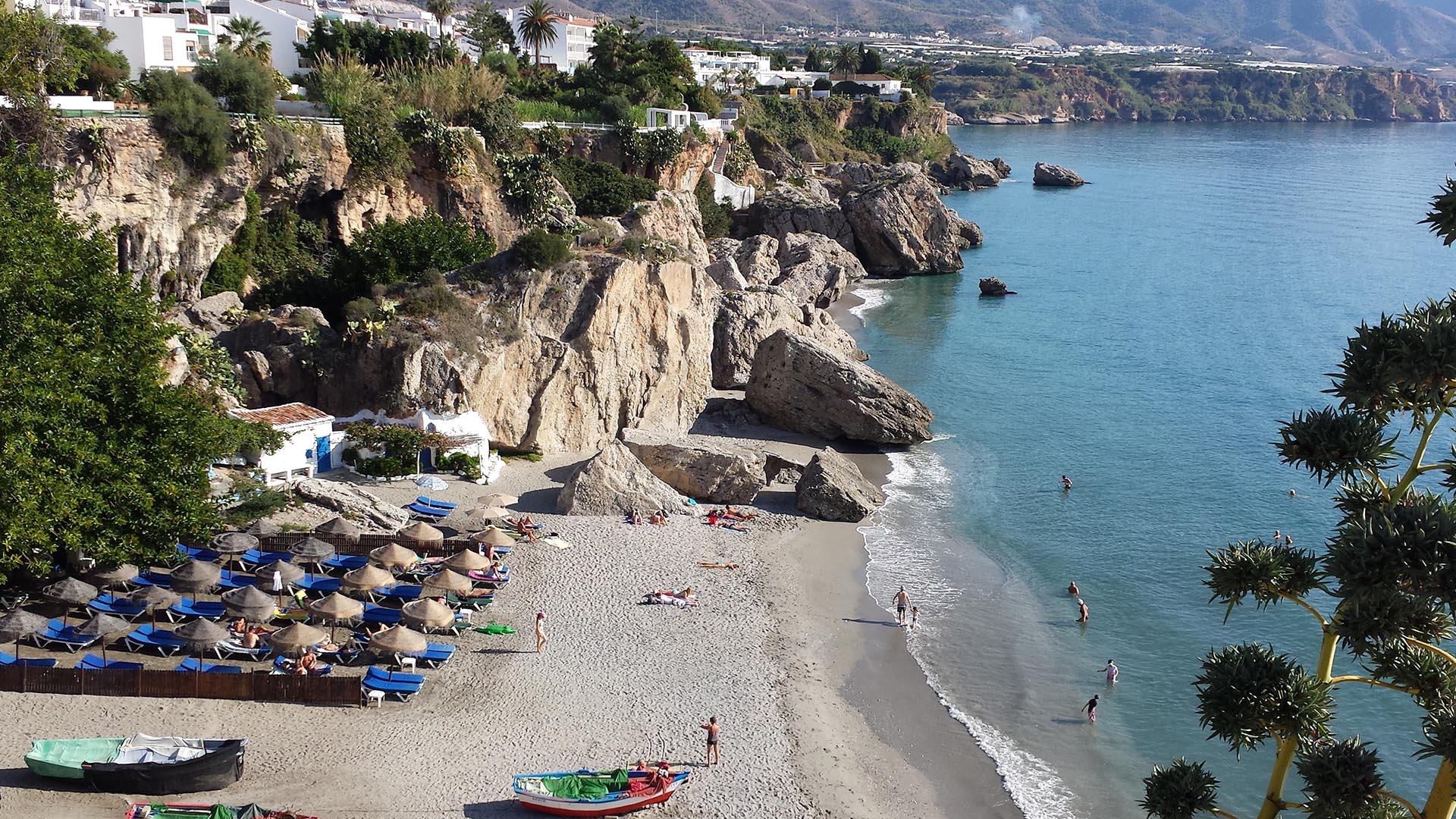
Preparing for a greener and bluer summer 2025
With summer just around the corner, it is this time of the year when many of us get a chance to step back, recharge, and enjoy the outdoors. From ETC-UMA´s side, as we head into the vacation season, we want ...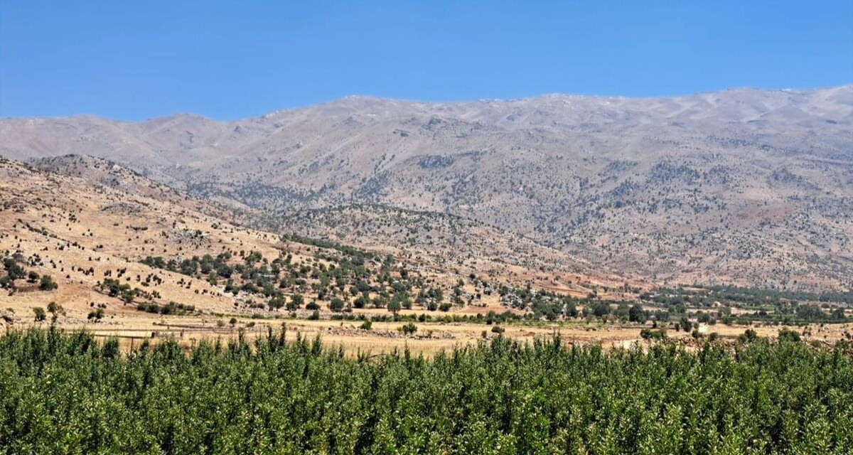
Back in Lebanon with BioConnect: Witnessing nature protection and socioecological resilience in action
As part of ETC-UMA’s role as the external evaluator for the EU-funded BioConnect project, the Centre’s Director, Dania Abdul Malak, carried out a site visit to Lebanon from July 8 to 12 to assess the project’s progress in its third ...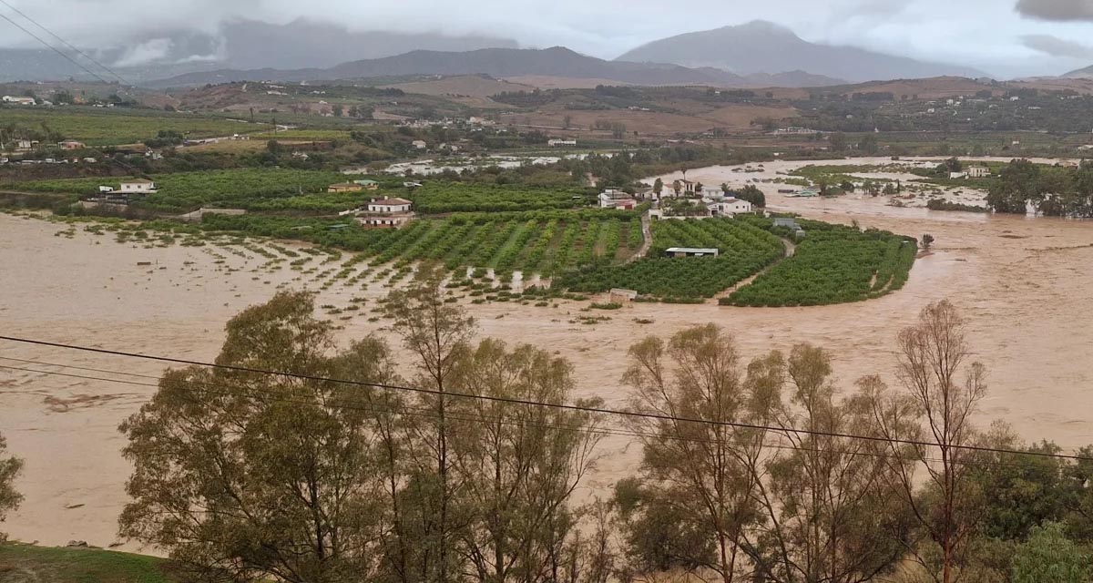
Boosting Climate Resilience: Wetland4Change Project Advances Flood Management Solutions for Mediterranean Coastal Zones
The Mediterranean coastal zone´s combination of multiple severe climate hazards – rising temperatures, water scarcity, sea-level rise, and extreme weather events – makes it a hotspot for highly interconnected climate risks for the ecosystems and societies. Recent catastrophic floods in ...RESTORE4Cs 1st Policy Brief: How can coastal wetlands help achieve EU climate goals?
The first RESTORE4Cs Policy Brief of RESTORE4Cs, “How can coastal wetlands help achieve EU climate goals?“, highlights the importance of European coastal wetlands for reducing Greenhouse Gas emissions. The key messages of the first RESTORE4Cs Policy Brief include: Coastal wetlands are important natural carbon stores, ...Mapping the Impact of Blue Tourism in the Mediterranean
The IUCN Centre for Mediterranean Cooperation with the support of ETC-UMA in the framework of the Blue Tourism Initiative, has released a comprehensive report entitled “Mapping the Impact of Blue Tourism in the Mediterranean: Vulnerability Assessment of Coastal and Marine ...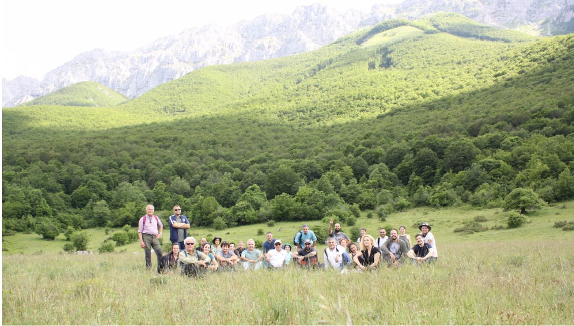
StrategyMedFor Presented at Annual Medforval Meeting 2024
StrategyMedFor was prominently featured at the Annual Medforval Meeting 2024, held from June 5-7 in Fontecchio, Italy. The event brought together 25 practitioners from national parks and natural reserves across 9 Mediterranean countries, providing a valuable platform for StrategyMedFor to ...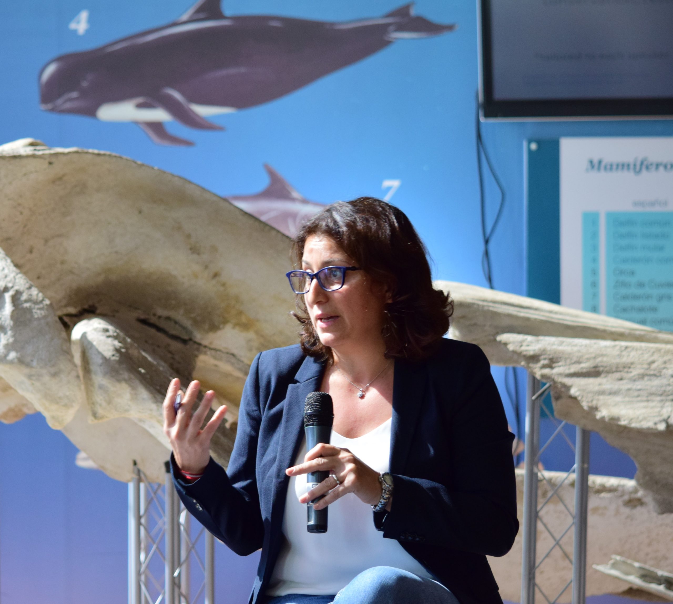
Celebrating leadership in environmental management: an interview with Dania Abdul Malak
From designing integrated ecosystem assessments in Europe and the Mediterranean to transforming outcomes into evidence-based recommendations for regional stakeholders, the European Topic Centre on Spatial Analysis and Synthesis (ETC-UMA) stands as a flagship for territorial cooperation. At the forefront of ...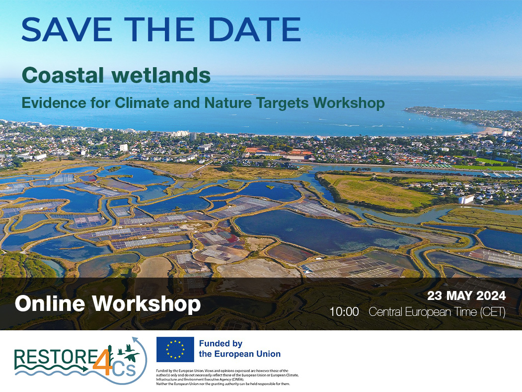
Save the date! Unlocking solutions for coastal conservation in Europe
How can coastal wetlands respond to major European Union objectives such as climate neutrality, biodiversity protection, and pollution reduction? What key role do coastal wetlands play in achieving EU commitments for climate mitigation and biodiversity conservation? The European Topic Centre ...
Towards a Strategy for the Sustainable Management of Mediterranean Forests (StrategyMedFor)
The StrategyMedFor project, co-financed by the Interreg Euro-MED programme, was launched at the University of Malaga during a two day meeting that took place on March 18 and 19, 2024. The European Topic Centre on Spatial Analysis and Synthesis (ETC-UMA), ...
Collaborative science for forests by ETC-UMA showcased in Slovenia during the COP23
As UNEP MAP partner organization, ETC-UMA recently engaged in the organization of a session with Mediterranean institutions under the topic of climate change, entitled: From COASTAL to FOREST ecosystems: Mediterranean Nature-based Solutions to tackle climate change and ensure the Resilience ...
Tools for conserving the Spanish coast
On the initiative of the Instituto Universitario Hábitat Territorio y Digitalización (iHTD) of the University of Malaga, around 70 representatives of Spanish public administrations, researchers, architecture and environmental science players and civil society signed up to the second debate on ...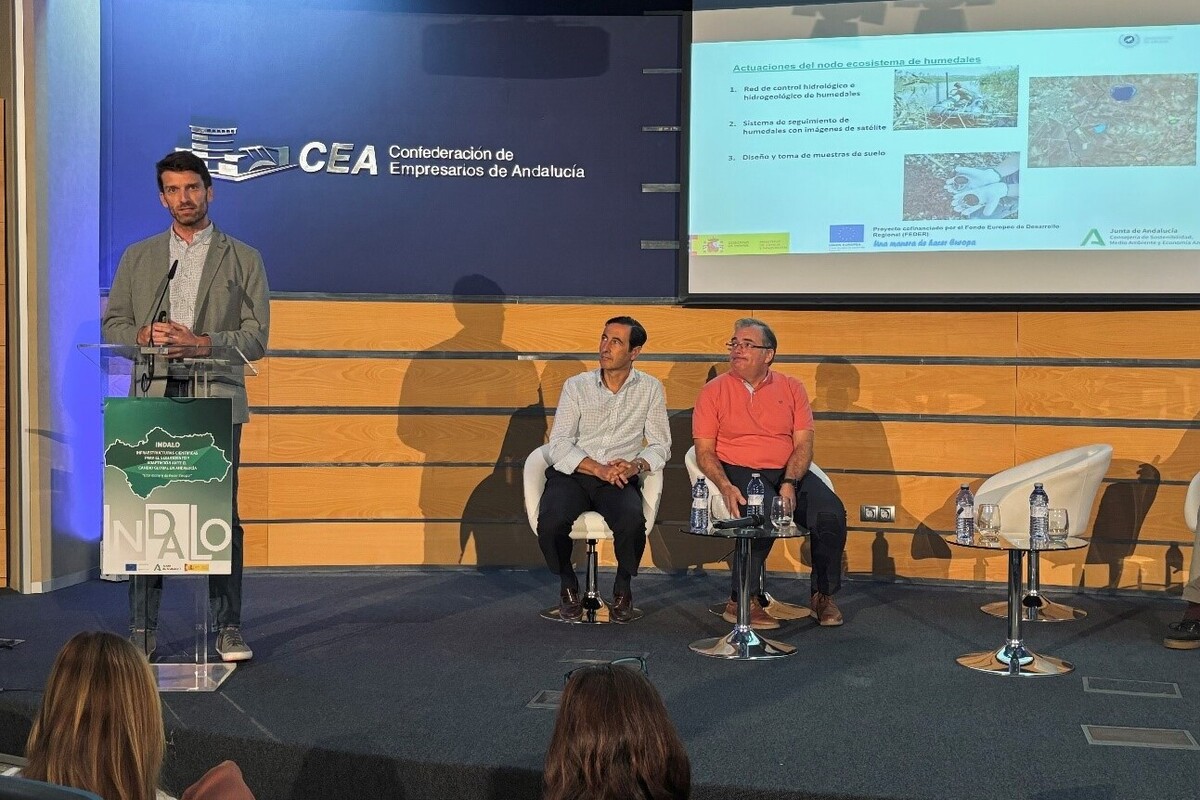
GreenEye System: a cloud-based system to monitor wetlands in Andalusia
Developed in the frame of the LifeWatch INDALO project cofinanced by the European Regional Development Fund (ERDF) for the study of biodiversity and global change in Andalucia, GreenEye System, this new cloud-based monitoring system, provides useful tools for wetlands’ assessment, ...
Looking back and forth to Mediterranean Forests
Timely published to enrich the knowledge available to fight fires and climate change challenges after an extremely hot summer, the proceedings of the Seventh Mediterranean Forest Week “Forest and Ecosystem Restoration for the next Mediterranean Generations” held from 21 to ...
More space for innovative Mediterranean forest data partnerships
The report entitled A knowledge baseline on Mediterranean forests supported by innovation launched in July by ETC-UMA provides a highlight of what Mediterranean countries and institutions are doing to integrate new digital, satellite and Artificial Intelligence technologies into forest monitoring ...