Geotechnology
Supporting environmental assessments with spatial data
CURRENT STATUS
Data are at the basis of decision-making. The evolution and amount of data gathering techniques and processing tools have exponentially increased data availability and the potential for different analyses. In this context, a sophisticated data management ecosystem is crucial to respond to complex environmental challenges. To serve its purpose, data harmonisation and integration are key in order to be able to respond effectively to the growing demand by environmental policy frameworks. European policies and initiatives such as INSPIRE and the European Environment Agency’s Integrated Data Platform are pushing forward this type of efforts towards a strong data system.
In parallel, the free and open data policy of major Earth Observation programmes such as Landsat and Copernicus is offering a huge potential for improved mapping, monitoring, modelling and assessment of environmental features on land, sea and in the atmosphere, with a wide range of data-related services developed and requiring continuous updates and improvement. The challenge lies still in making all these data and products available to the users, raising awareness on their availability, promoting their use and facilitating adoption in institutional and business workflows.
OUR ACTIONS
The ETC-UMA team can cover all parts of the Monitoring - Data - Information - Assessments - Knowledge (MDIAK) workflow, using remote sensing techniques for data collection, structuring them to achieve data, interpreting them into information, integrating information to assess the state and trends of the environment and contextualising the assessment to gain knowledge.
Our team has been involved in European environmental data initiatives from their very beginning, collaborating in the pre-operational phase of the programme on land monitoring (e.g. geoLand2, HELM) and supporting the development of data management structures for the European Environment Agency. We have contributed to improving the European land monitoring system by engaging in the EIONET Action Group on Land monitoring in Europe (EAGLE) and supported the Copernicus Land Monitoring Service. Based on this engagement, we have positioned ourselves in the national and European Copernicus ecosystem, being an active member of the Copernicus Academy network and the Spanish Copernicus User Forum.
Moreover, we have been strongly involved in the technical development of remote sensing applications in the context of wetland monitoring and land use modelling approaches in the Black Sea basin.
Our achievements are
Major contribution to the establishment of EEA’s Integrated Data Platform.
Continuous technical support to the Copernicus Land Monitoring Service (CMLS), particularly the EAGLE group.
Development of remote sensing applications.
Active membership in the Copernicus Academy and the Spanish Copernicus User Forum.
User engagement at national and European scale for successful user uptake of Copernicus products.
Development of mapping and knowledge portals at Mediterranean and European level.
Featured outputs
GreenEye System: a cloud-based system to monitor wetlands in Andalusia
MBPC site stories interactive map
Mediterranean wetland ecosystems knowledge base
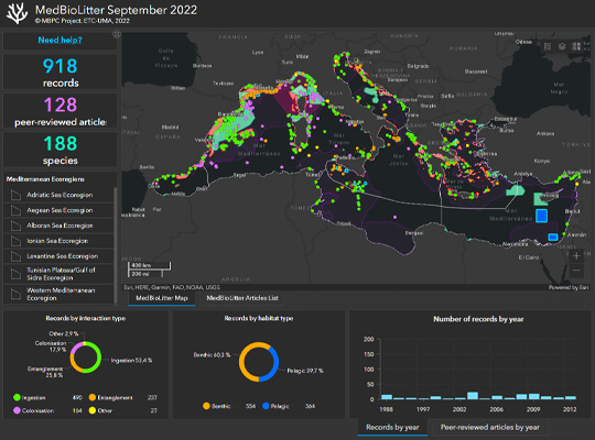
Marine litter and biodiversity knowledge base
Pelagos Sanctuary knowledge base
Maps section in the MBPK platform
Mediterranean MPAs, Key Biodiversity Areas and other indicators showing ecological vulnerability to tourism
Related projects


Resources
Books
Fritz, S.
Chapter 21 (Ecosystem mapping and assessment) of the book “European Landscape Dynamics” Book
1, CRC Press, 2017, ISBN: 978-1482244663, (1482244667 ISBN-10).
@book{Fritz2017,

title = {Chapter 21 (Ecosystem mapping and assessment) of the book “European Landscape Dynamics”},

author = {S. Fritz},

url = {https://www.researchgate.net/publication/314867308_European_Landscape_Dynamics_CORINE_Land_Cover_Data_Jan_Feranec_Tomas_Soukup_Gerard_Hazeu_Gabriel_Jaffrain_CRC_Press_Boca_Raton_2016_337_pp_Price_Hardback_12700_eBook_8890_ISBN_978-1-4822-4466-3},

doi = {DOI: 10.1016/j.jag.2017.02.020},

isbn = {978-1482244663},

year  = {2017},

date = {2017-07-01},

journal = {CRC Press},

volume = {1},

pages = {367},

publisher = {CRC Press},

edition = {1},

note = {1482244667 ISBN-10},

keywords = {},

pubstate = {published},

tppubtype = {book}

}
Journal Articles
Burgueño, A. M.; Aldana-Martín, J. F.; Vázquez-Pendón, M.; Barba-González, C.; Gómez, Y. J.; García-Millán, V. E.; Navas-Delgado, I.
Scalable approach for high-resolution land cover: a case study in the Mediterranean Basin Journal Article
In: Journal of Big Data, vol. 10, no. 91, 2023.
@article{Burgueño2023,

title = {Scalable approach for high-resolution land cover: a case study in the Mediterranean Basin},

author = {A. M. Burgueño and J. F. Aldana-Martín and M. Vázquez-Pendón and C. Barba-González and Y. J. Gómez and V. E. García-Millán and I. Navas-Delgado},

url = {https://doi.org/10.1186/s40537-023-00770-z},

doi = {https://doi.org/10.1186/s40537-023-00770-z},

year  = {2023},

date = {2023-06-02},

journal = {Journal of Big Data},

volume = {10},

number = {91},

abstract = {The production of land cover maps is an everyday use of image classification applications on remote sensing. However, managing Earth observation satellite data for a large region of interest is challenging in the task of creating land cover maps. Since satellite imagery is getting more precise and extensive, Big Data techniques are becoming essential to handle the rising quantity of data. Furthermore, given the complexity of managing and analysing the data, defining a methodology that reduces the complexity of the process into different smaller steps is vital to data processing. This paper presents a Big Data methodology for creating land cover maps employing artificial intelligence algorithms. Machine Learning algorithms are contemplated for remote sensing and geodata classification, supported by explainable artificial intelligence. Furthermore, the process considers aspects related to downloading data from different satellites, Copernicus and ASTER, executing the pre-processing and processing of the data in a distributed environment, and depicting the visualisation of the result. The methodology is validated in a test case for er map of the Mediterranean Basin.},

keywords = {},

pubstate = {published},

tppubtype = {article}

}
Martorell-Guerrero, G.; Rodríguez-Rodríguez, D.; García-Millán, V. E.
Long-term assessment of the effectiveness of coastal protection regulations in conserving natural habitats in Spain Journal Article
In: Ocean & Coastal Management, vol. 239, 2023.
@article{nokey,

title = {Long-term assessment of the effectiveness of coastal protection regulations in conserving natural habitats in Spain},

author = {G. Martorell-Guerrero and D. Rodríguez-Rodríguez and V. E. García-Millán},

url = {https://www.sciencedirect.com/science/article/pii/S0964569123001266},

doi = {https://doi.org/10.1016/j.ocecoaman.2023.106601},

year  = {2023},

date = {2023-05-15},

journal = {Ocean & Coastal Management},

volume = {239},

abstract = {Spain has undergone rapid socioeconomic development in the past three decades. This has been linked to massive residential and infrastructural development based on a short-term, profitable and resource-intensive consuming model. As a result, large amounts of agricultural, natural and semi-natural soils have been lost to artificial areas, especially around main cities and on the coast. In this study, we assessed the effectiveness of the Spanish Shores Act at preventing land development in two biogeographical regions and three administrative scales between 1988 and 2020 using a BACI design and remote sensing data. We also analysed the combined effect of other regulations to prevent land development on the coast. The Shores Act was effective in reducing land development although moderate to substantial land development occurred in the zones affected by the Law, especially in the Mediterranean region. Adding other sectoral regulations to the Shores Act notably and consistently reduced land development across regions. Among them, cumulative protected area (PA) regulations were most effective in reducing coastal land development. The use of satellite images, especially Sentinel 2A MSI data within a BACI design, proved a useful method for assessing the effectiveness of fine-scale objectives of environmental policies such as the Shores Act.},

keywords = {},

pubstate = {published},

tppubtype = {article}

}
García-Millán, V. E.; Rodríguez-Rodríguez, D.; Oncina, A. Martín; Andrianarimisa, A.; Randriamiharisoa, L. O.; Martorell-Guerrero, G.; Bóveda, A.; Abdul-Malak, D.
Identification of Priority Forest Conservation Areas for Critically Endangered Lemur Species of Madagascar Journal Article
In: Land, vol. 11, iss. 9, no. 1455, 2022.
@article{García-Millán2022,

title = {Identification of Priority Forest Conservation Areas for Critically Endangered Lemur Species of Madagascar},

author = {V. E. García-Millán and D. Rodríguez-Rodríguez and A. Martín Oncina and A. Andrianarimisa and L. O. Randriamiharisoa and G. Martorell-Guerrero and A. Bóveda and D. Abdul-Malak},

url = {https://doi.org/10.3390/land11091455},

doi = {https://doi.org/10.3390/land11091455},

year  = {2022},

date = {2022-09-01},

urldate = {2022-09-01},

journal = {Land},

volume = {11},

number = {1455},

issue = {9},

abstract = {Forests have extraordinary importance for the conservation of endemic species in Madagascar. However, they are disappearing fast due to a number of pressures, notably unsustainable agricultural practices leading to aggravated status of biodiversity. Here, we used a number of ecological and spatial criteria to identify and prioritise unprotected forest areas for the conservation of the eight critically endangered species of lemur belonging to the Lemuridae family in Madagascar. By combining spatial information layers on the distribution areas of the studied lemurs, forest extension and conservation status, and potential human impacts (such as roads, human settlements and agriculture lands), it was possible to identify the most appropriate sites for the expansion of the conservation areas of critically endangered lemur species. Seven new sites, totalling over 33,000 ha, were identified as priority sites for the protection of those species. All of them were adjacent to or inside (just one site) existing protected areas (PAs), which likely makes their protection both feasible and socioeconomically efficient by enlarging those PAs. Legally protecting these sites would not only take Madagascar one little step ahead for meeting oncoming global biodiversity targets for 2030 but could also make a substantial contribution to the mid-term survival of the studied lemur species.},

keywords = {},

pubstate = {published},

tppubtype = {article}

}
Kerzabi, R.; Mansour, H.; Yousfi, S.; Marín, A. I.; Andreo, B.; Bensefia, K. E.
Contribution of remote sensing and GIS to mapping groundwater vulnerability in arid zone: Case from Amour Mountains- Algerian Saharan Atlas Journal Article
In: Journal of African Earth Sciences, vol. 182, iss. October 2021, no. 104277, 2021.
@article{Kerzabi2021,

title = {Contribution of remote sensing and GIS to mapping groundwater vulnerability in arid zone: Case from Amour Mountains- Algerian Saharan Atlas},

author = {R. Kerzabi and H. Mansour and S. Yousfi and A. I. Marín and B. Andreo and K. E. Bensefia},

url = {https://doi.org/10.1016/j.jafrearsci.2021.104277},

doi = {https://doi.org/10.1016/j.jafrearsci.2021.104277},

year  = {2021},

date = {2021-10-01},

journal = {Journal of African Earth Sciences},

volume = {182},

number = {104277},

issue = {October 2021},

abstract = {Protecting groundwater resource from pollution in arid zone is coming an important act for sensing development in this region calling for geomatics tools to characterize the geological and hydrogeological environment. The present work gives a new way to combine remote sensing and geographic information systems to elaborate vulnerability map of Deffa watershed (in Amour Mountains). This region is a good example of arid zones how know an important growth of agriculture, but there is under gap of geological, hydrogeological and soil knowledge. In the first time, we analyzed the Landsat 8-OLI image data with bands combination, ratios composition in RGB and filters to cartography the lithology's contours and lineament map. The false color composition of bands (765, 753, and 543) in RGB given the primary lithological delimitation. Supported by band rationing technique, we produced of 1/50000 geological map. The filter treatments given the lineament map superposed to the first one to realize geo-structural map. In addition, these images served to elaborate pedology map, using Decision Tree (Slope, Redness Index and Lithology parameters). Secondly, we established a GIS including the result map of RS treatment (lithology, lineament and soil maps) and additional spatial information (aquifer type and deep of groundwater surface and precipitations …). In GIS, the vulnerability index are calculated using GOD and PI methods. Both of maps displayed four classes of vulnerability: between Low and Extreme in the first map, and Very low to High vulnerability in the second one. In the some areas, we have controversial values of vulnerability; this leads us to validate these maps using pollution indicators (NO3−, NH4+ and SO42−). The validation displayed that the PI coincides better with special concentrations of pollutants.},

keywords = {},

pubstate = {published},

tppubtype = {article}

}
Riedler, B.; Lang, S.; Zeil, P.; Miguel-Lago, M.; Schröder, C.; Politi-Stergiou, N.; Kerschbaumer, M.; Tramutoli, V.; Tzouvaras, M.
Copernicus Knowledge and innovation hubs Journal Article
In: The International Archives of the Photogrammetry, Remote Sensing and Spatial Information Sciences, vol. XLIII-B5-2020, pp. 35-42, 2020.
@article{Riedler2020,

title = {Copernicus Knowledge and innovation hubs},

author = {B. Riedler and S. Lang and P. Zeil and M. Miguel-Lago and C. Schröder and N. Politi-Stergiou and M. Kerschbaumer and V. Tramutoli and M. Tzouvaras},

url = {https://doi.org/10.5194/isprs-archives-XLIII-B5-2020-35-2020},

year  = {2020},

date = {2020-08-24},

journal = {The International Archives of the Photogrammetry, Remote Sensing and Spatial Information Sciences},

volume = {XLIII-B5-2020},

pages = {35-42},

abstract = {Copernicus, the European Space program ensures free data availability and the organisational and financial framework to provide standardized information products in its service domains atmosphere, marine, land monitoring, climate change, emergency management and human security. A key to success to the market uptake process is knowledge exchange among all actors from the various sectors involved, notably research and educational institutions, industry, and the public sector. As a successful instrument to foster and stimulate this exchange, maximize the impact and additionally boost related capacity building and training activities, the Copernicus Academy has been anchored in the European Space Strategy. The present paper highlights some key activities to leverage the potential of this dynamically growing network of experts from universities and research institutions, public and private organizations, companies, stakeholders, and increase the benefit to its members. The vision of establishing both physical implementations of regional Copernicus hubs and virtual Copernicus hubs, built on key elements of the European Innovation strategy, is discussed. Regional hubs, attached e.g. to centres of excellence, are essential to meet local needs for exchange and training to boost the user uptake. The increasing importance of virtual hubs is becoming evident as a critical means to maximise synergies among actors in the rapidly advancing technological areas. Proposed technical elements demonstrate innovative solutions to visualize and facilitate easy harvesting of the Copernicus Academy member´s expertise for different stakeholder and the public, and show cast possibilities of active involvement and exchange within the network.},

keywords = {},

pubstate = {published},

tppubtype = {article}

}
Sánchez-Espinosa, A.; Schröder, C.
Land use and land cover mapping in wetlands one step closer to the ground: Sentinel-2 versus Landsat 8 Journal Article
In: Journal of Environmental Management, vol. 247, pp. 484-498, 2019.
@article{Sánchez-Espinosa2019b,

title = {Land use and land cover mapping in wetlands one step closer to the ground: Sentinel-2 versus Landsat 8},

author = {A. Sánchez-Espinosa and C. Schröder},

url = {https://www.sciencedirect.com/science/article/pii/S0301479719308850},

doi = {10.1016/j.jenvman.2019.06.084},

year  = {2019},

date = {2019-10-01},

journal = {Journal of Environmental Management},

volume = {247},

pages = {484-498},

abstract = {Environmental studies with Landsat images have revealed many of the problems faced by wetland ecosystem, which are crucial for the conservation of biodiversity and the natural values of our planet. The study of LULC changes in wetlands through remote sensing constantly helps to identify and combat their main environmental threats improving the conservation of these natural habitats. Starting in mid-2015, the Sentinel-2 satellite opens new possibilities in the field of earth observation thanks to its higher spatial, spectral and temporal resolution becoming a powerful source of information for LULC monitoring in wetland areas. However, researchers may ask them selves to what extent Sentinel-2 is an improvement over Landsat 8 for general purposes. This research test if there is a real difference in the quality of the results delivered by both Sentinel-2 and Landsat 8 imagery when basic classification methods are applied.


The study uses Sentinel-2 and Landsat 8 imagery to produce LULC maps in a Mediterranean wetland area applying an object based classification method in order to compare the accuracy and reliability in the surface detected by both satellites. The results show that an object based classification using only the Sentinel-2 and Landsat 8 image information, without band indexes or ancillary data, offers very similar results for most LULC classes, being the overall accuracy around 87–88% with slightly better results when using Sentinel-2. Although using Sentinel-2 leads to an increase in file size and processing times, the analysis of certain LULC classes presents an improvement compared to Landsat 8, detecting more linear and small size elements with a better delineation of image features in the classified map. However, these improvements should not underestimate the value of Landsat imagery in the future since both satellites provide high precision information, so they can and should coexist and be used together to increase data availability in order to have the best possible results in remote sensing research.},

keywords = {},

pubstate = {published},

tppubtype = {article}

}
The study uses Sentinel-2 and Landsat 8 imagery to produce LULC maps in a Mediterranean wetland area applying an object based classification method in order to compare the accuracy and reliability in the surface detected by both satellites. The results show that an object based classification using only the Sentinel-2 and Landsat 8 image information, without band indexes or ancillary data, offers very similar results for most LULC classes, being the overall accuracy around 87–88% with slightly better results when using Sentinel-2. Although using Sentinel-2 leads to an increase in file size and processing times, the analysis of certain LULC classes presents an improvement compared to Landsat 8, detecting more linear and small size elements with a better delineation of image features in the classified map. However, these improvements should not underestimate the value of Landsat imagery in the future since both satellites provide high precision information, so they can and should coexist and be used together to increase data availability in order to have the best possible results in remote sensing research.
Palomo, I.
Practical solutions for bottlenecks in ecosystem services mapping Journal Article
In: One Ecosystem, vol. 3, 2018.
@article{etal.al.2018,

title = {Practical solutions for bottlenecks in ecosystem services mapping},

author = {I. Palomo et al.},

url = {https://oneecosystem.pensoft.net/article/20713/element/8/46777/},

doi = {10.3897/oneeco.3.e20713},

year  = {2018},

date = {2018-01-01},

journal = {One Ecosystem},

volume = {3},

abstract = {Background

Ecosystem services (ES) mapping is becoming mainstream in many sustainability assessments, but its impact on real world decision-making is still limited. Robustness, end-user relevance and transparency have been identified as key attributes needed for effective ES mapping. However, these requirements are not always met due to multiple challenges, referred to here as bottlenecks, that scientists, practitioners, policy makers and users from other public and private sectors encounter along the mapping process.


New information

A selection of commonly encountered ES mapping bottlenecks that relate to seven themes: i) map-maker map-user interaction; ii) nomenclature and ontologies; iii) skills and background; iv) data and maps availability; v) methods-selection; vi) technical difficulties; and vii) over-simplification of mapping process/output. The authors synthesise the variety of solutions already applied by map-makers and map-users to mitigate or cope with these bottlenecks and discuss the emerging trade-offs amongst different solutions. Tackling the bottlenecks described here is a crucial first step towards more effective ES mapping, which can in turn ensure the adequate impact of ES mapping in decision-making.},

keywords = {},

pubstate = {published},

tppubtype = {article}

}
Ecosystem services (ES) mapping is becoming mainstream in many sustainability assessments, but its impact on real world decision-making is still limited. Robustness, end-user relevance and transparency have been identified as key attributes needed for effective ES mapping. However, these requirements are not always met due to multiple challenges, referred to here as bottlenecks, that scientists, practitioners, policy makers and users from other public and private sectors encounter along the mapping process.
New information
A selection of commonly encountered ES mapping bottlenecks that relate to seven themes: i) map-maker map-user interaction; ii) nomenclature and ontologies; iii) skills and background; iv) data and maps availability; v) methods-selection; vi) technical difficulties; and vii) over-simplification of mapping process/output. The authors synthesise the variety of solutions already applied by map-makers and map-users to mitigate or cope with these bottlenecks and discuss the emerging trade-offs amongst different solutions. Tackling the bottlenecks described here is a crucial first step towards more effective ES mapping, which can in turn ensure the adequate impact of ES mapping in decision-making.
Sánchez-Espinosa, A.; Abdul-Malak, D.; Guelmami, A.; Perennou, C.
Development of an Indicator to Monitor Mediterranean Wetlands Journal Article
In: Plos One, vol. 10, no. 3, 2015.
@article{Sánchez-Espinosa2015,

title = {Development of an Indicator to Monitor Mediterranean Wetlands},

author = {A. Sánchez-Espinosa and D. Abdul-Malak and A. Guelmami and C. Perennou},

url = {http://journals.plos.org/plosone/article?id=10.1371/journal.pone.0122694},

doi = {https://doi.org/10.1371/journal.pone.0122694},

year  = {2015},

date = {2015-03-31},

journal = {Plos One},

volume = {10},

number = {3},

abstract = {Wetlands are sensitive ecosystems that are increasingly subjected to threats from anthropogenic factors. In the last decades, coastal Mediterranean wetlands have been suffering considerable pressures from land use change, intensification of urban growth, increasing tourism infrastructure and intensification of agricultural practices. Remote sensing (RS) and Geographic Information Systems (GIS) techniques are efficient tools that can support monitoring Mediterranean coastal wetlands on large scales and over long periods of time. The study aims at developing a wetland indicator to support monitoring Mediterranean coastal wetlands using these techniques. The indicator makes use of multi-temporal Landsat images, land use reference layers, a 50m numerical model of the territory (NMT) and Corine Land Cover (CLC) for the identification and mapping of wetlands. The approach combines supervised image classification techniques making use of vegetation indices and decision tree analysis to identify the surface covered by wetlands at a given date. A validation process is put in place to compare outcomes with existing local wetland inventories to check the results reliability. The indicator´s results demonstrate an improvement in the level of precision of change detection methods achieved by traditional tools providing reliability up to 95% in main wetland areas. The results confirm that the use of RS techniques improves the precision of wetland detection compared to the use of CLC for wetland monitoring and stress the strong relation between the level of wetland detection and the nature of the wetland areas and the monitoring scale considered.},

keywords = {},

pubstate = {published},

tppubtype = {article}

}
Mancosu, E.; Gago-Silva, A.; Barbosa, A.; de Bono, A.; Ivanov, E.; Lehmann, A.; Fons, J.
Future land-use change scenarios for the Black Sea catchment Journal Article
In: Environmental Science & Policy, vol. 46, pp. 26-36, 2015.
@article{Mancosu2015,

title = {Future land-use change scenarios for the Black Sea catchment},

author = {E. Mancosu and A. Gago-Silva and A. Barbosa and A. de Bono and E. Ivanov and A. Lehmann and J. Fons},

url = {https://www.sciencedirect.com/science/article/pii/S1462901114000550},

doi = {https://doi.org/10.1016/j.envsci.2014.02.008},

year  = {2015},

date = {2015-02-01},

journal = {Environmental Science & Policy},

volume = {46},

pages = {26-36},

abstract = {Plausible future scenarios have been created for the Black Sea catchment, focussing on spatially explicit alternatives for land-use changes. Four qualitative storylines (HOT, ALONE, COOP and COOL) were first developed, based on interpretation of the respective global scenarios (A1, A2, B1 and B2) produced by the Intergovernmental Panel on Climate Change. Quantitative statistical downscaling techniques were then used to disaggregate the outputs of global scenarios at a regional level. The resulting land-use maps were spatially allocated at 1 km resolution in the Metronamica model, using a set of factors related to the identified drivers of change. The land-use change model was calibrated on historical trends of land-cover change (MODIS 2001 and 2008) translated into spatial allocation rules, and future land-use projections (IMAGE, 2001) were adopted. Suitability and constraint maps and population trends were used to regulate the modelling process. The calibrated model was validated by statistical procedures, visual evaluation and stakeholder involvement in order to ensure its plausibility and accuracy. This methodology bridged the gap between the global and regional scales. Four simulated future states were produced for the main land-use classes–forest, grassland, cropland and built-up areas, as well as scrublands, crops/natural vegetation and barren land–for 2025 and 2050. The results suggest that the features highlighted in these scenarios are guided by global trends, such as population rise and decreasing agriculture, but with different growth rates and a variety of spatial patterns, with regional variations resulting from local backgrounds and policy objectives. This study aims to provide future land-use data as a potential geographical tool to assist policy makers in addressing environmental emergencies such as water stress and pollution. In particular, the exploration of plausible futures can support future assessments to comply with the EU Water Framework Directive and Integrated Coastal Zone Management policies around the Black Sea.},

keywords = {},

pubstate = {published},

tppubtype = {article}

}
Lehmann, A.; Giuliania, G.; Mancosu, E.; Abbaspour, K. C.; Sözen, S.; Gorgan, D.; Beel, A.; Ray, N.
Filling the gap between Earth observation and policy making in the Black Sea catchment with enviroGRIDS Journal Article
In: Environmental Science & Policy, vol. 46, pp. 1-12, 2015.
@article{Lehmann2015,

title = {Filling the gap between Earth observation and policy making in the Black Sea catchment with enviroGRIDS},

author = {A. Lehmann and G. Giuliania and E. Mancosu and K. C. Abbaspour and S. Sözen and D. Gorgan and A. Beel and N. Ray},

url = {https://www.sciencedirect.com/science/article/pii/S1462901114000525},

doi = {https://doi.org/10.1016/j.envsci.2014.02.005},

year  = {2015},

date = {2015-02-01},

journal = {Environmental Science & Policy},

volume = {46},

pages = {1-12},

abstract = {The environmental status of the Black Sea is obviously closely related to its catchment. Being a closed sea, this large water body drains an area of more than 2 million km2, encompassing 23 countries inhabited by more than 180 million people. The main environmental issues faced by the Black Sea catchment are the same as elsewhere in Europe. These problems are exacerbated by global changes with drastic changes predicted in temperature and precipitation by the end of the century, as well as land use and demographic changes. These environmental problems are taking place in a complex geopolitical situation. In this particular context, data sharing is essential to inform managers and policy-makers about the state of the environment, which will ultimately influence the state of the Black Sea itself. The enviroGRIDS project was set up in order to promote international data sharing initiatives such as the Global Earth Observation System of Systems and the European INSPIRE directive. The enviroGRIDS project was successful in reaching the following objectives: (a) performing a gap analysis on existing Earth observations systems in the region; (b) developing regional capacities at institutional, infrastructure and human resource levels; (c) creating regional scenarios to set the scene for plausible climatic, demographic and land use futures; (d) building the first hydrological model for the entire Black Sea catchment; (e) developing the Black Sea Catchment Observation System based on interoperability standards and Grid computing technologies; (f) showcasing data sharing in several case studies, addressing important environmental issues while building a network of people with improved capacity on data sharing principles. These relative successes should not, however, hide the difficulties in making the necessary Earth observation data available to scientists, decision makers and the public, as the mind-sets at all levels are changing slowly. Controlling the access to data is still perceived by many as a necessity to guarantee the power of the state on society and as a way to preserve its security. The need to develop national spatial data infrastructures (SDI) is very important to convince all ministries and data owner that publically funded data should be made publically available. The progress in the implementation of SDI seems more limited by political agendas than by technology. It is clear, however, that implementation of the INSPIRE directive in Europe is a prerequisite for the success of many other environmental policies (e.g. Water Framework Directive; Marine Strategy Framework Directive; Biodiversity strategy 2020).},

keywords = {},

pubstate = {published},

tppubtype = {article}

}
Technical Reports
Gregor, M.; Löhnertz, M.; Milego, R.; Fons, J.; Maucha, G.; Mancosu, E.; Littkopf, A.; Ivits, E.
2021.
@techreport{nokey,

title = {ETC/ULS Technical Report 01/2021: Time series inconsistency in the Copernicus HRL Imperviousness. Analysis of the 2015-2018 changes, implications and conclusions},

author = {M. Gregor and M. Löhnertz and R. Milego and J. Fons and G. Maucha and E. Mancosu and A. Littkopf and E. Ivits},

url = {https://www.eionet.europa.eu/etcs/etc-di/products/etc-uls-technical-report-01-2021-time-series-inconsistency-in-the-copernicus-hrl-imperviousness-analysis-of-the-2015-2018-changes-implications-and-conclusions},

year  = {2021},

date = {2021-12-14},

abstract = {A land cover (land use) map is always an abstraction, a model of the real earth surface. Features represented in this model are influenced by many factors, including the classification system, scale / level of generalization (e.g., Minimum Mapping Unit or MMU) and other mapping instructions as well as possible database errors. As long as the data model is consistent within a time series, changes and trends derived by pixel- or grid-based approaches (“pixel counting”) may be meaningful, i.e., valid within the same model (e.g., Corine Land Cover or CLC accounting). This is in fact the core idea of “pixel counting” based accounting systems.


Copernicus High Resolution Layers (HRLs) are Earth Observation (EO)-derived and raster-based datasets which provide information about different land cover characteristics. The longest and most complete time-series is available for the HRL Imperviousness products, with the first status layer being available for the reference year 2006, then 2009, 2012, 2015 and 2018. Change information are available for all change periods (both, density change and change classified). Primary 20m resolution (and aggregated 100m resolution) products were harmonized for the 2006-2015 period in a way that imperviousness status and change layers build a consistent time series, where imperviousness density changes are equal to the difference of subsequent imperviousness status layers.


However, the introduction of the increased 10m resolution in case of all primary HRLs in 2018 caused unexpected issues. The great advantage of the increased resolution has led to the appearance of more feature details. On the flipside, this fact has made the new 10m resolution imperviousness product incompatible with the previous time series especially in a statistical sense. Thus, with the introduction of the 10m EO data as basis for the HRL production, the data model of the HRL IMD became inconsistent, i.e., the long time series is broken and we are talking about two time series (2006-2015 with 20m resolution and from 2018 onwards with 10m resolution; there is no way to use and assess changes between 2015 and 2018 at the moment). As a consequence, any assessment and product that is dependent on the time series has to be broken down into two parts. This technical note describes the reasons and implications in more detail and draws some conclusions.},

keywords = {},

pubstate = {published},

tppubtype = {techreport}

}
Copernicus High Resolution Layers (HRLs) are Earth Observation (EO)-derived and raster-based datasets which provide information about different land cover characteristics. The longest and most complete time-series is available for the HRL Imperviousness products, with the first status layer being available for the reference year 2006, then 2009, 2012, 2015 and 2018. Change information are available for all change periods (both, density change and change classified). Primary 20m resolution (and aggregated 100m resolution) products were harmonized for the 2006-2015 period in a way that imperviousness status and change layers build a consistent time series, where imperviousness density changes are equal to the difference of subsequent imperviousness status layers.
However, the introduction of the increased 10m resolution in case of all primary HRLs in 2018 caused unexpected issues. The great advantage of the increased resolution has led to the appearance of more feature details. On the flipside, this fact has made the new 10m resolution imperviousness product incompatible with the previous time series especially in a statistical sense. Thus, with the introduction of the 10m EO data as basis for the HRL production, the data model of the HRL IMD became inconsistent, i.e., the long time series is broken and we are talking about two time series (2006-2015 with 20m resolution and from 2018 onwards with 10m resolution; there is no way to use and assess changes between 2015 and 2018 at the moment). As a consequence, any assessment and product that is dependent on the time series has to be broken down into two parts. This technical note describes the reasons and implications in more detail and draws some conclusions.
Abdul-Malak, D.; Schröder, C.; Guitart, C.; Sánchez-Espinosa, A.; Fitoka, E.; Hatziiordanou, L.; Mino, E.; Flink, S.; Silver, E.; Strauch, A.; Ling, M.; Brown, C.; Simonson, W.; Scott, E.; Plasmeijer, A.; Thulin, S.; Philipson, P.; Weise, K.; Höfer, R.; Franke, J.; Guelmami, A.
Enhanced wetland monitoring, assessment and indicators to support European and global environmental policy Technical Report
2019.
@techreport{Abdul-Malak2019,

title = {Enhanced wetland monitoring, assessment and indicators to support European and global environmental policy},

author = {D. Abdul-Malak and C. Schröder and C. Guitart and A. Sánchez-Espinosa and E. Fitoka and L. Hatziiordanou and E. Mino and S. Flink and E. Silver and A. Strauch and M. Ling and C. Brown and W. Simonson and E. Scott and A. Plasmeijer and S. Thulin and P. Philipson and K. Weise and R. Höfer and J. Franke and A. Guelmami},

url = {https://www.etc.uma.es/wp-content/uploads/Enhanced_wetland_monitoring_assessment_indicators_support_European_global_environmental_policy.pdf},

year  = {2019},

date = {2019-12-31},

abstract = {The 2019 report on Enhanced wetland monitoring, assessment and indicators to support European environmental policyidentifies the links between the Horizon 2020 Satellite-based Wetland Observation Service (SWOS) project outcomes (tools, methodologies and indicators) and existing policy frameworks at European and global levels. It aims to contribute to the refinement of EU Strategies and Directives to better integrate wetland ecosystems, contribute towards a European environmental model for wetland management and maintenance of their ecosystem services, and guide action towards achieving no-net-loss and restoration targets and objectives for wetland ecosystems. The report summarises (in four chapters) how SWOS can ensure a better understanding of wetland ecosystems, and thereby help to trigger further policy developments by improving key elements for wetland management.},

keywords = {},

pubstate = {published},

tppubtype = {techreport}

}
European-Environment-Agency,
European Ecosystem Assessment - concept, data, and implementation Technical Report
no. 6/2015, 2015, ISBN: 978-92-9213-646-8.
@techreport{EEA2015,

title = {European Ecosystem Assessment - concept, data, and implementation},

author = {European-Environment-Agency},

url = {https://www.researchgate.net/publication/277637973_European_Ecosystem_Assessment_-_concept_data_and_implementation},

doi = {10.2800/629258},

isbn = {978-92-9213-646-8},

year  = {2015},

date = {2015-06-01},

number = {6/2015},

abstract = {This report summarises EEA contributions to Target 2 Action 5 'Mapping and Assessment of Ecosystems and their Services (MAES)' for the implementation of the EU Biodiversity Strategy to 2020 (EC, 2011), the Strategy of the EU to meet the global targets of the Convention of Biodiversity (UN, 2010).},

keywords = {},

pubstate = {published},

tppubtype = {techreport}

}
Mancosu, E.
The enviroGRIDS scenarios Technical Report
EnviroGRIDS 2012.
@techreport{Mancosu2012,

title = {The enviroGRIDS scenarios},

author = {E. Mancosu},

url = {http://envirogrids.net/indexe649.html?option=com_jdownloads&Itemid=13&view=view.download&catid=12&cid=137 / http://envirogrids.net/envirogrids_d3.8_scenariosbd3b.pdf?option=com_jdownloads&Itemid=13&view=finish&cid=137&catid=12},

year  = {2012},

date = {2012-04-24},

institution = {EnviroGRIDS},

abstract = {The enviroGRIDS scenarios comprise a number of plausible alternatives (storylines) based on a coherent set of assumptions, key relationships and driving forces, to create a set of quantitative,

internally consistent and spatially explicit scenarios of future demography, climate and land use (LU) covering the entire Black Sea Catchment (BSC).

The aim of this report is to describe the technical specification of the final scenarios, the source data used and the different methodologies applied on each of them. We describe how the different sources were used and integrated in order to obtain the four alternatives storylines (HOT, ALONE, COOP and COOL), for a yearly time series from 2008 to 2050. The method applied to obtain the demographic growth according to the different storyline for the same time series is also described. Furthermore we describe also the results of the spatially explicit scenarios on climate change for the BSC (Task 3.6) of WP3, for a daily precipitation and temperature time series between 2071 and 2100.},

keywords = {},

pubstate = {published},

tppubtype = {techreport}

}
internally consistent and spatially explicit scenarios of future demography, climate and land use (LU) covering the entire Black Sea Catchment (BSC).
The aim of this report is to describe the technical specification of the final scenarios, the source data used and the different methodologies applied on each of them. We describe how the different sources were used and integrated in order to obtain the four alternatives storylines (HOT, ALONE, COOP and COOL), for a yearly time series from 2008 to 2050. The method applied to obtain the demographic growth according to the different storyline for the same time series is also described. Furthermore we describe also the results of the spatially explicit scenarios on climate change for the BSC (Task 3.6) of WP3, for a daily precipitation and temperature time series between 2071 and 2100.
Barbosa, A.; Mancosu, E.; Gago-Silva, A.; de Bono, A.; Lehmann, A.; Mierla, M.; Hanganu, J.; Littkopf, A.
Proposed land use scenario analysis, model input parameters and allocation rules Technical Report
EnviroGRIDS 2011.
@techreport{Barbosa2011,

title = {Proposed land use scenario analysis, model input parameters and allocation rules},

author = {A. Barbosa and E. Mancosu and A. Gago-Silva and A. de Bono and A. Lehmann and M. Mierla and J. Hanganu and A. Littkopf},

url = {http://envirogrids.net/indexa4c5.html?option=com_jdownloads&Itemid=13&view=view.download&catid=12&cid=120 / http://envirogrids.net/envirogrids_d3_7a10b.pdf?option=com_jdownloads&Itemid=13&view=finish&cid=120&catid=12},

year  = {2011},

date = {2011-07-06},

institution = {EnviroGRIDS},

abstract = {The enviroGRIDS scenarios comprise a number of plausible alternatives (storylines) based on a coherent set of assumptions, key relationships and driving forces, to create a set of quantitative, internally consistent and spatially explicit scenarios of future demography, climate and land use covering the entire Black Sea Catchment (BSC).

This report presents the analyses of the land use scenarios, a review of the combined method used to quantify the enviroGRIDS land use demand and the disaggregation of the global scenarios at a regional scale. Global land use demand was obtained from IMAGE 2.2 and disaggregated at regional (NUTS2) level. Afterwards a cellular automaton based land use model was applied to allocate the land use demands at local level. Land use allocation rules were assigned based on the scenario storylines and local decision rules. As a result, four alternative land use scenarios were derived: BS HOT, BS ALONE, BS COOP and BS COOL. The designation of allocation rules introduces local decisions based not only on the scenario storylines and expert knowledge but also on historical land use patterns. The method used can fill the gap between the global and regional scales and consequently translate land use patterns at various spatial levels.},

keywords = {},

pubstate = {published},

tppubtype = {techreport}

}
This report presents the analyses of the land use scenarios, a review of the combined method used to quantify the enviroGRIDS land use demand and the disaggregation of the global scenarios at a regional scale. Global land use demand was obtained from IMAGE 2.2 and disaggregated at regional (NUTS2) level. Afterwards a cellular automaton based land use model was applied to allocate the land use demands at local level. Land use allocation rules were assigned based on the scenario storylines and local decision rules. As a result, four alternative land use scenarios were derived: BS HOT, BS ALONE, BS COOP and BS COOL. The designation of allocation rules introduces local decisions based not only on the scenario storylines and expert knowledge but also on historical land use patterns. The method used can fill the gap between the global and regional scales and consequently translate land use patterns at various spatial levels.
Ivanov, E.; Barbosa, A.
Existing scenarios and data compilation on integrated scenarios using demographic, climatic, land cover from global and Black Sea Basin studies Technical Report
EnviroGRIDS 2010.
@techreport{Ivanov2010,

title = {Existing scenarios and data compilation on integrated scenarios using demographic, climatic, land cover from global and Black Sea Basin studies},

author = {E. Ivanov and A. Barbosa},

url = {http://envirogrids.net/index8f0c.html?option=com_jdownloads&Itemid=13&view=view.download&catid=12&cid=100 / http://envirogrids.net/envirogrids_d343644.pdf?option=com_jdownloads&Itemid=13&view=finish&cid=100&catid=12},

year  = {2010},

date = {2010-09-25},

journal = {EnviroGRIDS},

pages = {70},

institution = {EnviroGRIDS},

abstract = {This report presents an overview of different existing scenarios for the territory of the Black Sea Basin. Main sources include the IPCC, GSG and GEO scenarios. They are global scenarios with either country or broaderregion calculations of future changes, like plausible changes for Western Europe, Eastern Europe and the Middle East. Consequently, a number of driving forces were extracted and shortly presented in graphs outlining the trajectories of most plausible changes in the Black Sea Basin. Storyline descriptions per group of country were developed following the IPCC approach and applying the existing predictions of future GDP and population density numbers. The report concludes with an overview of integrated tools for environmental scenario development.},

keywords = {},

pubstate = {published},

tppubtype = {techreport}

}
Barbosa, A.; Ivanov, E.; Mancosu, E.; Hanganu, J.
Land cover model inputs and efficient data model with possibilities to be updated Technical Report
EnviroGRIDS 2010.
@techreport{Barbosa2010,

title = {Land cover model inputs and efficient data model with possibilities to be updated},

author = {A. Barbosa and E. Ivanov and E. Mancosu and J. Hanganu},

editor = {Autonomous University of Barcelona},

url = {http://envirogrids.net/indexae9e.html?option=com_jdownloads&Itemid=13&view=view.download&catid=12&cid=33},

year  = {2010},

date = {2010-03-01},

journal = {enviroGRIDS},

pages = {82},

institution = {EnviroGRIDS},

keywords = {},

pubstate = {published},

tppubtype = {techreport}

}
Proceedings
Martorell-Guerrero, G.; Marín, A. I.; Sánchez-Espinosa, A.; Schröder, C.
Herramientas de apoyo a la gestión de los humedales de Andalucía basadas en Google Earth Engine. Proceedings
2023.
@proceedings{nokey,

title = {Herramientas de apoyo a la gestión de los humedales de Andalucía basadas en Google Earth Engine.},

author = {G. Martorell-Guerrero and A. I. Marín and A. Sánchez-Espinosa and C. Schröder},

url = {https://riuma.uma.es/xmlui/bitstream/handle/10630/28052/Martorell_et_al_2023_SIAGA.pdf?sequence=1&isAllowed=y},

year  = {2023},

date = {2023-11-13},

urldate = {2023-11-13},

booktitle = {Simposio del Agua en Andalucía 2023},

abstract = {Los humedales son ecosistemas claves a nivel global para la provisión de servicios ecosistémicos tan importantes como la regulación climática o el mantenimiento de la biodiversidad. Sin embargo, en las últimas décadas la situación de degradación y desaparición de estos hábitats es alarmante a pesar de ser centro de múltiples políticas internacionales de protección que, a la luz de los resultados que están teniendo, no han tenido la efectividad esperada en su implementación real. Por tanto, es necesario tomar medidas urgentes dirigidas a revertir esta situación y que su implementación sea evaluada de forma objetiva, sistemática y recurrente. Este trabajo presenta una herramienta web llamada GreenEye Hub para el seguimiento de los humedales del Inventario de Humedales de Andalucía basada en imágenes de satélite del Sentinel-2, técnicas de teledetección y en tecnologías de procesamiento de datos masivos mediante Google Earth Engine. La herramienta, con un diseño orientado a la gestión de estos ecosistemas, presenta una consola de visualización que permite realizar el seguimiento de los principales indicadores de agua y vegetación y el análisis de tendencias de estos. Es, por tanto, un sistema de apoyo a la gestión y a la toma de decisiones. Este estudio proporciona información de cómo es factible en la actualidad desarrollar un sistema de seguimiento de humedales a escala regional a partir de datos gratuitos accesibles y cómo esta herramienta constituye un proceso de transferencia del conocimiento desde la ciencia a la gestión.},

keywords = {},

pubstate = {published},

tppubtype = {proceedings}

}
Merkohasanaj, M.; Sánchez-Espinosa, A.; Abdul-Malak, D.; Schroder, C.; Truckenbrodt, J.; Marín, A. I.
Simposio del Agua en Andalucía (SIAGA), Huelva, 24 a 27 de octubre, 2018.
@proceedings{Merkohasanaj2018,

title = {Utility assessment in using optical and radar data to monitor surface water dynamic in wetland ecosystems, Fuente de Piedra, Spain (UMA)},

author = {M. Merkohasanaj and A. Sánchez-Espinosa and D. Abdul-Malak and C. Schroder and J. Truckenbrodt and A. I. Marín},

url = {/wp-content/uploads/Merkohasanajetal2018.pdf},

year  = {2018},

date = {2018-10-24},

publisher = {Simposio del Agua en Andalucía (SIAGA), Huelva, 24 a 27 de octubre},

series = {SIAGA 2018},

abstract = {To enable a better conservation in wetland ecosystems is important to monitor continuous changes and pressures on them. In this context, satellite remote sensing has become one of the most suitable tools since it ensures good availability, high frequency and large coverage of imagery that is analyzed and validated in a harmonized way.

This study covers the validation process of Surface Water Dynamic (SWD) products of Fuente de Piedra, south Spain, developed in the framework of SWOS Horizon 2020 project, and assesses its applicability to provide accurate open water surface estimations and take a step further in enhancing water dynamics monitoring in wetland ecosystems.

Firstly, two different SWD temporal frequency (TF) datasets were generated for Fuente de Piedra: one using optical satellite data (Landsat time series), covering the period between January 2007 and September 2015, and the other using Synthetic Aperture Radar (SAR) data (Sentinel 1 time series), from November 2014 to March 2017. The open surface water extent area (SWE) was extracted for both cases and then validated with corresponded TF in-situ environmental data as precipitation, temperature and piezometric level.

Findings underscore that piezometric level is the first environmental variable highly correlated with the SWE and the variable with the strongest predictive capacity for SWD. Both optical and radar data provide high positive correlation with SWD, R= 0.932 for Landsat and R=0.936 for SAR products. The main conclusion of the study underlines the high accuracy of using remote sensing data in monitoring hydrological dynamics in this wetland ecosystem and provides evidence to use this approach for wetland monitoring at different scales.},

keywords = {},

pubstate = {published},

tppubtype = {proceedings}

}
This study covers the validation process of Surface Water Dynamic (SWD) products of Fuente de Piedra, south Spain, developed in the framework of SWOS Horizon 2020 project, and assesses its applicability to provide accurate open water surface estimations and take a step further in enhancing water dynamics monitoring in wetland ecosystems.
Firstly, two different SWD temporal frequency (TF) datasets were generated for Fuente de Piedra: one using optical satellite data (Landsat time series), covering the period between January 2007 and September 2015, and the other using Synthetic Aperture Radar (SAR) data (Sentinel 1 time series), from November 2014 to March 2017. The open surface water extent area (SWE) was extracted for both cases and then validated with corresponded TF in-situ environmental data as precipitation, temperature and piezometric level.
Findings underscore that piezometric level is the first environmental variable highly correlated with the SWE and the variable with the strongest predictive capacity for SWD. Both optical and radar data provide high positive correlation with SWD, R= 0.932 for Landsat and R=0.936 for SAR products. The main conclusion of the study underlines the high accuracy of using remote sensing data in monitoring hydrological dynamics in this wetland ecosystem and provides evidence to use this approach for wetland monitoring at different scales.
Ruíz-Martínez, R.; Marín, A. I.; Abdul-Malak, D.
Validación y propuesta para la mejora de la capa de alta resolución de humedales del proyecto Copérnico Proceedings
2016.
@proceedings{Ruíz-Martínez2016,

title = {Validación y propuesta para la mejora de la capa de alta resolución de humedales del proyecto Copérnico},

author = {R. Ruíz-Martínez and A. I. Marín and D. Abdul-Malak},

url = {https://www.etc.uma.es/wp-content/uploads/Congreso_TIG_2016.pdf},

year  = {2016},

date = {2016-07-01},

keywords = {},

pubstate = {published},

tppubtype = {proceedings}

}
Presentations
Mancosu, E.; Abdul-Malak, D.; Sánchez-Espinosa, A.
Regional indicators to support forest ecosystem management in the Carpathian Mountains Presentation
28.09.2016.
@misc{nokey,

title = {Regional indicators to support forest ecosystem management in the Carpathian Mountains},

author = {E. Mancosu and D. Abdul-Malak and A. Sánchez-Espinosa},

url = {https://www.etc.uma.es/wp-content/uploads/Poster_Forum_Carpaticum_2016.pdf},

year  = {2016},

date = {2016-09-28},

journal = {Forum Carpaticum 2016},

abstract = {The Carpathian Mountains are one of the most important forest ecosystems in Europe dueto the high concentration of virgin forests. The "protocol for sustainable forest management", signed by Carpathian convention Parties is formalising the need to preserve the richness and ensure sustainable use of its resources. Our research, in agreement with the Carpathian Convention Secretariat and the Environmental European Agency (EEA) is supporting this protocol with the identification and harmonization of dataset from multiple sources including Earth Observation, to combine and provide spatial indicators to support monitoring and management of forest far the Carpathians Environment Outlook (KEO) area.},

keywords = {},

pubstate = {published},

tppubtype = {presentation}

}
Sánchez-Espinosa, A.; Abdul-Malak, D.; Marín, A. I.
Mapping flood regulation capacity of coastal wetland ecosystems in the Mediterranean: Guadalhorce river mouth (Spain) Presentation
01.04.2016.
@misc{Sánchez-Espinosa2016,

title = {Mapping flood regulation capacity of coastal wetland ecosystems in the Mediterranean: Guadalhorce river mouth (Spain)},

author = {A. Sánchez-Espinosa and D. Abdul-Malak and A. I. Marín},

url = {/wp-content/uploads/publications/SWOS_Flood_EcoSummit2016.pdf},

year  = {2016},

date = {2016-04-01},

keywords = {},

pubstate = {published},

tppubtype = {presentation}

}
Sánchez-Espinosa, A.; Abdul-Malak, D.; Schröder, C.; Martínez-Murillo, J. F.
01.01.2016.
@misc{Sánchez-Espinosa2016b,

title = {Determination of wetland ecosystem boundaries and validation of habitat classifications using remote sensing: Fuente de Piedra (Spain).},

author = {A. Sánchez-Espinosa and D. Abdul-Malak and C. Schröder and J. F. Martínez-Murillo},

url = {/wp-content/uploads/publications/SWOS_EGU2016.pdf},

year  = {2016},

date = {2016-01-01},

keywords = {},

pubstate = {published},

tppubtype = {presentation}

}
Sánchez-Espinosa, A.; Abdul-Malak, D.; Guelmami, A.; Perennou, C.; Martínez-Murillo, J. F.
01.10.2015.
@misc{Sánchez-Espinosa2015b,

title = {Desarrollo de un indicador para el seguimiento de los niveles de inundación en humedales Mediterráneos. XVI Congreso de la Asociación Española de Teledetección (AET)},

author = {A. Sánchez-Espinosa and D. Abdul-Malak and A. Guelmami and C. Perennou and J. F. Martínez-Murillo},

url = {/wp-content/uploads/publications/Poster_Flooding_indicator.pdf},

year  = {2015},

date = {2015-10-01},

keywords = {},

pubstate = {published},

tppubtype = {presentation}

}
Sánchez-Espinosa, A.; Abdul-Malak, D.; Guelmami, A.; Perennou, C.
Development of an Indicator to Monitor Mediterranean Wetlands Presentation
01.01.2015.
@misc{Sánchez-Espinosa2015c,

title = {Development of an Indicator to Monitor Mediterranean Wetlands},

author = {A. Sánchez-Espinosa and D. Abdul-Malak and A. Guelmami and C. Perennou},

url = {/wp-content/uploads/publications/Poster_RHOMEO.pdf},

year  = {2015},

date = {2015-01-01},

keywords = {},

pubstate = {published},

tppubtype = {presentation}

}
Mancosu, E.; de Bono, A.; Gago-Silva, A.
Setting the scene for the future of the Black Sea catchmen Presentation
01.03.2013.
@misc{Mancosu2013b,

title = {Setting the scene for the future of the Black Sea catchmen},

author = {E. Mancosu and A. de Bono and A. Gago-Silva},

url = {/wp-content/uploads/publications/Presentation_WP3_Mancosu_UMA_22032013.pdf},

year  = {2013},

date = {2013-03-01},

keywords = {},

pubstate = {published},

tppubtype = {presentation}

}
Mancosu, E.
Land Use Change Scenarios for Black Sea Catchment. 4th Bi-annual Black Sea Scientific Conference. Presentation
01.03.2013.
@misc{Mancosu2013,

title = {Land Use Change Scenarios for Black Sea Catchment. 4th Bi-annual Black Sea Scientific Conference.},

author = {E. Mancosu},

url = {/wp-content/uploads/publications/Poster_4BSScientificConference_BS-GES_E_Mancosu.pdf},

year  = {2013},

date = {2013-03-01},

keywords = {},

pubstate = {published},

tppubtype = {presentation}

}
Masters Theses
Merkohasanaj, M.; Abdul-Malak, D.; Aksoy, E.
Tools and indicators for integrated wetland monitoring. Case study, Fuente de Piedra Wetland, Andalusia, Spain Masters Thesis
2016.
@mastersthesis{Merkohasanaj2016,

title = {Tools and indicators for integrated wetland monitoring. Case study, Fuente de Piedra Wetland, Andalusia, Spain},

author = {M. Merkohasanaj and D. Abdul-Malak and E. Aksoy},

url = {/wp-content/uploads/publications/Master_Thesis_Matilda_Merkohasanaj_06_2016.pdf},

year  = {2016},

date = {2016-01-01},

abstract = {Wetland ecosystems are important for the welling of the people as they provide a wide range of ecosystem services; however they are suffering several pressures coming from land use changes. This study focused on identifying pressures and changes in the Fuente de Piedra wetland ecosystem (Malaga, Andalusia) by using latest Earth Observation and GIS techniques. The major drivers of pressures on this rural area have been identified being land use land cover changes, intensification of agricultural practices namely by conversion to irrigated crops as well as soil erosion. Several topo-climatic variables have been analyzed in order to valuate past changes and present risks of the Fuente de Piedra wetland. A number of indicators are used to assess spatial and temporal changes namely remote sensing based Normalized.

Difference Vegetation Index (NDVI) indicator was used to discriminate land use patterns, in particular agricultural crops focused in cereals and olive groves between 1985 and 2015. The mean NDVI values show high potential to distinguish between different LULC classes and their changes in time, but mostly prove to be an accurate tool to monitor the intra-annual distribution and seasonality between cereals and olive groves. Wetland surface and flooding processes are monitored by using Normalized Difference Water Index (NDWI) derived from satellite images and Topographic Wetness Indicator (TWI) extracted from digital elevation model. The NDWI indicator shows to be an adequate tool for water surface discrimination and the temporal change detection in the wetland surface. As a potential risk in the area, soil erosion was analyzed through statistical Regression analysis. Results reveal that high soil erosion rates come as a result of different spatial-temporal variables, affected mainly by precipitation and slope, but also show that the rate of soil erosion is greatly affected by the agricultural practice and type of land cover. Namely techniques and indicator can provide to wetland management and decision makers accurate and precise data for a continuous monitor of their territory in order to improve planning of rural areas and conservation of wetland ecosystems.},

keywords = {},

pubstate = {published},

tppubtype = {mastersthesis}

}
Difference Vegetation Index (NDVI) indicator was used to discriminate land use patterns, in particular agricultural crops focused in cereals and olive groves between 1985 and 2015. The mean NDVI values show high potential to distinguish between different LULC classes and their changes in time, but mostly prove to be an accurate tool to monitor the intra-annual distribution and seasonality between cereals and olive groves. Wetland surface and flooding processes are monitored by using Normalized Difference Water Index (NDWI) derived from satellite images and Topographic Wetness Indicator (TWI) extracted from digital elevation model. The NDWI indicator shows to be an adequate tool for water surface discrimination and the temporal change detection in the wetland surface. As a potential risk in the area, soil erosion was analyzed through statistical Regression analysis. Results reveal that high soil erosion rates come as a result of different spatial-temporal variables, affected mainly by precipitation and slope, but also show that the rate of soil erosion is greatly affected by the agricultural practice and type of land cover. Namely techniques and indicator can provide to wetland management and decision makers accurate and precise data for a continuous monitor of their territory in order to improve planning of rural areas and conservation of wetland ecosystems.
Ruíz-Martínez, R.; Abdul-Malak, D.; Marín, A. I.
Aportación Europea al Inventariado y Monitoreo de Humedales Masters Thesis
Málaga University, 2015.
@mastersthesis{Ruíz-Martínez2015,

title = {Aportación Europea al Inventariado y Monitoreo de Humedales},

author = {R. Ruíz-Martínez and D. Abdul-Malak and A. I. Marín},

url = {/wp-content/uploads/publications/TFM_Rebeca_Ruiz.pdf},

year  = {2015},

date = {2015-12-01},

school = {Málaga University},

keywords = {},

pubstate = {published},

tppubtype = {mastersthesis}

}
Get in touch

Christoph Schröder
Copernicus - User engagementchristoph.schroder@uma.es
Based on my MSc in Geography (University of Bonn) I have developed expertise in Geographic Information Systems and land use/cover change analysis from local to global scale with particular interest in the Mediterranean...

Emanuele Mancosu
Integrated Data Platform - Land modellingemanuele.mancosu@uma.es
Strong interests and curiosity about environment subjects and informatics technology. The academic career was orientated in natural science finished in 2004 with highest honors with particular attention on geographic information system...
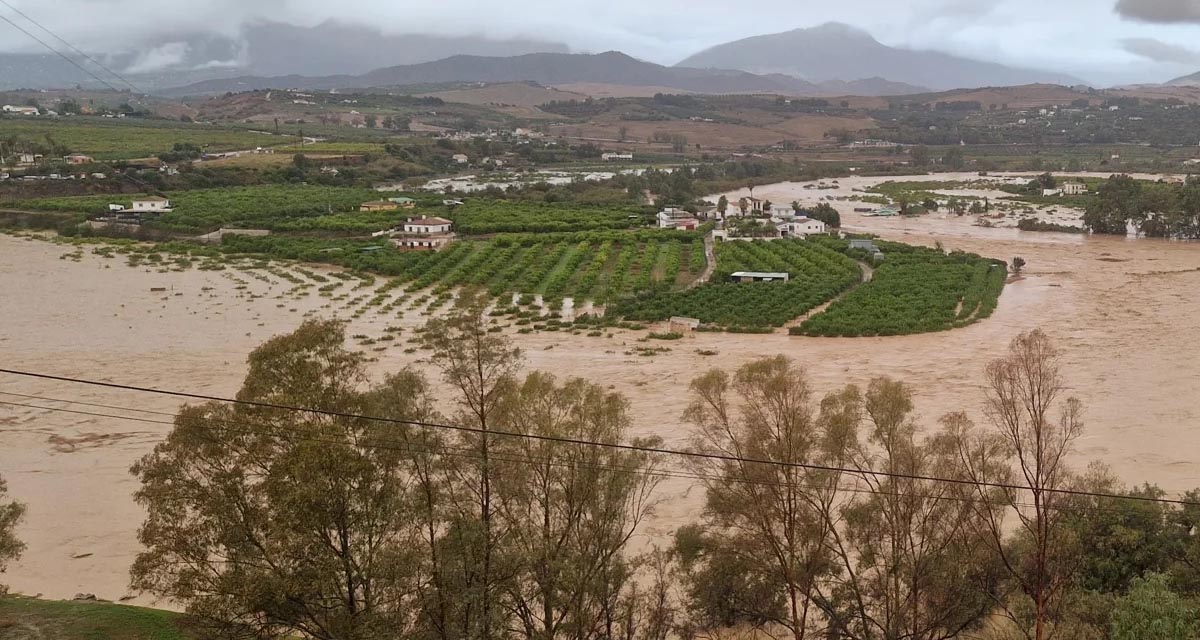
Boosting Climate Resilience: Wetland4Change Project Advances Flood Management Solutions for Mediterranean Coastal Zones
The Mediterranean coastal zone´s combination of multiple severe climate hazards – rising temperatures, water scarcity, sea-level rise, and extreme weather events – makes it a hotspot for highly interconnected climate risks for the ecosystems and societies. Recent catastrophic floods in ...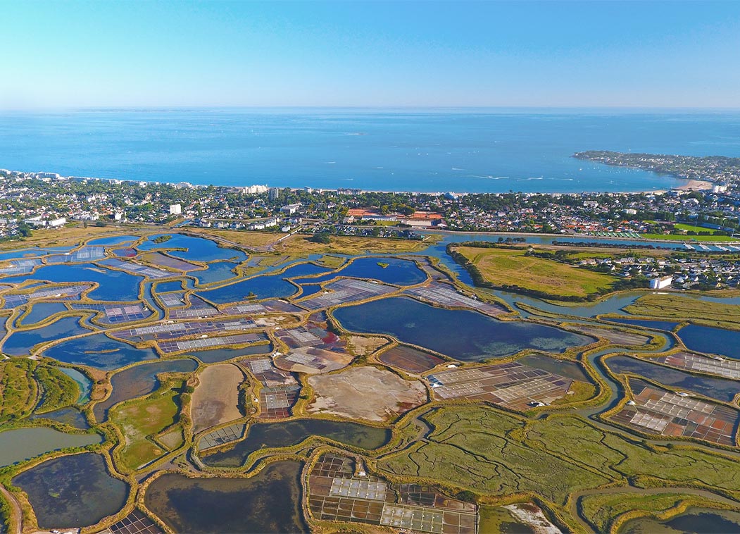
RESTORE4Cs 1st Policy Brief: How can coastal wetlands help achieve EU climate goals?
The first RESTORE4Cs Policy Brief of RESTORE4Cs, “How can coastal wetlands help achieve EU climate goals?“, highlights the importance of European coastal wetlands for reducing Greenhouse Gas emissions. The key messages of the first RESTORE4Cs Policy Brief include: Coastal wetlands are important natural carbon stores, ...
Mapping the Impact of Blue Tourism in the Mediterranean
The IUCN Centre for Mediterranean Cooperation with the support of ETC-UMA in the framework of the Blue Tourism Initiative, has released a comprehensive report entitled “Mapping the Impact of Blue Tourism in the Mediterranean: Vulnerability Assessment of Coastal and Marine ...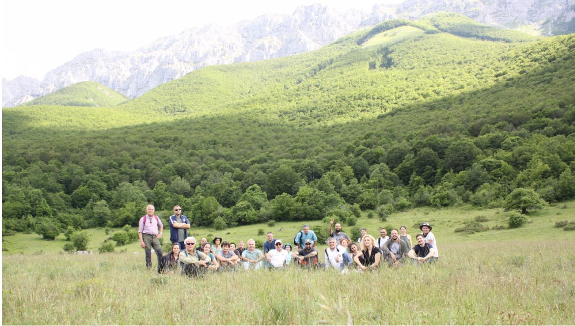
StrategyMedFor Presented at Annual Medforval Meeting 2024
StrategyMedFor was prominently featured at the Annual Medforval Meeting 2024, held from June 5-7 in Fontecchio, Italy. The event brought together 25 practitioners from national parks and natural reserves across 9 Mediterranean countries, providing a valuable platform for StrategyMedFor to ...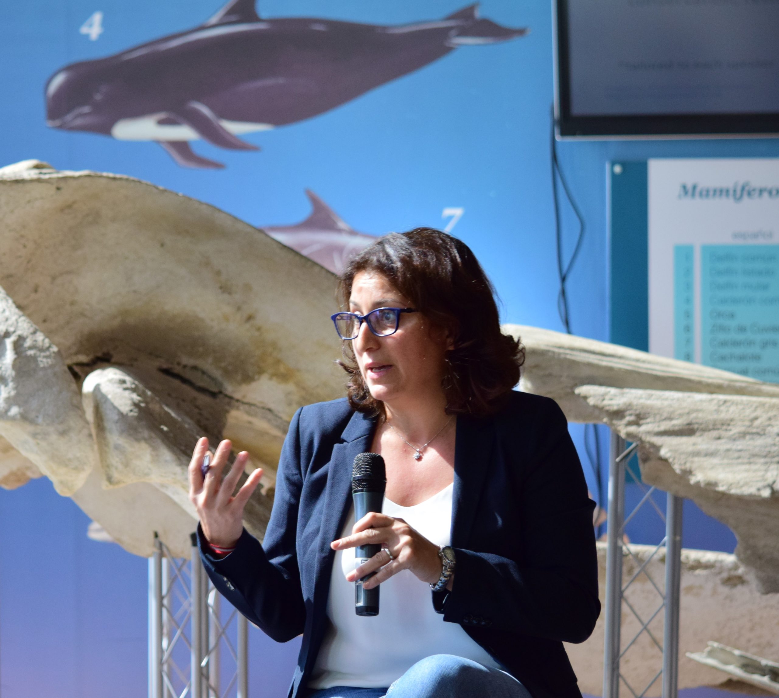
Celebrating leadership in environmental management: an interview with Dania Abdul Malak
From designing integrated ecosystem assessments in Europe and the Mediterranean to transforming outcomes into evidence-based recommendations for regional stakeholders, the European Topic Centre on Spatial Analysis and Synthesis (ETC-UMA) stands as a flagship for territorial cooperation. At the forefront of ...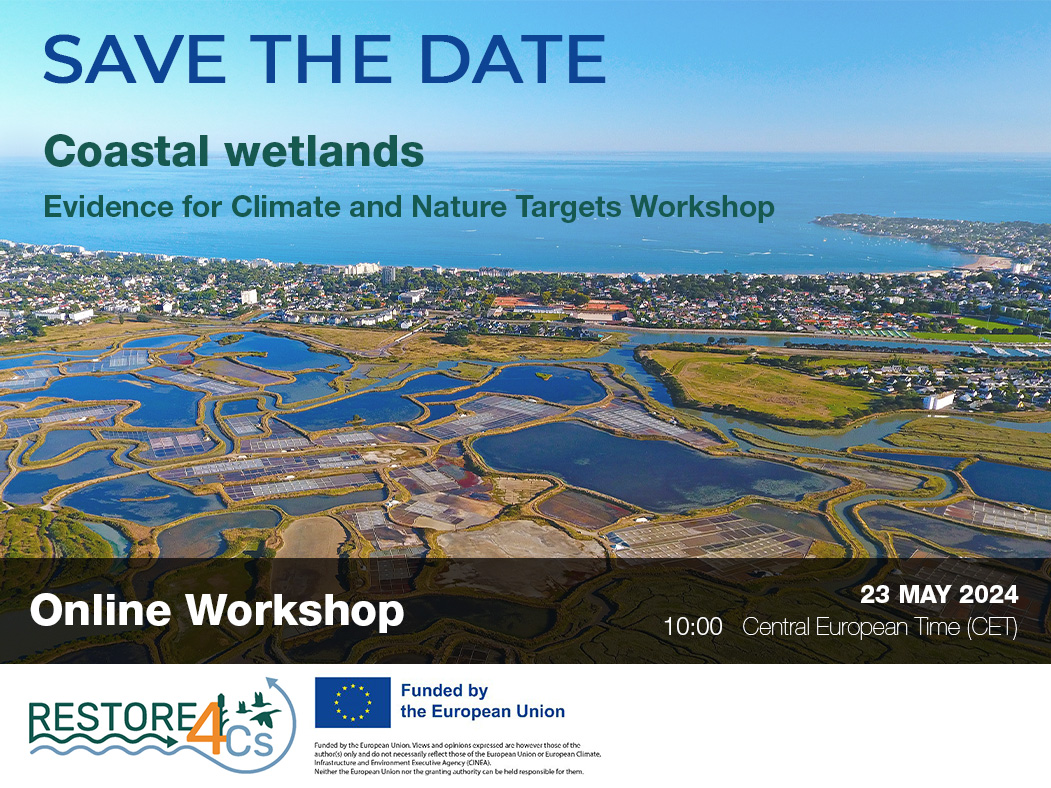
Save the date! Unlocking solutions for coastal conservation in Europe
How can coastal wetlands respond to major European Union objectives such as climate neutrality, biodiversity protection, and pollution reduction? What key role do coastal wetlands play in achieving EU commitments for climate mitigation and biodiversity conservation? The European Topic Centre ...
Towards a Strategy for the Sustainable Management of Mediterranean Forests (StrategyMedFor)
The StrategyMedFor project, co-financed by the Interreg Euro-MED programme, was launched at the University of Malaga during a two day meeting that took place on March 18 and 19, 2024. The European Topic Centre on Spatial Analysis and Synthesis (ETC-UMA), ...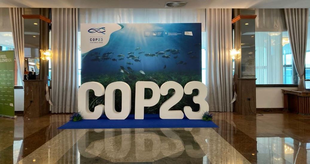
Collaborative science for forests by ETC-UMA showcased in Slovenia during the COP23
As UNEP MAP partner organization, ETC-UMA recently engaged in the organization of a session with Mediterranean institutions under the topic of climate change, entitled: From COASTAL to FOREST ecosystems: Mediterranean Nature-based Solutions to tackle climate change and ensure the Resilience ...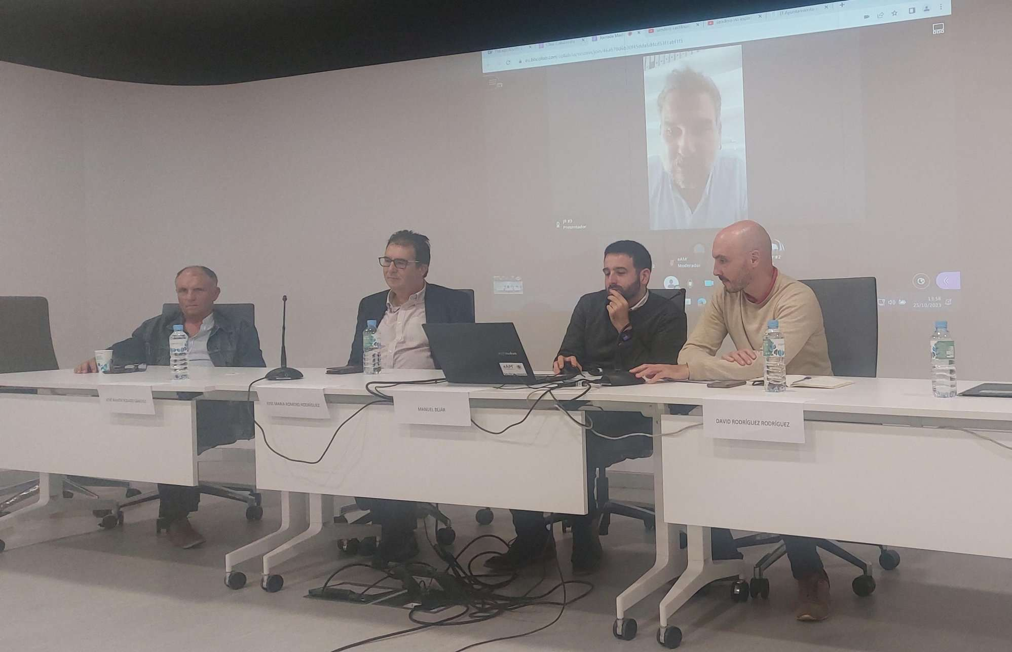
Tools for conserving the Spanish coast
On the initiative of the Instituto Universitario Hábitat Territorio y Digitalización (iHTD) of the University of Malaga, around 70 representatives of Spanish public administrations, researchers, architecture and environmental science players and civil society signed up to the second debate on ...GreenEye System: a cloud-based system to monitor wetlands in Andalusia
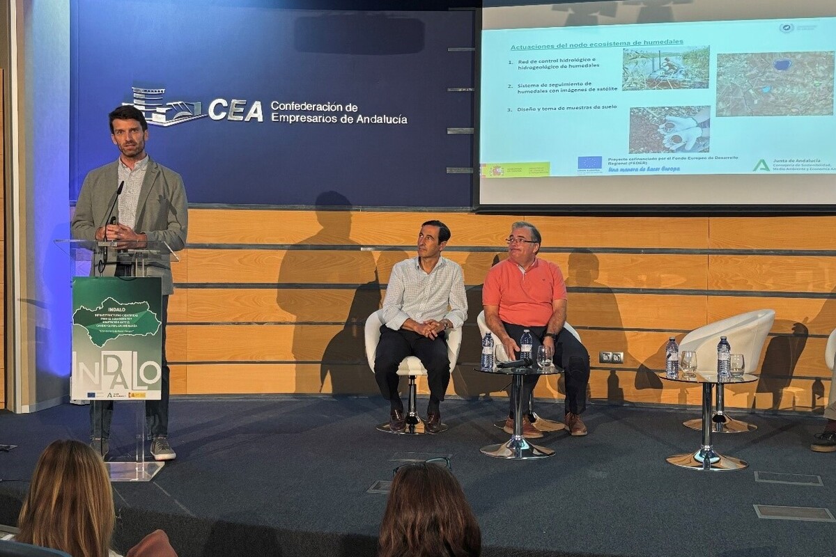
Developed in the frame of the LifeWatch INDALO project cofinanced by the European Regional Development Fund (ERDF) for the study of biodiversity and global change in Andalucia, GreenEye System, this new cloud-based monitoring system, provides useful tools for wetlands’ assessment, ...
Looking back and forth to Mediterranean Forests
Timely published to enrich the knowledge available to fight fires and climate change challenges after an extremely hot summer, the proceedings of the Seventh Mediterranean Forest Week “Forest and Ecosystem Restoration for the next Mediterranean Generations” held from 21 to ...
More space for innovative Mediterranean forest data partnerships
The report entitled A knowledge baseline on Mediterranean forests supported by innovation launched in July by ETC-UMA provides a highlight of what Mediterranean countries and institutions are doing to integrate new digital, satellite and Artificial Intelligence technologies into forest monitoring ...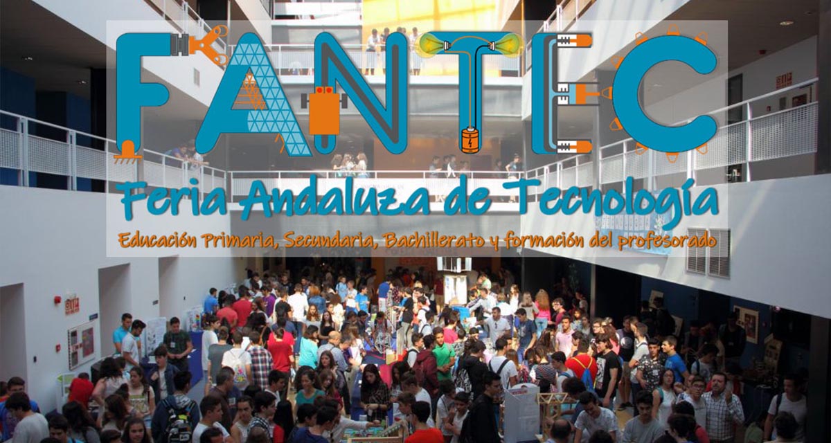
The Earth from Space shown by ETC-UMA at FANTEC 2023
Students from 80 centers from all over Andalusia came together on Friday 19 May 2023 at the High School of Industrial Engineering of the University of Malaga to participate, one more year, in the Andalusian Technology Fair 2023. Antonio Sanchez ...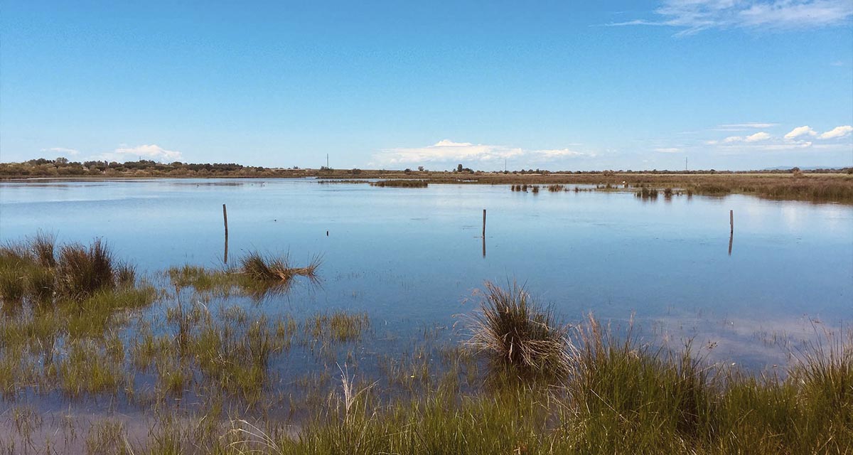
ETC-UMA launches new technologies applied to ecosystem knowledge
Built on the Google Earth Engine cloud computing platform, the new wetland monitoring system based on remote sensing data, developed by ETC-UMA and presented in April 2023 at the National Centre for Environmental Education (CENEAM by its acronym in Spanish) ...