European topic centre - university of malaga
Meet our team members

Dania Abdul Malak
ETC-UMA DIRECTOR
daniaabdulmalak@uma.es
+34 951 952 995
Dania Abdul Malak is a senior environmental researcher and Director of the European Topic Centre at the University of Malaga (ETC-UMA). She has over 15 years’ experience in environmental assessment and management. Her research focuses on setting transferable guidelines to apply ecosystem-based management to nature conservation and biodiversity protection at regional scales, including the Mediterranean and Europe. Her work supports the evidence behind the implementation of different Global, European and Mediterranean Directives such as the EU MSFD, the EU MSP, the EU Habitat Directive, the EU Biodiversity Strategy to 2020, the Barcelona Convention for the Protection of the Coastal and Marine Environment in the Mediterranean, as well as the Ramsar and the Carpathian Conventions.
Dania supports the European Environment Agency (EEA) by developing integrated ecosystem assessment frameworks to evaluate the functional capacity of ecosystems to provide ecosystem services. Furthermore, she coordinates several regional initiatives and participates in numerous international research projects related to her field of expertise. More recently, Dania is supporting the United Nations Economic and Social Commission for Western Asia (UNESCWA) in implementing sustainable Development Strategies in Western Asian countries.
She has written several scientific papers and has co-authored many international and regional technical reports and books, namely Adapting to Climate Change- an assessment of Vulnerability and risks to Human Security in the Western Mediterranean basin (Abdul Malak et al., 2017); the European forest ecosystems report (EEA, 2016); European ecosystem assessment – concept, data, and implementation (EEA, 2015), Monitoring Post-fire EVI regeneration in the Eastern Iberian Peninsula using GIS and Remote Sensing in International Journal of Applied Geospatial Research (2016) among others. More on publications are available in the ETC-UMA´s publication section.
RESOURCES
Books
Abdul-Malak, D.; McGlade, K.; Pascual, D.; Pla, E.
1, Springer International Publishing, 2017, ISBN: 978-3-319-51680-6, (2191-5547 ISSN 978-3-319-51680-6 eBook ISBN).
Abstract | Links | BibTeX | Tags: Climate Change, Mediterranean sea, Pressures
@book{Abdul-Malak2017,

title = {Adapting to Climate Change – An Assessment of Vulnerability and Risks to Human Security in the Western Mediterranean Basin},

author = {D. Abdul-Malak and K. McGlade and D. Pascual and E. Pla},

doi = {10.1007/978-3-319-51680-6},

isbn = {978-3-319-51680-6},

year  = {2017},

date = {2017-01-01},

number = {100},

publisher = {Springer International Publishing},

edition = {1},

abstract = {This book examines the water-related impacts of climate change in the UNESCO Intercontinental Biosphere Reserve of the Mediterranean (IBRM) straddling Spain and Morocco. This is the first in-depth publication on a fascinating transboundary case study; while climate change effects are rather homogenous across the IBRM, differing socio-economic contexts, land-use patterns and policy frameworks in Spain and Morocco mean considerable variations in vulnerability and consequences for human security. The authors have produced a novel and integrated vulnerability assessment that combines hydro-ecological, socio-economic and policy analyses. The interdisciplinary approach and insights contained in this volume will appeal both to those interested in the integration of natural and social sciences as well as those working on water and climate change from academic, practical or policy-oriented perspectives.},

note = {2191-5547 ISSN

978-3-319-51680-6 eBook ISBN},

keywords = {Climate Change, Mediterranean sea, Pressures},

pubstate = {published},

tppubtype = {book}

}
Book Chapters
Rodríguez-Rodríguez, D.; Sánchez-Espinosa, A.; Prem, M.; Abdul-Malak, D.; Schröder, C.
In: Chapter 9, pp. 173-186, Tirant Editorial, 1, 2024, ISBN: 978-84-1183-238-0.
Abstract | Links | BibTeX | Tags: Conservation and management, Land and soil, Mediterranean sea, Pressures, Transboundary management
@inbook{nokey,

title = {Mediterranean landscape in trasition. Nuevos enfoques para hacer frente a los nuevos retos sociales y medioambientales.},

author = {D. Rodríguez-Rodríguez and A. Sánchez-Espinosa and M. Prem and D. Abdul-Malak and C. Schröder},

url = {https://editorial.tirant.com/es/libro/mediterranean-landscape-in-trasition-nuevos-enfoques-para-hacer-frente-a-los-nuevos-retos-sociales-y-medioambientales-maria-jose-marquez-ballesteros-9788411832380?busqueda=mediterranean+landscape+in+transition&},

isbn = { 978-84-1183-238-0},

year  = {2024},

date = {2024-06-05},

urldate = {2024-06-05},

pages = {173-186},

publisher = {Tirant Editorial},

edition = {1},

chapter = {9},

abstract = {El litoral mediterráneo se enfrenta a un futuro con importantes retos y desafíos como consecuencia de su fuerte urbanización y el impacto del cambio climático. Con esta premisa, la red internacional de investigadores Mediterránean Landscape in Transition presenta esta publicación que recoge sus principales reflexiones para hacer frente a esta realidad. La intersección de las diferentes aportaciones nos muestra la complejidad y la urgencia de la situación a la que se enfrentan los paisajes mediterráneos y sus costas; donde la evaluación y medición de las dinámicas de transformación del litoral, en el contexto del cambio climático y la resiliencia, son fundamentales para comprender y conservar estos valiosos ecosistemas.


El lector conocerá las vulnerabilidades que amenazan su conservación que afecta tanto a la biodiversidad como a sus comunidades locales, subrayando la necesidad de adaptación y resiliencia para su supervivencia. También se aborda el problema del turismo masivo y la turistificación, proponiendo estrategias para equilibrar la actividad turística con la preservación ambiental y cultural. Todo ello, en un contexto donde los movimientos sociales y territoriales desempeñan un papel relevante en su defensa; y donde el paisaje social se convierte en una tarea crucial para garantizar la sostenibilidad y el bienestar de las comunidades y la naturaleza, en estos entornos costeros tan especiales.},

keywords = {Conservation and management, Land and soil, Mediterranean sea, Pressures, Transboundary management},

pubstate = {published},

tppubtype = {inbook}

}
El lector conocerá las vulnerabilidades que amenazan su conservación que afecta tanto a la biodiversidad como a sus comunidades locales, subrayando la necesidad de adaptación y resiliencia para su supervivencia. También se aborda el problema del turismo masivo y la turistificación, proponiendo estrategias para equilibrar la actividad turística con la preservación ambiental y cultural. Todo ello, en un contexto donde los movimientos sociales y territoriales desempeñan un papel relevante en su defensa; y donde el paisaje social se convierte en una tarea crucial para garantizar la sostenibilidad y el bienestar de las comunidades y la naturaleza, en estos entornos costeros tan especiales.
Journal Articles
Mackelworth, P.; Fortuna, C. M.; Antoninić, M.; Holcer, D.; Abdul-Malak, D.; Attia, K.; Bricelj, M.; Guerquin, F.; Marković, M.; Nunes, E.; Perez-Valverde, C.; Ramieri, E.; Stojanović, I.; Tunesi, L.; McGowan, J.
Ecologically and Biologically Significant Areas (EBSAs) as an enabling mechanism for transboundary marine spatial planning Journal Article
In: Marine Policy, vol. 166, pp. 106231, 2024, ISSN: 0308-597X.
Abstract | Links | BibTeX | Tags: Biodiversity, Conservation and management, Environmental conservation, Mediterranean sea, Protected areas, Transboundary management
@article{MACKELWORTH2024106231,

title = {Ecologically and Biologically Significant Areas (EBSAs) as an enabling mechanism for transboundary marine spatial planning},

author = {P. Mackelworth and C. M. Fortuna and M. Antoninić and D. Holcer and D. Abdul-Malak and K. Attia and M. Bricelj and F. Guerquin and M. Marković and E. Nunes and C. Perez-Valverde and E. Ramieri and I. Stojanović and L. Tunesi and J. McGowan},

url = {https://www.sciencedirect.com/science/article/pii/S0308597X2400229X},

doi = {https://doi.org/10.1016/j.marpol.2024.106231},

issn = {0308-597X},

year  = {2024},

date = {2024-01-01},

urldate = {2024-01-01},

journal = {Marine Policy},

volume = {166},

pages = {106231},

abstract = {As the new global biodiversity targets kick in, the signatories to the Convention of Biological Diversity (CBD) are searching for means to fulfil their obligations. Fortunately, more than a decade ago a long-neglected solution was created for the marine environment. The ecologically or biologically significant marine areas (EBSAs) provide a means for opening discussions around the management of large marine areas, ideally with conservation as a core priority. While the biological and ecological criteria for the selection of the EBSAs is clearly outlined, there is little clarity on the means to manage or govern these areas. The conservation and management measures are left as a matter to be resolved by those states which maintain some form of jurisdiction over regions within an EBSA. Of course, these measures must be in accordance with international law. Within the Mediterranean there are 15 EBSAs which have been identified and recognised by the parties of the UNEP regional seas programme. For the past four years, technical and scientific discussions have looked to move the EBSA recognition of the Southern Adriatic Ionian Straight (SAIS) forward and identify potential governance frameworks. This work has included a biodiversity threat analysis, a legal and governance review, and a preliminary spatial prioritization. We report on the processes undertaken, the policy implications for the SAIS-EBSA and the way forward. This work has implications not only for this region but for other regions within the Mediterranean and beyond.},

keywords = {Biodiversity, Conservation and management, Environmental conservation, Mediterranean sea, Protected areas, Transboundary management},

pubstate = {published},

tppubtype = {article}

}
García-Millán, V. E.; Rodríguez-Rodríguez, D.; Oncina, A. Martín; Andrianarimisa, A.; Randriamiharisoa, L. O.; Martorell-Guerrero, G.; Bóveda, A.; Abdul-Malak, D.
Identification of Priority Forest Conservation Areas for Critically Endangered Lemur Species of Madagascar Journal Article
In: Land, vol. 11, iss. 9, no. 1455, 2022.
Abstract | Links | BibTeX | Tags: Biodiversity, Conservation and management, Environmental conservation, Forest, Geotechnology, Protected areas
@article{García-Millán2022,

title = {Identification of Priority Forest Conservation Areas for Critically Endangered Lemur Species of Madagascar},

author = {V. E. García-Millán and D. Rodríguez-Rodríguez and A. Martín Oncina and A. Andrianarimisa and L. O. Randriamiharisoa and G. Martorell-Guerrero and A. Bóveda and D. Abdul-Malak},

url = {https://doi.org/10.3390/land11091455},

doi = {https://doi.org/10.3390/land11091455},

year  = {2022},

date = {2022-09-01},

urldate = {2022-09-01},

journal = {Land},

volume = {11},

number = {1455},

issue = {9},

abstract = {Forests have extraordinary importance for the conservation of endemic species in Madagascar. However, they are disappearing fast due to a number of pressures, notably unsustainable agricultural practices leading to aggravated status of biodiversity. Here, we used a number of ecological and spatial criteria to identify and prioritise unprotected forest areas for the conservation of the eight critically endangered species of lemur belonging to the Lemuridae family in Madagascar. By combining spatial information layers on the distribution areas of the studied lemurs, forest extension and conservation status, and potential human impacts (such as roads, human settlements and agriculture lands), it was possible to identify the most appropriate sites for the expansion of the conservation areas of critically endangered lemur species. Seven new sites, totalling over 33,000 ha, were identified as priority sites for the protection of those species. All of them were adjacent to or inside (just one site) existing protected areas (PAs), which likely makes their protection both feasible and socioeconomically efficient by enlarging those PAs. Legally protecting these sites would not only take Madagascar one little step ahead for meeting oncoming global biodiversity targets for 2030 but could also make a substantial contribution to the mid-term survival of the studied lemur species.},

keywords = {Biodiversity, Conservation and management, Environmental conservation, Forest, Geotechnology, Protected areas},

pubstate = {published},

tppubtype = {article}

}
Marín, A. I.; Abdul-Malak, D.; Bastrup-Birk, A.; Chirici, G.; Barbati, A.; Kleeschulte, S.
Mapping forest condition in Europe: Methodological developments in support to forest biodiversity assessments Journal Article
In: Ecological Indicators, vol. 128, 2021.
Abstract | Links | BibTeX | Tags: Biodiversity, Conservation and management, Ecosystem, Environmental conservation, Forest
@article{Marín2021b,

title = {Mapping forest condition in Europe: Methodological developments in support to forest biodiversity assessments},

author = {A. I. Marín and D. Abdul-Malak and A. Bastrup-Birk and G. Chirici and A. Barbati and S. Kleeschulte},

url = {https://doi.org/10.1016/j.ecolind.2021.107839},

doi = {10.1016/j.ecolind.2021.107839},

year  = {2021},

date = {2021-05-29},

journal = {Ecological Indicators},

volume = {128},

abstract = {Forest condition, biodiversity, and ecosystem services are strongly interlinked. The biodiversity levels depend to a large extent on the integrity, health, and vitality of forests at the same time as losses of forest biodiversity lead to decreased forest productivity and sustainability. Under this conceptual framework, this study presents a methodology for mapping forest condition at European scale supporting the attainment of the 2020 Aichi Biodiversity Target 5 “the rate of loss of all natural habitats, including forests, is at least halved and where feasible brought close to zero, and degradation and fragmentation is significantly reduced” and the implementation of Sustainable Development Goals (SDG), as well as the EU forest strategy since the sustainable forest management is oriented to support the provision of forest services and to enhance the condition of biodiversity forests’ host.


The work presents the developments of an operational indicator at European scale. This spatially explicit information on forest condition can be the baseline map with a 1 km resolution to monitor the state and changes of condition by exposition to pressures and threats. This condition indicator considers structural, functional, and compositional aspects of forest with relevance for health and vitality of species and habitats hosted by forest ecosystems.


The methodology implemented used harmonized, published and open datasets. It provided confident results for the assessment of the condition within hemiboreal, temperate and alpine forests, showing the Carpathian, Dinaric Alps and Alps, among others, as hotspots with pre-dominantly good condition. The results were validated with data derived from the reporting for the EU Habitat Directive and explicit dataset on known primary forests in Europe. However, this method underestimated the forest condition in the Mediterranean and Boreal forest types due to data gaps, regional specific characteristics, and design limitations.


This study illustrates an operational and transferable approach for addressing the assessment of ecosystem forest condition at European scale being considered as a support tool for European countries when mapping and assessing their national territory, as potential common approach to map forest ecosystems that allows for consistent aggregation and comparisons across scales.},

keywords = {Biodiversity, Conservation and management, Ecosystem, Environmental conservation, Forest},

pubstate = {published},

tppubtype = {article}

}
The work presents the developments of an operational indicator at European scale. This spatially explicit information on forest condition can be the baseline map with a 1 km resolution to monitor the state and changes of condition by exposition to pressures and threats. This condition indicator considers structural, functional, and compositional aspects of forest with relevance for health and vitality of species and habitats hosted by forest ecosystems.
The methodology implemented used harmonized, published and open datasets. It provided confident results for the assessment of the condition within hemiboreal, temperate and alpine forests, showing the Carpathian, Dinaric Alps and Alps, among others, as hotspots with pre-dominantly good condition. The results were validated with data derived from the reporting for the EU Habitat Directive and explicit dataset on known primary forests in Europe. However, this method underestimated the forest condition in the Mediterranean and Boreal forest types due to data gaps, regional specific characteristics, and design limitations.
This study illustrates an operational and transferable approach for addressing the assessment of ecosystem forest condition at European scale being considered as a support tool for European countries when mapping and assessing their national territory, as potential common approach to map forest ecosystems that allows for consistent aggregation and comparisons across scales.
Rodríguez-Rodríguez, D.; Sánchez-Espinosa, A.; Abdul-Malak, D.
Potential contribution of OECMs to international area-based conservation targets in a biodiversity rich country, Spain Journal Article
In: Journal for Nature Conservation, vol. 62, 2021.
Abstract | Links | BibTeX | Tags: Biodiversity, Conservation and management, Ecosystem, Environmental conservation, Marine protected areas, Protected areas
@article{Rodríguez-Rodríguez2021b,

title = {Potential contribution of OECMs to international area-based conservation targets in a biodiversity rich country, Spain},

author = {D. Rodríguez-Rodríguez and A. Sánchez-Espinosa and D. Abdul-Malak},

url = {https://doi.org/10.1016/j.jnc.2021.126019},

doi = {10.1016/j.jnc.2021.126019},

year  = {2021},

date = {2021-05-15},

journal = {Journal for Nature Conservation},

volume = {62},

abstract = {Other effective area-based conservation measures (OECMs) are new conservation tools intended to complement protected areas (PAs) at achieving effective biodiversity conservation and meeting international area-based targets. However, OECMs have been rarely considered in practical terms until recently. Here, we performed a rapid evaluation on the degree of fulfilment of current area-based international biodiversity targets, post-2020 foreseeable oncoming targets, and ecological targets by considering: 1) Protection coverage; 2) Inclusiveness of important areas for biodiversity; 3) Protection management; 4) Connectivity; and 5) Habitat representation, on land and at sea in Spain, a Euro-Mediterranean, biodiversity rich country. We conducted the evaluation under two scenarios: 1) Scenario 1 considers designated PAs; and 2) Scenario 2, that also includes potential OECMs. In order to generate Scenario 2, thirteen legal categories were assessed against international guidance on OECMs as a first step to screen their likelihood of providing OECMs in Spain. Our findings show that some potentially satisfactory OECM categories such as Public Utility Forests, River Reserves or Geoparks meet the OECM criteria to a large degree and deserve further study. Our results also highlight that Spain is currently well above most foreseeable post-2020 biodiversity targets and even close to some ecological targets using just PAs, except for marine protected area (MPA) management and MPA offshore coverage. Adding OECMs would noticeably improve the country’s figures yet without reaching many exigent ecological targets. OECMs can become a useful, cost-effective biodiversity conservation tool that contributes to international targets under new, more ambitious area-based conservation requirements in Spain and elsewhere. Nevertheless, for this to happen, suitable biodiversity management and monitoring schemes must be ensured.},

keywords = {Biodiversity, Conservation and management, Ecosystem, Environmental conservation, Marine protected areas, Protected areas},

pubstate = {published},

tppubtype = {article}

}
Bevilacqua, S.; Katsanevakis, S.; Micheli, F.; Sala, E.; Rilov, G.; Sarà, G.; Abdul-Malak, D.; Abdulla, A.; Gerovasileiou, V.; Gissi, E.; Mazaris, A. D.; Pipitone, C.; Sini, M.; Stelzenmüller, V.; Terlizzi, A.; Todorova, V.; Fraschetti, S.
The Status of Coastal Benthic Ecosystems in the Mediterranean Sea: Evidence From Ecological Indicators Journal Article
In: Frontiers in Marine Science, 2020.
Abstract | Links | BibTeX | Tags: Conservation and management, Ecosystem, Environmental conservation, Mediterranean sea
@article{Bevilacqua2020,

title = {The Status of Coastal Benthic Ecosystems in the Mediterranean Sea: Evidence From Ecological Indicators},

author = {S. Bevilacqua and S. Katsanevakis and F. Micheli and E. Sala and G. Rilov and G. Sarà and D. Abdul-Malak and A. Abdulla and V. Gerovasileiou and E. Gissi and A. D. Mazaris and C. Pipitone and M. Sini and V. Stelzenmüller and A. Terlizzi and V. Todorova and S. Fraschetti},

url = {https://doi.org/10.3389/fmars.2020.00475},

doi = {10.3389/fmars.2020.00475},

year  = {2020},

date = {2020-06-19},

journal = {Frontiers in Marine Science},

abstract = {The Mediterranean Sea is subject to multiple human pressures increasingly threatening its unique biodiversity. Spatially explicit information on the ecological status of marine ecosystems is therefore key to an effective maritime spatial planning and management, and to help the achievement of environmental targets. Here, we summarized scientific data on the ecological status of a selection of marine ecosystems based on a set of ecological indicators in more than 700 sites of the Mediterranean Sea. For Posidonia oceanica seagrass beds, rocky intertidal fringe, and coastal soft bottoms, more than 70% of investigated sites exhibited good to high ecological conditions. In contrast, about two-thirds of sites for subtidal rocky reefs were classified to be in moderate to bad conditions, stressing the need for prioritizing conservation initiatives on these productive and diverse environments. Very little quantitative information was available for the southern Mediterranean Sea, thus monitoring programs and assessments in this area are essential for a representative assessment of the health of marine coastal ecosystems in the whole basin. This overview represents a first step to implement a baseline that, through georeferenced data on ecological status, could help identifying information gaps, directing future research priorities, and supporting improvements to spatial models of expected cumulative impacts on marine ecosystems.},

keywords = {Conservation and management, Ecosystem, Environmental conservation, Mediterranean sea},

pubstate = {published},

tppubtype = {article}

}
Merkohasanaj, M.; Rodríguez-Rodríguez, D.; García-Martínez, M. C.; Vargas-Yáñez, M.; Abdul-Malak, D.
Assessing the environmental effectiveness of the Spanish Marine Reserve Network using remote sensing Journal Article
In: Ecological Indicators, vol. 107, 2019.
Abstract | Links | BibTeX | Tags: Conservation and management, Marine protected areas, Protected areas, SOSTPARK
@article{Merkohasanaj2019,

title = {Assessing the environmental effectiveness of the Spanish Marine Reserve Network using remote sensing},

author = {M. Merkohasanaj and D. Rodríguez-Rodríguez and M.C. García-Martínez and M. Vargas-Yáñez and D. Abdul-Malak},

url = {https://www.sciencedirect.com/science/article/pii/S1470160X19305758},

doi = {10.1016/j.ecolind.2019.105583},

year  = {2019},

date = {2019-12-01},

journal = {Ecological Indicators},

volume = {107},

abstract = {Healthy marine ecosystems provide a variety of ecosystem services crucial for human wellbeing. Effectively managed Marine Protected Areas (MPAs) are increasingly recognized to be an effective measure to protect endangered species and ensuring healthier ecosystems. This study assesses the environmental effectiveness of the Spanish Marine Reserve Network (MRN) with regard to: 1) water quality: chlorophyll-a concentrations (Chl-a), sea surface temperature (SST), and Salinity; and 2) protected species conservation: coverage and density of Posidonia oceanica (P. oceanica), using a Multiple-Paired-Before-After-Control-Impact (MPBACI) research design. Water quality and protected species indicators were compared before and after Marine Reserve (MR) designation, inside MRs and in different outer control areas of 1 km, 5 km, 10 km and equal-area buffers, for the whole MRN (Marine Reserve Network), by marine ecoregions and for some specific MRs. We used Copernicus Marine Monitoring Remote Sensing data to ascertain water quality values and validated their accuracy compared to in-situ data as well as the reliability of Chl-a concentration derived from Sentinel 2 (S2) images. Water quality results reveal significant differences in mean Chl-a and Chl-a range, mean Salinity and SST range between cases (inside MRs) and 5 km-buffer control areas for the entire MRN. Analyses by ecoregion showed no significant differences in water quality between cases and controls in the Western Mediterranean ecoregion or in the Azores, Canaries and Madeira ecoregion, whereas the Alboran Sea ecoregion MRs had higher mean Chl-a concentration and lower mean Salinity, mean SST and SST range than all controls. Results on P. oceanica beds showed a significant increase in P. oceanica density (almost twice) inside Tabarca MR (TBA) compared to outer control cases, but no significant changes in P. oceanica coverage. Validation of Remote Sensing (RS) data using in-situ measurements demonstrated significant differences for Chl-a concentration and no significant differences for SST and Salinity between both techniques. Chl-a concentration by S2 reveals statistically significant differences with in-situ data. Our findings suggest environmental effectiveness of the Spanish MRs and still limited sensitivity of open source medium resolution RS tools to assess MPA effectiveness.},

keywords = {Conservation and management, Marine protected areas, Protected areas, SOSTPARK},

pubstate = {published},

tppubtype = {article}

}
Hatziiordanou, L.; Fitoka, E.; Hadjicharalampous, E.; Votsi, N. E.; Palaskas, D.; Abdul-Malak, D.
In: One Ecosystem, vol. 4, no. e32704, 2019.
Abstract | Links | BibTeX | Tags: Biodiversity, Climate Change, Conservation and management, Ecosystem services, Forest, Land and soil, Pressures, Wetlands
@article{Hatziiordanou2019,

title = {Indicators for mapping and assessment of ecosystem condition and of the ecosystem service habitat maintenance in support of the EU Biodiversity Strategy to 2020},

author = {L. Hatziiordanou and E. Fitoka and E. Hadjicharalampous and N.E. Votsi and D. Palaskas and D. Abdul-Malak},

url = {https://oneecosystem.pensoft.net/article/32704/},

doi = {10.3897/oneeco.4.e32704},

year  = {2019},

date = {2019-06-13},

journal = {One Ecosystem},

volume = {4},

number = {e32704},

abstract = {A systematic approach to map and assess the “maintenance of nursery populations and habitats” ecosystem service (ES) (hereinafter called “habitat maintenance”) has not yet emerged. In this article, we present an ecosystem service framework implementation at landscape level, by proposing an approach for calculating and combining a series of indicators with spatial modelling techniques. Necessary conceptual elements for this approach are: a) ecosystem condition, b) supply and demand of the targeted ecosystem service and c) spatial relationships between the Service Providing Units (SPU) and the Service Connecting Units (SCU). Ecosystem condition is quantified and mapped based on two indicators, the Biodiversity State and the Anthropogenic Impact. Quantification and mapping of supply and demand are based on the hypothesis that high supply can be activated in strictly protected areas and that a demand is localised in the Natura 2000 sites (N2K), considering them as the Service Benefit Areas (SBA). Wetlands are assessed as SCU between the SBA and the landscape areas where the habitat maintenance ES is supplied. By assessing wetlands as SCU, we intent to highlight their role as biodiversity stepping stones and as green infrastructures. Overall, we conclude that the EU biodiversity policy demand for no net loss and for a coherent N2K network can be met by enhancing the delivery of the habitat maintenance ES. This approach can assist policy-makers in prioritisation of conservation and restoration targets, in line with the EU biodiversity strategy to 2020 and the preparation of the post-2020 Strategy.},

keywords = {Biodiversity, Climate Change, Conservation and management, Ecosystem services, Forest, Land and soil, Pressures, Wetlands},

pubstate = {published},

tppubtype = {article}

}
Rodríguez-Rodríguez, D.; Abdul-Malak, D.; Schröder, C.; McGlade, K.; Pascual, D.
Bridging the research-management gap in environmental conservation: A case study from Andalusia, southern Spain Journal Article
In: SDRP Journal of Earth Sciences & Environmental Studies, vol. 4, no. 2, pp. 579-588, 2019, ISBN: 2472-6397 .
Abstract | Links | BibTeX | Tags: Conservation and management, Environmental conservation, Protected areas, SOSTPARK
@article{Rodríguez-Rodríguez2019b,

title = {Bridging the research-management gap in environmental conservation: A case study from Andalusia, southern Spain},

author = {D. Rodríguez-Rodríguez and D. Abdul-Malak and C. Schröder and K. McGlade and D. Pascual},

url = {https://www.siftdesk.org/article-details/Bridging-the-research-management-gap-in-environmental-conservation-A-case-study-from-Andalusia-southern-Spain/489},

doi = {10.25177/JESES.4.2.RA.489},

isbn = {2472-6397 },

year  = {2019},

date = {2019-04-01},

journal = {SDRP Journal of Earth Sciences & Environmental Studies},

volume = {4},

number = {2},

pages = {579-588},

abstract = {Science is believed to provide the most objective basis for effective decision-making, though it is rarely implemented in environmental management. Here we reflect on the results of a regional workshop aimed at exploring the knowledge and use of scientific evidence by environmental managers in an ecologically diverse region in southern Spain: Andalusia. Scientists were moderately aware of regional managerial needs. They stated that regional managers’ needs could be mostly addressed by their research centers, and that they often considered managerial needs when conducting research. In turn, environmental managers had limited knowledge of, and interest in, the environmental research carried out in the region. However, managers stated they frequently use scientific outputs in their jobs. The main perceived barriers to effective use of science in regional environmental management by both groups were: different priorities by each group, and limited time of managers to check scientific information. Scientists also perceived that managers were not sufficiently engaged in research and that they were often reluctant to change their usual managerial practices. Managers mentioned inadequate scientific dissemination formats. The perceived solutions to those issues were: reinforcing collaboration mechanisms between both groups; aligning research to managerial needs more closely; greater managers’ awareness of adaptive management; and developing user friendly, synthetic communication tools for managers. The insights from the workshop are intended to help scientists and managers to enhance effective use of environmental science in Spain and elsewhere.},

keywords = {Conservation and management, Environmental conservation, Protected areas, SOSTPARK},

pubstate = {published},

tppubtype = {article}

}
Rodríguez-Rodríguez, D.; Abdul-Malak, D.; Soukissian, T.; Sánchez-Espinosa, A.
Achieving Blue Growth through maritime spatial planning: Offshore wind energy optimization and biodiversity conservation in Spain Journal Article
In: Marine Policy, vol. 73, pp. 8-14, 2016.
Abstract | Links | BibTeX | Tags: Biodiversity, Blue Growth, Climate Change, Conservation and management, Pressures
@article{Rodríguez-Rodríguez2016d,

title = {Achieving Blue Growth through maritime spatial planning: Offshore wind energy optimization and biodiversity conservation in Spain},

author = {D. Rodríguez-Rodríguez and D. Abdul-Malak and T. Soukissian and A. Sánchez-Espinosa},

url = {https://www.researchgate.net/publication/305824278_Achieving_Blue_Growth_through_maritime_spatial_planning_Offshore_wind_energy_optimization_and_biodiversity_conservation_in_Spain},

doi = {10.1016/j.marpol.2016.07.022},

year  = {2016},

date = {2016-11-01},

journal = {Marine Policy},

volume = {73},

pages = {8-14},

abstract = {Spain has a high potential for renewable energy production, being the world's third country by installed on-shore wind power. However, it has not yet fully developed its renewable energy production capacity, with no commercial offshore wind production to date, and remains highly dependent on fossil fuel imports. The country is also one of Europe's most biodiverse, on land and at sea. This study spatially assesses the country's offshore wind energy potential by incorporating the newly designated marine protected areas (MPAs) to the official Spanish strategic environmental assessment for the installation of offshore windfarms (SEA). It also identifies optimal areas for offshore windfarm development according to key physical variables such as wind speed, depth and substrate type. It finally assesses real commercial windfarm projects against current environmental constraints. The results show that nearly 50% of the whole area within 24 nm from the Spanish coast could be suitable for offshore windfarm development at the planning phase. However, only 0.7% of that area is optimal for wind energy production with current fixed turbine technology. Nevertheless, either area would allow Spain to meet its national targets of 750 MW of ocean power capacity installed by 2020 under adequate local wind conditions. Over 88% of all commercial windfarm project area is within the SEA's Exclusion zone, thus unfeasible under current circumstances. Technological breakthroughs like floating turbines may soon make the optimal windfarm area (OWA) less restrictive and reduce current environmental impacts of marine windfarms within a truly sustainable Blue Growth.},

keywords = {Biodiversity, Blue Growth, Climate Change, Conservation and management, Pressures},

pubstate = {published},

tppubtype = {article}

}
Rodríguez-Rodríguez, D.; Rodríguez, J.; Blanco, J María; Abdul-Malak, D.
Marine protected area design patterns in the Mediterranean Sea: Implications for conservation Journal Article
In: Marine Pollution Bulletin , vol. 110, no. 1, 2016.
Abstract | Links | BibTeX | Tags: Conservation and management, Marine protected areas, Mediterranean sea, Protected areas
@article{Rodríguez-Rodríguez2016,

title = {Marine protected area design patterns in the Mediterranean Sea: Implications for conservation},

author = {D. Rodríguez-Rodríguez and J. Rodríguez and J María Blanco and D. Abdul-Malak},

url = {https://www.researchgate.net/publication/304896823_Marine_protected_area_design_patterns_in_the_Mediterranean_Sea_Implications_for_conservation},

doi = {10.1016/j.marpolbul.2016.06.044},

year  = {2016},

date = {2016-10-01},

journal = {Marine Pollution Bulletin },

volume = {110},

number = {1},

abstract = {Mediterranean marine protected area (MPA) design patterns regarding geographic distribution, size, spacing and shape were analysed as a proxy of the region's MPA's ecological effectiveness and a first step towards an ecologically coherent MPA network. Results for legally designated MPAs and ecologically functional MPAs accounting for overlaps are presented. Geographically, Mediterranean MPA area is very unevenly distributed, with four-fifths concentrated in just three countries of the north-western part of the basin. Average distance between functional MPAs lies within recommended ecological thresholds, which suggests adequate potential connectivity of the Mediterranean MPA system. Mediterranean designated MPAs are larger than MPAs worldwide on average, although they are generally smaller than international guidance suggests at different levels: ecoregion, country and designation category. On average, Mediterranean designated and functional MPAs have relatively high compactness, which makes them prone to spillover and adequate viability, and less vulnerable to edge effects.},

keywords = {Conservation and management, Marine protected areas, Mediterranean sea, Protected areas},

pubstate = {published},

tppubtype = {article}

}
Rodríguez-Rodríguez, D.; Rodríguez, J.; Abdul-Malak, D.; Hernandez, P.
In: Marine Policy, vol. 64, pp. 24-30, 2016.
Abstract | Links | BibTeX | Tags: Conservation and management, Marine protected areas, Mediterranean sea, Protected areas
@article{Rodríguez-Rodríguez2016c,

title = {Marine protected areas and fisheries restricted areas in the Mediterranean: Assessing "actual" marine biodiversity protection coverage at multiple scales},

author = {D. Rodríguez-Rodríguez and J. Rodríguez and D. Abdul-Malak and P. Hernandez},

url = {https://www.researchgate.net/publication/304896848_Marine_protected_areas_and_fisheries_restricted_areas_in_the_Mediterranean_Assessing_actual_marine_biodiversity_protection_coverage_at_multiple_scales},

doi = {10.1016/j.marpol.2015.11.006},

year  = {2016},

date = {2016-02-01},

journal = {Marine Policy},

volume = {64},

pages = {24-30},

abstract = {This study uses a tiered approach to assessing progress towards achieving the Convention on Biological Diversity (CBD) target to increase marine protected area (MPA) coverage to 10% at different scales: the whole Mediterranean Sea, by ecoregions and by countries. It additively considers marine protection coverage by conventional MPAs (cMPAs; tier 1); unconventional MPAs (uMPAs, including international Fisheries Restricted Areas –iFRAs-; tier 2); and Other Effective Area-Based Conservation Measures (OEABCMs, including national FRAs -nFRAs; tier 3). It also discusses the appropriateness of considering tiers 2 & 3 as legal and managerial tools for sustainable marine development in national reporting against international protection coverage targets. At the Mediterranean Sea scale, by mid-2015 there were 1,077 cMPAs which covered 6.45% of its area. At the ecoregional scale, only the Western Mediterranean ecoregion exceeds the 10% coverage target. At national scale, four countries (Monaco, France, Spain and Turkey) currently exceed the 10% target for their entire hypothetical Exclusive Economic Zones (EEZs). The cMPA designations that contribute most to Mediterranean MPA coverage are Specially Protected Areas of Mediterranean Importance (SPAMIs), the Pelagos Sanctuary, Natura 2000 sites and national designations, respectively. When considering uMPAs, the amount of marine area under protection in the Mediterranean reaches 1,632,507 km2 or roughly 64.48% of the Mediterranean Sea area; all the ecoregions more than double the CBD coverage target; all countries but Malta meet the target in their inshore waters; and all countries meet the target in their whole hypothetical EEZs. Finally, nFRAs contributed 565 km2 of additional protected area and made the percentage of legally protected marine area reach 64.50% of the total Mediterranean Sea area.},

keywords = {Conservation and management, Marine protected areas, Mediterranean sea, Protected areas},

pubstate = {published},

tppubtype = {article}

}
Rodriguez-Rodriguez, D.; J. Rodriguez,; Abdul-Malak, D.
In: Journal of Environmental Management, vol. 167, pp. 29-37, 2016.
Abstract | Links | BibTeX | Tags: Conservation and management, Marine protected areas, Mediterranean sea, Protected areas
@article{Rodriguez-Rodriguez2016b,

title = {Development and testing of a new framework for rapidly assessing legal and managerial protection afforded by marine protected areas: Mediterranean Sea case study},

author = {D. Rodriguez-Rodriguez and J. Rodriguez, and D. Abdul-Malak},

url = {https://www.researchgate.net/publication/284358773_Development_and_testing_of_a_new_framework_for_rapidly_assessing_legal_and_managerial_protection_afforded_by_marine_protected_areas_Mediterranean_Sea_case_study},

doi = {10.1016/j.jenvman.2015.11.016},

year  = {2016},

date = {2016-02-01},

journal = {Journal of Environmental Management},

volume = {167},

pages = {29-37},

abstract = {The Convention on Biological Diversity (CBD) states the need to effectively conserve at least 10% of coastal and marine areas of particular importance for biodiversity by 2020. Here, a new indicator-based methodological framework to assess biodiversity protection afforded by marine protected areas' (MPA) was developed as a quick surrogate for MPAs' potential conservation effectiveness: the Marine Protected Area Protection Assessment Framework (MaPAF). The MaPAF consists of a limited number of headline indicators that are integrated in two indexes: Legal protection and Management effort, which eventually integrate in the overall MPA Protection super-index. The MaPAF was then tested in the Mediterranean MPA network as a case study. Spatial analyses were performed at three meaningful scales: the whole Mediterranean Sea, Mediterranean ecoregions and countries. The results of this study suggest that: 1) The MaPAF can serve as a useful tool for consistent, adaptive, quick and cost-effective MPA effectiveness assessments of MPAs and MPA networks in virtually any marine region, as the headline indicators used are commonly compiled and easy to retrieve; 2) The MaPAF proved usable and potentially relevant in the Mediterranean Sea where most indicators in the framework can be publicly accessed through the MAPAMED database and are planned to be regularly updated; 3) Protection afforded by MPAs is low across the whole Mediterranean, with only few MPAs having relatively high legal and managerial protection; and 4) Most Mediterranean countries need to devote substantially more work to improve MPA effectiveness mainly through increased management effort. },

keywords = {Conservation and management, Marine protected areas, Mediterranean sea, Protected areas},

pubstate = {published},

tppubtype = {article}

}
Rodríguez-Rodríguez, D.; Rodríguez, J.; Abdul-Malak, D.
In: Journal of Environmental Management, vol. 167, pp. 29-37, 2016.
Abstract | Links | BibTeX | Tags: Conservation and management, Marine protected areas, Mediterranean sea, Protected areas
@article{Rodríguez-Rodríguez2016e,

title = {Development and testing of a new framework for rapidly assessing legal and managerial protection afforded by marine protected areas: Mediterranean Sea case study},

author = {D. Rodríguez-Rodríguez and J. Rodríguez and D. Abdul-Malak},

url = {https://www.sciencedirect.com/science/article/pii/S0301479715303704},

doi = {https://doi.org/10.1016/j.jenvman.2015.11.016},

year  = {2016},

date = {2016-02-01},

journal = {Journal of Environmental Management},

volume = {167},

pages = {29-37},

abstract = {The Convention on Biological Diversity (CBD) states the need to effectively conserve at least 10% of coastal and marine areas of particular importance for biodiversity by 2020. Here, a new indicator-based methodological framework to assess biodiversity protection afforded by marine protected areas' (MPA) was developed as a quick surrogate for MPAs' potential conservation effectiveness: the Marine Protected Area Protection Assessment Framework (MaPAF). The MaPAF consists of a limited number of headline indicators that are integrated in two indexes: Legal protection and Management effort, which eventually integrate in the overall MPA Protection super-index. The MaPAF was then tested in the Mediterranean MPA network as a case study. Spatial analyses were performed at three meaningful scales: the whole Mediterranean Sea, Mediterranean ecoregions and countries. The results of this study suggest that: 1) The MaPAF can serve as a useful tool for consistent, adaptive, quick and cost-effective MPA effectiveness assessments of MPAs and MPA networks in virtually any marine region, as the headline indicators used are commonly compiled and easy to retrieve; 2) The MaPAF proved usable and potentially relevant in the Mediterranean Sea where most indicators in the framework can be publicly accessed through the MAPAMED database and are planned to be regularly updated; 3) Protection afforded by MPAs is low across the whole Mediterranean, with only few MPAs having relatively high legal and managerial protection; and 4) Most Mediterranean countries need to devote substantially more work to improve MPA effectiveness mainly through increased management effort.},

keywords = {Conservation and management, Marine protected areas, Mediterranean sea, Protected areas},

pubstate = {published},

tppubtype = {article}

}
Rodríguez-Rodríguez, D.; Rodríguez, J.; Abdul-Malak, D.; Nastasi, A.; Hernández, P.
In: Marine Policy, vol. 64, pp. 24-30, 2016.
Abstract | Links | BibTeX | Tags: Conservation and management, Marine protected areas, Mediterranean sea, Protected areas
@article{Rodríguez-Rodrígueza2016,

title = {Marine protected areas and fisheries restricted areas in the Mediterranean: assessing “actual” marine biodiversity protection coverage at multiple scales},

author = {D. Rodríguez-Rodríguez and J. Rodríguez and D. Abdul-Malak and A. Nastasi and P. Hernández},

url = {https://www.sciencedirect.com/science/article/pii/S0308597X15003255},

doi = {https://doi.org/10.1016/j.marpol.2015.11.006},

year  = {2016},

date = {2016-02-01},

journal = {Marine Policy},

volume = {64},

pages = {24-30},

abstract = {This study uses a tiered approach to assessing progress towards achieving the Convention on Biological Diversity (CBD) target to increase marine protected area (MPA) coverage to 10% at different scales: the whole Mediterranean Sea, by ecoregions and by countries. It additively considers marine protection coverage by conventional MPAs (cMPAs; tier 1); unconventional MPAs (uMPAs, including international Fisheries Restricted Areas – iFRAs-; tier 2); and Other Effective Area-Based Conservation Measures (OEABCMs, including national FRAs–nFRAs; tier 3). It also discusses the appropriateness of considering tiers 2 and 3 as legal and managerial tools for sustainable marine development in national reporting against international protection coverage targets. At the Mediterranean Sea scale, by mid-2015 there were 1077 cMPAs which covered 6.45% of its area. At the ecoregional scale, only the Western Mediterranean ecoregion exceeds the 10% coverage target. At national scale, four countries (Monaco, France, Spain and Turkey) currently exceed the 10% target for their entire hypothetical Exclusive Economic Zones (EEZs). The cMPA designations that contribute most to Mediterranean MPA coverage are Specially Protected Areas of Mediterranean Importance (SPAMIs), the Pelagos Sanctuary, Natura 2000 sites and national designations, respectively. When considering uMPAs, the amount of marine area under protection in the Mediterranean reaches 1,632,507 km2 or roughly 64.48% of the Mediterranean Sea area; all the ecoregions more than double the CBD coverage target; all countries but Malta meet the target in their inshore waters; and all countries meet the target in their whole hypothetical EEZs. Finally, nFRAs contributed 565 km2 of additional protected area and made the percentage of legally protected marine area reach 64.50% of the total Mediterranean Sea area.},

keywords = {Conservation and management, Marine protected areas, Mediterranean sea, Protected areas},

pubstate = {published},

tppubtype = {article}

}
Rodríguez-Rodríguez, D.; Sánchez-Espinosa, A.; Schröder, C.; Abdul-Malak, D.; Rodríguez, J.
Cumulative pressures and low protection: a concerning blend for Mediterranean MPAs Journal Article
In: Marine Pollution Bulletin, vol. 101, pp. 288-295, 2015.
Abstract | Links | BibTeX | Tags: Climate Change, Marine protected areas, Mediterranean sea, Pressures
@article{Rodríguez-Rodrígueza2015,

title = {Cumulative pressures and low protection: a concerning blend for Mediterranean MPAs},

author = {D. Rodríguez-Rodríguez and A. Sánchez-Espinosa and C. Schröder and D. Abdul-Malak and J. Rodríguez},

url = {https://www.sciencedirect.com/science/article/pii/S0025326X15300540},

doi = {https://doi.org/10.1016/j.marpolbul.2015.09.039},

year  = {2015},

date = {2015-12-01},

journal = {Marine Pollution Bulletin},

volume = {101},

pages = {288-295},

abstract = {This study classifies Mediterranean marine protected areas (MPAs) according to the combined result of pressure level and protection. Six major marine environment pressures were considered: pressures from fish farms, fishing, marine litter, pressures from marinas, pollution from maritime transport, and climate change. MPA protection was assessed through legal protection and management effort. Most MPA area in the Mediterranean is under relatively high pressure level and afforded low protection. Inshore areas show higher pressure levels. Five marine ecoregions, nine countries and nineteen MPA designation categories have over 50% of their MPA area under major concern. The mean number of cumulative pressures occurring in priority MPAs ranges between three and four, although the mean combined intensity of those pressures is low. However, these figures are most likely underestimated, especially for the southern Mediterranean. The most concerning pressures to MPAs regarding extent and intensity were: climate change, fishing and pollution from maritime transport.},

keywords = {Climate Change, Marine protected areas, Mediterranean sea, Pressures},

pubstate = {published},

tppubtype = {article}

}
Abdul-Malak, D.; Pausa, J. G.; Pardo-Pascual, J. E.; Ruiz, L. A.
Fire Recurrence and the Dynamics Journal Article
In: International Journal of Applied Geospatial Research, vol. 6, no. 2, pp. 18-35, 2015.
Abstract | Links | BibTeX | Tags: Forest, Forest fire, Mediterranean sea
@article{Abdul-Malak2015,

title = {Fire Recurrence and the Dynamics},

author = {D. Abdul-Malak and J. G. Pausa and J. E. Pardo-Pascual and L. A. Ruiz},

url = {https://www.researchgate.net/publication/271468045_Fire_Recurrence_and_the_Dynamics_of_the_Enhanced_Vegetation_Index_in_a_Mediterranean_Ecosystem},

doi = {10.4018/ijagr.2015040102},

year  = {2015},

date = {2015-04-01},

journal = {International Journal of Applied Geospatial Research},

volume = {6},

number = {2},

pages = {18-35},

abstract = {This study area is located in the eastern littoral of the Iberian Peninsula; its importance resides in its Mediterranean ecosystem, complex topography, extensive land use changes, and intensive forest fires history. The study is done at the landscape level, covering a wide area for an extended period of time. This work uses Geographic Information Systems (GIS) and Satellite Remote Sensing (SRS) techniques to evaluate the impact of spatio-temporal parameters on shaping Mediterranean landscapes. Interacting ecological parameters are analysed and correlated to post-fire vegetation regeneration in an attempt to understand its dynamics. The results provide evidence that the number of fires separated by short time intervals influence vegetation growth negatively measured as Enhanced Vegetation Index (EVI). During this period, micro-climatic effects (soil and environmental humidity) are major factors influencing EVI-measured vegetation regeneration. The conclusions expect shifts in Mediterranean plant communities in heavily burned ecosystems stressing the importance of their correct short and long term post-fire management.},

keywords = {Forest, Forest fire, Mediterranean sea},

pubstate = {published},

tppubtype = {article}

}
Sánchez-Espinosa, A.; Abdul-Malak, D.; Guelmami, A.; Perennou, C.
Development of an Indicator to Monitor Mediterranean Wetlands Journal Article
In: Plos One, vol. 10, no. 3, 2015.
Abstract | Links | BibTeX | Tags: Geotechnology, Wetlands
@article{Sánchez-Espinosa2015,

title = {Development of an Indicator to Monitor Mediterranean Wetlands},

author = {A. Sánchez-Espinosa and D. Abdul-Malak and A. Guelmami and C. Perennou},

url = {http://journals.plos.org/plosone/article?id=10.1371/journal.pone.0122694},

doi = {https://doi.org/10.1371/journal.pone.0122694},

year  = {2015},

date = {2015-03-31},

journal = {Plos One},

volume = {10},

number = {3},

abstract = {Wetlands are sensitive ecosystems that are increasingly subjected to threats from anthropogenic factors. In the last decades, coastal Mediterranean wetlands have been suffering considerable pressures from land use change, intensification of urban growth, increasing tourism infrastructure and intensification of agricultural practices. Remote sensing (RS) and Geographic Information Systems (GIS) techniques are efficient tools that can support monitoring Mediterranean coastal wetlands on large scales and over long periods of time. The study aims at developing a wetland indicator to support monitoring Mediterranean coastal wetlands using these techniques. The indicator makes use of multi-temporal Landsat images, land use reference layers, a 50m numerical model of the territory (NMT) and Corine Land Cover (CLC) for the identification and mapping of wetlands. The approach combines supervised image classification techniques making use of vegetation indices and decision tree analysis to identify the surface covered by wetlands at a given date. A validation process is put in place to compare outcomes with existing local wetland inventories to check the results reliability. The indicator´s results demonstrate an improvement in the level of precision of change detection methods achieved by traditional tools providing reliability up to 95% in main wetland areas. The results confirm that the use of RS techniques improves the precision of wetland detection compared to the use of CLC for wetland monitoring and stress the strong relation between the level of wetland detection and the nature of the wetland areas and the monitoring scale considered.},

keywords = {Geotechnology, Wetlands},

pubstate = {published},

tppubtype = {article}

}
Proceedings
García-Millán, V. E.; Bourlion, N.; Bastrup-Birk, A.; Roddier-Quefelec, C.; Touhami, I.; Martinoli, A.; Hani, N.; Abdul-Malak, D.
Seventh Mediterranean Forest Week - Proceedings Proceedings
2022, ISBN: 978-92-5-137977-6.
Abstract | Links | BibTeX | Tags: Forest
@proceedings{García-Millán2022b,

title = {Seventh Mediterranean Forest Week - Proceedings},

author = {V. E. García-Millán and N. Bourlion and A. Bastrup-Birk and C. Roddier-Quefelec and I. Touhami and A. Martinoli and N. Hani and D. Abdul-Malak},

editor = {FAO and Ministry of Agriculture and Forestry (MoAF) and Republic of Türkiye and Bursa Technical University (BTU) Türkiye and Association Internationale des Forets (AIFM)},

url = {https://www.etc.uma.es/wp-content/uploads/Seventh_Mediterranean_ForestWeek_Proceedings_March_2022_web.pdf},

doi = {https://doi.org/10.4060/cc6801en},

isbn = {978-92-5-137977-6},

year  = {2022},

date = {2022-03-25},

urldate = {2022-03-25},

abstract = {The Seventh Mediterranean Forest Week, entitled “Forest and Ecosystem Restoration for the next Mediterranean Generations", took place from 21 to 25 March 2022 in Antalya, Türkiye. The Mediterranean Forest Week gathered more than 150 public and private sector representatives, national and local governments, technical and scientific organizations, forestry experts and managers, environmental organizations, non-governmental organizations (NGOs), young professionals, media, scientists and academics, and stakeholders from forest-related sectors coming from 14 countries, all of which contribute in setting up a shared vision for the Mediterranean forests in this event.},

keywords = {Forest},

pubstate = {published},

tppubtype = {proceedings}

}
Merkohasanaj, M.; Sánchez-Espinosa, A.; Abdul-Malak, D.; Schroder, C.; Truckenbrodt, J.; Marín, A. I.
Simposio del Agua en Andalucía (SIAGA), Huelva, 24 a 27 de octubre, 2018.
Abstract | Links | BibTeX | Tags: Ecosystem services, Geotechnology, Groundwater, SWOS, Wetlands
@proceedings{Merkohasanaj2018,

title = {Utility assessment in using optical and radar data to monitor surface water dynamic in wetland ecosystems, Fuente de Piedra, Spain (UMA)},

author = {M. Merkohasanaj and A. Sánchez-Espinosa and D. Abdul-Malak and C. Schroder and J. Truckenbrodt and A. I. Marín},

url = {/wp-content/uploads/Merkohasanajetal2018.pdf},

year  = {2018},

date = {2018-10-24},

publisher = {Simposio del Agua en Andalucía (SIAGA), Huelva, 24 a 27 de octubre},

series = {SIAGA 2018},

abstract = {To enable a better conservation in wetland ecosystems is important to monitor continuous changes and pressures on them. In this context, satellite remote sensing has become one of the most suitable tools since it ensures good availability, high frequency and large coverage of imagery that is analyzed and validated in a harmonized way.

This study covers the validation process of Surface Water Dynamic (SWD) products of Fuente de Piedra, south Spain, developed in the framework of SWOS Horizon 2020 project, and assesses its applicability to provide accurate open water surface estimations and take a step further in enhancing water dynamics monitoring in wetland ecosystems.

Firstly, two different SWD temporal frequency (TF) datasets were generated for Fuente de Piedra: one using optical satellite data (Landsat time series), covering the period between January 2007 and September 2015, and the other using Synthetic Aperture Radar (SAR) data (Sentinel 1 time series), from November 2014 to March 2017. The open surface water extent area (SWE) was extracted for both cases and then validated with corresponded TF in-situ environmental data as precipitation, temperature and piezometric level.

Findings underscore that piezometric level is the first environmental variable highly correlated with the SWE and the variable with the strongest predictive capacity for SWD. Both optical and radar data provide high positive correlation with SWD, R= 0.932 for Landsat and R=0.936 for SAR products. The main conclusion of the study underlines the high accuracy of using remote sensing data in monitoring hydrological dynamics in this wetland ecosystem and provides evidence to use this approach for wetland monitoring at different scales.},

keywords = {Ecosystem services, Geotechnology, Groundwater, SWOS, Wetlands},

pubstate = {published},

tppubtype = {proceedings}

}
This study covers the validation process of Surface Water Dynamic (SWD) products of Fuente de Piedra, south Spain, developed in the framework of SWOS Horizon 2020 project, and assesses its applicability to provide accurate open water surface estimations and take a step further in enhancing water dynamics monitoring in wetland ecosystems.
Firstly, two different SWD temporal frequency (TF) datasets were generated for Fuente de Piedra: one using optical satellite data (Landsat time series), covering the period between January 2007 and September 2015, and the other using Synthetic Aperture Radar (SAR) data (Sentinel 1 time series), from November 2014 to March 2017. The open surface water extent area (SWE) was extracted for both cases and then validated with corresponded TF in-situ environmental data as precipitation, temperature and piezometric level.
Findings underscore that piezometric level is the first environmental variable highly correlated with the SWE and the variable with the strongest predictive capacity for SWD. Both optical and radar data provide high positive correlation with SWD, R= 0.932 for Landsat and R=0.936 for SAR products. The main conclusion of the study underlines the high accuracy of using remote sensing data in monitoring hydrological dynamics in this wetland ecosystem and provides evidence to use this approach for wetland monitoring at different scales.
Marín, A. I.; Abdul-Malak, D.
What is old growth forest? A definition structure Proceedings
Conference for protection of old growth forest in Europe, Brusse, 13 September, 2017, (Not available online).
Abstract | Links | BibTeX | Tags: Forest
@proceedings{Marín2017,

title = {What is old growth forest? A definition structure},

author = {A. I. Marín and D. Abdul-Malak},

url = {Not available online},

year  = {2017},

date = {2017-09-13},

publisher = {Conference for protection of old growth forest in Europe, Brusse, 13 September},

abstract = {Not available online},

note = {Not available online},

keywords = {Forest},

pubstate = {published},

tppubtype = {proceedings}

}
Ruíz-Martínez, R.; Marín, A. I.; Abdul-Malak, D.
Validación y propuesta para la mejora de la capa de alta resolución de humedales del proyecto Copérnico Proceedings
2016.
Links | BibTeX | Tags: Geotechnology, Wetlands
@proceedings{Ruíz-Martínez2016,

title = {Validación y propuesta para la mejora de la capa de alta resolución de humedales del proyecto Copérnico},

author = {R. Ruíz-Martínez and A. I. Marín and D. Abdul-Malak},

url = {https://www.etc.uma.es/wp-content/uploads/Congreso_TIG_2016.pdf},

year  = {2016},

date = {2016-07-01},

keywords = {Geotechnology, Wetlands},

pubstate = {published},

tppubtype = {proceedings}

}
Marín, A. I.; Abdul-Malak, D.
An Indicator Of Forest Fire Intensity Applied To European Forest Ecosystems Proceedings
VI Reunión Internacional Fuegored, Malaga, 19-21 Noviembre, 2015.
Links | BibTeX | Tags: Ecosystem, Forest, Forest fire
@proceedings{Marín2015d,

title = {An Indicator Of Forest Fire Intensity Applied To European Forest Ecosystems},

author = {A. I. Marín and D. Abdul-Malak},

url = {https://www.etc.uma.es/wp-content/uploads/FUEGO_RED2015.pdf},

year  = {2015},

date = {2015-11-21},

publisher = {VI Reunión Internacional Fuegored, Malaga, 19-21 Noviembre},

keywords = {Ecosystem, Forest, Forest fire},

pubstate = {published},

tppubtype = {proceedings}

}
Technical Reports
del Mar Otero, M.; Camacho, A.; Abdul-Malak, D.; Kampa, E.; Scheid, A.; Elkina, E.
RESTORE4Cs Policy Brief: How can coastal wetlands help achieve EU climate goals? Technical Report
2024.
Abstract | Links | BibTeX | Tags: Climate Change, Transboundary management, Wetlands
@techreport{nokey,
title = {RESTORE4Cs Policy Brief: How can coastal wetlands help achieve EU climate goals?},
author = {M. del Mar Otero and A. Camacho and D. Abdul-Malak and E. Kampa and A. Scheid and E. Elkina},
url = {https://www.etc.uma.es/wp-content/uploads/R4Cs-Policy-Brief-EU-climate-goals.pdf},
year = {2024},
date = {2024-09-01},
urldate = {2024-09-01},
abstract = {The first RESTORE4Cs Policy Brief of RESTORE4Cs, “How can coastal wetlands help achieve EU climate goals?“, highlights the importance of European coastal wetlands for reducing Greenhouse Gas emissions.
The key messages of the first RESTORE4Cs Policy Brief include:
1) Coastal wetlands are important natural carbon stores, given their capacity to sequester carbon efficiently while emitting relatively less methane – a Greenhouse Gas (GHG) with much higher warming potential than CO2 at medium term.
2) When well-preserved or restored, coastal wetlands deliver key ecosystem services and have positive impacts on the environment and society. The conservation and restoration of coastal wetlands in Europe is therefore a cost-effective climate mitigation strategy in line with the European Climate Law and can contribute to reach climate neutrality by 2050.
3) Robust carbon certification sche mes can offer additional tools to finance projects for protecting and restoring European coastal wetlands. Coastal wetland protection and restoration activities that contribute to reduce GHG emissions, sequester carbon and provide long-term storage should qualify and be recognised under the EU Certification Framework for Carbon Removals. These measures provide an opportunity for unlocking new financial sources for wetland conservation and restoration while ensuring ecological and social benefits with the necessary safeguards in place.
4) Actions to protect and restore carbon sinks – including the sustainable management and restoration of wetlands – are qualified by the EU Taxonomy Regulation as ‘environmentally sustainable’ economic activities. These actions can create incentives for companies that aim to become more climate-friendly and attract new investments for restoration by labelling certain activities as ‘environmentally friendly’ or reducing their financial transaction costs.},
keywords = {Climate Change, Transboundary management, Wetlands},
pubstate = {published},
tppubtype = {techreport}
}
The key messages of the first RESTORE4Cs Policy Brief include:
1) Coastal wetlands are important natural carbon stores, given their capacity to sequester carbon efficiently while emitting relatively less methane – a Greenhouse Gas (GHG) with much higher warming potential than CO2 at medium term.
2) When well-preserved or restored, coastal wetlands deliver key ecosystem services and have positive impacts on the environment and society. The conservation and restoration of coastal wetlands in Europe is therefore a cost-effective climate mitigation strategy in line with the European Climate Law and can contribute to reach climate neutrality by 2050.
3) Robust carbon certification sche mes can offer additional tools to finance projects for protecting and restoring European coastal wetlands. Coastal wetland protection and restoration activities that contribute to reduce GHG emissions, sequester carbon and provide long-term storage should qualify and be recognised under the EU Certification Framework for Carbon Removals. These measures provide an opportunity for unlocking new financial sources for wetland conservation and restoration while ensuring ecological and social benefits with the necessary safeguards in place.
4) Actions to protect and restore carbon sinks – including the sustainable management and restoration of wetlands – are qualified by the EU Taxonomy Regulation as ‘environmentally sustainable’ economic activities. These actions can create incentives for companies that aim to become more climate-friendly and attract new investments for restoration by labelling certain activities as ‘environmentally friendly’ or reducing their financial transaction costs.
Fortuna, C.; Sánchez-Espinosa, A.; Rodríguez-Rodríguez, D.; Abdul-Malak, D.; Podestà, M.; Panigada, S.
2022.
Abstract | Links | BibTeX | Tags: Biodiversity, Conservation and management, Environmental conservation, Marine protected areas, Maritime transport, Mediterranean sea
@techreport{Fortuna2022,

title = {Pathways to coexistence between large cetaceans and maritime transport in the north-western Mediterranean region: Collision risk between ships and whales within the proposed north-western Mediterranean PSSA, including the Pelagos Sanctuary},

author = {C. Fortuna and A. Sánchez-Espinosa and D. Rodríguez-Rodríguez and D. Abdul-Malak and M. Podestà and S. Panigada},

url = {https://panaceaweb.adabyron.uma.es/wp-content/uploads/Pathways-to-coexistence-between-large-cetaceans-and-maritime-transport-in-the-north-western-Mediterranean-region.pdf},

year  = {2022},

date = {2022-11-18},

urldate = {2022-11-18},

abstract = {This short report is the result of a collaborative effort among researchers from ISPRA in Italy and ETC-UMA in Spain supported by Mediterranean institutions partnering in the MBPC project. The level of maritime traffic and the intricacy of the network of shipping routes within the Pelagos Sanctuary and  the new proposed north western Mediterranean Particularly Sensitive Sea Area (PSSA is an area that needs special protection through action by International Maritime Organization (IMO) because of its significance for recognized ecological or socio-economic or scientific reasons and which may be vulnerable to damage by international maritime activities) has an impact on fin whales, particularly in spring and summer when they can be found in the region to feed. Many of these shipping routes also cross several marine protected areas (MPAs), including large Nature 2000 sites.  To assist in the identification of hotspot areas in the Pelagos Sanctuary and adjacent areas concerning key biodiversity and pressures, ETC-UMA produced several spatial data analysis, maps and informative interactive dashboards with Mediterranean-level data, which are now part of this report and other products now available through the MBPC Knowledge platform online, hosted and maintained by ETC-UMA.},

keywords = {Biodiversity, Conservation and management, Environmental conservation, Marine protected areas, Maritime transport, Mediterranean sea},

pubstate = {published},

tppubtype = {techreport}

}
Rodríguez-Rodríguez, D.; Abdul-Malak, D.
An assessment of marine biodiversity protection in the Mediterranean Sea: A threatened global biodiversity hotspot Technical Report
2022.
Abstract | Links | BibTeX | Tags: Biodiversity, Conservation and management, Environmental conservation, Marine protected areas, Mediterranean sea, Protected areas
@techreport{Rodríguez-Rodríguez2022,

title = {An assessment of marine biodiversity protection in the Mediterranean Sea: A threatened global biodiversity hotspot},

author = {D. Rodríguez-Rodríguez and D. Abdul-Malak},

url = {https://panaceaweb.adabyron.uma.es/wp-content/uploads/An_assessment_of_marine_biodiversity_protection_in_the_Mediterranean_Sea.pdf},

year  = {2022},

date = {2022-11-01},

urldate = {2022-11-01},

abstract = {The Mediterranean Sea is a World’s biodiversity hotspot. It harbours around 11% of all marine species in less than 1% of the global marine area (Bianchi & Morri, 2000). Furthermore, around 20% of those species are endemic (Coll et al., 2010). Nevertheless, Mediterranean  marine biodiversity is under threat by a number of pressures including overfishing, pollution, introduction of alien invasive species, coastaldevelopment and rising water temperature and acidity.


Efforts to conserve the Mediterranean environment have been going on for years, notably since the adoption of the Barcelona Convention against marine pollution in 1976 and its expanded version to cover the protection of the broader marine and coastal environment in 1995. Moreover, the entry into force of the Convention on Biological Diversity and the related Habitats Directive in the European Union in 1992 additionally supported conservation actions in the region, especially in the European Union side of the Mediterranean.


As a result of those efforts, an increasing number of marine protected areas (MPAs) have been designated across the Mediterranean Sea

representing over 9.5% of the Mediterranean Sea, but mainly in the North-Western Mediterranean (Gomei et al., 2019). When addressing managerial effort, this percentage drops dramatically, with 1.27% of the Mediterranean sea being covered by MPAs that effectively implemented their management plans in 2018 (Gomei et al., 2019). New international protection coverage targets are likely to include 30% of marine and coastal areas being effectively protected by networks of MPAs or Other Effective Conservation Measures (OECMs) by 2030 (CBD, 2021). Additional protection targets by the European Union require that 10% of important areas for biodiversity are designated under legally stringent no-take (M)PAs by 2030, which may further broaden the long-lasting North-South marine protection gap in the Mediterranean (Adbulla et al., 2008).},

keywords = {Biodiversity, Conservation and management, Environmental conservation, Marine protected areas, Mediterranean sea, Protected areas},

pubstate = {published},

tppubtype = {techreport}

}
Efforts to conserve the Mediterranean environment have been going on for years, notably since the adoption of the Barcelona Convention against marine pollution in 1976 and its expanded version to cover the protection of the broader marine and coastal environment in 1995. Moreover, the entry into force of the Convention on Biological Diversity and the related Habitats Directive in the European Union in 1992 additionally supported conservation actions in the region, especially in the European Union side of the Mediterranean.
As a result of those efforts, an increasing number of marine protected areas (MPAs) have been designated across the Mediterranean Sea
representing over 9.5% of the Mediterranean Sea, but mainly in the North-Western Mediterranean (Gomei et al., 2019). When addressing managerial effort, this percentage drops dramatically, with 1.27% of the Mediterranean sea being covered by MPAs that effectively implemented their management plans in 2018 (Gomei et al., 2019). New international protection coverage targets are likely to include 30% of marine and coastal areas being effectively protected by networks of MPAs or Other Effective Conservation Measures (OECMs) by 2030 (CBD, 2021). Additional protection targets by the European Union require that 10% of important areas for biodiversity are designated under legally stringent no-take (M)PAs by 2030, which may further broaden the long-lasting North-South marine protection gap in the Mediterranean (Adbulla et al., 2008).
Trombetti, M.; Abdul-Malak, D.; Sánchez-Espinosa, A.; Guelmami, A.; García, N.; Fitoka, E.
Mapping and assessment of the state of wetland ecosystems: A Mediterranean perspective Technical Report
2022.
Abstract | Links | BibTeX | Tags: Biodiversity, Climate Change, Conservation and management, Ecosystem services, Environmental conservation, Mediterranean sea, Protected areas, Wetlands
@techreport{Trombetti2022,

title = {Mapping and assessment of the state of wetland ecosystems: A Mediterranean perspective},

author = {M. Trombetti and D. Abdul-Malak and A. Sánchez-Espinosa and A. Guelmami and N. García and E. Fitoka},

editor = {Interreg Mediterranean Biodiversity Protection Community project},

url = {https://www.etc.uma.es/wp-content/uploads/Report_Mapping_and_assessment_of_the_state_of_wetland_ecosystems_2022.pdf},

year  = {2022},

date = {2022-06-01},

urldate = {2022-06-01},

abstract = {The Pan-Mediterranean wetland ecosystem map fills a major knowledge gap in the region by setting a Mediterranean-wide knowledge base on wetland ecosystems following the Ramsar definition of wetlands. The wetland ecosystem mapping is complemented by the assessment of wetland biodiversity conditions that aims to highlight priority areas for potential conservation and restoration actions in the region, and to support the regional efforts in advocating for effective wetland management and nature-based solutions in the Mediterranean region. The outputs of this activity include (i) a Pan-Mediterranean wetland ecosystem knowledge base, and (ii) an assessment of their condition that will be used to raise awareness and advocate for a change in wetland management that promotes effective protection, conservation and restoration. The outputs also support regional and national inventories, filling a major regional gap locating Mediterranean wetland habitats, and feed regional and global agendas, namely the EU Biodiversity Strategy to 2030, the Mediterranean Strategy for Sustainable development as well as the Ramsar Convention.},

keywords = {Biodiversity, Climate Change, Conservation and management, Ecosystem services, Environmental conservation, Mediterranean sea, Protected areas, Wetlands},

pubstate = {published},

tppubtype = {techreport}

}
Sánchez-Espinosa, A.; Abdul-Malak, D.; San-Román, S.; Vera, A.
Marine mega fauna and litter in the Mediterranean: Overview of impacts in MedBioLitter Technical Report
2022.
Abstract | Links | BibTeX | Tags: Biodiversity, Conservation and management, Environmental conservation, Marine litter, Marine protected areas, Mediterranean sea, Pressures, Protected areas
@techreport{Sánchez-Espinosa2022,

title = {Marine mega fauna and litter in the Mediterranean: Overview of impacts in MedBioLitter},

author = {A. Sánchez-Espinosa and D. Abdul-Malak and S. San-Román and A. Vera},

url = {https://www.etc.uma.es/wp-content/uploads/Marine_mega_fauna_litter_Mediterranean_March2022.pdf},

year  = {2022},

date = {2022-04-01},

urldate = {2022-04-01},

abstract = {This report highlights the conclusions coming from the analysis of MedBiolitter spatial and scientific data on interactions between marine fauna and litter in the Mediterranean published in English as in v.8 updated in March 2022, integrated with marine litter data collected by ACCOBAMS in the frame of the Aerial Survey Initiative on cetaceans and marine litter. The analysis focuses on the impacts on marine megafauna (large mammals like cetaceans and seals, turtles, cartilaginous fishes like sharks and rays, and scombridae like tuna and swordfish). This publication follows the publication of the “Mediterranean biodiversity and marine litter: an interaction knowledge base” report in the frame of the Interreg Mediterranean Biodiversity Protection project published in 2019. },

keywords = {Biodiversity, Conservation and management, Environmental conservation, Marine litter, Marine protected areas, Mediterranean sea, Pressures, Protected areas},

pubstate = {published},

tppubtype = {techreport}

}
Abdul-Malak, D.; Marín, A. I.; Trombetti, M.; San-Román, S.
Carbon pools and sequestration potential of wetlands in the European Union Technical Report
2021, ISBN: 978-3-200-07433-0.
Abstract | Links | BibTeX | Tags: Climate Change, Ecosystem services, Environmental conservation, Land and soil, Soil functions, Wetlands
@techreport{Abdul-Malak2021,

title = {Carbon pools and sequestration potential of wetlands in the European Union},

author = {D. Abdul-Malak and A. I. Marín and M. Trombetti and S. San-Román},

editor = {European Topic Centre on Urban, Land and Soil Systems},

url = {https://www.eionet.europa.eu/etcs/etc-uls/products/etc-uls-reports/etc-uls-report-10-2021-carbon-pools-and-sequestration-potential-of-wetlands-in-the-european-union},

isbn = {978-3-200-07433-0},

year  = {2021},

date = {2021-09-01},

urldate = {2021-09-01},

abstract = {Wetland ecosystems as defined by the Ramsar convention host a wide variety of wetland habitats across terrestrial, coastal and marine environments. When in good condition, wetland habitats provide many societal benefits and values, among others, they play a crucial role in the carbon cycle because of their capacities to limit the availability of oxygen to soil microbes and decomposition of organic matter. Policies and practices do not sufficiently consider these interconnections and interdependencies in Europe yet due to the fragmented consideration of this ecosystem in their schemes. The findings of this report argue that healthy European wetland habitats have an enormous capacity to contribute to carbon neutrality objectives in Europe. Across the wide array of European ecosystems they belong to, wetland habitats have a role in contributing to the carbon cycle. The most meaningful European wetland habitats to contribute to carbon storage include well-functioning salt marshes, healthy mires, bogs and fens as well as riparian, fluvial and swamp forests. Furthermore, when healthy, terrestrial wetlands namely mires, bogs and fens (where peatlands underly), followed by riparian, fluvial and swamp forests as well as inland marshes ensure a high carbon sequestration potential. If kept in a good condition or restored, the EU wetland related carbon stock capacity of their overall area in Europe (EU 27 and the UK) is estimated to be between 12 - 31 Gt CO2-eq, corresponding to an overall value ranging between 3 and 8 years of EU GHG emissions1. Whereas the Carbon sequestration potential of healthy EU Wetlands per year is calculated to range between 24 and 144 Mt CO2 eq yr-1 (24,352 and 14,3719 kt CO2 eq yr-1), being a quantity that contributes to “neutralising” between 1 and 4 % of the total GHG emissions registered in the EU27 and the UK (according to 2018 reference year for reported emission). These findings should trigger wetland conservation and restoration to become a high priority for the EU to support reaching climate neutrality by 2050. Climate reporting systems require Parties to report on anthropogenic emissions and removals of greenhouse gases which includes reporting heavily modified peatland habitats only partially and dominantly as a net carbon emitter. Using ecosystem-based approaches to managing reported peatland habitats and re-establishing their ecosystem functioning do transform many of them from climate ‘heaters’ (carbon net sources) into climate ‘coolers’ (carbon net sinks).},

keywords = {Climate Change, Ecosystem services, Environmental conservation, Land and soil, Soil functions, Wetlands},

pubstate = {published},

tppubtype = {techreport}

}
Maes, J.; Erhard, M.; Conde, S.; Rodriguez-Vallecillo, S.; Barredo-Cano, J. I.; Paracchini, M.; Abdul-Malak, D.; Trombetti, M.; Vigiak, O.; Zulian, G.; Addamo, A.; Grizzetti, B.; Somma, F.; Hagyo, A.; Vogt, P.; Polce, C.; Jones, A.; Carré, A.; Hauser, R.
EU ecosystem assessment - Summary for policymakers Technical Report
Joint Research Center (JRC) 2021, ISSN: 1831-9424.
Abstract | Links | BibTeX | Tags: Biodiversity, Conservation and management, Ecosystem, Ecosystem services, Environmental conservation, Forest, Land and soil, Pressures, Protected areas, Wetlands
@techreport{Maes2021,

title = {EU ecosystem assessment - Summary for policymakers},

author = {J. Maes and M. Erhard and S. Conde and S. Rodriguez-Vallecillo and J.I. Barredo-Cano and M. Paracchini and D. Abdul-Malak and M. Trombetti and O. Vigiak and G. Zulian and A. Addamo and B. Grizzetti and F. Somma and A. Hagyo and P. Vogt and C. Polce and A. Jones and A. Carré and R. Hauser

},

editor = {Publications Office of the European Union},

url = {https://publications.jrc.ec.europa.eu/repository/handle/JRC123783},

doi = {10.2760/190829},

issn = {1831-9424},

year  = {2021},

date = {2021-06-01},

institution = {Joint Research Center (JRC)},

abstract = {Europe’s ecosystems, on which we depend for food, timber, clean air, clean water, climate regulation and recreation, suffer from unrelenting pressures caused by intensive land or sea use, climate change, pollution, overexploitation and invasive alien species. Ensuring that ecosystems achieve or maintain a healthy state or a good condition is thus a key requirement to secure the sustainability of human activities and human well-being. This guiding principle applies for all ecosystems including marine and freshwater ecosystems, natural and semi-natural areas such as wetlands or heathlands but also managed ecosystems such as forests, farmlands and urban green spaces. Knowledge about ecosystem condition, the factors that improve or decline that condition, and the impacts on ecosystem services, with the benefits they deliver to people, is key to effective management, decision-making and policy design. Such an understanding helps target actions for conservation or restoration and more broadly sustainable use. This ecosystem assessment extends and complements the knowledge we have about the state and trends of ecosystems reported under the EU environmental legislation. The conservation of habitats and species as well as the environmental ambitions on freshwater and marine ecosystems have a well-defined thematic and geographical scope. This assessment goes beyond covering the entire terrestrial and marine territory of the EU and in many cases provides more spatially explicit information. Ecosystems inside and outside protected areas such as coastal and inland wetlands and forests contribute to the wellbeing of people through ecosystem services. Despite their importance, they are often heavily impacted and bringing these systems back in a good condition is a key objective for a more sustainable planet. But also human dominated ecosystems such as farmlands and urban green spaces are important providers of provisioning, regulating and cultural ecosystem services and can host remarkable levels of biodiversity that are at the basis of ecosystem services. These ecosystems should not be ignored when considering solutions to bend the curve of biodiversity loss. Consequently, this assessment brings together for the first time EU wide and commonly agreed data sets that can be used to assess the state and trends of ecosystems and their services as well as the pressures and their trends they are exposed to. This is particularly important to understand where and how much ecosystems are degraded and threatened so as to guide priority and cost-effective restoration efforts.},

keywords = {Biodiversity, Conservation and management, Ecosystem, Ecosystem services, Environmental conservation, Forest, Land and soil, Pressures, Protected areas, Wetlands},

pubstate = {published},

tppubtype = {techreport}

}
UNEP-MAP,; Plan-Bleu,; Abdul-Malak, D.; Marín, A. I.; Schröder, C.; Sánchez-Espinosa, A.
SoED 2020 : State of Environment and Development in Mediterranean Technical Report
2020.
Abstract | Links | BibTeX | Tags: Biodiversity, Climate Change, Conservation and management, Environmental conservation, Marine protected areas, Mediterranean sea, Pressures, Protected areas
@techreport{UNEP-MAP2020,

title = {SoED 2020 : State of Environment and Development in Mediterranean},

author = {UNEP-MAP and Plan-Bleu and D. Abdul-Malak and A. I. Marín and C. Schröder and A. Sánchez-Espinosa},

url = {https://planbleu.org/en/soed-2020-state-of-environment-and-development-in-mediterranean/},

year  = {2020},

date = {2020-12-01},

abstract = {The SoED provides a comprehensive and up-to-date assessment of environment and development interactions in the Mediterranean region. The 2020 version consists of eight thematic chapters and is complemented by two summary papers: Summary for Decision Makers and Key Messages. Topics covered include: socio-economic drivers and trends; climate change; biodiversity and ecosystem services; economic activities and related pressures; coastal dynamics and related impacts; food and water security; health and environment; and governance.},

keywords = {Biodiversity, Climate Change, Conservation and management, Environmental conservation, Marine protected areas, Mediterranean sea, Pressures, Protected areas},

pubstate = {published},

tppubtype = {techreport}

}
Maes, J.; Teller, A.; Erhard, M.; Condé, S.; Vallecillo, S.; Barredo, J. I.; Paracchini, M. L.; Abdul-Malak, D.; Trombetti, M.; Vigiak, O.; Zulian, G.; Addamo, A. M.; Grizzetti, B.; Somma, F.; Hagyo, A.; Vogt, P.; Polce, C.; Jones, A.; Marin, A. I.; Ivits, E.; Mauri, A.; Rega, C.; Czúcz, B.; Ceccherini, G.; Pisoni, E.; Ceglar, A.; de Palma, P.; Cerrani, I.; Meroni, M.; Caudullo, G.; Lugato, E.; Vogt, J. V.; Spinoni, J.; Cammalleri, C.; Bastrup-Birk, A.; Miguel, J. San; San-Román, S.; Kristensen, P.; Christiansen, T.; Zal, N.; de Roo, A.; Cardoso, A. C.; Pistocchi, A.; del Barrio Alvarellos, I.; Tsiamis, K.; Gervasini, E.; Deriu, I.; la Notte, A.; Viñas, R. Abad; Vizzarri, M.; Camia, A.; Robert, N.; Kakoulaki, G.; Bendito, E. Garcia; Panagos, P.; Ballabio, C.; Scarpa, S.; Montanarella, L.; Orgiazzi, A.; Ugalde, O. Fernandez; Santos-Martín, F.
Mapping and Assessment of Ecosystems and their Services: An EU ecosystem assessment Technical Report
Publications Office of the European Union 2020, ISBN: 978-92-76-17833-0.
Abstract | Links | BibTeX | Tags: Biodiversity, Conservation and management, Ecosystem, Ecosystem services, Forest, Wetlands
@techreport{Maes2020,

title = {Mapping and Assessment of Ecosystems and their Services: An EU ecosystem assessment},

author = {J. Maes and A. Teller and M. Erhard and S. Condé and S. Vallecillo and J.I. Barredo and M.L. Paracchini and D. Abdul-Malak and M. Trombetti and O. Vigiak and G. Zulian and A.M. Addamo and B. Grizzetti and F. Somma and A. Hagyo and P. Vogt and C. Polce and A. Jones and A. I. Marin and E. Ivits and A. Mauri and C. Rega and B. Czúcz and G. Ceccherini and E. Pisoni and A. Ceglar and P. de Palma and I. Cerrani and M. Meroni and G. Caudullo and E. Lugato and J.V. Vogt and J. Spinoni and C. Cammalleri and A. Bastrup-Birk and J. San Miguel and S. San-Román and P. Kristensen and T. Christiansen and N. Zal and A. de Roo and A.C. Cardoso and A. Pistocchi and I. del Barrio Alvarellos and K. Tsiamis and E. Gervasini and I. Deriu and A. la Notte and R. Abad Viñas and M. Vizzarri and A. Camia and N. Robert and G. Kakoulaki and E. Garcia Bendito and P. Panagos and C. Ballabio and S. Scarpa and L. Montanarella and A. Orgiazzi and O. Fernandez Ugalde and F. Santos-Martín},

url = {http://publications.jrc.ec.europa.eu/repository/handle/JRC120383},

doi = {10.2760/757183},

isbn = {978-92-76-17833-0},

year  = {2020},

date = {2020-10-01},

urldate = {2020-10-01},

institution = {Publications Office of the European Union},

abstract = {This report presents an ecosystem assessment covering the total land area of the EU as well as the EU marine regions. The assessment is carried out by Joint Research Centre, European Environment Agency, DG Environment, and the European Topic Centres on Biological Diversity and on Urban, Land and Soil Systems. This report constitutes a knowledge base which can support the evaluation of the 2020 biodiversity targets. It also provides a data foundation for future assessments and policy developments, in particular with respect to the ecosystem restoration agenda for the next decade (2020-2030). The report presents an analysis of the pressures and condition of terrestrial, freshwater and marine ecosystems using a single, comparable methodology based on European data on trends of pressures and condition relative to the policy baseline 2010. The following main conclusions are drawn: - Pressures on ecosystems exhibit different trends. - Land take, atmospheric emissions of air pollutants and critical loads of nitrogen are decreasing but the absolute values of all these pressures remain too high. - Impacts from climate change on ecosystems are increasing. - Invasive alien species of union concern are observed in all ecosystems, but their impact is particularly high in urban ecosystems and grasslands. - Pressures from overfishing activities and marine pollution are still high. - In the long term, air and freshwater quality is improving. - In forests and agroecosystems, which represent over 80% of the EU territory, there are improvements in structural condition indicators (biomass, deadwood, area under organic farming) relative to the baseline year 2010 but some key bio-indicators such as tree-crown defoliation continue to increase. This indicates that ecosystem condition is not improving. - Species-related indicators show no progress or further declines, particularly in agroecosystems. The analysis of trends in ecosystem services concluded that the current potential of ecosystems to deliver timber, protection against floods, crop pollination, and nature-based recreation is equal to or lower than the baseline value for 2010. At the same time, the demand for these services has significantly increased. A lowered potential in combination with a higher demand risks to further decrease the condition of ecosystems and their contribution to human well-being. Despite the wide coverage of environmental legislation in the EU, there are still large gaps in the legal protection of ecosystems. On land, 76% of the area of terrestrial ecosystems, mainly forests, agroecosystems and urban ecosystems, are excluded from a legal designation under the Bird and Habitat Directives. Freshwater and marine ecosystems are subject to specific protection measures under the Water Framework and Marine Strategy Framework Directives. The condition of ecosystems that are under legal designation is unfavourable. More efforts are needed to bend the curve of biodiversity loss and ecosystem degradation and to put ecosystems on a path to recovery. The progress that is made in certain areas such as pollution reduction, increasing air and water quality, increasing share of organic farming, the expansion of forests, and the efforts to maintain marine fish stocks at sustainable levels show that a persistent implementation of policies can be effective. These successes should encourage us to act now and to put forward an ambitious plan for the restoration of Europe’s ecosystems.},

keywords = {Biodiversity, Conservation and management, Ecosystem, Ecosystem services, Forest, Wetlands},

pubstate = {published},

tppubtype = {techreport}

}
Guitart, C.; Abdul-Malak, D.; Sánchez-Espinosa, A.; Valverde, C. Pérez; Bigagli, E.; San-Román, S.
Mediterranean biodiversity and marine litter: an interaction knowledge base Technical Report
2020.
Abstract | Links | BibTeX | Tags: Biodiversity, Conservation and management, Marine litter, Marine protected areas, Mediterranean sea, Pressures
@techreport{Guitart2020,

title = {Mediterranean biodiversity and marine litter: an interaction knowledge base},

author = {C. Guitart and D. Abdul-Malak and A. Sánchez-Espinosa and C. Pérez Valverde and E. Bigagli and S. San-Román},

editor = {ETC-UMA},

url = {https://www.etc.uma.es/wp-content/uploads/PAN_report_Mediterranean-biodiversity-and-marine-litter_LowRes.pdf},

year  = {2020},

date = {2020-01-10},

urldate = {2020-01-10},

abstract = {The Interreg-Med programme (2014-2020) has co-financed several initiatives that tackle the issue of marine litter. The Mediterranean Biodiversity Protection Community, co-financed by Interreg Med and featured by PANACeA, is one of these networks and aims at ensuring harmonized approaches to provide transferable evidence-based solutions on this growing challenge in the region. Part of the contribution of this Interreg Med community is to increase the evidence and the understanding of marine litter concerns and to reduce the pressures coming from marine litter as well as its impacts on biodiversity and ecosystems in the Mediterranean region.


The main areas of work of this community to date include the compilation of knowledge and available information on monitoring, measures and actions in marine protected areas (MPAs) and beyond, and to provide tools to support biodiversity protection and management to a wide range of stakeholders from local managers to regional policy makers in the Mediterranean region. An insight on projects tackling marine litter policy, management, pressures, impacts and best practices to combat litter in the marine and coastal environment is presented in Table 1. Five projects (out of 11 thematic projects within the Mediterranean Biodiversity Protection Community) have pursued marine litter pollution knowledge objectives. The knowledge generated by the Biodiversity Protection community has been synthesized here to offer coordinated knowledge and practice in the Mediterranean region and to contribute to both the Mediterranean and international marine litter reduction challenges.},

keywords = {Biodiversity, Conservation and management, Marine litter, Marine protected areas, Mediterranean sea, Pressures},

pubstate = {published},

tppubtype = {techreport}

}
The main areas of work of this community to date include the compilation of knowledge and available information on monitoring, measures and actions in marine protected areas (MPAs) and beyond, and to provide tools to support biodiversity protection and management to a wide range of stakeholders from local managers to regional policy makers in the Mediterranean region. An insight on projects tackling marine litter policy, management, pressures, impacts and best practices to combat litter in the marine and coastal environment is presented in Table 1. Five projects (out of 11 thematic projects within the Mediterranean Biodiversity Protection Community) have pursued marine litter pollution knowledge objectives. The knowledge generated by the Biodiversity Protection community has been synthesized here to offer coordinated knowledge and practice in the Mediterranean region and to contribute to both the Mediterranean and international marine litter reduction challenges.
Abdul-Malak, D.; Schröder, C.; Guitart, C.; Sánchez-Espinosa, A.; Fitoka, E.; Hatziiordanou, L.; Mino, E.; Flink, S.; Silver, E.; Strauch, A.; Ling, M.; Brown, C.; Simonson, W.; Scott, E.; Plasmeijer, A.; Thulin, S.; Philipson, P.; Weise, K.; Höfer, R.; Franke, J.; Guelmami, A.
Enhanced wetland monitoring, assessment and indicators to support European and global environmental policy Technical Report
2019.
Abstract | Links | BibTeX | Tags: Conservation and management, Ecosystem, Geotechnology, SWOS, Wetlands
@techreport{Abdul-Malak2019,

title = {Enhanced wetland monitoring, assessment and indicators to support European and global environmental policy},

author = {D. Abdul-Malak and C. Schröder and C. Guitart and A. Sánchez-Espinosa and E. Fitoka and L. Hatziiordanou and E. Mino and S. Flink and E. Silver and A. Strauch and M. Ling and C. Brown and W. Simonson and E. Scott and A. Plasmeijer and S. Thulin and P. Philipson and K. Weise and R. Höfer and J. Franke and A. Guelmami},

url = {https://www.etc.uma.es/wp-content/uploads/Enhanced_wetland_monitoring_assessment_indicators_support_European_global_environmental_policy.pdf},

year  = {2019},

date = {2019-12-31},

abstract = {The 2019 report on Enhanced wetland monitoring, assessment and indicators to support European environmental policyidentifies the links between the Horizon 2020 Satellite-based Wetland Observation Service (SWOS) project outcomes (tools, methodologies and indicators) and existing policy frameworks at European and global levels. It aims to contribute to the refinement of EU Strategies and Directives to better integrate wetland ecosystems, contribute towards a European environmental model for wetland management and maintenance of their ecosystem services, and guide action towards achieving no-net-loss and restoration targets and objectives for wetland ecosystems. The report summarises (in four chapters) how SWOS can ensure a better understanding of wetland ecosystems, and thereby help to trigger further policy developments by improving key elements for wetland management.},

keywords = {Conservation and management, Ecosystem, Geotechnology, SWOS, Wetlands},

pubstate = {published},

tppubtype = {techreport}

}
Gomei, M.; Abdulla, A.; Schröder, C.; Yadav, S.; Sánchez-Espinosa, A.; Rodríguez-Rodríguez, D.; Abdul-Malak, D.
Towards 2020: how Mediterranean countries are performing to protect their sea Technical Report
2019.
Links | BibTeX | Tags: Biodiversity, Conservation and management, Environmental conservation, Marine protected areas, Mediterranean sea, Pressures, Protected areas
@techreport{Gomei2019,

title = {Towards 2020: how Mediterranean countries are performing to protect their sea},

author = {M. Gomei and A. Abdulla and C. Schröder and S. Yadav and A. Sánchez-Espinosa and D. Rodríguez-Rodríguez and D. Abdul-Malak},

url = {https://d2ouvy59p0dg6k.cloudfront.net/downloads/towards2020_report_nov2019.pdf},

year  = {2019},

date = {2019-11-01},

keywords = {Biodiversity, Conservation and management, Environmental conservation, Marine protected areas, Mediterranean sea, Pressures, Protected areas},

pubstate = {published},

tppubtype = {techreport}

}
Presentations
Mancosu, E.; Abdul-Malak, D.; Sánchez-Espinosa, A.
Regional indicators to support forest ecosystem management in the Carpathian Mountains Presentation
28.09.2016.
Abstract | Links | BibTeX | Tags: Conservation and management, Forest, Geotechnology, Land and soil, Protected areas
@misc{nokey,

title = {Regional indicators to support forest ecosystem management in the Carpathian Mountains},

author = {E. Mancosu and D. Abdul-Malak and A. Sánchez-Espinosa},

url = {https://www.etc.uma.es/wp-content/uploads/Poster_Forum_Carpaticum_2016.pdf},

year  = {2016},

date = {2016-09-28},

journal = {Forum Carpaticum 2016},

abstract = {The Carpathian Mountains are one of the most important forest ecosystems in Europe dueto the high concentration of virgin forests. The "protocol for sustainable forest management", signed by Carpathian convention Parties is formalising the need to preserve the richness and ensure sustainable use of its resources. Our research, in agreement with the Carpathian Convention Secretariat and the Environmental European Agency (EEA) is supporting this protocol with the identification and harmonization of dataset from multiple sources including Earth Observation, to combine and provide spatial indicators to support monitoring and management of forest far the Carpathians Environment Outlook (KEO) area.},

keywords = {Conservation and management, Forest, Geotechnology, Land and soil, Protected areas},

pubstate = {published},

tppubtype = {presentation}

}
Sánchez-Espinosa, A.; Abdul-Malak, D.; Marín, A. I.
Mapping flood regulation capacity of coastal wetland ecosystems in the Mediterranean: Guadalhorce river mouth (Spain) Presentation
01.04.2016.
Links | BibTeX | Tags: Ecosystem services, Geotechnology, SWOS, Wetlands
@misc{Sánchez-Espinosa2016,

title = {Mapping flood regulation capacity of coastal wetland ecosystems in the Mediterranean: Guadalhorce river mouth (Spain)},

author = {A. Sánchez-Espinosa and D. Abdul-Malak and A. I. Marín},

url = {/wp-content/uploads/publications/SWOS_Flood_EcoSummit2016.pdf},

year  = {2016},

date = {2016-04-01},

keywords = {Ecosystem services, Geotechnology, SWOS, Wetlands},

pubstate = {published},

tppubtype = {presentation}

}
Sánchez-Espinosa, A.; Abdul-Malak, D.; Schröder, C.; Martínez-Murillo, J. F.
01.01.2016.
Links | BibTeX | Tags: Ecosystem, Geotechnology, Land and soil, SWOS, Wetlands
@misc{Sánchez-Espinosa2016b,

title = {Determination of wetland ecosystem boundaries and validation of habitat classifications using remote sensing: Fuente de Piedra (Spain).},

author = {A. Sánchez-Espinosa and D. Abdul-Malak and C. Schröder and J. F. Martínez-Murillo},

url = {/wp-content/uploads/publications/SWOS_EGU2016.pdf},

year  = {2016},

date = {2016-01-01},

keywords = {Ecosystem, Geotechnology, Land and soil, SWOS, Wetlands},

pubstate = {published},

tppubtype = {presentation}

}
Schröder, C.; Abdul-Malak, D.; Sánchez-Espinosa, A.; Andreo, B.
Póster proyecto SWOS. Simposio del Agua de Andalucía 2015 (SIAGA) Presentation
01.11.2015.
@misc{Schröder2015,

title = {Póster proyecto SWOS. Simposio del Agua de Andalucía 2015 (SIAGA)},

author = {C. Schröder and D. Abdul-Malak and A. Sánchez-Espinosa and B. Andreo},

url = {/wp-content/uploads/publications/SWOS_poster_SIAGA.pdf},

year  = {2015},

date = {2015-11-01},

keywords = {SWOS},

pubstate = {published},

tppubtype = {presentation}

}
Sánchez-Espinosa, A.; Abdul-Malak, D.; Guelmami, A.; Perennou, C.; Martínez-Murillo, J. F.
01.10.2015.
Links | BibTeX | Tags: Geotechnology, Groundwater, SWOS, Wetlands
@misc{Sánchez-Espinosa2015b,

title = {Desarrollo de un indicador para el seguimiento de los niveles de inundación en humedales Mediterráneos. XVI Congreso de la Asociación Española de Teledetección (AET)},

author = {A. Sánchez-Espinosa and D. Abdul-Malak and A. Guelmami and C. Perennou and J. F. Martínez-Murillo},

url = {/wp-content/uploads/publications/Poster_Flooding_indicator.pdf},

year  = {2015},

date = {2015-10-01},

keywords = {Geotechnology, Groundwater, SWOS, Wetlands},

pubstate = {published},

tppubtype = {presentation}

}
Abdul-Malak, D.
Med-IAMER: 2015 ASLO Aquatic Sciences Meeting Presentation
25.02.2015.
Links | BibTeX | Tags: Med-IAMER, Mediterranean sea
@misc{Abdul-Malak2015b,

title = {Med-IAMER: 2015 ASLO Aquatic Sciences Meeting},

author = {D. Abdul-Malak},

url = {http://www.medmaritimeprojects.eu/download/ProjectMediamer/Cumulative_pressures_Mediterranean_UMA_ASLO.pdf},

year  = {2015},

date = {2015-02-25},

keywords = {Med-IAMER, Mediterranean sea},

pubstate = {published},

tppubtype = {presentation}

}
Sánchez-Espinosa, A.; Abdul-Malak, D.; Guelmami, A.; Perennou, C.
Development of an Indicator to Monitor Mediterranean Wetlands Presentation
01.01.2015.
Links | BibTeX | Tags: Geotechnology, Wetlands
@misc{Sánchez-Espinosa2015c,

title = {Development of an Indicator to Monitor Mediterranean Wetlands},

author = {A. Sánchez-Espinosa and D. Abdul-Malak and A. Guelmami and C. Perennou},

url = {/wp-content/uploads/publications/Poster_RHOMEO.pdf},

year  = {2015},

date = {2015-01-01},

keywords = {Geotechnology, Wetlands},

pubstate = {published},

tppubtype = {presentation}

}
Abdul-Malak, D.
Med-IAMER: Blue Energies in the Mediterrean Sea Presentation
10.12.2014.
Links | BibTeX | Tags: Blue Growth, Med-IAMER, Mediterranean sea
@misc{Abdul-Malak2014c,

title = {Med-IAMER: Blue Energies in the Mediterrean Sea},

author = {D. Abdul-Malak},

url = {http://www.medmaritimeprojects.eu/download/ProjectMediamer/Blue_Energy/Med-IAMER_BlueEnergy_presentation_UMA.pdf},

year  = {2014},

date = {2014-12-10},

keywords = {Blue Growth, Med-IAMER, Mediterranean sea},

pubstate = {published},

tppubtype = {presentation}

}
Aksoy, E.; Abdul-Malak, D.; Gardi, C.; Fons, J.
Impact assessment of major pressures on Earthworms in Europe. Global Soil Biodiversity Initiative in Dijon Presentation
01.12.2014.
Links | BibTeX | Tags: Biodiversity, Land and soil, Pressures, Soil functions
@misc{Aksoy2014,

title = {Impact assessment of major pressures on Earthworms in Europe. Global Soil Biodiversity Initiative in Dijon},

author = {E. Aksoy and D. Abdul-Malak and C. Gardi and J. Fons},

url = {/wp-content/uploads/publications/Poster_GSBI_Aksoy_3.pdf},

year  = {2014},

date = {2014-12-01},

keywords = {Biodiversity, Land and soil, Pressures, Soil functions},

pubstate = {published},

tppubtype = {presentation}

}
Abdul-Malak, D.
Med-IAMER: Project general presentation Presentation
29.10.2014.
Links | BibTeX | Tags: Med-IAMER, Mediterranean sea
@misc{Abdul-Malak2014b,

title = {Med-IAMER: Project general presentation},

author = {D. Abdul-Malak},

url = {http://www.medmaritimeprojects.eu/download/ProjectMediamer/SH_Meeting_AIE/Med-Iamer%20general%20presentation.pdf},

year  = {2014},

date = {2014-10-29},

keywords = {Med-IAMER, Mediterranean sea},

pubstate = {published},

tppubtype = {presentation}

}
Abdul-Malak, D.
Póster proyecto Med-IAMER Presentation
01.01.2014.
Links | BibTeX | Tags: Med-IAMER, Mediterranean sea
@misc{Abdul-Malak2014,

title = {Póster proyecto Med-IAMER},

author = {D. Abdul-Malak},

url = {/wp-content/uploads/publications/Poster_MEDIAMER.pdf},

year  = {2014},

date = {2014-01-01},

keywords = {Med-IAMER, Mediterranean sea},

pubstate = {published},

tppubtype = {presentation}

}
Masters Theses
Merkohasanaj, M.; Abdul-Malak, D.; Aksoy, E.
Tools and indicators for integrated wetland monitoring. Case study, Fuente de Piedra Wetland, Andalusia, Spain Masters Thesis
2016.
Abstract | Links | BibTeX | Tags: Geotechnology, Land and soil, SWOS, Wetlands
@mastersthesis{Merkohasanaj2016,

title = {Tools and indicators for integrated wetland monitoring. Case study, Fuente de Piedra Wetland, Andalusia, Spain},

author = {M. Merkohasanaj and D. Abdul-Malak and E. Aksoy},

url = {/wp-content/uploads/publications/Master_Thesis_Matilda_Merkohasanaj_06_2016.pdf},

year  = {2016},

date = {2016-01-01},

abstract = {Wetland ecosystems are important for the welling of the people as they provide a wide range of ecosystem services; however they are suffering several pressures coming from land use changes. This study focused on identifying pressures and changes in the Fuente de Piedra wetland ecosystem (Malaga, Andalusia) by using latest Earth Observation and GIS techniques. The major drivers of pressures on this rural area have been identified being land use land cover changes, intensification of agricultural practices namely by conversion to irrigated crops as well as soil erosion. Several topo-climatic variables have been analyzed in order to valuate past changes and present risks of the Fuente de Piedra wetland. A number of indicators are used to assess spatial and temporal changes namely remote sensing based Normalized.

Difference Vegetation Index (NDVI) indicator was used to discriminate land use patterns, in particular agricultural crops focused in cereals and olive groves between 1985 and 2015. The mean NDVI values show high potential to distinguish between different LULC classes and their changes in time, but mostly prove to be an accurate tool to monitor the intra-annual distribution and seasonality between cereals and olive groves. Wetland surface and flooding processes are monitored by using Normalized Difference Water Index (NDWI) derived from satellite images and Topographic Wetness Indicator (TWI) extracted from digital elevation model. The NDWI indicator shows to be an adequate tool for water surface discrimination and the temporal change detection in the wetland surface. As a potential risk in the area, soil erosion was analyzed through statistical Regression analysis. Results reveal that high soil erosion rates come as a result of different spatial-temporal variables, affected mainly by precipitation and slope, but also show that the rate of soil erosion is greatly affected by the agricultural practice and type of land cover. Namely techniques and indicator can provide to wetland management and decision makers accurate and precise data for a continuous monitor of their territory in order to improve planning of rural areas and conservation of wetland ecosystems.},

keywords = {Geotechnology, Land and soil, SWOS, Wetlands},

pubstate = {published},

tppubtype = {mastersthesis}

}
Difference Vegetation Index (NDVI) indicator was used to discriminate land use patterns, in particular agricultural crops focused in cereals and olive groves between 1985 and 2015. The mean NDVI values show high potential to distinguish between different LULC classes and their changes in time, but mostly prove to be an accurate tool to monitor the intra-annual distribution and seasonality between cereals and olive groves. Wetland surface and flooding processes are monitored by using Normalized Difference Water Index (NDWI) derived from satellite images and Topographic Wetness Indicator (TWI) extracted from digital elevation model. The NDWI indicator shows to be an adequate tool for water surface discrimination and the temporal change detection in the wetland surface. As a potential risk in the area, soil erosion was analyzed through statistical Regression analysis. Results reveal that high soil erosion rates come as a result of different spatial-temporal variables, affected mainly by precipitation and slope, but also show that the rate of soil erosion is greatly affected by the agricultural practice and type of land cover. Namely techniques and indicator can provide to wetland management and decision makers accurate and precise data for a continuous monitor of their territory in order to improve planning of rural areas and conservation of wetland ecosystems.
Ruíz-Martínez, R.; Abdul-Malak, D.; Marín, A. I.
Aportación Europea al Inventariado y Monitoreo de Humedales Masters Thesis
Málaga University, 2015.
Links | BibTeX | Tags: Conservation and management, Geotechnology, Wetlands
@mastersthesis{Ruíz-Martínez2015,

title = {Aportación Europea al Inventariado y Monitoreo de Humedales},

author = {R. Ruíz-Martínez and D. Abdul-Malak and A. I. Marín},

url = {/wp-content/uploads/publications/TFM_Rebeca_Ruiz.pdf},

year  = {2015},

date = {2015-12-01},

school = {Málaga University},

keywords = {Conservation and management, Geotechnology, Wetlands},

pubstate = {published},

tppubtype = {mastersthesis}

}
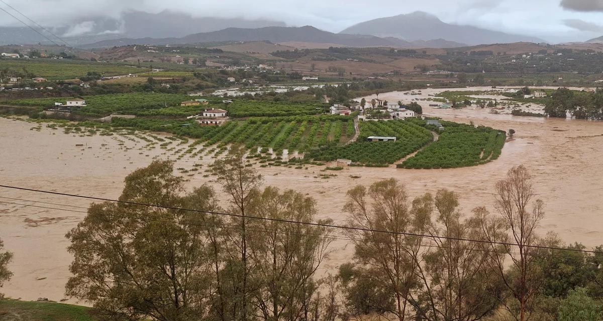
Boosting Climate Resilience: Wetland4Change Project Advances Flood Management Solutions for Mediterranean Coastal Zones
The Mediterranean coastal zone´s combination of multiple severe climate hazards – rising temperatures, water scarcity, sea-level rise, and extreme weather events – makes it a hotspot for highly interconnected climate risks for the ecosystems and societies. Recent catastrophic floods in ...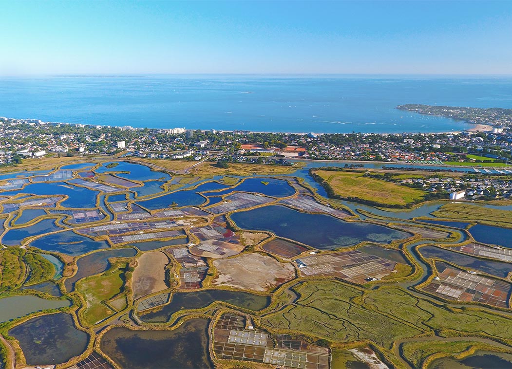
RESTORE4Cs 1st Policy Brief: How can coastal wetlands help achieve EU climate goals?
The first RESTORE4Cs Policy Brief of RESTORE4Cs, “How can coastal wetlands help achieve EU climate goals?“, highlights the importance of European coastal wetlands for reducing Greenhouse Gas emissions. The key messages of the first RESTORE4Cs Policy Brief include: Coastal wetlands are important natural carbon stores, ...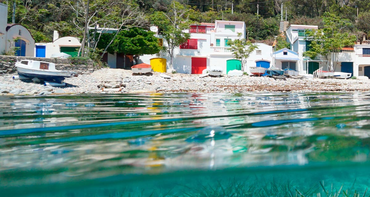
Mapping the Impact of Blue Tourism in the Mediterranean
The IUCN Centre for Mediterranean Cooperation with the support of ETC-UMA in the framework of the Blue Tourism Initiative, has released a comprehensive report entitled “Mapping the Impact of Blue Tourism in the Mediterranean: Vulnerability Assessment of Coastal and Marine ...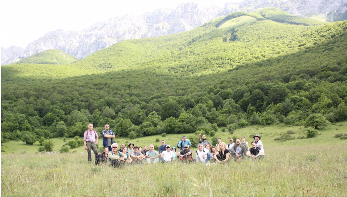
StrategyMedFor Presented at Annual Medforval Meeting 2024
StrategyMedFor was prominently featured at the Annual Medforval Meeting 2024, held from June 5-7 in Fontecchio, Italy. The event brought together 25 practitioners from national parks and natural reserves across 9 Mediterranean countries, providing a valuable platform for StrategyMedFor to ...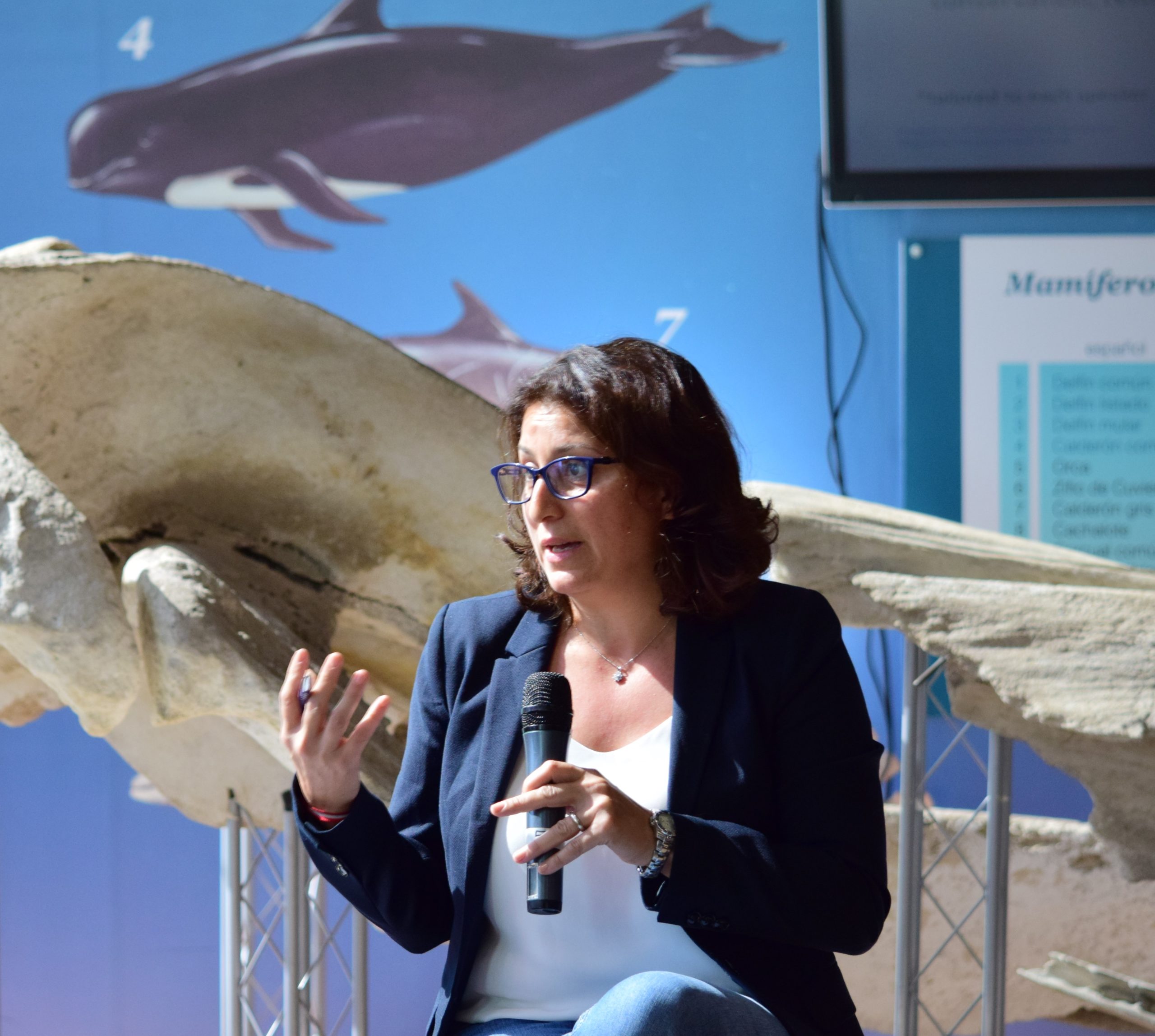
Celebrating leadership in environmental management: an interview with Dania Abdul Malak
From designing integrated ecosystem assessments in Europe and the Mediterranean to transforming outcomes into evidence-based recommendations for regional stakeholders, the European Topic Centre on Spatial Analysis and Synthesis (ETC-UMA) stands as a flagship for territorial cooperation. At the forefront of ...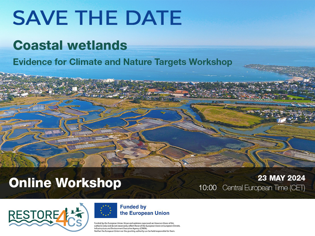
Save the date! Unlocking solutions for coastal conservation in Europe
How can coastal wetlands respond to major European Union objectives such as climate neutrality, biodiversity protection, and pollution reduction? What key role do coastal wetlands play in achieving EU commitments for climate mitigation and biodiversity conservation? The European Topic Centre ...
Towards a Strategy for the Sustainable Management of Mediterranean Forests (StrategyMedFor)
The StrategyMedFor project, co-financed by the Interreg Euro-MED programme, was launched at the University of Malaga during a two day meeting that took place on March 18 and 19, 2024. The European Topic Centre on Spatial Analysis and Synthesis (ETC-UMA), ...
Collaborative science for forests by ETC-UMA showcased in Slovenia during the COP23
As UNEP MAP partner organization, ETC-UMA recently engaged in the organization of a session with Mediterranean institutions under the topic of climate change, entitled: From COASTAL to FOREST ecosystems: Mediterranean Nature-based Solutions to tackle climate change and ensure the Resilience ...
Tools for conserving the Spanish coast
On the initiative of the Instituto Universitario Hábitat Territorio y Digitalización (iHTD) of the University of Malaga, around 70 representatives of Spanish public administrations, researchers, architecture and environmental science players and civil society signed up to the second debate on ...
GreenEye System: a cloud-based system to monitor wetlands in Andalusia
Developed in the frame of the LifeWatch INDALO project cofinanced by the European Regional Development Fund (ERDF) for the study of biodiversity and global change in Andalucia, GreenEye System, this new cloud-based monitoring system, provides useful tools for wetlands’ assessment, ...
Looking back and forth to Mediterranean Forests
Timely published to enrich the knowledge available to fight fires and climate change challenges after an extremely hot summer, the proceedings of the Seventh Mediterranean Forest Week “Forest and Ecosystem Restoration for the next Mediterranean Generations” held from 21 to ...
More space for innovative Mediterranean forest data partnerships
The report entitled A knowledge baseline on Mediterranean forests supported by innovation launched in July by ETC-UMA provides a highlight of what Mediterranean countries and institutions are doing to integrate new digital, satellite and Artificial Intelligence technologies into forest monitoring ...
The Earth from Space shown by ETC-UMA at FANTEC 2023
Students from 80 centers from all over Andalusia came together on Friday 19 May 2023 at the High School of Industrial Engineering of the University of Malaga to participate, one more year, in the Andalusian Technology Fair 2023. Antonio Sanchez ...
ETC-UMA launches new technologies applied to ecosystem knowledge
Built on the Google Earth Engine cloud computing platform, the new wetland monitoring system based on remote sensing data, developed by ETC-UMA and presented in April 2023 at the National Centre for Environmental Education (CENEAM by its acronym in Spanish) ...