European topic centre - university of malaga
Meet our team members

Antonio Sánchez
Environmental scientist, GIS and Remote Sensing specialist
Antonio Sánchez
Environmental scientist, GIS and Remote Sensing specialist
a_sanchez@uma.es
+34 951 952 905
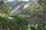
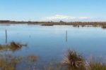
Antonio has developed his career focused on Geographic Information Systems and Remote Sensing tools, especially in the management and processing of data to calculate indicators and generate illustrative maps of environmental problems of all kind. His main area of work has been marine and wetlands related data, where he has produced the analysis of environmental pressures and sea-coast interactions in different sectors such as transport, fishing, tourism and energy among others, as well as the study of environmental data such as populations of marine species and protected areas. In the field of remote sensing, he has developed different products related to wetland ecosystems using Landsat and Sentinel images, such as land use/land cover maps, surface water dynamics, flood regulation and land use/land cover change indicators. He has also participated as a trainer in remote sensing for different wetland user organizations.
Antonio also works as freelance photographer, graphic and web designer for different companies and public institutions. The experience in this field is put into practice in the ETC-UMA, giving greater versatility to the team when it comes to producing dissemination material for both experts and the general public, as well as in the development and maintenance of web pages.
Related projects

Wetland4Change

RESTORE4Cs


PANACEA – MBPC
OECM CASE STUDIES

WWF Mediterranean MPA assessment
WWF EU MPA assessment
RESOURCES
Journal Articles
Sánchez-Espinosa, A.; Schröder, C.
Land use and land cover mapping in wetlands one step closer to the ground: Sentinel-2 versus Landsat 8 Journal Article
In: Journal of Environmental Management, vol. 247, pp. 484-498, 2019.
Abstract | Links | BibTeX | Tags: Geotechnology, Land and soil, SWOS, Wetlands
@article{Sánchez-Espinosa2019b,

title = {Land use and land cover mapping in wetlands one step closer to the ground: Sentinel-2 versus Landsat 8},

author = {A. Sánchez-Espinosa and C. Schröder},

url = {https://www.sciencedirect.com/science/article/pii/S0301479719308850},

doi = {10.1016/j.jenvman.2019.06.084},

year  = {2019},

date = {2019-10-01},

journal = {Journal of Environmental Management},

volume = {247},

pages = {484-498},

abstract = {Environmental studies with Landsat images have revealed many of the problems faced by wetland ecosystem, which are crucial for the conservation of biodiversity and the natural values of our planet. The study of LULC changes in wetlands through remote sensing constantly helps to identify and combat their main environmental threats improving the conservation of these natural habitats. Starting in mid-2015, the Sentinel-2 satellite opens new possibilities in the field of earth observation thanks to its higher spatial, spectral and temporal resolution becoming a powerful source of information for LULC monitoring in wetland areas. However, researchers may ask them selves to what extent Sentinel-2 is an improvement over Landsat 8 for general purposes. This research test if there is a real difference in the quality of the results delivered by both Sentinel-2 and Landsat 8 imagery when basic classification methods are applied.


The study uses Sentinel-2 and Landsat 8 imagery to produce LULC maps in a Mediterranean wetland area applying an object based classification method in order to compare the accuracy and reliability in the surface detected by both satellites. The results show that an object based classification using only the Sentinel-2 and Landsat 8 image information, without band indexes or ancillary data, offers very similar results for most LULC classes, being the overall accuracy around 87–88% with slightly better results when using Sentinel-2. Although using Sentinel-2 leads to an increase in file size and processing times, the analysis of certain LULC classes presents an improvement compared to Landsat 8, detecting more linear and small size elements with a better delineation of image features in the classified map. However, these improvements should not underestimate the value of Landsat imagery in the future since both satellites provide high precision information, so they can and should coexist and be used together to increase data availability in order to have the best possible results in remote sensing research.},

keywords = {Geotechnology, Land and soil, SWOS, Wetlands},

pubstate = {published},

tppubtype = {article}

}
The study uses Sentinel-2 and Landsat 8 imagery to produce LULC maps in a Mediterranean wetland area applying an object based classification method in order to compare the accuracy and reliability in the surface detected by both satellites. The results show that an object based classification using only the Sentinel-2 and Landsat 8 image information, without band indexes or ancillary data, offers very similar results for most LULC classes, being the overall accuracy around 87–88% with slightly better results when using Sentinel-2. Although using Sentinel-2 leads to an increase in file size and processing times, the analysis of certain LULC classes presents an improvement compared to Landsat 8, detecting more linear and small size elements with a better delineation of image features in the classified map. However, these improvements should not underestimate the value of Landsat imagery in the future since both satellites provide high precision information, so they can and should coexist and be used together to increase data availability in order to have the best possible results in remote sensing research.
Weise, K.; Höfer, R.; Franke, J.; Guelmami, A.; Simonson, W.; Muro, J.; O'Connor, B.; Strauch, A.; Flink, S.; Eberle, J.; Mino, E.; Thulin, S.; Philipson, P.; van Valkengoed, E.; Truckenbrodt, J.; Zander, F.; Sánchez-Espinosa, A.; Schröder, C.; Thinfeld, F.; Fitoka, E.; Scott, E.; Ling, M.; Schwarz, M.; Kunz, I.; Thürmer, G.; Plasmeijer, A.; Hilarides, L.
Wetland extent tools for SDG 6.6.1 reporting from the Satellite-based Wetland Observation Service (SWOS) Journal Article
In: Remote Sensing of Environment, vol. 247, 2019.
Abstract | Links | BibTeX | Tags: Climate Change, Conservation and management, Environmental conservation, SWOS, Wetlands
@article{Weise2019,

title = {Wetland extent tools for SDG 6.6.1 reporting from the Satellite-based Wetland Observation Service (SWOS)},

author = {K. Weise and R. Höfer and J. Franke and A. Guelmami and W. Simonson and J. Muro and B. O'Connor and A. Strauch and S. Flink and J. Eberle and E. Mino and S. Thulin and P. Philipson and E. van Valkengoed and J. Truckenbrodt and F. Zander and A. Sánchez-Espinosa and C. Schröder and F. Thinfeld and E. Fitoka and E. Scott and M. Ling and M. Schwarz and I. Kunz and G. Thürmer and A. Plasmeijer and L. Hilarides},

url = {https://doi.org/10.1016/j.rse.2020.111892},

doi = {https://doi.org/10.1016/j.rse.2020.111892},

year  = {2019},

date = {2019-09-15},

journal = {Remote Sensing of Environment},

volume = {247},

abstract = {Wetlands are the most fragile and threatened ecosystems worldwide, and also one of the most rapidly declining. At the same time wetlands are typically biodiversity hotspots and provide a range of valuable ecosystem services, such as water supply and purification, disaster risk reduction, climate change adaptation, and carbon sequestration.


Pressures on wetlands are likely to further intensify in the coming decades due to increased global demand for land and water, and due to climate change. Stakeholders at all levels of governance have to be involved to slow, stop and reverse these processes. However, the information they need on wetland extent, their ecological character, and their ecosystem services is often scattered, sparse and difficult to find and access.


The freely available Sentinel satellite data of the Copernicus Programme, as well as the Landsat archive, provide a comprehensive basis to map and inventory wetland areas (extent), to derive information on the ecological status, as well as long- and short-term trends in wetland characteristics. However, making use of these Earth Observation (EO) resources for robust and standardized wetland monitoring requires expert knowledge on often complex data processing techniques, which impedes practical implementation. In this respect, the Satellite-based Wetland Observation Service (SWOS), a Horizon 2020 funded project (www.swos-service.eu) has developed and made disseminated monitoring approaches based on EO data, specifically designed for less experienced satellite data users.


The SWOS monitoring tools aim at assisting countries in conducting national wetland inventories for their Sustainable Development Goals (SDG) reporting and monitoring obligations, and additionally facilitates other monitoring obligations such as those required by the Ramsar Convention and supports decision-making in local conservation activities. The four main components of the SWOS approach are: map and indicator production; software development; capacity building; and initializing the GEO Wetlands Community Portal. Wetland managers and data analysists from more than fifty wetland sites and river basins across Europe, the Middle East, and Africa investigated the benefits and limitations of this EO-based wetland mapping and monitoring approach.


We describe research that applies the SWOS tools to test their potential for the mapping of wetlands in a case study based in Albania, and show its effectiveness to derive metrics relevant to the monitoring of SDG indicator 6.6.1.},

keywords = {Climate Change, Conservation and management, Environmental conservation, SWOS, Wetlands},

pubstate = {published},

tppubtype = {article}

}
Pressures on wetlands are likely to further intensify in the coming decades due to increased global demand for land and water, and due to climate change. Stakeholders at all levels of governance have to be involved to slow, stop and reverse these processes. However, the information they need on wetland extent, their ecological character, and their ecosystem services is often scattered, sparse and difficult to find and access.
The freely available Sentinel satellite data of the Copernicus Programme, as well as the Landsat archive, provide a comprehensive basis to map and inventory wetland areas (extent), to derive information on the ecological status, as well as long- and short-term trends in wetland characteristics. However, making use of these Earth Observation (EO) resources for robust and standardized wetland monitoring requires expert knowledge on often complex data processing techniques, which impedes practical implementation. In this respect, the Satellite-based Wetland Observation Service (SWOS), a Horizon 2020 funded project (www.swos-service.eu) has developed and made disseminated monitoring approaches based on EO data, specifically designed for less experienced satellite data users.
The SWOS monitoring tools aim at assisting countries in conducting national wetland inventories for their Sustainable Development Goals (SDG) reporting and monitoring obligations, and additionally facilitates other monitoring obligations such as those required by the Ramsar Convention and supports decision-making in local conservation activities. The four main components of the SWOS approach are: map and indicator production; software development; capacity building; and initializing the GEO Wetlands Community Portal. Wetland managers and data analysists from more than fifty wetland sites and river basins across Europe, the Middle East, and Africa investigated the benefits and limitations of this EO-based wetland mapping and monitoring approach.
We describe research that applies the SWOS tools to test their potential for the mapping of wetlands in a case study based in Albania, and show its effectiveness to derive metrics relevant to the monitoring of SDG indicator 6.6.1.
Sánchez-Espinosa, A.; Abdul-Malak, D.; Guelmami, A.; Perennou, C.
Development of an Indicator to Monitor Mediterranean Wetlands Journal Article
In: Plos One, vol. 10, no. 3, 2015.
Abstract | Links | BibTeX | Tags: Geotechnology, Wetlands
@article{Sánchez-Espinosa2015,

title = {Development of an Indicator to Monitor Mediterranean Wetlands},

author = {A. Sánchez-Espinosa and D. Abdul-Malak and A. Guelmami and C. Perennou},

url = {http://journals.plos.org/plosone/article?id=10.1371/journal.pone.0122694},

doi = {https://doi.org/10.1371/journal.pone.0122694},

year  = {2015},

date = {2015-03-31},

journal = {Plos One},

volume = {10},

number = {3},

abstract = {Wetlands are sensitive ecosystems that are increasingly subjected to threats from anthropogenic factors. In the last decades, coastal Mediterranean wetlands have been suffering considerable pressures from land use change, intensification of urban growth, increasing tourism infrastructure and intensification of agricultural practices. Remote sensing (RS) and Geographic Information Systems (GIS) techniques are efficient tools that can support monitoring Mediterranean coastal wetlands on large scales and over long periods of time. The study aims at developing a wetland indicator to support monitoring Mediterranean coastal wetlands using these techniques. The indicator makes use of multi-temporal Landsat images, land use reference layers, a 50m numerical model of the territory (NMT) and Corine Land Cover (CLC) for the identification and mapping of wetlands. The approach combines supervised image classification techniques making use of vegetation indices and decision tree analysis to identify the surface covered by wetlands at a given date. A validation process is put in place to compare outcomes with existing local wetland inventories to check the results reliability. The indicator´s results demonstrate an improvement in the level of precision of change detection methods achieved by traditional tools providing reliability up to 95% in main wetland areas. The results confirm that the use of RS techniques improves the precision of wetland detection compared to the use of CLC for wetland monitoring and stress the strong relation between the level of wetland detection and the nature of the wetland areas and the monitoring scale considered.},

keywords = {Geotechnology, Wetlands},

pubstate = {published},

tppubtype = {article}

}
Proceedings
Martorell-Guerrero, G.; Marín, A. I.; Sánchez-Espinosa, A.; Schröder, C.
Herramientas de apoyo a la gestión de los humedales de Andalucía basadas en Google Earth Engine. Proceedings
2023.
Abstract | Links | BibTeX | Tags: Climate Change, Conservation and management, Environmental conservation, Geotechnology, Groundwater, Pressures, Wetlands
@proceedings{nokey,

title = {Herramientas de apoyo a la gestión de los humedales de Andalucía basadas en Google Earth Engine.},

author = {G. Martorell-Guerrero and A. I. Marín and A. Sánchez-Espinosa and C. Schröder},

url = {https://riuma.uma.es/xmlui/bitstream/handle/10630/28052/Martorell_et_al_2023_SIAGA.pdf?sequence=1&isAllowed=y},

year  = {2023},

date = {2023-11-13},

urldate = {2023-11-13},

booktitle = {Simposio del Agua en Andalucía 2023},

abstract = {Los humedales son ecosistemas claves a nivel global para la provisión de servicios ecosistémicos tan importantes como la regulación climática o el mantenimiento de la biodiversidad. Sin embargo, en las últimas décadas la situación de degradación y desaparición de estos hábitats es alarmante a pesar de ser centro de múltiples políticas internacionales de protección que, a la luz de los resultados que están teniendo, no han tenido la efectividad esperada en su implementación real. Por tanto, es necesario tomar medidas urgentes dirigidas a revertir esta situación y que su implementación sea evaluada de forma objetiva, sistemática y recurrente. Este trabajo presenta una herramienta web llamada GreenEye Hub para el seguimiento de los humedales del Inventario de Humedales de Andalucía basada en imágenes de satélite del Sentinel-2, técnicas de teledetección y en tecnologías de procesamiento de datos masivos mediante Google Earth Engine. La herramienta, con un diseño orientado a la gestión de estos ecosistemas, presenta una consola de visualización que permite realizar el seguimiento de los principales indicadores de agua y vegetación y el análisis de tendencias de estos. Es, por tanto, un sistema de apoyo a la gestión y a la toma de decisiones. Este estudio proporciona información de cómo es factible en la actualidad desarrollar un sistema de seguimiento de humedales a escala regional a partir de datos gratuitos accesibles y cómo esta herramienta constituye un proceso de transferencia del conocimiento desde la ciencia a la gestión.},

keywords = {Climate Change, Conservation and management, Environmental conservation, Geotechnology, Groundwater, Pressures, Wetlands},

pubstate = {published},

tppubtype = {proceedings}

}
Merkohasanaj, M.; Sánchez-Espinosa, A.; Abdul-Malak, D.; Schroder, C.; Truckenbrodt, J.; Marín, A. I.
Simposio del Agua en Andalucía (SIAGA), Huelva, 24 a 27 de octubre, 2018.
Abstract | Links | BibTeX | Tags: Ecosystem services, Geotechnology, Groundwater, SWOS, Wetlands
@proceedings{Merkohasanaj2018,

title = {Utility assessment in using optical and radar data to monitor surface water dynamic in wetland ecosystems, Fuente de Piedra, Spain (UMA)},

author = {M. Merkohasanaj and A. Sánchez-Espinosa and D. Abdul-Malak and C. Schroder and J. Truckenbrodt and A. I. Marín},

url = {/wp-content/uploads/Merkohasanajetal2018.pdf},

year  = {2018},

date = {2018-10-24},

publisher = {Simposio del Agua en Andalucía (SIAGA), Huelva, 24 a 27 de octubre},

series = {SIAGA 2018},

abstract = {To enable a better conservation in wetland ecosystems is important to monitor continuous changes and pressures on them. In this context, satellite remote sensing has become one of the most suitable tools since it ensures good availability, high frequency and large coverage of imagery that is analyzed and validated in a harmonized way.

This study covers the validation process of Surface Water Dynamic (SWD) products of Fuente de Piedra, south Spain, developed in the framework of SWOS Horizon 2020 project, and assesses its applicability to provide accurate open water surface estimations and take a step further in enhancing water dynamics monitoring in wetland ecosystems.

Firstly, two different SWD temporal frequency (TF) datasets were generated for Fuente de Piedra: one using optical satellite data (Landsat time series), covering the period between January 2007 and September 2015, and the other using Synthetic Aperture Radar (SAR) data (Sentinel 1 time series), from November 2014 to March 2017. The open surface water extent area (SWE) was extracted for both cases and then validated with corresponded TF in-situ environmental data as precipitation, temperature and piezometric level.

Findings underscore that piezometric level is the first environmental variable highly correlated with the SWE and the variable with the strongest predictive capacity for SWD. Both optical and radar data provide high positive correlation with SWD, R= 0.932 for Landsat and R=0.936 for SAR products. The main conclusion of the study underlines the high accuracy of using remote sensing data in monitoring hydrological dynamics in this wetland ecosystem and provides evidence to use this approach for wetland monitoring at different scales.},

keywords = {Ecosystem services, Geotechnology, Groundwater, SWOS, Wetlands},

pubstate = {published},

tppubtype = {proceedings}

}
This study covers the validation process of Surface Water Dynamic (SWD) products of Fuente de Piedra, south Spain, developed in the framework of SWOS Horizon 2020 project, and assesses its applicability to provide accurate open water surface estimations and take a step further in enhancing water dynamics monitoring in wetland ecosystems.
Firstly, two different SWD temporal frequency (TF) datasets were generated for Fuente de Piedra: one using optical satellite data (Landsat time series), covering the period between January 2007 and September 2015, and the other using Synthetic Aperture Radar (SAR) data (Sentinel 1 time series), from November 2014 to March 2017. The open surface water extent area (SWE) was extracted for both cases and then validated with corresponded TF in-situ environmental data as precipitation, temperature and piezometric level.
Findings underscore that piezometric level is the first environmental variable highly correlated with the SWE and the variable with the strongest predictive capacity for SWD. Both optical and radar data provide high positive correlation with SWD, R= 0.932 for Landsat and R=0.936 for SAR products. The main conclusion of the study underlines the high accuracy of using remote sensing data in monitoring hydrological dynamics in this wetland ecosystem and provides evidence to use this approach for wetland monitoring at different scales.
Technical Reports
Trombetti, M.; Abdul-Malak, D.; Sánchez-Espinosa, A.; Guelmami, A.; García, N.; Fitoka, E.
Mapping and assessment of the state of wetland ecosystems: A Mediterranean perspective Technical Report
2022.
Abstract | Links | BibTeX | Tags: Biodiversity, Climate Change, Conservation and management, Ecosystem services, Environmental conservation, Mediterranean sea, Protected areas, Wetlands
@techreport{Trombetti2022,

title = {Mapping and assessment of the state of wetland ecosystems: A Mediterranean perspective},

author = {M. Trombetti and D. Abdul-Malak and A. Sánchez-Espinosa and A. Guelmami and N. García and E. Fitoka},

editor = {Interreg Mediterranean Biodiversity Protection Community project},

url = {https://www.etc.uma.es/wp-content/uploads/Report_Mapping_and_assessment_of_the_state_of_wetland_ecosystems_2022.pdf},

year  = {2022},

date = {2022-06-01},

urldate = {2022-06-01},

abstract = {The Pan-Mediterranean wetland ecosystem map fills a major knowledge gap in the region by setting a Mediterranean-wide knowledge base on wetland ecosystems following the Ramsar definition of wetlands. The wetland ecosystem mapping is complemented by the assessment of wetland biodiversity conditions that aims to highlight priority areas for potential conservation and restoration actions in the region, and to support the regional efforts in advocating for effective wetland management and nature-based solutions in the Mediterranean region. The outputs of this activity include (i) a Pan-Mediterranean wetland ecosystem knowledge base, and (ii) an assessment of their condition that will be used to raise awareness and advocate for a change in wetland management that promotes effective protection, conservation and restoration. The outputs also support regional and national inventories, filling a major regional gap locating Mediterranean wetland habitats, and feed regional and global agendas, namely the EU Biodiversity Strategy to 2030, the Mediterranean Strategy for Sustainable development as well as the Ramsar Convention.},

keywords = {Biodiversity, Climate Change, Conservation and management, Ecosystem services, Environmental conservation, Mediterranean sea, Protected areas, Wetlands},

pubstate = {published},

tppubtype = {techreport}

}
Abdul-Malak, D.; Schröder, C.; Guitart, C.; Sánchez-Espinosa, A.; Fitoka, E.; Hatziiordanou, L.; Mino, E.; Flink, S.; Silver, E.; Strauch, A.; Ling, M.; Brown, C.; Simonson, W.; Scott, E.; Plasmeijer, A.; Thulin, S.; Philipson, P.; Weise, K.; Höfer, R.; Franke, J.; Guelmami, A.
Enhanced wetland monitoring, assessment and indicators to support European and global environmental policy Technical Report
2019.
Abstract | Links | BibTeX | Tags: Conservation and management, Ecosystem, Geotechnology, SWOS, Wetlands
@techreport{Abdul-Malak2019,

title = {Enhanced wetland monitoring, assessment and indicators to support European and global environmental policy},

author = {D. Abdul-Malak and C. Schröder and C. Guitart and A. Sánchez-Espinosa and E. Fitoka and L. Hatziiordanou and E. Mino and S. Flink and E. Silver and A. Strauch and M. Ling and C. Brown and W. Simonson and E. Scott and A. Plasmeijer and S. Thulin and P. Philipson and K. Weise and R. Höfer and J. Franke and A. Guelmami},

url = {https://www.etc.uma.es/wp-content/uploads/Enhanced_wetland_monitoring_assessment_indicators_support_European_global_environmental_policy.pdf},

year  = {2019},

date = {2019-12-31},

abstract = {The 2019 report on Enhanced wetland monitoring, assessment and indicators to support European environmental policyidentifies the links between the Horizon 2020 Satellite-based Wetland Observation Service (SWOS) project outcomes (tools, methodologies and indicators) and existing policy frameworks at European and global levels. It aims to contribute to the refinement of EU Strategies and Directives to better integrate wetland ecosystems, contribute towards a European environmental model for wetland management and maintenance of their ecosystem services, and guide action towards achieving no-net-loss and restoration targets and objectives for wetland ecosystems. The report summarises (in four chapters) how SWOS can ensure a better understanding of wetland ecosystems, and thereby help to trigger further policy developments by improving key elements for wetland management.},

keywords = {Conservation and management, Ecosystem, Geotechnology, SWOS, Wetlands},

pubstate = {published},

tppubtype = {techreport}

}
Presentations
Sánchez-Espinosa, A.; Abdul-Malak, D.; Marín, A. I.
Mapping flood regulation capacity of coastal wetland ecosystems in the Mediterranean: Guadalhorce river mouth (Spain) Presentation
01.04.2016.
Links | BibTeX | Tags: Ecosystem services, Geotechnology, SWOS, Wetlands
@misc{Sánchez-Espinosa2016,

title = {Mapping flood regulation capacity of coastal wetland ecosystems in the Mediterranean: Guadalhorce river mouth (Spain)},

author = {A. Sánchez-Espinosa and D. Abdul-Malak and A. I. Marín},

url = {/wp-content/uploads/publications/SWOS_Flood_EcoSummit2016.pdf},

year  = {2016},

date = {2016-04-01},

keywords = {Ecosystem services, Geotechnology, SWOS, Wetlands},

pubstate = {published},

tppubtype = {presentation}

}
Sánchez-Espinosa, A.; Abdul-Malak, D.; Schröder, C.; Martínez-Murillo, J. F.
01.01.2016.
Links | BibTeX | Tags: Ecosystem, Geotechnology, Land and soil, SWOS, Wetlands
@misc{Sánchez-Espinosa2016b,

title = {Determination of wetland ecosystem boundaries and validation of habitat classifications using remote sensing: Fuente de Piedra (Spain).},

author = {A. Sánchez-Espinosa and D. Abdul-Malak and C. Schröder and J. F. Martínez-Murillo},

url = {/wp-content/uploads/publications/SWOS_EGU2016.pdf},

year  = {2016},

date = {2016-01-01},

keywords = {Ecosystem, Geotechnology, Land and soil, SWOS, Wetlands},

pubstate = {published},

tppubtype = {presentation}

}
Sánchez-Espinosa, A.; Abdul-Malak, D.; Guelmami, A.; Perennou, C.; Martínez-Murillo, J. F.
01.10.2015.
Links | BibTeX | Tags: Geotechnology, Groundwater, SWOS, Wetlands
@misc{Sánchez-Espinosa2015b,

title = {Desarrollo de un indicador para el seguimiento de los niveles de inundación en humedales Mediterráneos. XVI Congreso de la Asociación Española de Teledetección (AET)},

author = {A. Sánchez-Espinosa and D. Abdul-Malak and A. Guelmami and C. Perennou and J. F. Martínez-Murillo},

url = {/wp-content/uploads/publications/Poster_Flooding_indicator.pdf},

year  = {2015},

date = {2015-10-01},

keywords = {Geotechnology, Groundwater, SWOS, Wetlands},

pubstate = {published},

tppubtype = {presentation}

}
Sánchez-Espinosa, A.; Abdul-Malak, D.; Guelmami, A.; Perennou, C.
Development of an Indicator to Monitor Mediterranean Wetlands Presentation
01.01.2015.
Links | BibTeX | Tags: Geotechnology, Wetlands
@misc{Sánchez-Espinosa2015c,

title = {Development of an Indicator to Monitor Mediterranean Wetlands},

author = {A. Sánchez-Espinosa and D. Abdul-Malak and A. Guelmami and C. Perennou},

url = {/wp-content/uploads/publications/Poster_RHOMEO.pdf},

year  = {2015},

date = {2015-01-01},

keywords = {Geotechnology, Wetlands},

pubstate = {published},

tppubtype = {presentation}

}
ETC-UMA launches new technologies applied to ecosystem knowledge