European topic centre - university of malaga
Meet our team members

Ana Isabel Marín
Environmental Scientist and GIS specialist
aimarin@uma.es
+34 951 952 997
Ana (PhD) is an environmental researcher and GIS specialist at the European Topic Centre of University of Málaga. She holds a European-mention PhD in Environmental Science, an MSc in regional planning and a BSc in Environmental Sciences. Her academic career is focused on Environmental assessment and protection issues. She developed her PhD, under an European framework, on groundwater protection, more precisely on water supply protection areas in karst according to WFD within the team of Centre of hydrogeology of University of Malaga.
From March 2012, she is working in the ETC-UMA being involved in different EEA tasks related to the Pan-European ecosystem assessment to support the Biodiversity Strategy 2020, the development of a Land use thematic assessment methodology, task related with wetland / water (ECRINS, Copernicus HRLs, water accounts, … ), changes in Landscape, etc. Furthermore, she has been involved in other ETC-UMA projects such as Geoland2 or MS. MONINA.
At the same time, she is member of the Hydrogeology research team of UMA (RNM-308), participating in researches and papers related to the groundwater protection. Additionally, she shares her time with training lessons on water protection and GIS in Master on Water Resources and Environment (RHYMA), being another link between University of Málaga and ETC-UMA.
Related projects

RESOURCES
Journal Articles
Siegel, L.; Goldscheider, N.; Petitta, M.; Xanke, J.; Andreo, B.; Bakalowicz, M.; Barberá, J. A.; Bouhlila, R.; Burg, A.; Doummar, J.; Ezzine, I.; Fernández-Ortega, J.; Ghanmi, M.; Jourde, H.; Marín, A. I.; Mhimdi, A.; Pipan, T.; Ravbar, N.; Stevanović, A. M.; Stevanović, Z.
Distribution, threats and protection of selected karst groundwater-dependent ecosystems in the Mediterranean region Journal Article
In: Hydrogeology Journal , 2023.
Abstract | Links | BibTeX | Tags: Groundwater, Pressures
@article{Siegel2023,

title = {Distribution, threats and protection of selected karst groundwater-dependent ecosystems in the Mediterranean region},

author = {L. Siegel and N. Goldscheider and M. Petitta and J. Xanke and B. Andreo and M. Bakalowicz and J. A. Barberá and R. Bouhlila and A. Burg and J. Doummar and I. Ezzine and J. Fernández-Ortega and M. Ghanmi and H. Jourde and A. I. Marín and A. Mhimdi and T. Pipan and N. Ravbar and A. M. Stevanović and Z. Stevanović},

url = {https://link.springer.com/article/10.1007/s10040-023-02711-9},

doi = {https://doi.org/10.1007/s10040-023-02711-9},

year  = {2023},

date = {2023-09-22},

urldate = {2023-09-22},

journal = { Hydrogeology Journal },

abstract = {Karst groundwater-dependent ecosystems (KGDEs) in the Mediterranean region are important in terms of ecosystem services and biodiversity but are increasingly under anthropogenic pressures and climate-change constraints. For this study, the ecohydrological characteristics, threats, and protection status of 112 selected KGDEs around the Mediterranean Sea, including caves, springs, rivers and wetlands, were evaluated, based on local expert knowledge and scientific literature. Results demonstrate that KGDEs contribute considerably to regional biodiversity. The diversity of karst landscapes, combined with the groundwater emergence at springs, leads to exceptional habitat diversity, particularly in arid climates, where KGDEs serve as a refuge for species that could not thrive in the surrounding environment. The most common threats identified among the selected sites are direct human disturbances, such as mass tourism or overfishing, water-quality deterioration and water shortage from aquifer overdraft and/or climate change. Although most of the selected sites are under protection, conservation measures are frequently insufficient. Such shortcomings are often caused by poor data availability, little knowledge on conservation needs of invertebrate species, and conflicts of interest with the local population. For this purpose, it is necessary to raise environmental awareness and promote interdisciplinary research, in order to monitor water quality and quantity in addition to the status of the biocenoses.},

keywords = {Groundwater, Pressures},

pubstate = {published},

tppubtype = {article}

}
Kerzabi, R.; Mansour, H.; Yousfi, S.; Marín, A. I.; Andreo, B.; Bensefia, K. E.
Contribution of remote sensing and GIS to mapping groundwater vulnerability in arid zone: Case from Amour Mountains- Algerian Saharan Atlas Journal Article
In: Journal of African Earth Sciences, vol. 182, iss. October 2021, no. 104277, 2021.
Abstract | Links | BibTeX | Tags: Climate Change, Conservation and management, Geotechnology, Groundwater, Pressures
@article{Kerzabi2021,

title = {Contribution of remote sensing and GIS to mapping groundwater vulnerability in arid zone: Case from Amour Mountains- Algerian Saharan Atlas},

author = {R. Kerzabi and H. Mansour and S. Yousfi and A. I. Marín and B. Andreo and K. E. Bensefia},

url = {https://doi.org/10.1016/j.jafrearsci.2021.104277},

doi = {https://doi.org/10.1016/j.jafrearsci.2021.104277},

year  = {2021},

date = {2021-10-01},

journal = {Journal of African Earth Sciences},

volume = {182},

number = {104277},

issue = {October 2021},

abstract = {Protecting groundwater resource from pollution in arid zone is coming an important act for sensing development in this region calling for geomatics tools to characterize the geological and hydrogeological environment. The present work gives a new way to combine remote sensing and geographic information systems to elaborate vulnerability map of Deffa watershed (in Amour Mountains). This region is a good example of arid zones how know an important growth of agriculture, but there is under gap of geological, hydrogeological and soil knowledge. In the first time, we analyzed the Landsat 8-OLI image data with bands combination, ratios composition in RGB and filters to cartography the lithology's contours and lineament map. The false color composition of bands (765, 753, and 543) in RGB given the primary lithological delimitation. Supported by band rationing technique, we produced of 1/50000 geological map. The filter treatments given the lineament map superposed to the first one to realize geo-structural map. In addition, these images served to elaborate pedology map, using Decision Tree (Slope, Redness Index and Lithology parameters). Secondly, we established a GIS including the result map of RS treatment (lithology, lineament and soil maps) and additional spatial information (aquifer type and deep of groundwater surface and precipitations …). In GIS, the vulnerability index are calculated using GOD and PI methods. Both of maps displayed four classes of vulnerability: between Low and Extreme in the first map, and Very low to High vulnerability in the second one. In the some areas, we have controversial values of vulnerability; this leads us to validate these maps using pollution indicators (NO3−, NH4+ and SO42−). The validation displayed that the PI coincides better with special concentrations of pollutants.},

keywords = {Climate Change, Conservation and management, Geotechnology, Groundwater, Pressures},

pubstate = {published},

tppubtype = {article}

}
Marín, A. I.; Abdul-Malak, D.; Bastrup-Birk, A.; Chirici, G.; Barbati, A.; Kleeschulte, S.
Mapping forest condition in Europe: Methodological developments in support to forest biodiversity assessments Journal Article
In: Ecological Indicators, vol. 128, 2021.
Abstract | Links | BibTeX | Tags: Biodiversity, Conservation and management, Ecosystem, Environmental conservation, Forest
@article{Marín2021b,

title = {Mapping forest condition in Europe: Methodological developments in support to forest biodiversity assessments},

author = {A. I. Marín and D. Abdul-Malak and A. Bastrup-Birk and G. Chirici and A. Barbati and S. Kleeschulte},

url = {https://doi.org/10.1016/j.ecolind.2021.107839},

doi = {10.1016/j.ecolind.2021.107839},

year  = {2021},

date = {2021-05-29},

journal = {Ecological Indicators},

volume = {128},

abstract = {Forest condition, biodiversity, and ecosystem services are strongly interlinked. The biodiversity levels depend to a large extent on the integrity, health, and vitality of forests at the same time as losses of forest biodiversity lead to decreased forest productivity and sustainability. Under this conceptual framework, this study presents a methodology for mapping forest condition at European scale supporting the attainment of the 2020 Aichi Biodiversity Target 5 “the rate of loss of all natural habitats, including forests, is at least halved and where feasible brought close to zero, and degradation and fragmentation is significantly reduced” and the implementation of Sustainable Development Goals (SDG), as well as the EU forest strategy since the sustainable forest management is oriented to support the provision of forest services and to enhance the condition of biodiversity forests’ host.


The work presents the developments of an operational indicator at European scale. This spatially explicit information on forest condition can be the baseline map with a 1 km resolution to monitor the state and changes of condition by exposition to pressures and threats. This condition indicator considers structural, functional, and compositional aspects of forest with relevance for health and vitality of species and habitats hosted by forest ecosystems.


The methodology implemented used harmonized, published and open datasets. It provided confident results for the assessment of the condition within hemiboreal, temperate and alpine forests, showing the Carpathian, Dinaric Alps and Alps, among others, as hotspots with pre-dominantly good condition. The results were validated with data derived from the reporting for the EU Habitat Directive and explicit dataset on known primary forests in Europe. However, this method underestimated the forest condition in the Mediterranean and Boreal forest types due to data gaps, regional specific characteristics, and design limitations.


This study illustrates an operational and transferable approach for addressing the assessment of ecosystem forest condition at European scale being considered as a support tool for European countries when mapping and assessing their national territory, as potential common approach to map forest ecosystems that allows for consistent aggregation and comparisons across scales.},

keywords = {Biodiversity, Conservation and management, Ecosystem, Environmental conservation, Forest},

pubstate = {published},

tppubtype = {article}

}
The work presents the developments of an operational indicator at European scale. This spatially explicit information on forest condition can be the baseline map with a 1 km resolution to monitor the state and changes of condition by exposition to pressures and threats. This condition indicator considers structural, functional, and compositional aspects of forest with relevance for health and vitality of species and habitats hosted by forest ecosystems.
The methodology implemented used harmonized, published and open datasets. It provided confident results for the assessment of the condition within hemiboreal, temperate and alpine forests, showing the Carpathian, Dinaric Alps and Alps, among others, as hotspots with pre-dominantly good condition. The results were validated with data derived from the reporting for the EU Habitat Directive and explicit dataset on known primary forests in Europe. However, this method underestimated the forest condition in the Mediterranean and Boreal forest types due to data gaps, regional specific characteristics, and design limitations.
This study illustrates an operational and transferable approach for addressing the assessment of ecosystem forest condition at European scale being considered as a support tool for European countries when mapping and assessing their national territory, as potential common approach to map forest ecosystems that allows for consistent aggregation and comparisons across scales.
Marín, A. I.; Rodríguez, J. F. Martín; Barberá, J. A.; Fernández-Ortega, J.; Mudarra, M.; Sánchez, D.; Andreo, B.
In: Hydrogeology Journal, 2021.
Abstract | Links | BibTeX | Tags: Groundwater
@article{Marín2021,

title = {Groundwater vulnerability to pollution in karst aquifers, considering key challenges and considerations: application to the Ubrique springs in southern Spain},

author = {A. I. Marín and J. F. Martín Rodríguez and J. A. Barberá and J. Fernández-Ortega and M. Mudarra and D. Sánchez and B. Andreo},

url = {https://link.springer.com/article/10.1007/s10040-020-02279-8},

doi = {https://doi.org/10.1007/s10040-020-02279-8},

year  = {2021},

date = {2021-01-21},

journal = {Hydrogeology Journal},

abstract = {Groundwater vulnerability mapping is one of the tools most often applied to analyse the sensitivity of karst aquifers to pollution. These maps aim to support stakeholders in decision-making and to promote land-use management compatible with water protection; however, the validation of these maps is still a challenge in many cases, triggering high uncertainty. For karst media, due to the strong heterogeneity in recharge mechanisms and hydraulic characteristics, validation is a significant stage and it must be inherent within the groundwater vulnerability assessment process. This work aims to assess the implementation of tools used for protecting the quality of water discharging or extracted from the Ubrique karst system in southern Spain, which supplies drinking water that is threatened by periodical pollution/turbidity episodes. A groundwater vulnerability map, attained by application of the COP method and validated by multiple in-situ observations, shows an extremely vulnerable system due to the absence of protective overlayers and the significant development of exokarst landforms, including shallow holes. This map could constitute the basis for defining protection zones for the Ubrique springs; however, their comprehensive protection requires the implementation of monitoring tools and an effective management strategy, through an early warning system that assures stable environmental and hydrogeological conditions and improves operational procedures associated with the drinking water service. This research establishes the strong relationship of the different methods applied to protect the source from contamination events, ranging from classical hydrodynamic and hydrochemical approaches to the implementation of protection zones and early warning groundwater quality monitoring networks.},

keywords = {Groundwater},

pubstate = {published},

tppubtype = {article}

}
Andreo, B.; Barberá, J. A.; Mudarra, M.; Marín, A. I.; García-Orellana, J.; Rodellas, V.; Pérez, I.
In: Hydrogeology Journal, vol. 26, no. 1, pp. 41-56, 2018, ISSN: 1431-2174.
Abstract | Links | BibTeX | Tags: Conservation and management, Groundwater
@article{Andreo2018,

title = {A multi-method approach for groundwater resource assessment in coastal carbonate (karst) aquifers: the case study of Sierra Almijara (southern Spain)},

author = {B. Andreo and J. A. Barberá and M. Mudarra and A. I. Marín and J. García-Orellana and V. Rodellas and I. Pérez},

url = {https://link.springer.com/article/10.1007/s10040-017-1652-7},

doi = {10.1007/s10040-017-1652-7},

issn = {1431-2174},

year  = {2018},

date = {2018-02-01},

journal = {Hydrogeology Journal},

volume = {26},

number = {1},

pages = {41-56},

abstract = {Understanding the transference of water resources within hydrogeological systems, particularly in coastal aquifers, in which groundwater discharge may occur through multiple pathways (through springs, into rivers and streams, towards the sea, etc.), is crucial for sustainable groundwater use. This research aims to demonstrate the usefulness of the application of conventional recharge assessment methods coupled to isotopic techniques for accurately quantifying the hydrogeological balance and submarine groundwater discharge (SGD) from coastal carbonate aquifers. Sierra Almijara (Southern Spain), a carbonate aquifer formed of Triassic marbles, is considered as representative of Mediterranean coastal karst formations. The use of a multi-method approach has permitted the computation of a wide range of groundwater infiltration rates (17–60%) by means of direct application of hydrometeorological methods (Thornthwaite and Kessler) and spatially distributed information (modified APLIS method). A spatially weighted recharge rate of 42% results from the most coherent information on physiographic and hydrogeological characteristics of the studied system. Natural aquifer discharge and groundwater abstraction have been volumetrically quantified, based on flow and water-level data, while the relevance of SGD was estimated from the spatial analysis of salinity, 222Rn and the short-lived radium isotope 224Ra in coastal seawater. The total mean aquifer discharge (44.9–45.9 hm3 year−1) is in agreement with the average recharged groundwater (44.7 hm3 year−1), given that the system is volumetrically equilibrated during the study period. Besides the groundwater resources assessment, the methodological aspects of this research may be interesting for groundwater management and protection strategies in coastal areas, particularly karst environments.},

keywords = {Conservation and management, Groundwater},

pubstate = {published},

tppubtype = {article}

}
Marín, A. I.; Andreo, B.; Mudarra, M.
Vulnerability mapping and protection zoning of karst springs. Validation by multitracer tests Journal Article
In: Science of The Total Environment, vol. 532, pp. 435-446, 2015.
Abstract | Links | BibTeX | Tags: Conservation and management, Groundwater, Pressures
@article{Marín2015b,

title = {Vulnerability mapping and protection zoning of karst springs. Validation by multitracer tests},

author = {A. I. Marín and B. Andreo and M. Mudarra},

url = {https://www.sciencedirect.com/science/article/pii/S0048969715300875},

doi = {https://doi.org/10.1016/j.scitotenv.2015.05.029},

year  = {2015},

date = {2015-11-01},

journal = {Science of The Total Environment},

volume = {532},

pages = {435-446},

abstract = {Protection zoning of karst springs and wells used for water supply is a key aspect in many countries, calling for specific methodologies adapted to the particular characteristics of karst media. This work presents a new approach, in view of the present state of the art and based on experiences with contamination vulnerability mapping at the pilot site of the Villanueva del Rosario karst system (southern Spain). Source (intrinsic) vulnerability maps were prepared and compared using three European procedures for karst aquifers. The vulnerability maps were then tested using dye tracers. The COP + K method and Slovene Approach appear to provide reliable results in terms of intrinsic vulnerability mapping. Nevertheless, all the methods have a margin of error. The COP + K map is adopted as the baseline to delineate the protection zones, through the conversion from vulnerability classes to degrees of protection.},

keywords = {Conservation and management, Groundwater, Pressures},

pubstate = {published},

tppubtype = {article}

}
Marín, A. I.; Andreo, B.
In: Ustron, pp. 52, 2015, (Not available online).
Abstract | Links | BibTeX | Tags: Conservation and management, Groundwater, Pressures
@article{Marín2015c,

title = {Preliminary proposal of a guideline to delineate the protection zones of karts springs In Groundwater vulnerability -from scientific concept to practical application},

author = {A. I. Marín and B. Andreo},

url = {Not available online},

year  = {2015},

date = {2015-05-25},

journal = {Ustron},

pages = {52},

abstract = {Not available online},

note = {Not available online},

keywords = {Conservation and management, Groundwater, Pressures},

pubstate = {published},

tppubtype = {article}

}
Marín, A. I.; Andreo, B.
Vulnerability to Contamination of Karst Aquifers Journal Article
In: Karst Aquifers—Characterization and Engineering, pp. 251-266, 2015, ISBN: 978-3-319-12850-4.
Abstract | Links | BibTeX | Tags: Groundwater, Pressures
@article{Marín2015,

title = {Vulnerability to Contamination of Karst Aquifers},

author = {A. I. Marín and B. Andreo},

url = {https://link.springer.com/chapter/10.1007%2F978-3-319-12850-4_8},

doi = {https://doi.org/10.1007/978-3-319-12850-4_8},

isbn = {978-3-319-12850-4},

year  = {2015},

date = {2015-02-26},

journal = {Karst Aquifers—Characterization and Engineering},

pages = {251-266},

abstract = {The karst aquifers are especially vulnerable to pollution due to their hydrological behavior derived from karstification. The vulnerability mapping is one of the most applied tools to protect them. There is a wide range of methodologies for vulnerability mapping that have been developed for karst aquifer, to consider the specific characteristics of karst into the vulnerability assessment, such as EPIK, PI, COP, Slovene Approach and PaPRIKa, among others. The vulnerability map can help the water stakeholder for decision-making and to promote a land-use management compatible with the water protection. So the maps should have reliable accuracy. Many works highlight that the maps of groundwater contamination vulnerability obtained from different methods differ significantly, although they were all obtained by methods developed for karst aquifers or they are obtained from the same source of information and applied by the same person. So, the validation is an essential element of any contamination vulnerability assessment. The current challenge of researchers is to obtain versatile and easy methods to test and validate vulnerability maps.},

keywords = {Groundwater, Pressures},

pubstate = {published},

tppubtype = {article}

}
Proceedings
Martorell-Guerrero, G.; Marín, A. I.; Sánchez-Espinosa, A.; Schröder, C.
Herramientas de apoyo a la gestión de los humedales de Andalucía basadas en Google Earth Engine. Proceedings
2023.
Abstract | Links | BibTeX | Tags: Climate Change, Conservation and management, Environmental conservation, Geotechnology, Groundwater, Pressures, Wetlands
@proceedings{nokey,

title = {Herramientas de apoyo a la gestión de los humedales de Andalucía basadas en Google Earth Engine.},

author = {G. Martorell-Guerrero and A. I. Marín and A. Sánchez-Espinosa and C. Schröder},

url = {https://riuma.uma.es/xmlui/bitstream/handle/10630/28052/Martorell_et_al_2023_SIAGA.pdf?sequence=1&isAllowed=y},

year  = {2023},

date = {2023-11-13},

urldate = {2023-11-13},

booktitle = {Simposio del Agua en Andalucía 2023},

abstract = {Los humedales son ecosistemas claves a nivel global para la provisión de servicios ecosistémicos tan importantes como la regulación climática o el mantenimiento de la biodiversidad. Sin embargo, en las últimas décadas la situación de degradación y desaparición de estos hábitats es alarmante a pesar de ser centro de múltiples políticas internacionales de protección que, a la luz de los resultados que están teniendo, no han tenido la efectividad esperada en su implementación real. Por tanto, es necesario tomar medidas urgentes dirigidas a revertir esta situación y que su implementación sea evaluada de forma objetiva, sistemática y recurrente. Este trabajo presenta una herramienta web llamada GreenEye Hub para el seguimiento de los humedales del Inventario de Humedales de Andalucía basada en imágenes de satélite del Sentinel-2, técnicas de teledetección y en tecnologías de procesamiento de datos masivos mediante Google Earth Engine. La herramienta, con un diseño orientado a la gestión de estos ecosistemas, presenta una consola de visualización que permite realizar el seguimiento de los principales indicadores de agua y vegetación y el análisis de tendencias de estos. Es, por tanto, un sistema de apoyo a la gestión y a la toma de decisiones. Este estudio proporciona información de cómo es factible en la actualidad desarrollar un sistema de seguimiento de humedales a escala regional a partir de datos gratuitos accesibles y cómo esta herramienta constituye un proceso de transferencia del conocimiento desde la ciencia a la gestión.},

keywords = {Climate Change, Conservation and management, Environmental conservation, Geotechnology, Groundwater, Pressures, Wetlands},

pubstate = {published},

tppubtype = {proceedings}

}
de Souza, R. T.; Marín, A. I.; Sampaio, J. Dias; Andreo, B.
46th IAH Congress, Malaga, 22-27 September, 2019.
Abstract | Links | BibTeX | Tags: Groundwater
@proceedings{deSouza2019,

title = {Soil thickness approaching to adapt the COP method for groundwater vulnerability mapping to humid tropical karst},

author = {R. T. de Souza and A. I. Marín and J. Dias Sampaio and B. Andreo},

editor = {A. I. Marín},

url = {https://www.etc.uma.es/wp-content/uploads/souza_iah2019.pdf},

year  = {2019},

date = {2019-10-01},

publisher = {46th IAH Congress, Malaga, 22-27 September},

abstract = {In geosciences, the direct application of methodologies developed in temperate climates do not always apply to tropical environments. One example is the application of the COP methodology created to assess the intrinsic vulnerability to contamination of carbonate aquifers when applied directly in a tropical country, such as Brazil. This methodology considers to estimate the vulnerability the properties related to the C=Concentration flow, O=Overlaying layers and P=Precipitation. In the parameter O, where the layers of soil and rock of vadose zone are used to measure the protection given to the aquifer, there is a significant difference between European karst and Brazilian tropical humid karst. Among main differences, we can mention thickness, texture and soil mineralogy. Whereas in European karst the soil thickness rarely exceeds 1,0 m, with predominantly clay minerals 2:1 and clayey silt texture, in tropical Brazilian humid karst soil layers are frequently thicker than 1,0 m with predominantly 1:1 clay minerals and strongly homogeneously textured clay. To evaluate these differences, simulations were performed for a study area located approximately 50 km from the city of Belo Horizonte (southeast region of Brazil) where the soil thickness of original methodology (Os subfactor) was multiple by 10X, 20X, 30X and 40X. In this way, other factors that could influence the protection of the aquifer were eliminated. With this, the same parameters for calculations in original methodology (varying only thickness) were considered. The purpose of these simulations was to demonstrate the influence of large soil thicknesses found in Brazillian tropical humid karst in comparison to the soil thickness found in European karst. The results showed considerable differences from the original methodology. The area is characterized predominantly by soils of the class Oxisol and clayey alteration material that directly cover the Proterozoic limestones of the Bambuí Group, belonging to the Sete Lagoas Formation. Stratigraphically, over the limestones are the metapelites of the Serra de Santa Helena Formation and Tertiary and Quaternary sediments. The simulations for the original methodology showed that the protection given by the soil layer will always be high due to a clayey texture characteristic (>30% of clay) and thickness greater than 1,0 m, as shown in the calculation of the subfactor Os. In fact, accounting for different soil thicknesses as a factor of modification from the original methodology, the results showed that there is a gradation of the high protection class for the moderate protection class. These simulations showed the need for modification of the original methodology for application in tropical environments. The direct application of the original methodology to tropical areas can lead to errors of protection class, which directly impacts the vulnerability assessment of an aquifer.},

keywords = {Groundwater},

pubstate = {published},

tppubtype = {proceedings}

}
Merkohasanaj, M.; Sánchez-Espinosa, A.; Abdul-Malak, D.; Schroder, C.; Truckenbrodt, J.; Marín, A. I.
Simposio del Agua en Andalucía (SIAGA), Huelva, 24 a 27 de octubre, 2018.
Abstract | Links | BibTeX | Tags: Ecosystem services, Geotechnology, Groundwater, SWOS, Wetlands
@proceedings{Merkohasanaj2018,

title = {Utility assessment in using optical and radar data to monitor surface water dynamic in wetland ecosystems, Fuente de Piedra, Spain (UMA)},

author = {M. Merkohasanaj and A. Sánchez-Espinosa and D. Abdul-Malak and C. Schroder and J. Truckenbrodt and A. I. Marín},

url = {/wp-content/uploads/Merkohasanajetal2018.pdf},

year  = {2018},

date = {2018-10-24},

publisher = {Simposio del Agua en Andalucía (SIAGA), Huelva, 24 a 27 de octubre},

series = {SIAGA 2018},

abstract = {To enable a better conservation in wetland ecosystems is important to monitor continuous changes and pressures on them. In this context, satellite remote sensing has become one of the most suitable tools since it ensures good availability, high frequency and large coverage of imagery that is analyzed and validated in a harmonized way.

This study covers the validation process of Surface Water Dynamic (SWD) products of Fuente de Piedra, south Spain, developed in the framework of SWOS Horizon 2020 project, and assesses its applicability to provide accurate open water surface estimations and take a step further in enhancing water dynamics monitoring in wetland ecosystems.

Firstly, two different SWD temporal frequency (TF) datasets were generated for Fuente de Piedra: one using optical satellite data (Landsat time series), covering the period between January 2007 and September 2015, and the other using Synthetic Aperture Radar (SAR) data (Sentinel 1 time series), from November 2014 to March 2017. The open surface water extent area (SWE) was extracted for both cases and then validated with corresponded TF in-situ environmental data as precipitation, temperature and piezometric level.

Findings underscore that piezometric level is the first environmental variable highly correlated with the SWE and the variable with the strongest predictive capacity for SWD. Both optical and radar data provide high positive correlation with SWD, R= 0.932 for Landsat and R=0.936 for SAR products. The main conclusion of the study underlines the high accuracy of using remote sensing data in monitoring hydrological dynamics in this wetland ecosystem and provides evidence to use this approach for wetland monitoring at different scales.},

keywords = {Ecosystem services, Geotechnology, Groundwater, SWOS, Wetlands},

pubstate = {published},

tppubtype = {proceedings}

}
This study covers the validation process of Surface Water Dynamic (SWD) products of Fuente de Piedra, south Spain, developed in the framework of SWOS Horizon 2020 project, and assesses its applicability to provide accurate open water surface estimations and take a step further in enhancing water dynamics monitoring in wetland ecosystems.
Firstly, two different SWD temporal frequency (TF) datasets were generated for Fuente de Piedra: one using optical satellite data (Landsat time series), covering the period between January 2007 and September 2015, and the other using Synthetic Aperture Radar (SAR) data (Sentinel 1 time series), from November 2014 to March 2017. The open surface water extent area (SWE) was extracted for both cases and then validated with corresponded TF in-situ environmental data as precipitation, temperature and piezometric level.
Findings underscore that piezometric level is the first environmental variable highly correlated with the SWE and the variable with the strongest predictive capacity for SWD. Both optical and radar data provide high positive correlation with SWD, R= 0.932 for Landsat and R=0.936 for SAR products. The main conclusion of the study underlines the high accuracy of using remote sensing data in monitoring hydrological dynamics in this wetland ecosystem and provides evidence to use this approach for wetland monitoring at different scales.
Anaya, M.; Marín, A. I.; Mancosu, E.
Simposio del Agua en Andalucía (SIAGA), Huelva, 24 a 27 de octubre, 2018.
Links | BibTeX | Tags: Groundwater
@proceedings{Anaya2018b,

title = {Aproximación metodológica para la inclusión del estado de la agua subterráneas en el Sistema Integrado para la Contabilidad del capital Natural en Europa: aplicación al caso español},

author = {M. Anaya and A. I. Marín and E. Mancosu},

url = {https://www.etc.uma.es/wp-content/uploads/SIAGA_2018.pdf},

year  = {2018},

date = {2018-06-01},

publisher = {Simposio del Agua en Andalucía (SIAGA), Huelva, 24 a 27 de octubre},

keywords = {Groundwater},

pubstate = {published},

tppubtype = {proceedings}

}
Marín, A. I.; Abdul-Malak, D.
What is old growth forest? A definition structure Proceedings
Conference for protection of old growth forest in Europe, Brusse, 13 September, 2017, (Not available online).
Abstract | Links | BibTeX | Tags: Forest
@proceedings{Marín2017,

title = {What is old growth forest? A definition structure},

author = {A. I. Marín and D. Abdul-Malak},

url = {Not available online},

year  = {2017},

date = {2017-09-13},

publisher = {Conference for protection of old growth forest in Europe, Brusse, 13 September},

abstract = {Not available online},

note = {Not available online},

keywords = {Forest},

pubstate = {published},

tppubtype = {proceedings}

}
Ruíz-Martínez, R.; Marín, A. I.; Abdul-Malak, D.
Validación y propuesta para la mejora de la capa de alta resolución de humedales del proyecto Copérnico Proceedings
2016.
Links | BibTeX | Tags: Geotechnology, Wetlands
@proceedings{Ruíz-Martínez2016,

title = {Validación y propuesta para la mejora de la capa de alta resolución de humedales del proyecto Copérnico},

author = {R. Ruíz-Martínez and A. I. Marín and D. Abdul-Malak},

url = {https://www.etc.uma.es/wp-content/uploads/Congreso_TIG_2016.pdf},

year  = {2016},

date = {2016-07-01},

keywords = {Geotechnology, Wetlands},

pubstate = {published},

tppubtype = {proceedings}

}
Rizo-Decelis, L. D.; Marín, A. I.; Andreo, B.
Groundwater vulnerability mapping in Guadalajara aquifers system (Western Mexico) Proceedings
EGU General Assembly Conference, vol. 18, 2016.
Abstract | Links | BibTeX | Tags: Groundwater
@proceedings{Rizo-Decelis2016,

title = {Groundwater vulnerability mapping in Guadalajara aquifers system (Western Mexico)},

author = {L. D. Rizo-Decelis and A. I. Marín and B. Andreo},

url = {https://www.etc.uma.es/wp-content/uploads/EGU2016-16684-2.pdf},

year  = {2016},

date = {2016-01-01},

volume = {18},

publisher = {EGU General Assembly Conference},

abstract = {This work aims to propose an approach for groundwater protection cartography, based on the application and the comparison of results from different contamination vulnerability methods. These outcomes may assist water authorities to identify the higher vulnerable zones of the aquifers, in order to improving and adapting the land planning and management according to the protection of the own water resources.},

keywords = {Groundwater},

pubstate = {published},

tppubtype = {proceedings}

}
Marín, A. I.; Abdul-Malak, D.
An Indicator Of Forest Fire Intensity Applied To European Forest Ecosystems Proceedings
VI Reunión Internacional Fuegored, Malaga, 19-21 Noviembre, 2015.
Links | BibTeX | Tags: Ecosystem, Forest, Forest fire
@proceedings{Marín2015d,

title = {An Indicator Of Forest Fire Intensity Applied To European Forest Ecosystems},

author = {A. I. Marín and D. Abdul-Malak},

url = {https://www.etc.uma.es/wp-content/uploads/FUEGO_RED2015.pdf},

year  = {2015},

date = {2015-11-21},

publisher = {VI Reunión Internacional Fuegored, Malaga, 19-21 Noviembre},

keywords = {Ecosystem, Forest, Forest fire},

pubstate = {published},

tppubtype = {proceedings}

}
Technical Reports
Abdul-Malak, D.; Marín, A. I.; Trombetti, M.; San-Román, S.
Carbon pools and sequestration potential of wetlands in the European Union Technical Report
2021, ISBN: 978-3-200-07433-0.
Abstract | Links | BibTeX | Tags: Climate Change, Ecosystem services, Environmental conservation, Land and soil, Soil functions, Wetlands
@techreport{Abdul-Malak2021,

title = {Carbon pools and sequestration potential of wetlands in the European Union},

author = {D. Abdul-Malak and A. I. Marín and M. Trombetti and S. San-Román},

editor = {European Topic Centre on Urban, Land and Soil Systems},

url = {https://www.eionet.europa.eu/etcs/etc-uls/products/etc-uls-reports/etc-uls-report-10-2021-carbon-pools-and-sequestration-potential-of-wetlands-in-the-european-union},

isbn = {978-3-200-07433-0},

year  = {2021},

date = {2021-09-01},

urldate = {2021-09-01},

abstract = {Wetland ecosystems as defined by the Ramsar convention host a wide variety of wetland habitats across terrestrial, coastal and marine environments. When in good condition, wetland habitats provide many societal benefits and values, among others, they play a crucial role in the carbon cycle because of their capacities to limit the availability of oxygen to soil microbes and decomposition of organic matter. Policies and practices do not sufficiently consider these interconnections and interdependencies in Europe yet due to the fragmented consideration of this ecosystem in their schemes. The findings of this report argue that healthy European wetland habitats have an enormous capacity to contribute to carbon neutrality objectives in Europe. Across the wide array of European ecosystems they belong to, wetland habitats have a role in contributing to the carbon cycle. The most meaningful European wetland habitats to contribute to carbon storage include well-functioning salt marshes, healthy mires, bogs and fens as well as riparian, fluvial and swamp forests. Furthermore, when healthy, terrestrial wetlands namely mires, bogs and fens (where peatlands underly), followed by riparian, fluvial and swamp forests as well as inland marshes ensure a high carbon sequestration potential. If kept in a good condition or restored, the EU wetland related carbon stock capacity of their overall area in Europe (EU 27 and the UK) is estimated to be between 12 - 31 Gt CO2-eq, corresponding to an overall value ranging between 3 and 8 years of EU GHG emissions1. Whereas the Carbon sequestration potential of healthy EU Wetlands per year is calculated to range between 24 and 144 Mt CO2 eq yr-1 (24,352 and 14,3719 kt CO2 eq yr-1), being a quantity that contributes to “neutralising” between 1 and 4 % of the total GHG emissions registered in the EU27 and the UK (according to 2018 reference year for reported emission). These findings should trigger wetland conservation and restoration to become a high priority for the EU to support reaching climate neutrality by 2050. Climate reporting systems require Parties to report on anthropogenic emissions and removals of greenhouse gases which includes reporting heavily modified peatland habitats only partially and dominantly as a net carbon emitter. Using ecosystem-based approaches to managing reported peatland habitats and re-establishing their ecosystem functioning do transform many of them from climate ‘heaters’ (carbon net sources) into climate ‘coolers’ (carbon net sinks).},

keywords = {Climate Change, Ecosystem services, Environmental conservation, Land and soil, Soil functions, Wetlands},

pubstate = {published},

tppubtype = {techreport}

}
UNEP-MAP,; Plan-Bleu,; Abdul-Malak, D.; Marín, A. I.; Schröder, C.; Sánchez-Espinosa, A.
SoED 2020 : State of Environment and Development in Mediterranean Technical Report
2020.
Abstract | Links | BibTeX | Tags: Biodiversity, Climate Change, Conservation and management, Environmental conservation, Marine protected areas, Mediterranean sea, Pressures, Protected areas
@techreport{UNEP-MAP2020,

title = {SoED 2020 : State of Environment and Development in Mediterranean},

author = {UNEP-MAP and Plan-Bleu and D. Abdul-Malak and A. I. Marín and C. Schröder and A. Sánchez-Espinosa},

url = {https://planbleu.org/en/soed-2020-state-of-environment-and-development-in-mediterranean/},

year  = {2020},

date = {2020-12-01},

abstract = {The SoED provides a comprehensive and up-to-date assessment of environment and development interactions in the Mediterranean region. The 2020 version consists of eight thematic chapters and is complemented by two summary papers: Summary for Decision Makers and Key Messages. Topics covered include: socio-economic drivers and trends; climate change; biodiversity and ecosystem services; economic activities and related pressures; coastal dynamics and related impacts; food and water security; health and environment; and governance.},

keywords = {Biodiversity, Climate Change, Conservation and management, Environmental conservation, Marine protected areas, Mediterranean sea, Pressures, Protected areas},

pubstate = {published},

tppubtype = {techreport}

}
Maes, J.; Teller, A.; Erhard, M.; Condé, S.; Vallecillo, S.; Barredo, J. I.; Paracchini, M. L.; Abdul-Malak, D.; Trombetti, M.; Vigiak, O.; Zulian, G.; Addamo, A. M.; Grizzetti, B.; Somma, F.; Hagyo, A.; Vogt, P.; Polce, C.; Jones, A.; Marin, A. I.; Ivits, E.; Mauri, A.; Rega, C.; Czúcz, B.; Ceccherini, G.; Pisoni, E.; Ceglar, A.; de Palma, P.; Cerrani, I.; Meroni, M.; Caudullo, G.; Lugato, E.; Vogt, J. V.; Spinoni, J.; Cammalleri, C.; Bastrup-Birk, A.; Miguel, J. San; San-Román, S.; Kristensen, P.; Christiansen, T.; Zal, N.; de Roo, A.; Cardoso, A. C.; Pistocchi, A.; del Barrio Alvarellos, I.; Tsiamis, K.; Gervasini, E.; Deriu, I.; la Notte, A.; Viñas, R. Abad; Vizzarri, M.; Camia, A.; Robert, N.; Kakoulaki, G.; Bendito, E. Garcia; Panagos, P.; Ballabio, C.; Scarpa, S.; Montanarella, L.; Orgiazzi, A.; Ugalde, O. Fernandez; Santos-Martín, F.
Mapping and Assessment of Ecosystems and their Services: An EU ecosystem assessment Technical Report
Publications Office of the European Union 2020, ISBN: 978-92-76-17833-0.
Abstract | Links | BibTeX | Tags: Biodiversity, Conservation and management, Ecosystem, Ecosystem services, Forest, Wetlands
@techreport{Maes2020,

title = {Mapping and Assessment of Ecosystems and their Services: An EU ecosystem assessment},

author = {J. Maes and A. Teller and M. Erhard and S. Condé and S. Vallecillo and J.I. Barredo and M.L. Paracchini and D. Abdul-Malak and M. Trombetti and O. Vigiak and G. Zulian and A.M. Addamo and B. Grizzetti and F. Somma and A. Hagyo and P. Vogt and C. Polce and A. Jones and A. I. Marin and E. Ivits and A. Mauri and C. Rega and B. Czúcz and G. Ceccherini and E. Pisoni and A. Ceglar and P. de Palma and I. Cerrani and M. Meroni and G. Caudullo and E. Lugato and J.V. Vogt and J. Spinoni and C. Cammalleri and A. Bastrup-Birk and J. San Miguel and S. San-Román and P. Kristensen and T. Christiansen and N. Zal and A. de Roo and A.C. Cardoso and A. Pistocchi and I. del Barrio Alvarellos and K. Tsiamis and E. Gervasini and I. Deriu and A. la Notte and R. Abad Viñas and M. Vizzarri and A. Camia and N. Robert and G. Kakoulaki and E. Garcia Bendito and P. Panagos and C. Ballabio and S. Scarpa and L. Montanarella and A. Orgiazzi and O. Fernandez Ugalde and F. Santos-Martín},

url = {http://publications.jrc.ec.europa.eu/repository/handle/JRC120383},

doi = {10.2760/757183},

isbn = {978-92-76-17833-0},

year  = {2020},

date = {2020-10-01},

urldate = {2020-10-01},

institution = {Publications Office of the European Union},

abstract = {This report presents an ecosystem assessment covering the total land area of the EU as well as the EU marine regions. The assessment is carried out by Joint Research Centre, European Environment Agency, DG Environment, and the European Topic Centres on Biological Diversity and on Urban, Land and Soil Systems. This report constitutes a knowledge base which can support the evaluation of the 2020 biodiversity targets. It also provides a data foundation for future assessments and policy developments, in particular with respect to the ecosystem restoration agenda for the next decade (2020-2030). The report presents an analysis of the pressures and condition of terrestrial, freshwater and marine ecosystems using a single, comparable methodology based on European data on trends of pressures and condition relative to the policy baseline 2010. The following main conclusions are drawn: - Pressures on ecosystems exhibit different trends. - Land take, atmospheric emissions of air pollutants and critical loads of nitrogen are decreasing but the absolute values of all these pressures remain too high. - Impacts from climate change on ecosystems are increasing. - Invasive alien species of union concern are observed in all ecosystems, but their impact is particularly high in urban ecosystems and grasslands. - Pressures from overfishing activities and marine pollution are still high. - In the long term, air and freshwater quality is improving. - In forests and agroecosystems, which represent over 80% of the EU territory, there are improvements in structural condition indicators (biomass, deadwood, area under organic farming) relative to the baseline year 2010 but some key bio-indicators such as tree-crown defoliation continue to increase. This indicates that ecosystem condition is not improving. - Species-related indicators show no progress or further declines, particularly in agroecosystems. The analysis of trends in ecosystem services concluded that the current potential of ecosystems to deliver timber, protection against floods, crop pollination, and nature-based recreation is equal to or lower than the baseline value for 2010. At the same time, the demand for these services has significantly increased. A lowered potential in combination with a higher demand risks to further decrease the condition of ecosystems and their contribution to human well-being. Despite the wide coverage of environmental legislation in the EU, there are still large gaps in the legal protection of ecosystems. On land, 76% of the area of terrestrial ecosystems, mainly forests, agroecosystems and urban ecosystems, are excluded from a legal designation under the Bird and Habitat Directives. Freshwater and marine ecosystems are subject to specific protection measures under the Water Framework and Marine Strategy Framework Directives. The condition of ecosystems that are under legal designation is unfavourable. More efforts are needed to bend the curve of biodiversity loss and ecosystem degradation and to put ecosystems on a path to recovery. The progress that is made in certain areas such as pollution reduction, increasing air and water quality, increasing share of organic farming, the expansion of forests, and the efforts to maintain marine fish stocks at sustainable levels show that a persistent implementation of policies can be effective. These successes should encourage us to act now and to put forward an ambitious plan for the restoration of Europe’s ecosystems.},

keywords = {Biodiversity, Conservation and management, Ecosystem, Ecosystem services, Forest, Wetlands},

pubstate = {published},

tppubtype = {techreport}

}
Presentations
Sánchez-Espinosa, A.; Abdul-Malak, D.; Marín, A. I.
Mapping flood regulation capacity of coastal wetland ecosystems in the Mediterranean: Guadalhorce river mouth (Spain) Presentation
01.04.2016.
Links | BibTeX | Tags: Ecosystem services, Geotechnology, SWOS, Wetlands
@misc{Sánchez-Espinosa2016,

title = {Mapping flood regulation capacity of coastal wetland ecosystems in the Mediterranean: Guadalhorce river mouth (Spain)},

author = {A. Sánchez-Espinosa and D. Abdul-Malak and A. I. Marín},

url = {/wp-content/uploads/publications/SWOS_Flood_EcoSummit2016.pdf},

year  = {2016},

date = {2016-04-01},

keywords = {Ecosystem services, Geotechnology, SWOS, Wetlands},

pubstate = {published},

tppubtype = {presentation}

}
Masters Theses
Anaya, M.; Marín, A. I.
2018, (Not available online).
Abstract | Links | BibTeX | Tags: Groundwater
@mastersthesis{Anaya2018,

title = {Aproximación metodológica para la inclusión del estado de la agua subterráneas en el Sistema Integrado para la Contabilidad del capital Natural en Europa: aplicación al caso español},

author = {M. Anaya and A. I. Marín},

url = {Not available online},

year  = {2018},

date = {2018-06-01},

abstract = {Not available online},

note = {Not available online},

keywords = {Groundwater},

pubstate = {published},

tppubtype = {mastersthesis}

}
Ruíz-Martínez, R.; Abdul-Malak, D.; Marín, A. I.
Aportación Europea al Inventariado y Monitoreo de Humedales Masters Thesis
Málaga University, 2015.
Links | BibTeX | Tags: Conservation and management, Geotechnology, Wetlands
@mastersthesis{Ruíz-Martínez2015,

title = {Aportación Europea al Inventariado y Monitoreo de Humedales},

author = {R. Ruíz-Martínez and D. Abdul-Malak and A. I. Marín},

url = {/wp-content/uploads/publications/TFM_Rebeca_Ruiz.pdf},

year  = {2015},

date = {2015-12-01},

school = {Málaga University},

keywords = {Conservation and management, Geotechnology, Wetlands},

pubstate = {published},

tppubtype = {mastersthesis}

}
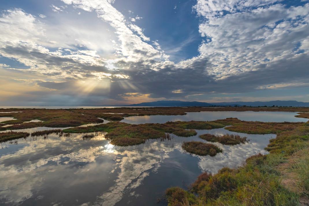
RESTORE4Cs 2nd Policy Brief: Unlocking Potential of Coastal Wetlands in Europe: Integration into National Restoration Plans
The second RESTORE4Cs Policy Brief of RESTORE4Cs, “Unlocking Potential of Coastal Wetlands in Europe: Integration into National Restoration Plans“, highlights the critical role of National Restoration Plans (NRPs) under the EU Nature Restoration Regulation in enhancing the restoration and resilience of coastal wetlands. The brief outlines how ...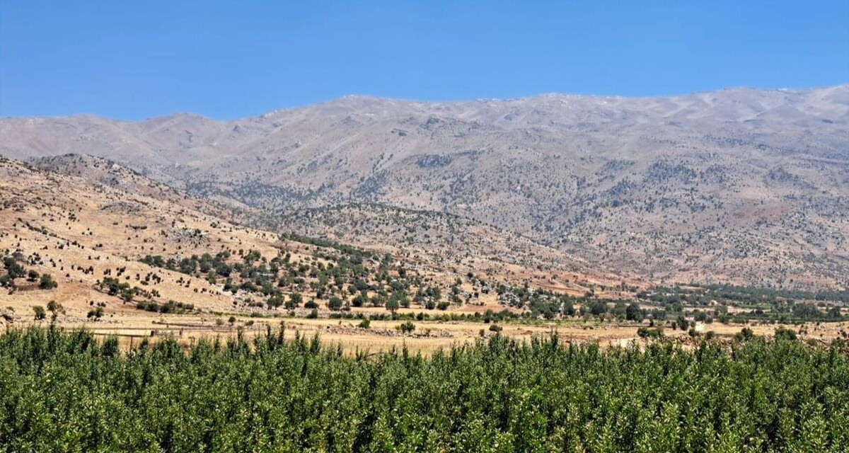
Back in Lebanon with BioConnect: Witnessing nature protection and socioecological resilience in action
As part of ETC-UMA’s role as the external evaluator for the EU-funded BioConnect project, the Centre’s Director, Dania Abdul Malak, carried out a site visit to Lebanon from July 8 to 12 to assess the project’s progress in its third ...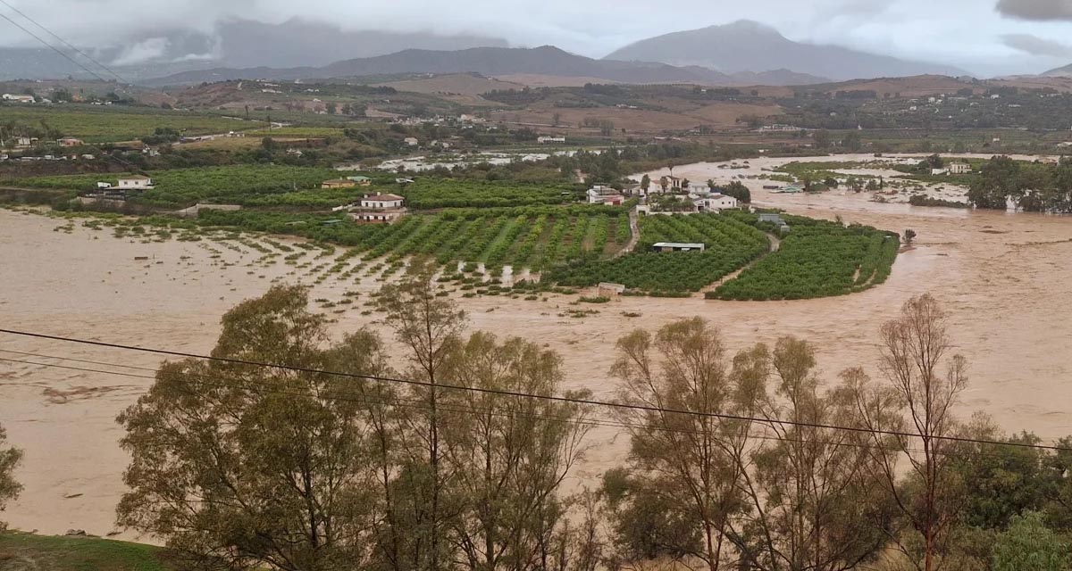
Boosting Climate Resilience: Wetland4Change Project Advances Flood Management Solutions for Mediterranean Coastal Zones
The Mediterranean coastal zone´s combination of multiple severe climate hazards – rising temperatures, water scarcity, sea-level rise, and extreme weather events – makes it a hotspot for highly interconnected climate risks for the ecosystems and societies. Recent catastrophic floods in ...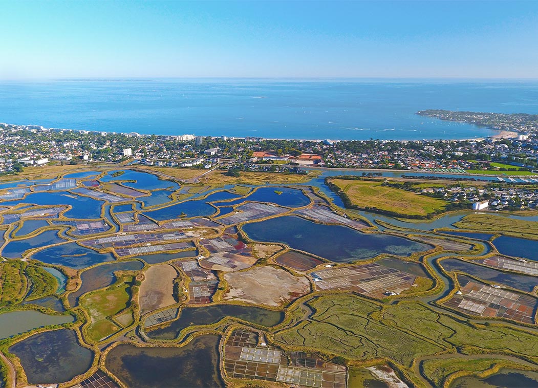
RESTORE4Cs 1st Policy Brief: How can coastal wetlands help achieve EU climate goals?
The first RESTORE4Cs Policy Brief of RESTORE4Cs, “How can coastal wetlands help achieve EU climate goals?“, highlights the importance of European coastal wetlands for reducing Greenhouse Gas emissions. The key messages of the first RESTORE4Cs Policy Brief include: Coastal wetlands are important natural carbon stores, ...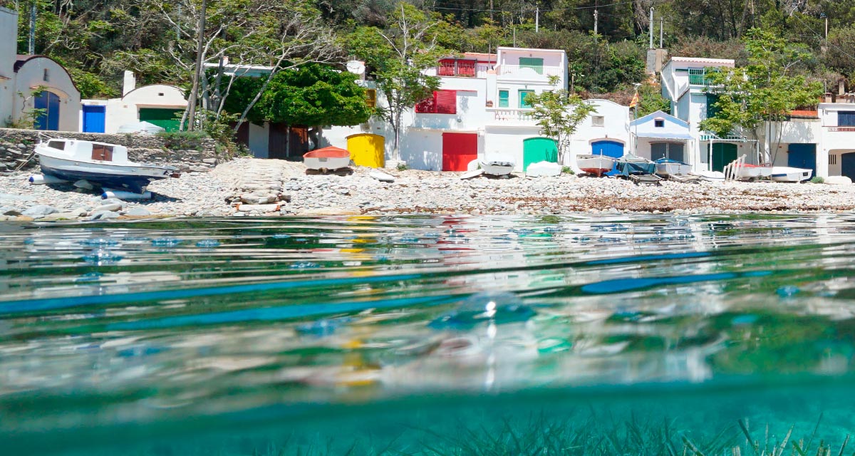
Mapping the Impact of Blue Tourism in the Mediterranean
The IUCN Centre for Mediterranean Cooperation with the support of ETC-UMA in the framework of the Blue Tourism Initiative, has released a comprehensive report entitled “Mapping the Impact of Blue Tourism in the Mediterranean: Vulnerability Assessment of Coastal and Marine ...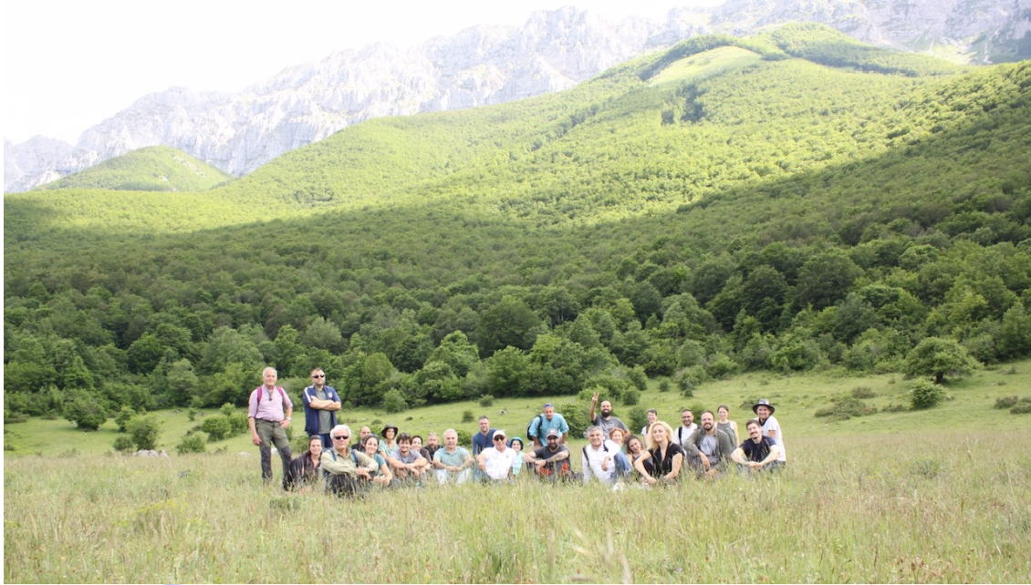
StrategyMedFor Presented at Annual Medforval Meeting 2024
StrategyMedFor was prominently featured at the Annual Medforval Meeting 2024, held from June 5-7 in Fontecchio, Italy. The event brought together 25 practitioners from national parks and natural reserves across 9 Mediterranean countries, providing a valuable platform for StrategyMedFor to ...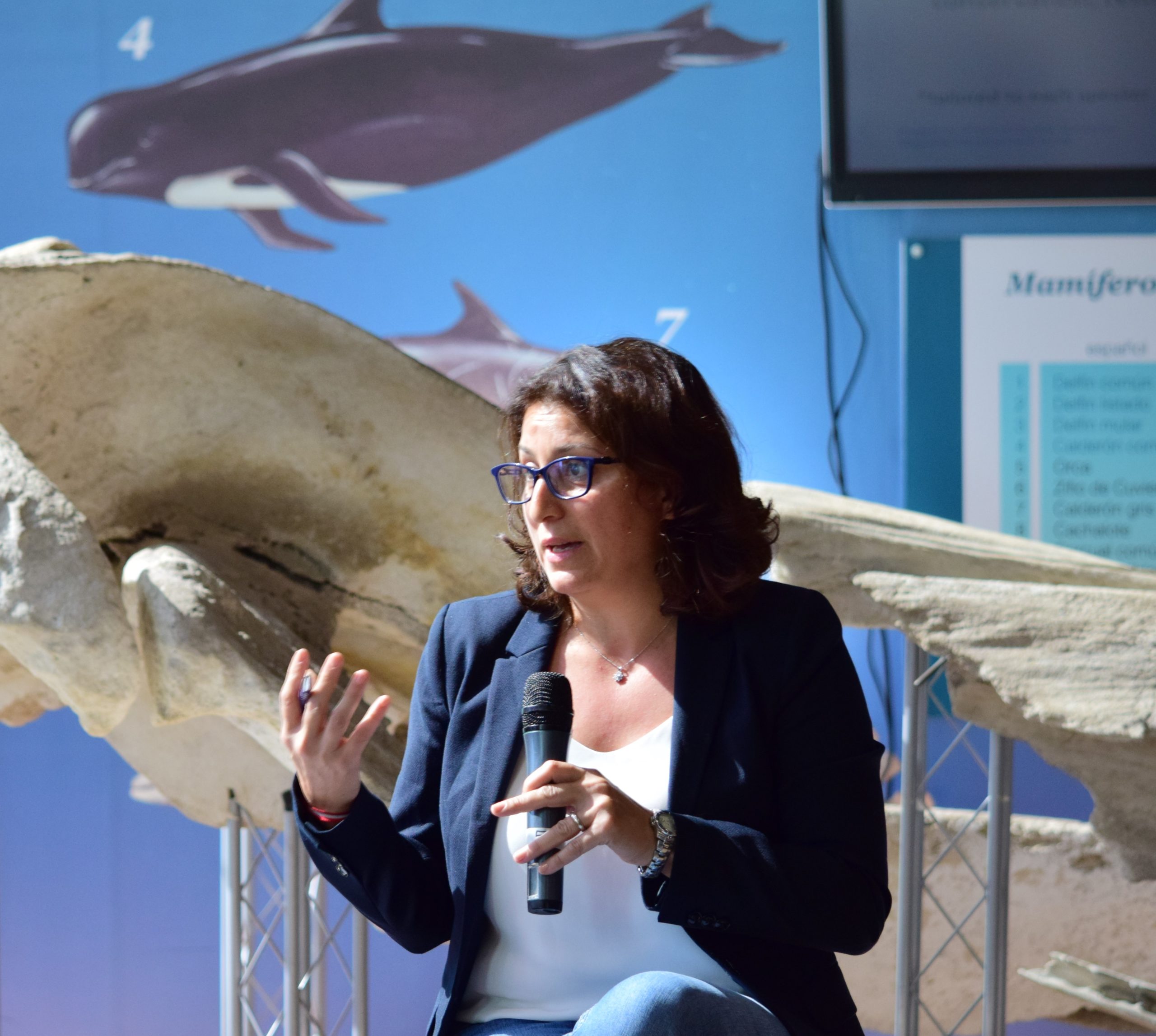
Celebrating leadership in environmental management: an interview with Dania Abdul Malak
From designing integrated ecosystem assessments in Europe and the Mediterranean to transforming outcomes into evidence-based recommendations for regional stakeholders, the European Topic Centre on Spatial Analysis and Synthesis (ETC-UMA) stands as a flagship for territorial cooperation. At the forefront of ...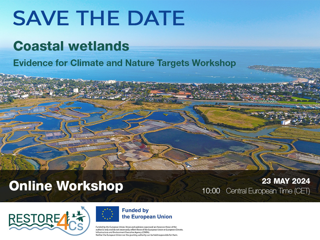
Save the date! Unlocking solutions for coastal conservation in Europe
How can coastal wetlands respond to major European Union objectives such as climate neutrality, biodiversity protection, and pollution reduction? What key role do coastal wetlands play in achieving EU commitments for climate mitigation and biodiversity conservation? The European Topic Centre ...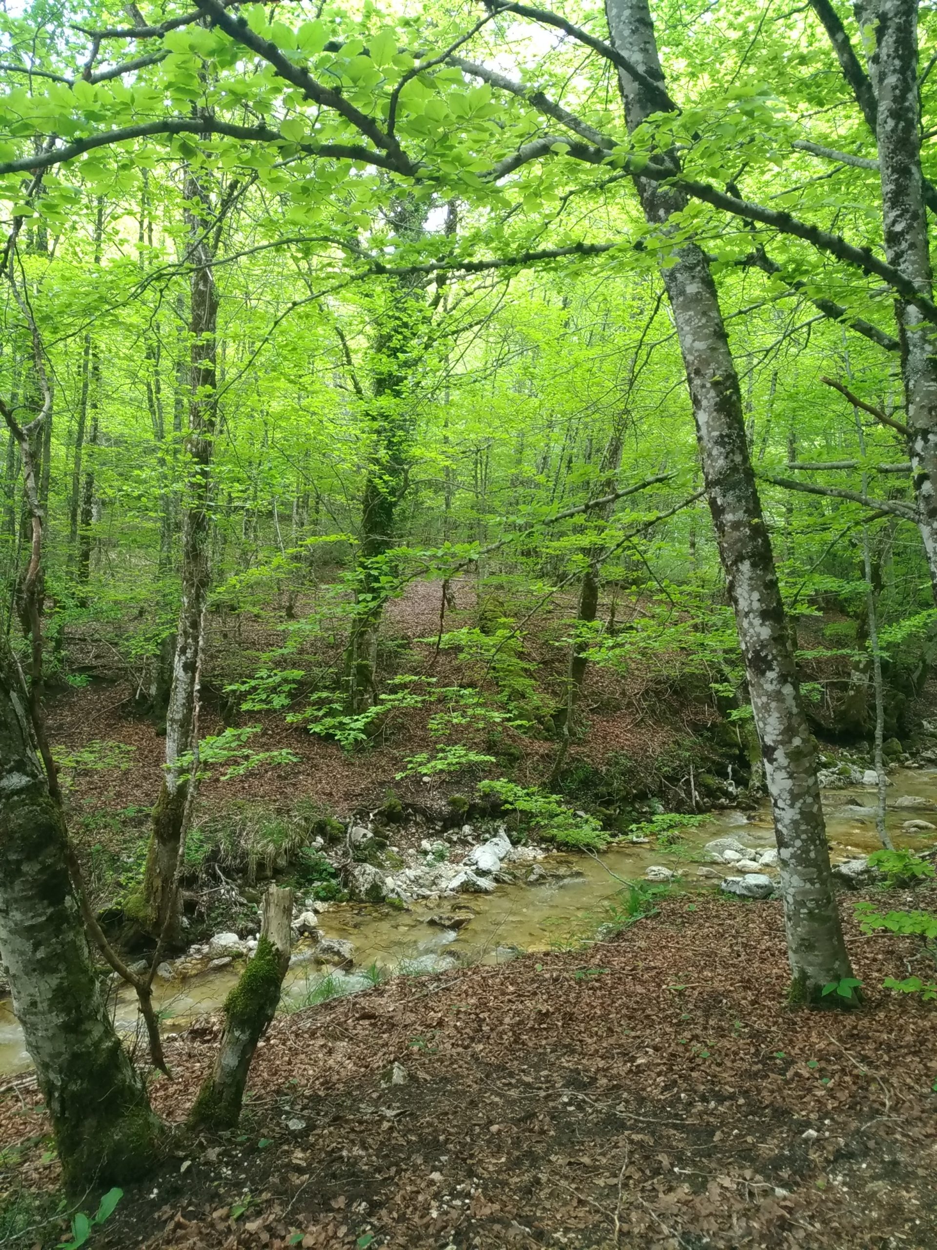
Towards a Strategy for the Sustainable Management of Mediterranean Forests (StrategyMedFor)
The StrategyMedFor project, co-financed by the Interreg Euro-MED programme, was launched at the University of Malaga during a two day meeting that took place on March 18 and 19, 2024. The European Topic Centre on Spatial Analysis and Synthesis (ETC-UMA), ...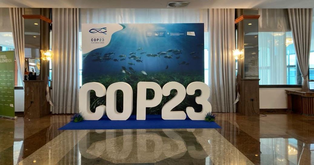
Collaborative science for forests by ETC-UMA showcased in Slovenia during the COP23
As UNEP MAP partner organization, ETC-UMA recently engaged in the organization of a session with Mediterranean institutions under the topic of climate change, entitled: From COASTAL to FOREST ecosystems: Mediterranean Nature-based Solutions to tackle climate change and ensure the Resilience ...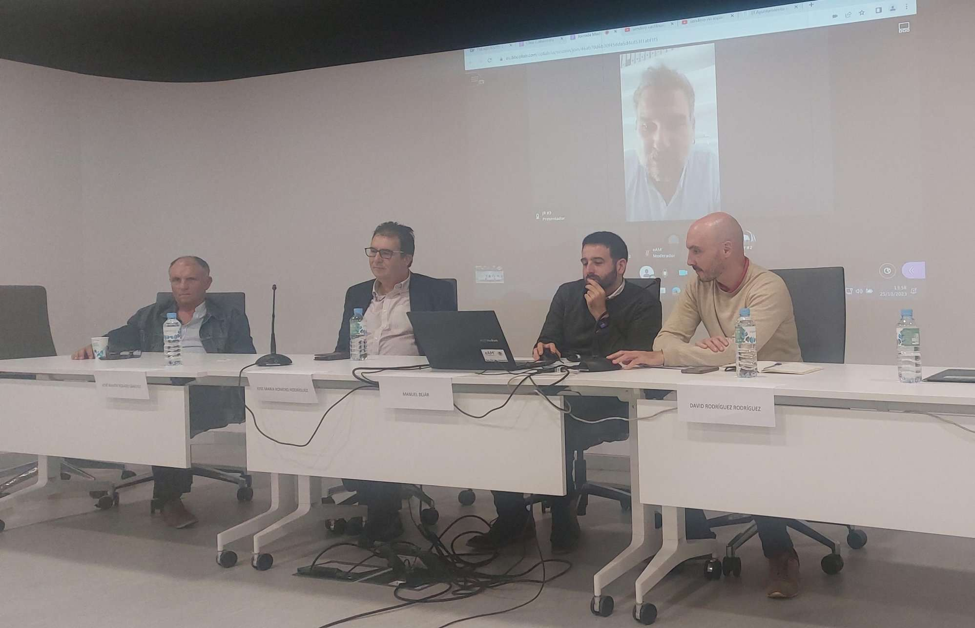
Tools for conserving the Spanish coast
On the initiative of the Instituto Universitario Hábitat Territorio y Digitalización (iHTD) of the University of Malaga, around 70 representatives of Spanish public administrations, researchers, architecture and environmental science players and civil society signed up to the second debate on ...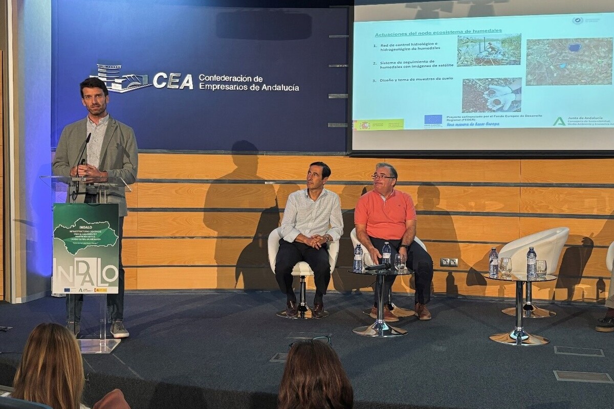
GreenEye System: a cloud-based system to monitor wetlands in Andalusia
Developed in the frame of the LifeWatch INDALO project cofinanced by the European Regional Development Fund (ERDF) for the study of biodiversity and global change in Andalucia, GreenEye System, this new cloud-based monitoring system, provides useful tools for wetlands’ assessment, ...
Looking back and forth to Mediterranean Forests
Timely published to enrich the knowledge available to fight fires and climate change challenges after an extremely hot summer, the proceedings of the Seventh Mediterranean Forest Week “Forest and Ecosystem Restoration for the next Mediterranean Generations” held from 21 to ...
More space for innovative Mediterranean forest data partnerships
The report entitled A knowledge baseline on Mediterranean forests supported by innovation launched in July by ETC-UMA provides a highlight of what Mediterranean countries and institutions are doing to integrate new digital, satellite and Artificial Intelligence technologies into forest monitoring ...