European topic centre - university of malaga
Meet our team members
Ana Isabel Marín
Environmental Scientist and GIS specialist
Ana Isabel Marín
Environmental Scientist and GIS specialist
aimarin@uma.es
+34 951 952 997
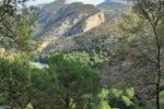
Ana (PhD) is an environmental researcher and GIS specialist at the European Topic Centre of University of Málaga. She holds a European-mention PhD in Environmental Science, an MSc in regional planning and a BSc in Environmental Sciences. Her academic career is focused on Environmental assessment and protection issues. She developed her PhD, under an European framework, on groundwater protection, more precisely on water supply protection areas in karst according to WFD within the team of Centre of hydrogeology of University of Malaga.
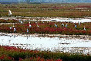
From March 2012, she is working in the ETC-UMA being involved in different EEA tasks related to the Pan-European ecosystem assessment to support the Biodiversity Strategy 2020, the development of a Land use thematic assessment methodology, task related with wetland / water (ECRINS, Copernicus HRLs, water accounts, … ), changes in Landscape, etc. Furthermore, she has been involved in other ETC-UMA projects such as Geoland2 or MS. MONINA.
At the same time, she is member of the Hydrogeology research team of UMA (RNM-308), participating in researches and papers related to the groundwater protection. Additionally, she shares her time with training lessons on water protection and GIS in Master on Water Resources and Environment (RHYMA), being another link between University of Málaga and ETC-UMA.
RESOURCES
Journal Articles
Siegel, L.; Goldscheider, N.; Petitta, M.; Xanke, J.; Andreo, B.; Bakalowicz, M.; Barberá, J. A.; Bouhlila, R.; Burg, A.; Doummar, J.; Ezzine, I.; Fernández-Ortega, J.; Ghanmi, M.; Jourde, H.; Marín, A. I.; Mhimdi, A.; Pipan, T.; Ravbar, N.; Stevanović, A. M.; Stevanović, Z.
Distribution, threats and protection of selected karst groundwater-dependent ecosystems in the Mediterranean region Journal Article
In: Hydrogeology Journal , 2023.
Abstract | Links | BibTeX | Tags: Groundwater, Pressures
@article{Siegel2023,
title = {Distribution, threats and protection of selected karst groundwater-dependent ecosystems in the Mediterranean region},
author = {L. Siegel and N. Goldscheider and M. Petitta and J. Xanke and B. Andreo and M. Bakalowicz and J. A. Barberá and R. Bouhlila and A. Burg and J. Doummar and I. Ezzine and J. Fernández-Ortega and M. Ghanmi and H. Jourde and A. I. Marín and A. Mhimdi and T. Pipan and N. Ravbar and A. M. Stevanović and Z. Stevanović},
url = {https://link.springer.com/article/10.1007/s10040-023-02711-9},
doi = {https://doi.org/10.1007/s10040-023-02711-9},
year = {2023},
date = {2023-09-22},
urldate = {2023-09-22},
journal = { Hydrogeology Journal },
abstract = {Karst groundwater-dependent ecosystems (KGDEs) in the Mediterranean region are important in terms of ecosystem services and biodiversity but are increasingly under anthropogenic pressures and climate-change constraints. For this study, the ecohydrological characteristics, threats, and protection status of 112 selected KGDEs around the Mediterranean Sea, including caves, springs, rivers and wetlands, were evaluated, based on local expert knowledge and scientific literature. Results demonstrate that KGDEs contribute considerably to regional biodiversity. The diversity of karst landscapes, combined with the groundwater emergence at springs, leads to exceptional habitat diversity, particularly in arid climates, where KGDEs serve as a refuge for species that could not thrive in the surrounding environment. The most common threats identified among the selected sites are direct human disturbances, such as mass tourism or overfishing, water-quality deterioration and water shortage from aquifer overdraft and/or climate change. Although most of the selected sites are under protection, conservation measures are frequently insufficient. Such shortcomings are often caused by poor data availability, little knowledge on conservation needs of invertebrate species, and conflicts of interest with the local population. For this purpose, it is necessary to raise environmental awareness and promote interdisciplinary research, in order to monitor water quality and quantity in addition to the status of the biocenoses.},
keywords = {Groundwater, Pressures},
pubstate = {published},
tppubtype = {article}
}
Kerzabi, R.; Mansour, H.; Yousfi, S.; Marín, A. I.; Andreo, B.; Bensefia, K. E.
Contribution of remote sensing and GIS to mapping groundwater vulnerability in arid zone: Case from Amour Mountains- Algerian Saharan Atlas Journal Article
In: Journal of African Earth Sciences, vol. 182, iss. October 2021, no. 104277, 2021.
Abstract | Links | BibTeX | Tags: Climate Change, Conservation and management, Geotechnology, Groundwater, Pressures
@article{Kerzabi2021,
title = {Contribution of remote sensing and GIS to mapping groundwater vulnerability in arid zone: Case from Amour Mountains- Algerian Saharan Atlas},
author = {R. Kerzabi and H. Mansour and S. Yousfi and A. I. Marín and B. Andreo and K. E. Bensefia},
url = {https://doi.org/10.1016/j.jafrearsci.2021.104277},
doi = {https://doi.org/10.1016/j.jafrearsci.2021.104277},
year = {2021},
date = {2021-10-01},
journal = {Journal of African Earth Sciences},
volume = {182},
number = {104277},
issue = {October 2021},
abstract = {Protecting groundwater resource from pollution in arid zone is coming an important act for sensing development in this region calling for geomatics tools to characterize the geological and hydrogeological environment. The present work gives a new way to combine remote sensing and geographic information systems to elaborate vulnerability map of Deffa watershed (in Amour Mountains). This region is a good example of arid zones how know an important growth of agriculture, but there is under gap of geological, hydrogeological and soil knowledge. In the first time, we analyzed the Landsat 8-OLI image data with bands combination, ratios composition in RGB and filters to cartography the lithology's contours and lineament map. The false color composition of bands (765, 753, and 543) in RGB given the primary lithological delimitation. Supported by band rationing technique, we produced of 1/50000 geological map. The filter treatments given the lineament map superposed to the first one to realize geo-structural map. In addition, these images served to elaborate pedology map, using Decision Tree (Slope, Redness Index and Lithology parameters). Secondly, we established a GIS including the result map of RS treatment (lithology, lineament and soil maps) and additional spatial information (aquifer type and deep of groundwater surface and precipitations …). In GIS, the vulnerability index are calculated using GOD and PI methods. Both of maps displayed four classes of vulnerability: between Low and Extreme in the first map, and Very low to High vulnerability in the second one. In the some areas, we have controversial values of vulnerability; this leads us to validate these maps using pollution indicators (NO3−, NH4+ and SO42−). The validation displayed that the PI coincides better with special concentrations of pollutants.},
keywords = {Climate Change, Conservation and management, Geotechnology, Groundwater, Pressures},
pubstate = {published},
tppubtype = {article}
}
Marín, A. I.; Andreo, B.; Mudarra, M.
Vulnerability mapping and protection zoning of karst springs. Validation by multitracer tests Journal Article
In: Science of The Total Environment, vol. 532, pp. 435-446, 2015.
Abstract | Links | BibTeX | Tags: Conservation and management, Groundwater, Pressures
@article{Marín2015b,
title = {Vulnerability mapping and protection zoning of karst springs. Validation by multitracer tests},
author = {A. I. Marín and B. Andreo and M. Mudarra},
url = {https://www.sciencedirect.com/science/article/pii/S0048969715300875},
doi = {https://doi.org/10.1016/j.scitotenv.2015.05.029},
year = {2015},
date = {2015-11-01},
journal = {Science of The Total Environment},
volume = {532},
pages = {435-446},
abstract = {Protection zoning of karst springs and wells used for water supply is a key aspect in many countries, calling for specific methodologies adapted to the particular characteristics of karst media. This work presents a new approach, in view of the present state of the art and based on experiences with contamination vulnerability mapping at the pilot site of the Villanueva del Rosario karst system (southern Spain). Source (intrinsic) vulnerability maps were prepared and compared using three European procedures for karst aquifers. The vulnerability maps were then tested using dye tracers. The COP + K method and Slovene Approach appear to provide reliable results in terms of intrinsic vulnerability mapping. Nevertheless, all the methods have a margin of error. The COP + K map is adopted as the baseline to delineate the protection zones, through the conversion from vulnerability classes to degrees of protection.},
keywords = {Conservation and management, Groundwater, Pressures},
pubstate = {published},
tppubtype = {article}
}
Marín, A. I.; Andreo, B.
In: Ustron, pp. 52, 2015, (Not available online).
Abstract | Links | BibTeX | Tags: Conservation and management, Groundwater, Pressures
@article{Marín2015c,
title = {Preliminary proposal of a guideline to delineate the protection zones of karts springs In Groundwater vulnerability -from scientific concept to practical application},
author = {A. I. Marín and B. Andreo},
url = {Not available online},
year = {2015},
date = {2015-05-25},
journal = {Ustron},
pages = {52},
abstract = {Not available online},
note = {Not available online},
keywords = {Conservation and management, Groundwater, Pressures},
pubstate = {published},
tppubtype = {article}
}
Marín, A. I.; Andreo, B.
Vulnerability to Contamination of Karst Aquifers Journal Article
In: Karst Aquifers—Characterization and Engineering, pp. 251-266, 2015, ISBN: 978-3-319-12850-4.
Abstract | Links | BibTeX | Tags: Groundwater, Pressures
@article{Marín2015,
title = {Vulnerability to Contamination of Karst Aquifers},
author = {A. I. Marín and B. Andreo},
url = {https://link.springer.com/chapter/10.1007%2F978-3-319-12850-4_8},
doi = {https://doi.org/10.1007/978-3-319-12850-4_8},
isbn = {978-3-319-12850-4},
year = {2015},
date = {2015-02-26},
journal = {Karst Aquifers—Characterization and Engineering},
pages = {251-266},
abstract = {The karst aquifers are especially vulnerable to pollution due to their hydrological behavior derived from karstification. The vulnerability mapping is one of the most applied tools to protect them. There is a wide range of methodologies for vulnerability mapping that have been developed for karst aquifer, to consider the specific characteristics of karst into the vulnerability assessment, such as EPIK, PI, COP, Slovene Approach and PaPRIKa, among others. The vulnerability map can help the water stakeholder for decision-making and to promote a land-use management compatible with the water protection. So the maps should have reliable accuracy. Many works highlight that the maps of groundwater contamination vulnerability obtained from different methods differ significantly, although they were all obtained by methods developed for karst aquifers or they are obtained from the same source of information and applied by the same person. So, the validation is an essential element of any contamination vulnerability assessment. The current challenge of researchers is to obtain versatile and easy methods to test and validate vulnerability maps.},
keywords = {Groundwater, Pressures},
pubstate = {published},
tppubtype = {article}
}
Proceedings
Martorell-Guerrero, G.; Marín, A. I.; Sánchez-Espinosa, A.; Schröder, C.
Herramientas de apoyo a la gestión de los humedales de Andalucía basadas en Google Earth Engine. Proceedings
2023.
Abstract | Links | BibTeX | Tags: Climate Change, Conservation and management, Environmental conservation, Geotechnology, Groundwater, Pressures, Wetlands
@proceedings{nokey,
title = {Herramientas de apoyo a la gestión de los humedales de Andalucía basadas en Google Earth Engine.},
author = {G. Martorell-Guerrero and A. I. Marín and A. Sánchez-Espinosa and C. Schröder},
url = {https://riuma.uma.es/xmlui/bitstream/handle/10630/28052/Martorell_et_al_2023_SIAGA.pdf?sequence=1&isAllowed=y},
year = {2023},
date = {2023-11-13},
urldate = {2023-11-13},
booktitle = {Simposio del Agua en Andalucía 2023},
abstract = {Los humedales son ecosistemas claves a nivel global para la provisión de servicios ecosistémicos tan importantes como la regulación climática o el mantenimiento de la biodiversidad. Sin embargo, en las últimas décadas la situación de degradación y desaparición de estos hábitats es alarmante a pesar de ser centro de múltiples políticas internacionales de protección que, a la luz de los resultados que están teniendo, no han tenido la efectividad esperada en su implementación real. Por tanto, es necesario tomar medidas urgentes dirigidas a revertir esta situación y que su implementación sea evaluada de forma objetiva, sistemática y recurrente. Este trabajo presenta una herramienta web llamada GreenEye Hub para el seguimiento de los humedales del Inventario de Humedales de Andalucía basada en imágenes de satélite del Sentinel-2, técnicas de teledetección y en tecnologías de procesamiento de datos masivos mediante Google Earth Engine. La herramienta, con un diseño orientado a la gestión de estos ecosistemas, presenta una consola de visualización que permite realizar el seguimiento de los principales indicadores de agua y vegetación y el análisis de tendencias de estos. Es, por tanto, un sistema de apoyo a la gestión y a la toma de decisiones. Este estudio proporciona información de cómo es factible en la actualidad desarrollar un sistema de seguimiento de humedales a escala regional a partir de datos gratuitos accesibles y cómo esta herramienta constituye un proceso de transferencia del conocimiento desde la ciencia a la gestión.},
keywords = {Climate Change, Conservation and management, Environmental conservation, Geotechnology, Groundwater, Pressures, Wetlands},
pubstate = {published},
tppubtype = {proceedings}
}
Technical Reports
UNEP-MAP,; Plan-Bleu,; Abdul-Malak, D.; Marín, A. I.; Schröder, C.; Sánchez-Espinosa, A.
SoED 2020 : State of Environment and Development in Mediterranean Technical Report
2020.
Abstract | Links | BibTeX | Tags: Biodiversity, Climate Change, Conservation and management, Environmental conservation, Marine protected areas, Mediterranean sea, Pressures, Protected areas
@techreport{UNEP-MAP2020,
title = {SoED 2020 : State of Environment and Development in Mediterranean},
author = {UNEP-MAP and Plan-Bleu and D. Abdul-Malak and A. I. Marín and C. Schröder and A. Sánchez-Espinosa},
url = {https://planbleu.org/en/soed-2020-state-of-environment-and-development-in-mediterranean/},
year = {2020},
date = {2020-12-01},
abstract = {The SoED provides a comprehensive and up-to-date assessment of environment and development interactions in the Mediterranean region. The 2020 version consists of eight thematic chapters and is complemented by two summary papers: Summary for Decision Makers and Key Messages. Topics covered include: socio-economic drivers and trends; climate change; biodiversity and ecosystem services; economic activities and related pressures; coastal dynamics and related impacts; food and water security; health and environment; and governance.},
keywords = {Biodiversity, Climate Change, Conservation and management, Environmental conservation, Marine protected areas, Mediterranean sea, Pressures, Protected areas},
pubstate = {published},
tppubtype = {techreport}
}