Developing and Utilising Geospatial Workflows to Monitor UN Sustainable Development Goals
Country Scoping and Assessment: a Component of the Development Account Programme on Data and Statistics for SDGs
Project summary
The Sustainable Development Goals (SDGs) are a series of 17 global goals under the 2030 Agenda for Sustainable Development. Monitoring progress in the Sustainable Development Goals is a fundamental component of the post 2015 United Nations Sustainable Development Agenda since only indicator-based measurements of the progress towards the targets can allow the development of national strategies to achieve these Goals.
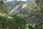
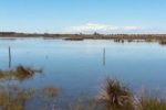
The United Nations Economic and Social Commission for Western Asia (ESCWA) recognizes the benefits of using geospatial data, particularly from Earth Observations, to strengthen the SDG monitoring capacities of countries. With this objective, an initiative to use Geographical Information Systems (GIS) was launched to gather and use Environmental Statistical Data strategically and help assess the data availability and capacity of National Statistical Offices (NSOs) in three selected ESCWA member countries: Jordan, Egypt and Palestine.
Our role
We were in charge of implementing the following activities:
- Undertake a survey of available geospatial data and expertise in Jordan, Egypt and Palestine.
- Convene a National Workshop for stakeholders that are associated with SDGs, environmental data, and geospatial information systems, in these 3 countries.
- Organize basic training and raising awareness in these 3 countries on the importance of geospatial workflows, global initiatives and technologies, and publicly accessible data relevant to SDG monitoring.
- Provide an overview of data, expertise available and needs for establishing effective geospatial workflows to measure and monitor SDGs.
Main outputs
More about it

Christoph Schröder
Assessment approachchristoph.schroder@uma.es
Based on my MSc in Geography (University of Bonn) I have developed expertise in Geographic Information Systems and land use/cover change analysis from local to global scale with particular interest in the Mediterranean...

Antonio Sánchez
Data related inquiriesa_sanchez@uma.es
Antonio Sánchez has developed his career focused on Geographic Information Systems and Remote Sensing tools, especially in the management and processing of data to calculate indicators and generate illustrative maps of environmental problems of all kind...Our partners

United Nations Development Account Programme on Data and Statistics for the SDGs
ETC-UMA launches new technologies applied to ecosystem knowledge