Assessment on the state and progress of Marine Protected Areas in the Mediterranean in 2019
Towards 2020: how Mediterranean countries are performing to protect their sea
Project summary
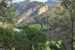
Ongoing unsustainable fishing, tourism, plastic and chemical pollution, and a rapid coastal development are causing a dramatic decline and loss of marine species and the destruction of fragile habitats in the Mediterranean. The increasing effects of climate change and future trends in development at sea are added threats to the ecological and economic resilience of the whole region. As a response, Mediterranean countries signed the CBD Aichi Target 11 committing to protect at least 10% of their waters with the creation of effective Marine Protected Areas (MPAs).
The WWF Mediterranean Office commissioned an assessment of the actions taken by Mediterranean countries on all shores to implement conservation policies and create an effective and well-managed network of MPAs. We undertook an analysis of the status of designation, the level of management implementation and of the ecological coherence of the existing network.
Our role
Main outputs
Gomei M., Abdulla A., Schröder C., Yadav S., Sánchez A., Rodríguez D., Abdel Malek D. (2019)
Policy Briefing
Gomei M., Abdulla A., Schröder C., Yadav S., Sánchez A., Rodríguez D., Abdel Malek D. (2019)
More about it

Christoph Schröder
Assessment approachchristoph.schroder@uma.es
Based on my MSc in Geography (University of Bonn) I have developed expertise in Geographic Information Systems and land use/cover change analysis from local to global scale with particular interest in the Mediterranean...

Antonio Sánchez
Data related inquiriesa_sanchez@uma.es
Antonio Sánchez has developed his career focused on Geographic Information Systems and Remote Sensing tools, especially in the management and processing of data to calculate indicators and generate illustrative maps of environmental problems of all kind...Our partners
WWF Mediterranean Programme Office
Supported by national officesTowards an ecologically representative and efficiently managed network of Mediterranean Marine Protected Areas (MedMPA Network), managed by UN Environment/MAP, co-executed by SPA/RAC, WWF Mediterranean and MedPAN, and financially supported by the European Union
ETC-UMA launches new technologies applied to ecosystem knowledge