European topic centre - university of malaga
Meet our team members

Antonio Sánchez
Environmental scientist, GIS and Remote Sensing specialist
Antonio Sánchez
Environmental scientist, GIS and Remote Sensing specialist
a_sanchez@uma.es
+34 951 952 905
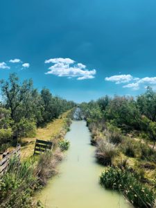
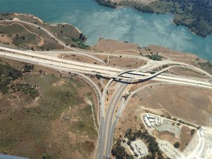
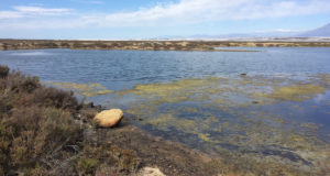
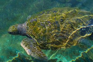
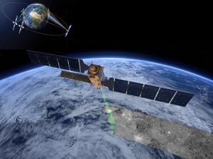
Antonio has developed his career focused on Geographic Information Systems and Remote Sensing tools, especially in the management and processing of data to calculate indicators and generate illustrative maps of environmental problems of all kind. His main area of work has been marine and wetlands related data, where he has produced the analysis of environmental pressures and sea-coast interactions in different sectors such as transport, fishing, tourism and energy among others, as well as the study of environmental data such as populations of marine species and protected areas. In the field of remote sensing, he has developed different products related to wetland ecosystems using Landsat and Sentinel images, such as land use/land cover maps, surface water dynamics, flood regulation and land use/land cover change indicators. He has also participated as a trainer in remote sensing for different wetland user organizations.
Antonio also works as freelance photographer, graphic and web designer for different companies and public institutions. The experience in this field is put into practice in the ETC-UMA, giving greater versatility to the team when it comes to producing dissemination material for both experts and the general public, as well as in the development and maintenance of web pages.
Related projects
WetlandSolutions4Change
RESTORE4Cs

PANACEA – MBPC
OECM CASE STUDIES
WWF Mediterranean MPA assessment
WWF EU MPA assessment
RESOURCES
Journal Articles
Rodríguez-Rodríguez, D.; Sánchez-Espinosa, A.; Abdul-Malak, D.
Potential contribution of OECMs to international area-based conservation targets in a biodiversity rich country, Spain Journal Article
In: Journal for Nature Conservation, vol. 62, 2021.
Abstract | Links | BibTeX | Tags: Biodiversity, Conservation and management, Ecosystem, Environmental conservation, Marine protected areas, Protected areas
@article{Rodríguez-Rodríguez2021b,

title = {Potential contribution of OECMs to international area-based conservation targets in a biodiversity rich country, Spain},

author = {D. Rodríguez-Rodríguez and A. Sánchez-Espinosa and D. Abdul-Malak},

url = {https://doi.org/10.1016/j.jnc.2021.126019},

doi = {10.1016/j.jnc.2021.126019},

year  = {2021},

date = {2021-05-15},

journal = {Journal for Nature Conservation},

volume = {62},

abstract = {Other effective area-based conservation measures (OECMs) are new conservation tools intended to complement protected areas (PAs) at achieving effective biodiversity conservation and meeting international area-based targets. However, OECMs have been rarely considered in practical terms until recently. Here, we performed a rapid evaluation on the degree of fulfilment of current area-based international biodiversity targets, post-2020 foreseeable oncoming targets, and ecological targets by considering: 1) Protection coverage; 2) Inclusiveness of important areas for biodiversity; 3) Protection management; 4) Connectivity; and 5) Habitat representation, on land and at sea in Spain, a Euro-Mediterranean, biodiversity rich country. We conducted the evaluation under two scenarios: 1) Scenario 1 considers designated PAs; and 2) Scenario 2, that also includes potential OECMs. In order to generate Scenario 2, thirteen legal categories were assessed against international guidance on OECMs as a first step to screen their likelihood of providing OECMs in Spain. Our findings show that some potentially satisfactory OECM categories such as Public Utility Forests, River Reserves or Geoparks meet the OECM criteria to a large degree and deserve further study. Our results also highlight that Spain is currently well above most foreseeable post-2020 biodiversity targets and even close to some ecological targets using just PAs, except for marine protected area (MPA) management and MPA offshore coverage. Adding OECMs would noticeably improve the country’s figures yet without reaching many exigent ecological targets. OECMs can become a useful, cost-effective biodiversity conservation tool that contributes to international targets under new, more ambitious area-based conservation requirements in Spain and elsewhere. Nevertheless, for this to happen, suitable biodiversity management and monitoring schemes must be ensured.},

keywords = {Biodiversity, Conservation and management, Ecosystem, Environmental conservation, Marine protected areas, Protected areas},

pubstate = {published},

tppubtype = {article}

}
Weise, K.; Höfer, R.; Franke, J.; Guelmami, A.; Simonson, W.; Muro, J.; O'Connor, B.; Strauch, A.; Flink, S.; Eberle, J.; Mino, E.; Thulin, S.; Philipson, P.; van Valkengoed, E.; Truckenbrodt, J.; Zander, F.; Sánchez-Espinosa, A.; Schröder, C.; Thinfeld, F.; Fitoka, E.; Scott, E.; Ling, M.; Schwarz, M.; Kunz, I.; Thürmer, G.; Plasmeijer, A.; Hilarides, L.
Wetland extent tools for SDG 6.6.1 reporting from the Satellite-based Wetland Observation Service (SWOS) Journal Article
In: Remote Sensing of Environment, vol. 247, 2019.
Abstract | Links | BibTeX | Tags: Climate Change, Conservation and management, Environmental conservation, SWOS, Wetlands
@article{Weise2019,

title = {Wetland extent tools for SDG 6.6.1 reporting from the Satellite-based Wetland Observation Service (SWOS)},

author = {K. Weise and R. Höfer and J. Franke and A. Guelmami and W. Simonson and J. Muro and B. O'Connor and A. Strauch and S. Flink and J. Eberle and E. Mino and S. Thulin and P. Philipson and E. van Valkengoed and J. Truckenbrodt and F. Zander and A. Sánchez-Espinosa and C. Schröder and F. Thinfeld and E. Fitoka and E. Scott and M. Ling and M. Schwarz and I. Kunz and G. Thürmer and A. Plasmeijer and L. Hilarides},

url = {https://doi.org/10.1016/j.rse.2020.111892},

doi = {https://doi.org/10.1016/j.rse.2020.111892},

year  = {2019},

date = {2019-09-15},

journal = {Remote Sensing of Environment},

volume = {247},

abstract = {Wetlands are the most fragile and threatened ecosystems worldwide, and also one of the most rapidly declining. At the same time wetlands are typically biodiversity hotspots and provide a range of valuable ecosystem services, such as water supply and purification, disaster risk reduction, climate change adaptation, and carbon sequestration.


Pressures on wetlands are likely to further intensify in the coming decades due to increased global demand for land and water, and due to climate change. Stakeholders at all levels of governance have to be involved to slow, stop and reverse these processes. However, the information they need on wetland extent, their ecological character, and their ecosystem services is often scattered, sparse and difficult to find and access.


The freely available Sentinel satellite data of the Copernicus Programme, as well as the Landsat archive, provide a comprehensive basis to map and inventory wetland areas (extent), to derive information on the ecological status, as well as long- and short-term trends in wetland characteristics. However, making use of these Earth Observation (EO) resources for robust and standardized wetland monitoring requires expert knowledge on often complex data processing techniques, which impedes practical implementation. In this respect, the Satellite-based Wetland Observation Service (SWOS), a Horizon 2020 funded project (www.swos-service.eu) has developed and made disseminated monitoring approaches based on EO data, specifically designed for less experienced satellite data users.


The SWOS monitoring tools aim at assisting countries in conducting national wetland inventories for their Sustainable Development Goals (SDG) reporting and monitoring obligations, and additionally facilitates other monitoring obligations such as those required by the Ramsar Convention and supports decision-making in local conservation activities. The four main components of the SWOS approach are: map and indicator production; software development; capacity building; and initializing the GEO Wetlands Community Portal. Wetland managers and data analysists from more than fifty wetland sites and river basins across Europe, the Middle East, and Africa investigated the benefits and limitations of this EO-based wetland mapping and monitoring approach.


We describe research that applies the SWOS tools to test their potential for the mapping of wetlands in a case study based in Albania, and show its effectiveness to derive metrics relevant to the monitoring of SDG indicator 6.6.1.},

keywords = {Climate Change, Conservation and management, Environmental conservation, SWOS, Wetlands},

pubstate = {published},

tppubtype = {article}

}
Pressures on wetlands are likely to further intensify in the coming decades due to increased global demand for land and water, and due to climate change. Stakeholders at all levels of governance have to be involved to slow, stop and reverse these processes. However, the information they need on wetland extent, their ecological character, and their ecosystem services is often scattered, sparse and difficult to find and access.
The freely available Sentinel satellite data of the Copernicus Programme, as well as the Landsat archive, provide a comprehensive basis to map and inventory wetland areas (extent), to derive information on the ecological status, as well as long- and short-term trends in wetland characteristics. However, making use of these Earth Observation (EO) resources for robust and standardized wetland monitoring requires expert knowledge on often complex data processing techniques, which impedes practical implementation. In this respect, the Satellite-based Wetland Observation Service (SWOS), a Horizon 2020 funded project (www.swos-service.eu) has developed and made disseminated monitoring approaches based on EO data, specifically designed for less experienced satellite data users.
The SWOS monitoring tools aim at assisting countries in conducting national wetland inventories for their Sustainable Development Goals (SDG) reporting and monitoring obligations, and additionally facilitates other monitoring obligations such as those required by the Ramsar Convention and supports decision-making in local conservation activities. The four main components of the SWOS approach are: map and indicator production; software development; capacity building; and initializing the GEO Wetlands Community Portal. Wetland managers and data analysists from more than fifty wetland sites and river basins across Europe, the Middle East, and Africa investigated the benefits and limitations of this EO-based wetland mapping and monitoring approach.
We describe research that applies the SWOS tools to test their potential for the mapping of wetlands in a case study based in Albania, and show its effectiveness to derive metrics relevant to the monitoring of SDG indicator 6.6.1.
Rodríguez-Rodríguez, D.; Abdul-Malak, D.; Soukissian, T.; Sánchez-Espinosa, A.
Achieving Blue Growth through maritime spatial planning: Offshore wind energy optimization and biodiversity conservation in Spain Journal Article
In: Marine Policy, vol. 73, pp. 8-14, 2016.
Abstract | Links | BibTeX | Tags: Biodiversity, Blue Growth, Climate Change, Conservation and management, Pressures
@article{Rodríguez-Rodríguez2016d,

title = {Achieving Blue Growth through maritime spatial planning: Offshore wind energy optimization and biodiversity conservation in Spain},

author = {D. Rodríguez-Rodríguez and D. Abdul-Malak and T. Soukissian and A. Sánchez-Espinosa},

url = {https://www.researchgate.net/publication/305824278_Achieving_Blue_Growth_through_maritime_spatial_planning_Offshore_wind_energy_optimization_and_biodiversity_conservation_in_Spain},

doi = {10.1016/j.marpol.2016.07.022},

year  = {2016},

date = {2016-11-01},

journal = {Marine Policy},

volume = {73},

pages = {8-14},

abstract = {Spain has a high potential for renewable energy production, being the world's third country by installed on-shore wind power. However, it has not yet fully developed its renewable energy production capacity, with no commercial offshore wind production to date, and remains highly dependent on fossil fuel imports. The country is also one of Europe's most biodiverse, on land and at sea. This study spatially assesses the country's offshore wind energy potential by incorporating the newly designated marine protected areas (MPAs) to the official Spanish strategic environmental assessment for the installation of offshore windfarms (SEA). It also identifies optimal areas for offshore windfarm development according to key physical variables such as wind speed, depth and substrate type. It finally assesses real commercial windfarm projects against current environmental constraints. The results show that nearly 50% of the whole area within 24 nm from the Spanish coast could be suitable for offshore windfarm development at the planning phase. However, only 0.7% of that area is optimal for wind energy production with current fixed turbine technology. Nevertheless, either area would allow Spain to meet its national targets of 750 MW of ocean power capacity installed by 2020 under adequate local wind conditions. Over 88% of all commercial windfarm project area is within the SEA's Exclusion zone, thus unfeasible under current circumstances. Technological breakthroughs like floating turbines may soon make the optimal windfarm area (OWA) less restrictive and reduce current environmental impacts of marine windfarms within a truly sustainable Blue Growth.},

keywords = {Biodiversity, Blue Growth, Climate Change, Conservation and management, Pressures},

pubstate = {published},

tppubtype = {article}

}
Proceedings
Martorell-Guerrero, G.; Marín, A. I.; Sánchez-Espinosa, A.; Schröder, C.
Herramientas de apoyo a la gestión de los humedales de Andalucía basadas en Google Earth Engine. Proceedings
2023.
Abstract | Links | BibTeX | Tags: Climate Change, Conservation and management, Environmental conservation, Geotechnology, Groundwater, Pressures, Wetlands
@proceedings{nokey,

title = {Herramientas de apoyo a la gestión de los humedales de Andalucía basadas en Google Earth Engine.},

author = {G. Martorell-Guerrero and A. I. Marín and A. Sánchez-Espinosa and C. Schröder},

url = {https://riuma.uma.es/xmlui/bitstream/handle/10630/28052/Martorell_et_al_2023_SIAGA.pdf?sequence=1&isAllowed=y},

year  = {2023},

date = {2023-11-13},

urldate = {2023-11-13},

booktitle = {Simposio del Agua en Andalucía 2023},

abstract = {Los humedales son ecosistemas claves a nivel global para la provisión de servicios ecosistémicos tan importantes como la regulación climática o el mantenimiento de la biodiversidad. Sin embargo, en las últimas décadas la situación de degradación y desaparición de estos hábitats es alarmante a pesar de ser centro de múltiples políticas internacionales de protección que, a la luz de los resultados que están teniendo, no han tenido la efectividad esperada en su implementación real. Por tanto, es necesario tomar medidas urgentes dirigidas a revertir esta situación y que su implementación sea evaluada de forma objetiva, sistemática y recurrente. Este trabajo presenta una herramienta web llamada GreenEye Hub para el seguimiento de los humedales del Inventario de Humedales de Andalucía basada en imágenes de satélite del Sentinel-2, técnicas de teledetección y en tecnologías de procesamiento de datos masivos mediante Google Earth Engine. La herramienta, con un diseño orientado a la gestión de estos ecosistemas, presenta una consola de visualización que permite realizar el seguimiento de los principales indicadores de agua y vegetación y el análisis de tendencias de estos. Es, por tanto, un sistema de apoyo a la gestión y a la toma de decisiones. Este estudio proporciona información de cómo es factible en la actualidad desarrollar un sistema de seguimiento de humedales a escala regional a partir de datos gratuitos accesibles y cómo esta herramienta constituye un proceso de transferencia del conocimiento desde la ciencia a la gestión.},

keywords = {Climate Change, Conservation and management, Environmental conservation, Geotechnology, Groundwater, Pressures, Wetlands},

pubstate = {published},

tppubtype = {proceedings}

}
Technical Reports
Fortuna, C.; Sánchez-Espinosa, A.; Rodríguez-Rodríguez, D.; Abdul-Malak, D.; Podestà, M.; Panigada, S.
2022.
Abstract | Links | BibTeX | Tags: Biodiversity, Conservation and management, Environmental conservation, Marine protected areas, Maritime transport, Mediterranean sea
@techreport{Fortuna2022,

title = {Pathways to coexistence between large cetaceans and maritime transport in the north-western Mediterranean region: Collision risk between ships and whales within the proposed north-western Mediterranean PSSA, including the Pelagos Sanctuary},

author = {C. Fortuna and A. Sánchez-Espinosa and D. Rodríguez-Rodríguez and D. Abdul-Malak and M. Podestà and S. Panigada},

url = {https://panaceaweb.adabyron.uma.es/wp-content/uploads/Pathways-to-coexistence-between-large-cetaceans-and-maritime-transport-in-the-north-western-Mediterranean-region.pdf},

year  = {2022},

date = {2022-11-18},

urldate = {2022-11-18},

abstract = {This short report is the result of a collaborative effort among researchers from ISPRA in Italy and ETC-UMA in Spain supported by Mediterranean institutions partnering in the MBPC project. The level of maritime traffic and the intricacy of the network of shipping routes within the Pelagos Sanctuary and  the new proposed north western Mediterranean Particularly Sensitive Sea Area (PSSA is an area that needs special protection through action by International Maritime Organization (IMO) because of its significance for recognized ecological or socio-economic or scientific reasons and which may be vulnerable to damage by international maritime activities) has an impact on fin whales, particularly in spring and summer when they can be found in the region to feed. Many of these shipping routes also cross several marine protected areas (MPAs), including large Nature 2000 sites.  To assist in the identification of hotspot areas in the Pelagos Sanctuary and adjacent areas concerning key biodiversity and pressures, ETC-UMA produced several spatial data analysis, maps and informative interactive dashboards with Mediterranean-level data, which are now part of this report and other products now available through the MBPC Knowledge platform online, hosted and maintained by ETC-UMA.},

keywords = {Biodiversity, Conservation and management, Environmental conservation, Marine protected areas, Maritime transport, Mediterranean sea},

pubstate = {published},

tppubtype = {techreport}

}
Trombetti, M.; Abdul-Malak, D.; Sánchez-Espinosa, A.; Guelmami, A.; García, N.; Fitoka, E.
Mapping and assessment of the state of wetland ecosystems: A Mediterranean perspective Technical Report
2022.
Abstract | Links | BibTeX | Tags: Biodiversity, Climate Change, Conservation and management, Ecosystem services, Environmental conservation, Mediterranean sea, Protected areas, Wetlands
@techreport{Trombetti2022,

title = {Mapping and assessment of the state of wetland ecosystems: A Mediterranean perspective},

author = {M. Trombetti and D. Abdul-Malak and A. Sánchez-Espinosa and A. Guelmami and N. García and E. Fitoka},

editor = {Interreg Mediterranean Biodiversity Protection Community project},

url = {https://www.etc.uma.es/wp-content/uploads/Report_Mapping_and_assessment_of_the_state_of_wetland_ecosystems_2022.pdf},

year  = {2022},

date = {2022-06-01},

urldate = {2022-06-01},

abstract = {The Pan-Mediterranean wetland ecosystem map fills a major knowledge gap in the region by setting a Mediterranean-wide knowledge base on wetland ecosystems following the Ramsar definition of wetlands. The wetland ecosystem mapping is complemented by the assessment of wetland biodiversity conditions that aims to highlight priority areas for potential conservation and restoration actions in the region, and to support the regional efforts in advocating for effective wetland management and nature-based solutions in the Mediterranean region. The outputs of this activity include (i) a Pan-Mediterranean wetland ecosystem knowledge base, and (ii) an assessment of their condition that will be used to raise awareness and advocate for a change in wetland management that promotes effective protection, conservation and restoration. The outputs also support regional and national inventories, filling a major regional gap locating Mediterranean wetland habitats, and feed regional and global agendas, namely the EU Biodiversity Strategy to 2030, the Mediterranean Strategy for Sustainable development as well as the Ramsar Convention.},

keywords = {Biodiversity, Climate Change, Conservation and management, Ecosystem services, Environmental conservation, Mediterranean sea, Protected areas, Wetlands},

pubstate = {published},

tppubtype = {techreport}

}
Sánchez-Espinosa, A.; Abdul-Malak, D.; San-Román, S.; Vera, A.
Marine mega fauna and litter in the Mediterranean: Overview of impacts in MedBioLitter Technical Report
2022.
Abstract | Links | BibTeX | Tags: Biodiversity, Conservation and management, Environmental conservation, Marine litter, Marine protected areas, Mediterranean sea, Pressures, Protected areas
@techreport{Sánchez-Espinosa2022,

title = {Marine mega fauna and litter in the Mediterranean: Overview of impacts in MedBioLitter},

author = {A. Sánchez-Espinosa and D. Abdul-Malak and S. San-Román and A. Vera},

url = {https://www.etc.uma.es/wp-content/uploads/Marine_mega_fauna_litter_Mediterranean_March2022.pdf},

year  = {2022},

date = {2022-04-01},

urldate = {2022-04-01},

abstract = {This report highlights the conclusions coming from the analysis of MedBiolitter spatial and scientific data on interactions between marine fauna and litter in the Mediterranean published in English as in v.8 updated in March 2022, integrated with marine litter data collected by ACCOBAMS in the frame of the Aerial Survey Initiative on cetaceans and marine litter. The analysis focuses on the impacts on marine megafauna (large mammals like cetaceans and seals, turtles, cartilaginous fishes like sharks and rays, and scombridae like tuna and swordfish). This publication follows the publication of the “Mediterranean biodiversity and marine litter: an interaction knowledge base” report in the frame of the Interreg Mediterranean Biodiversity Protection project published in 2019. },

keywords = {Biodiversity, Conservation and management, Environmental conservation, Marine litter, Marine protected areas, Mediterranean sea, Pressures, Protected areas},

pubstate = {published},

tppubtype = {techreport}

}
UNEP-MAP,; Plan-Bleu,; Abdul-Malak, D.; Marín, A. I.; Schröder, C.; Sánchez-Espinosa, A.
SoED 2020 : State of Environment and Development in Mediterranean Technical Report
2020.
Abstract | Links | BibTeX | Tags: Biodiversity, Climate Change, Conservation and management, Environmental conservation, Marine protected areas, Mediterranean sea, Pressures, Protected areas
@techreport{UNEP-MAP2020,

title = {SoED 2020 : State of Environment and Development in Mediterranean},

author = {UNEP-MAP and Plan-Bleu and D. Abdul-Malak and A. I. Marín and C. Schröder and A. Sánchez-Espinosa},

url = {https://planbleu.org/en/soed-2020-state-of-environment-and-development-in-mediterranean/},

year  = {2020},

date = {2020-12-01},

abstract = {The SoED provides a comprehensive and up-to-date assessment of environment and development interactions in the Mediterranean region. The 2020 version consists of eight thematic chapters and is complemented by two summary papers: Summary for Decision Makers and Key Messages. Topics covered include: socio-economic drivers and trends; climate change; biodiversity and ecosystem services; economic activities and related pressures; coastal dynamics and related impacts; food and water security; health and environment; and governance.},

keywords = {Biodiversity, Climate Change, Conservation and management, Environmental conservation, Marine protected areas, Mediterranean sea, Pressures, Protected areas},

pubstate = {published},

tppubtype = {techreport}

}
Guitart, C.; Abdul-Malak, D.; Sánchez-Espinosa, A.; Valverde, C. Pérez; Bigagli, E.; San-Román, S.
Mediterranean biodiversity and marine litter: an interaction knowledge base Technical Report
2020.
Abstract | Links | BibTeX | Tags: Biodiversity, Conservation and management, Marine litter, Marine protected areas, Mediterranean sea, Pressures
@techreport{Guitart2020,

title = {Mediterranean biodiversity and marine litter: an interaction knowledge base},

author = {C. Guitart and D. Abdul-Malak and A. Sánchez-Espinosa and C. Pérez Valverde and E. Bigagli and S. San-Román},

editor = {ETC-UMA},

url = {https://www.etc.uma.es/wp-content/uploads/PAN_report_Mediterranean-biodiversity-and-marine-litter_LowRes.pdf},

year  = {2020},

date = {2020-01-10},

urldate = {2020-01-10},

abstract = {The Interreg-Med programme (2014-2020) has co-financed several initiatives that tackle the issue of marine litter. The Mediterranean Biodiversity Protection Community, co-financed by Interreg Med and featured by PANACeA, is one of these networks and aims at ensuring harmonized approaches to provide transferable evidence-based solutions on this growing challenge in the region. Part of the contribution of this Interreg Med community is to increase the evidence and the understanding of marine litter concerns and to reduce the pressures coming from marine litter as well as its impacts on biodiversity and ecosystems in the Mediterranean region.


The main areas of work of this community to date include the compilation of knowledge and available information on monitoring, measures and actions in marine protected areas (MPAs) and beyond, and to provide tools to support biodiversity protection and management to a wide range of stakeholders from local managers to regional policy makers in the Mediterranean region. An insight on projects tackling marine litter policy, management, pressures, impacts and best practices to combat litter in the marine and coastal environment is presented in Table 1. Five projects (out of 11 thematic projects within the Mediterranean Biodiversity Protection Community) have pursued marine litter pollution knowledge objectives. The knowledge generated by the Biodiversity Protection community has been synthesized here to offer coordinated knowledge and practice in the Mediterranean region and to contribute to both the Mediterranean and international marine litter reduction challenges.},

keywords = {Biodiversity, Conservation and management, Marine litter, Marine protected areas, Mediterranean sea, Pressures},

pubstate = {published},

tppubtype = {techreport}

}
The main areas of work of this community to date include the compilation of knowledge and available information on monitoring, measures and actions in marine protected areas (MPAs) and beyond, and to provide tools to support biodiversity protection and management to a wide range of stakeholders from local managers to regional policy makers in the Mediterranean region. An insight on projects tackling marine litter policy, management, pressures, impacts and best practices to combat litter in the marine and coastal environment is presented in Table 1. Five projects (out of 11 thematic projects within the Mediterranean Biodiversity Protection Community) have pursued marine litter pollution knowledge objectives. The knowledge generated by the Biodiversity Protection community has been synthesized here to offer coordinated knowledge and practice in the Mediterranean region and to contribute to both the Mediterranean and international marine litter reduction challenges.
Abdul-Malak, D.; Schröder, C.; Guitart, C.; Sánchez-Espinosa, A.; Fitoka, E.; Hatziiordanou, L.; Mino, E.; Flink, S.; Silver, E.; Strauch, A.; Ling, M.; Brown, C.; Simonson, W.; Scott, E.; Plasmeijer, A.; Thulin, S.; Philipson, P.; Weise, K.; Höfer, R.; Franke, J.; Guelmami, A.
Enhanced wetland monitoring, assessment and indicators to support European and global environmental policy Technical Report
2019.
Abstract | Links | BibTeX | Tags: Conservation and management, Ecosystem, Geotechnology, SWOS, Wetlands
@techreport{Abdul-Malak2019,

title = {Enhanced wetland monitoring, assessment and indicators to support European and global environmental policy},

author = {D. Abdul-Malak and C. Schröder and C. Guitart and A. Sánchez-Espinosa and E. Fitoka and L. Hatziiordanou and E. Mino and S. Flink and E. Silver and A. Strauch and M. Ling and C. Brown and W. Simonson and E. Scott and A. Plasmeijer and S. Thulin and P. Philipson and K. Weise and R. Höfer and J. Franke and A. Guelmami},

url = {https://www.etc.uma.es/wp-content/uploads/Enhanced_wetland_monitoring_assessment_indicators_support_European_global_environmental_policy.pdf},

year  = {2019},

date = {2019-12-31},

abstract = {The 2019 report on Enhanced wetland monitoring, assessment and indicators to support European environmental policyidentifies the links between the Horizon 2020 Satellite-based Wetland Observation Service (SWOS) project outcomes (tools, methodologies and indicators) and existing policy frameworks at European and global levels. It aims to contribute to the refinement of EU Strategies and Directives to better integrate wetland ecosystems, contribute towards a European environmental model for wetland management and maintenance of their ecosystem services, and guide action towards achieving no-net-loss and restoration targets and objectives for wetland ecosystems. The report summarises (in four chapters) how SWOS can ensure a better understanding of wetland ecosystems, and thereby help to trigger further policy developments by improving key elements for wetland management.},

keywords = {Conservation and management, Ecosystem, Geotechnology, SWOS, Wetlands},

pubstate = {published},

tppubtype = {techreport}

}
Gomei, M.; Abdulla, A.; Schröder, C.; Yadav, S.; Sánchez-Espinosa, A.; Rodríguez-Rodríguez, D.; Abdul-Malak, D.
Towards 2020: how Mediterranean countries are performing to protect their sea Technical Report
2019.
Links | BibTeX | Tags: Biodiversity, Conservation and management, Environmental conservation, Marine protected areas, Mediterranean sea, Pressures, Protected areas
@techreport{Gomei2019,

title = {Towards 2020: how Mediterranean countries are performing to protect their sea},

author = {M. Gomei and A. Abdulla and C. Schröder and S. Yadav and A. Sánchez-Espinosa and D. Rodríguez-Rodríguez and D. Abdul-Malak},

url = {https://d2ouvy59p0dg6k.cloudfront.net/downloads/towards2020_report_nov2019.pdf},

year  = {2019},

date = {2019-11-01},

keywords = {Biodiversity, Conservation and management, Environmental conservation, Marine protected areas, Mediterranean sea, Pressures, Protected areas},

pubstate = {published},

tppubtype = {techreport}

}
Presentations
Mancosu, E.; Abdul-Malak, D.; Sánchez-Espinosa, A.
Regional indicators to support forest ecosystem management in the Carpathian Mountains Presentation
28.09.2016.
Abstract | Links | BibTeX | Tags: Conservation and management, Forest, Geotechnology, Land and soil, Protected areas
@misc{nokey,

title = {Regional indicators to support forest ecosystem management in the Carpathian Mountains},

author = {E. Mancosu and D. Abdul-Malak and A. Sánchez-Espinosa},

url = {https://www.etc.uma.es/wp-content/uploads/Poster_Forum_Carpaticum_2016.pdf},

year  = {2016},

date = {2016-09-28},

journal = {Forum Carpaticum 2016},

abstract = {The Carpathian Mountains are one of the most important forest ecosystems in Europe dueto the high concentration of virgin forests. The "protocol for sustainable forest management", signed by Carpathian convention Parties is formalising the need to preserve the richness and ensure sustainable use of its resources. Our research, in agreement with the Carpathian Convention Secretariat and the Environmental European Agency (EEA) is supporting this protocol with the identification and harmonization of dataset from multiple sources including Earth Observation, to combine and provide spatial indicators to support monitoring and management of forest far the Carpathians Environment Outlook (KEO) area.},

keywords = {Conservation and management, Forest, Geotechnology, Land and soil, Protected areas},

pubstate = {published},

tppubtype = {presentation}

}
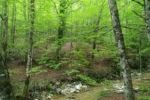
Towards a Strategy for the Sustainable Management of Mediterranean Forests (StrategyMedFor)
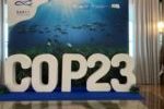
Collaborative science for forests by ETC-UMA showcased in Slovenia during the COP23
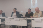
Job opening: Senior Specialist in Forest ecosystem conservation and climate resilience
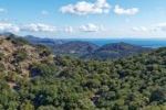
Tools for conserving the Spanish coast